Category:Hook Norton
Jump to navigation
Jump to search
village and civil parish in Cherwell district, Oxfordshire, England  | |||||
| Upload media | |||||
| Instance of | |||||
|---|---|---|---|---|---|
| Location | Cherwell, Oxfordshire, South East England, England | ||||
| Population |
| ||||
| Area |
| ||||
| Said to be the same as | Hook Norton (Wikimedia duplicated page, civil parish) | ||||
| official website | |||||
 | |||||
Subcategories
This category has the following 3 subcategories, out of 3 total.
Media in category "Hook Norton"
The following 200 files are in this category, out of 470 total.
(previous page) (next page)-
 A part of High Street in Hook Norton - geograph.org.uk - 5596620.jpg 4,000 × 3,000; 3.5 MB
-
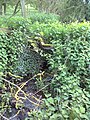
 A spring at the foot of Council Hill - geograph.org.uk - 2966262.jpg 1,600 × 1,200; 799 KB
-
-
 A view down the valley - geograph.org.uk - 1732286.jpg 4,000 × 3,000; 1.95 MB
-
 A view over oilseed rape, south of Sibford Ferris - geograph.org.uk - 2947526.jpg 1,600 × 1,200; 638 KB
-
 Across the drive - geograph.org.uk - 1975389.jpg 4,000 × 3,000; 4.61 MB
-
 Across the field - geograph.org.uk - 2433443.jpg 4,288 × 3,216; 2.52 MB
-
 Across the field - geograph.org.uk - 2780407.jpg 4,320 × 3,240; 4.83 MB
-
 Across the Hook Norton Brook valley (geograph 7414814).jpg 4,187 × 2,518; 1.28 MB
-
 Across the road - geograph.org.uk - 2779259.jpg 4,320 × 3,240; 4.93 MB
-
 Allotments and Church - geograph.org.uk - 2433002.jpg 4,288 × 3,216; 3.9 MB
-
 Approaching Hook Norton - geograph.org.uk - 1735229.jpg 4,000 × 3,000; 2.54 MB
-
 Arable fields north of South Hill Farm - geograph.org.uk - 3993307.jpg 3,648 × 2,736; 2.51 MB
-
 Away from the lake - geograph.org.uk - 2780438.jpg 4,320 × 3,240; 4.82 MB
-
 Baptist Church Hall - geograph.org.uk - 1733412.jpg 1,280 × 959; 390 KB
-
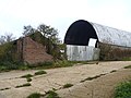
 Barn at Cowpastures Farm - geograph.org.uk - 1973823.jpg 4,000 × 3,000; 2 MB
-
 Bell Hill - geograph.org.uk - 1733427.jpg 1,280 × 959; 262 KB
-
 Bell Hill meets the High Street - geograph.org.uk - 3994812.jpg 3,482 × 2,630; 1.18 MB
-
 Belle Isle Farm - geograph.org.uk - 2779233.jpg 4,320 × 3,240; 4.88 MB
-
 Benacre Cottage being re-thatched (geograph 6618641).jpg 1,024 × 768; 163 KB
-
 Berryfield Farm - geograph.org.uk - 408420.jpg 640 × 480; 152 KB
-
 Between the houses - geograph.org.uk - 2780479.jpg 4,320 × 3,240; 4.95 MB
-
 Beware of badgers - geograph.org.uk - 1732262.jpg 4,000 × 3,000; 3.48 MB
-
 Bird shelter - geograph.org.uk - 2778293.jpg 4,320 × 3,240; 4.85 MB
-

-
 Bourne Lane - geograph.org.uk - 2693361.jpg 640 × 480; 90 KB
-
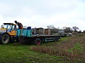
 Brewery dray at the Pear Tree Inn - geograph.org.uk - 2441324.jpg 640 × 480; 104 KB
-
 Brewery Dray, Hook Horton - geograph.org.uk - 4766868.jpg 1,500 × 1,701; 1.18 MB
-
 Brewery Lane - geograph.org.uk - 1733399.jpg 1,280 × 959; 351 KB
-
 Bridge abutment - geograph.org.uk - 5431441.jpg 1,024 × 768; 281 KB
-
 Bridleway across the road - geograph.org.uk - 1735185.jpg 4,000 × 3,000; 4.73 MB
-
 Bridleway and cottage - geograph.org.uk - 2779256.jpg 4,320 × 3,240; 4.93 MB
-

-
 Bridleway junction (1) - geograph.org.uk - 2779504.jpg 4,320 × 3,240; 4.85 MB
-
 Bridleway junction (2) - geograph.org.uk - 2779514.jpg 4,320 × 3,240; 4.87 MB
-
 Bridleway junction (3) - geograph.org.uk - 2779529.jpg 4,320 × 3,240; 4.61 MB
-
 Bridleway leaves road - geograph.org.uk - 2412875.jpg 4,288 × 3,216; 2.15 MB
-
 Bridleway sign - geograph.org.uk - 389160.jpg 640 × 481; 108 KB
-
 Bridleway to Wychford Hill - geograph.org.uk - 2433458.jpg 4,288 × 3,216; 1.1 MB
-
 Brockford Farm - geograph.org.uk - 1975399.jpg 4,000 × 3,000; 2.83 MB
-
 Brymbo Cottages - geograph.org.uk - 2266292.jpg 896 × 600; 123 KB
-
 Bus shelter, High Street - geograph.org.uk - 1733423.jpg 1,280 × 959; 243 KB
-
 Butter Hill under snow - geograph.org.uk - 2608872.jpg 2,592 × 1,944; 798 KB
-
 Buxton and Tornley - geograph.org.uk - 5107741.jpg 1,024 × 768; 287 KB
-
 By a spring on the path to Council Hill - geograph.org.uk - 2966999.jpg 1,200 × 1,600; 852 KB
-
 Camouflaged stile - geograph.org.uk - 1975385.jpg 4,000 × 3,000; 3.21 MB
-
 Cattle grid and drive - geograph.org.uk - 5429164.jpg 1,024 × 768; 254 KB
-
 Chalet style - geograph.org.uk - 2779552.jpg 4,320 × 3,240; 4.66 MB
-
 Church bus stop, Hook Norton - geograph.org.uk - 1733419.jpg 959 × 1,280; 273 KB
-
 Hook Norton Baptist Church - geograph.org.uk - 1733440.jpg 1,251 × 934; 599 KB
-
 Clay Bank - geograph.org.uk - 1733400.jpg 1,280 × 959; 289 KB
-
 Climb the hill - geograph.org.uk - 2432971.jpg 4,288 × 3,216; 2.5 MB
-
 Closeup of spring on the path to Council Hill - geograph.org.uk - 2967005.jpg 1,600 × 1,200; 685 KB
-
 Colman's Elm Barn - geograph.org.uk - 2777974.jpg 4,320 × 3,240; 4.85 MB
-
 Corner Cottage - geograph.org.uk - 1733432.jpg 1,280 × 959; 244 KB
-
 Corner Cottage - geograph.org.uk - 3994835.jpg 3,262 × 2,595; 1.26 MB
-
 Cornisa Cottage - geograph.org.uk - 2779239.jpg 4,320 × 3,240; 4.77 MB
-
 Cottage near The Pear Tree pub - geograph.org.uk - 765393.jpg 640 × 426; 109 KB
-
 Cottage on the green - geograph.org.uk - 2432851.jpg 4,288 × 3,216; 4.65 MB
-
 Cottages on Bell Hill - geograph.org.uk - 1733426.jpg 1,280 × 959; 362 KB
-
 Cottages on Netting Street - geograph.org.uk - 2721205.jpg 1,024 × 769; 623 KB
-
 Cottages on Netting Street, Hook Norton (geograph 7091640).jpg 3,406 × 2,591; 1.13 MB
-
 Country crossroads - geograph.org.uk - 2777990.jpg 4,320 × 3,240; 5.35 MB
-
 Country junction - geograph.org.uk - 2415687.jpg 4,288 × 3,216; 2.78 MB
-
 Country junction - geograph.org.uk - 2415701.jpg 4,288 × 3,216; 3.28 MB
-
 Country junction - geograph.org.uk - 2432150.jpg 4,288 × 3,216; 5.16 MB
-
 Country junction - geograph.org.uk - 2729536.jpg 4,320 × 3,240; 4.96 MB
-
 Country junction - geograph.org.uk - 2729822.jpg 4,320 × 3,240; 5 MB
-
 Country junction - geograph.org.uk - 2779207.jpg 4,320 × 3,240; 4.77 MB
-
 Country road, north of Hook Norton - geograph.org.uk - 5429203.jpg 1,024 × 768; 240 KB
-
 Court Farm - geograph.org.uk - 1732275.jpg 4,000 × 3,000; 2.9 MB
-
 Court Farm - geograph.org.uk - 1733460.jpg 4,000 × 3,000; 1.47 MB
-
 Cowpasture Farm (1) - geograph.org.uk - 1973785.jpg 4,000 × 3,000; 3.52 MB
-
 Cowpasture Farm (2) - geograph.org.uk - 1973788.jpg 4,000 × 3,000; 2.8 MB
-
 Cowpasture Farm (3) - geograph.org.uk - 1973793.jpg 4,000 × 3,000; 3.16 MB
-
 Cowpasture Farm (4) - geograph.org.uk - 1973802.jpg 4,000 × 3,000; 3.04 MB
-
 Cowpastures Farmhouse - geograph.org.uk - 1735195.jpg 4,000 × 3,000; 5.48 MB
-
 Croft's Lane - geograph.org.uk - 5429868.jpg 1,024 × 768; 263 KB
-
 D'Arcy Dalton Way (1) - geograph.org.uk - 2780376.jpg 4,320 × 3,240; 4.81 MB
-
 D'Arcy Dalton Way (2) - geograph.org.uk - 2780381.jpg 4,320 × 3,240; 4.72 MB
-
 D'Arcy Dalton Way (3) - geograph.org.uk - 2780477.jpg 4,320 × 3,240; 4.96 MB
-
 D'Arcy Dalton Way (4) - geograph.org.uk - 2780481.jpg 4,320 × 3,240; 4.9 MB
-
 D'Arcy Dalton Way (5) - geograph.org.uk - 2780482.jpg 4,320 × 3,240; 4.99 MB
-
 D'Arcy Dalton Way (6) - geograph.org.uk - 2780483.jpg 4,320 × 3,240; 4.69 MB
-
 D'Arcy Dalton Way - geograph.org.uk - 4754178.jpg 640 × 480; 78 KB
-
 D'Arcy Dalton Way - geograph.org.uk - 4754183.jpg 640 × 480; 95 KB
-
 D'Arcy Dalton Way - geograph.org.uk - 4754190.jpg 640 × 480; 96 KB
-

-
 Digging out the mash tun at Hook Norton - geograph.org.uk - 1862760.jpg 640 × 480; 221 KB
-
 Double gates - geograph.org.uk - 5429906.jpg 1,024 × 768; 365 KB
-
 Double stile - geograph.org.uk - 2777953.jpg 4,320 × 3,240; 5.02 MB
-
 Down End - geograph.org.uk - 1733433.jpg 1,280 × 959; 308 KB
-
 Down End, Hook Norton (geograph 7434816).jpg 4,210 × 2,227; 1.74 MB
-
 Driveway and bridleway - geograph.org.uk - 2779579.jpg 4,320 × 3,240; 4.54 MB
-
 Driveway and footpath - geograph.org.uk - 1735210.jpg 4,000 × 3,000; 2.32 MB
-
 Driveway to Hafotty - geograph.org.uk - 1735218.jpg 4,000 × 3,000; 3.47 MB
-
 Driveway to Swerford Park Farm - geograph.org.uk - 215452.jpg 640 × 480; 85 KB
-
 Driveway to the manor. - geograph.org.uk - 1975391.jpg 4,000 × 3,000; 3.15 MB
-
 East End Railway - geograph.org.uk - 202184.jpg 640 × 480; 136 KB
-
 East window, Hook Norton church - geograph.org.uk - 5430312.jpg 768 × 1,024; 282 KB
-
 Eating is more important - geograph.org.uk - 2777968.jpg 4,320 × 3,240; 4.75 MB
-
 Enclosed footpath - geograph.org.uk - 1973797.jpg 4,000 × 3,000; 3.96 MB
-
 End of bridleway - geograph.org.uk - 1735203.jpg 4,000 × 3,000; 4.9 MB
-
 End of the bridleway - geograph.org.uk - 2780366.jpg 4,320 × 3,240; 4.65 MB
-
 Entering Hook Norton - geograph.org.uk - 407990.jpg 640 × 480; 134 KB
-
 Explosives store - geograph.org.uk - 2780415.jpg 4,320 × 3,240; 4.48 MB
-
 Farm buildings (1) - geograph.org.uk - 2779479.jpg 4,320 × 3,240; 4.79 MB
-
 Farm buildings (2) - geograph.org.uk - 2779493.jpg 4,320 × 3,240; 5.08 MB
-
 Farm buildings - geograph.org.uk - 389208.jpg 640 × 481; 73 KB
-
 Farm directions - geograph.org.uk - 2779609.jpg 4,320 × 3,240; 4.92 MB
-
 Farm Drive - geograph.org.uk - 1973782.jpg 4,000 × 3,000; 3.3 MB
-
 Farmland - geograph.org.uk - 389171.jpg 640 × 481; 76 KB
-
 Farmland - geograph.org.uk - 389175.jpg 640 × 481; 71 KB
-
 Farmland - geograph.org.uk - 389199.jpg 640 × 481; 59 KB
-
 Farmland at Hook Norton - geograph.org.uk - 5429863.jpg 1,024 × 768; 361 KB
-
 Farmland beside Chipping Norton Road - geograph.org.uk - 5429862.jpg 1,024 × 768; 345 KB
-
 Farmland near Fodge Farm - geograph.org.uk - 5429199.jpg 1,024 × 768; 342 KB
-
 Farmland near Rollright Heath Farm - geograph.org.uk - 5429861.jpg 1,024 × 768; 296 KB
-
 Field below Fanville Farm - geograph.org.uk - 2693383.jpg 640 × 480; 104 KB
-
 Field beside Croft's Lane - geograph.org.uk - 5429869.jpg 1,024 × 768; 262 KB
-
 Field edge path - geograph.org.uk - 1973817.jpg 4,000 × 3,000; 3.8 MB
-
 Field edge path - geograph.org.uk - 2433438.jpg 4,288 × 3,216; 1.63 MB
-
 Fields of poppies (1) - geograph.org.uk - 3053417.jpg 4,320 × 3,240; 4.44 MB
-
 Fields of poppies (2) - geograph.org.uk - 3053432.jpg 4,320 × 3,240; 5.3 MB
-
 Find the bridge - geograph.org.uk - 2778060.jpg 4,320 × 3,240; 4.87 MB
-
 Find the path - geograph.org.uk - 2778057.jpg 4,320 × 3,240; 4.49 MB
-
 Find the path - geograph.org.uk - 2778235.jpg 4,320 × 3,240; 4.76 MB
-
 Fine tree - geograph.org.uk - 2780478.jpg 4,320 × 3,240; 5.2 MB
-
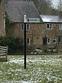 Fingerpost at Scotland End - geograph.org.uk - 1733393.jpg 959 × 1,280; 376 KB
-
 Firs garage crossroads - geograph.org.uk - 2969610.jpg 1,200 × 1,600; 586 KB
-
 Fodge Farm (1) - geograph.org.uk - 2778069.jpg 4,320 × 3,240; 4.84 MB
-
 Fodge Farm (2) - geograph.org.uk - 2778074.jpg 4,320 × 3,240; 4.68 MB
-
 Fodge Farm (3) - geograph.org.uk - 2778080.jpg 4,320 × 3,240; 4.58 MB
-
 Fodge Farm (4) - geograph.org.uk - 2778099.jpg 4,320 × 3,240; 4.77 MB
-
 Fodge Farm (5) - geograph.org.uk - 2778343.jpg 4,320 × 3,240; 5.14 MB
-
 Follow the field edge - geograph.org.uk - 2777950.jpg 4,320 × 3,240; 5.18 MB
-
 Font detail, Hook Norton church ^1 - geograph.org.uk - 5430330.jpg 768 × 1,024; 200 KB
-
 Font detail, Hook Norton church ^2 - geograph.org.uk - 5430334.jpg 768 × 1,024; 201 KB
-
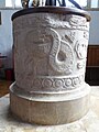 Font detail, Hook Norton church ^3 - geograph.org.uk - 5430341.jpg 768 × 1,024; 182 KB
-
 Footpath from South Hill - geograph.org.uk - 2693371.jpg 640 × 480; 74 KB
-
 Footpath leaves road - geograph.org.uk - 2432904.jpg 4,288 × 3,216; 1.76 MB
-
 Footpath leaves road - geograph.org.uk - 2780371.jpg 4,320 × 3,240; 5.63 MB
-
 Footpath meets road - geograph.org.uk - 2433435.jpg 4,288 × 3,216; 5.28 MB
-
 Footpath meets road - geograph.org.uk - 2729817.jpg 4,320 × 3,240; 5.06 MB
-
 Footpath meets the road - geograph.org.uk - 2778310.jpg 4,320 × 3,240; 4.57 MB
-
 Footpath to Swalcliffe - geograph.org.uk - 2780471.jpg 4,320 × 3,240; 5.35 MB
-
 Footpath to Temple Mills - geograph.org.uk - 2729691.jpg 4,320 × 3,240; 4.75 MB
-
 Former wort cooler - geograph.org.uk - 5107702.jpg 1,024 × 768; 199 KB
-
 Four ways to go (2) - geograph.org.uk - 2433497.jpg 4,288 × 3,216; 5.85 MB
-
 Four ways to go (3) - geograph.org.uk - 2433512.jpg 4,067 × 2,873; 4.1 MB
-
 Gates at Swerford - geograph.org.uk - 2450583.jpg 640 × 480; 118 KB
-
 Grass Mowing - geograph.org.uk - 5027567.jpg 1,600 × 900; 586 KB
-
 Grist Mill, Hook Norton Brewery - geograph.org.uk - 5107718.jpg 1,024 × 768; 197 KB
-
 Growing well - geograph.org.uk - 2432954.jpg 4,288 × 3,216; 3.31 MB
-
 Heading towards Wychford Lodge Farm - geograph.org.uk - 2693400.jpg 640 × 480; 93 KB
-
 High Street with village store - geograph.org.uk - 1733430.jpg 1,280 × 959; 273 KB
-
 High Street, Hook Norton - geograph.org.uk - 5429898.jpg 1,024 × 768; 292 KB
-
 Highwall Spinney from near Fodge Farm - geograph.org.uk - 2778261.jpg 4,320 × 3,240; 4.77 MB
-
 D'Arcy Dalton Way - geograph.org.uk - 389167.jpg 640 × 481; 69 KB
-

-

-
 Hook Norton - geograph.org.uk - 2432812.jpg 4,288 × 3,216; 3.97 MB
-
 Hook Norton - The Pear Tree P.H. - geograph.org.uk - 4712300.jpg 1,337 × 1,000; 934 KB
-
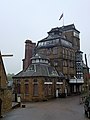
 Hook Norton - The Tower Brewery - geograph.org.uk - 4712316.jpg 1,000 × 1,319; 1.07 MB
-
 Hook Norton Brewery (geograph 7416532).jpg 4,268 × 2,465; 835 KB
-
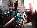 Hook Norton Brewery - Buxton ^ Thornley Steam Engine - geograph.org.uk - 5404377.jpg 1,301 × 1,000; 902 KB
-
 Hook Norton Brewery - geograph.org.uk - 3201007.jpg 3,240 × 4,320; 4.9 MB
-
 Hook Norton Brewery - geograph.org.uk - 3894656.jpg 1,024 × 683; 220 KB
-
 Hook Norton Brewery - geograph.org.uk - 4282381.jpg 2,000 × 1,314; 916 KB
-
 Hook Norton Brewery - geograph.org.uk - 4599746.jpg 480 × 640; 60 KB
-
 Hook Norton Brewery - geograph.org.uk - 4599751.jpg 480 × 640; 55 KB
-
 Hook Norton Brewery - geograph.org.uk - 4766900.jpg 2,000 × 2,082; 1.28 MB
-
 Hook Norton Brewery - geograph.org.uk - 5048827.jpg 1,125 × 1,500; 181 KB
-
 Hook Norton Brewery - geograph.org.uk - 5048830.jpg 1,119 × 1,500; 221 KB
-
 Hook Norton Brewery - geograph.org.uk - 5106128.jpg 768 × 1,024; 231 KB
-
 Hook Norton Brewery - geograph.org.uk - 5107689.jpg 1,024 × 768; 200 KB
-
 Hook Norton Brewery - geograph.org.uk - 5429502.jpg 768 × 1,024; 205 KB
-
 Hook Norton Brewery - geograph.org.uk - 5861318.jpg 851 × 1,024; 204 KB
-
 Hook Norton Brewery - geograph.org.uk - 5881820.jpg 1,600 × 1,200; 477 KB
-
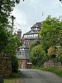
 Hook Norton Brewery - Old Brewery and tower - geograph.org.uk - 5404355.jpg 1,000 × 1,391; 942 KB
-
 Hook Norton Brewery - steam engine - geograph.org.uk - 5655775.jpg 640 × 443; 74 KB
-
 Hook Norton Brewery - Steam Engine in action - geograph.org.uk - 5404369.jpg 1,362 × 1,000; 645 KB
-
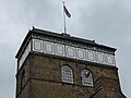 Hook Norton Brewery - Top of the tower - geograph.org.uk - 5404358.jpg 1,333 × 1,000; 721 KB
-
 Hook Norton Brewery appears on Brewery Lane - geograph.org.uk - 4712306.jpg 1,000 × 1,333; 1.2 MB
-
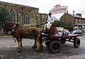 Hook Norton Brewery dray outside the Sun Inn - geograph.org.uk - 4282393.jpg 2,000 × 1,380; 877 KB
-
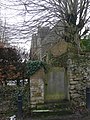
 Hook Norton church - geograph.org.uk - 5429487.jpg 768 × 1,024; 220 KB
-
 Hook Norton cottages 1 - geograph.org.uk - 2721213.jpg 1,024 × 768; 682 KB
-
 Hook Norton cottages 2 - geograph.org.uk - 2721215.jpg 1,024 × 768; 640 KB
-
 Hook Norton High Street - geograph.org.uk - 5429903.jpg 1,024 × 768; 287 KB
-
 Hook Norton Library - geograph.org.uk - 1733414.jpg 1,280 × 959; 374 KB
-
 Hook Norton Manor - geograph.org.uk - 1733442.jpg 959 × 1,280; 418 KB
-
 Hook Norton Memorial Hall on Chapel Street - geograph.org.uk - 4974035.jpg 1,600 × 1,086; 653 KB
-
 Hook Norton Road junction east of Rollright Heath Farm - geograph.org.uk - 3993140.jpg 3,648 × 2,736; 1.46 MB
-
 Hook Norton Viaduct - geograph.org.uk - 224672.jpg 639 × 430; 44 KB
-
 Hook norton viaduct 1.jpg 1,024 × 581; 594 KB
-
 Hook Norton, St. Peter's Church - geograph.org.uk - 5434747.jpg 3,680 × 3,778; 5.5 MB
-
 Hook Norton, St. Peter's Church, c15th roof corbel 1 - geograph.org.uk - 5434895.jpg 3,678 × 2,456; 3.4 MB
-
 Hook Norton, St. Peter's Church, c15th roof corbel 2 - geograph.org.uk - 5434900.jpg 3,678 × 2,456; 3.69 MB
-
 Hook Norton, St. Peter's Church, c15th roof corbel 3 - geograph.org.uk - 5434904.jpg 3,678 × 2,456; 3.32 MB
-
 Hook Norton, St. Peter's Church, c15th roof corbel 4 - geograph.org.uk - 5434908.jpg 2,424 × 1,586; 1.77 MB


.jpg)


.jpg)


_-_geograph.org.uk_-_2779504.jpg)
_-_geograph.org.uk_-_2779514.jpg)
_-_geograph.org.uk_-_2779529.jpg)


.jpg)


_-_geograph.org.uk_-_1973785.jpg)
_-_geograph.org.uk_-_1973788.jpg)
_-_geograph.org.uk_-_1973793.jpg)
_-_geograph.org.uk_-_1973802.jpg)


_-_geograph.org.uk_-_2780376.jpg)
_-_geograph.org.uk_-_2780381.jpg)
_-_geograph.org.uk_-_2780477.jpg)
_-_geograph.org.uk_-_2780481.jpg)
_-_geograph.org.uk_-_2780482.jpg)
_-_geograph.org.uk_-_2780483.jpg)


.jpg)


_-_geograph.org.uk_-_2779479.jpg)
_-_geograph.org.uk_-_2779493.jpg)


_-_geograph.org.uk_-_3053417.jpg)
_-_geograph.org.uk_-_3053432.jpg)


_-_geograph.org.uk_-_2778069.jpg)
_-_geograph.org.uk_-_2778074.jpg)
_-_geograph.org.uk_-_2778080.jpg)
_-_geograph.org.uk_-_2778099.jpg)
_-_geograph.org.uk_-_2778343.jpg)


_-_geograph.org.uk_-_2433497.jpg)
_-_geograph.org.uk_-_2433512.jpg)


.jpg)


