Category:Holburn
Jump to navigation
Jump to search
village in Northumberland, England, UK  | |||||
| Upload media | |||||
| Instance of | |||||
|---|---|---|---|---|---|
| Location | Lowick, Northumberland, North East England, England | ||||
 | |||||
English: Category:Villages in Northumberland
Subcategories
This category has the following 2 subcategories, out of 2 total.
B
- Bowden Doors (5 F)
S
- Saint Cuthbert's Cave (13 F)
Media in category "Holburn"
The following 29 files are in this category, out of 29 total.
-

-
 Hedge planting - geograph.org.uk - 312613.jpg 630 × 423; 81 KB
-
 Holburn - geograph.org.uk - 1750668.jpg 1,600 × 1,067; 437 KB
-
 Holburn - geograph.org.uk - 1750678.jpg 1,600 × 1,067; 368 KB
-
 HolburnNorthumberland.JPG 3,456 × 2,304; 3.57 MB
-
 Pill Box located on St Cuthbert's Way - geograph.org.uk - 517114.jpg 640 × 480; 129 KB
-
 Rock outcrop above St Cuthbert's Cave - geograph.org.uk - 1750885.jpg 1,600 × 1,067; 310 KB
-
 Save our bench.jpg 4,032 × 3,024; 2.69 MB
-
 Sheep near Hetton Hall - geograph.org.uk - 403039.jpg 640 × 480; 94 KB
-
 St Cuthbert's Way - geograph.org.uk - 312630.jpg 640 × 480; 116 KB
-
 St Cuthbert's Way rerouted section - geograph.org.uk - 517826.jpg 640 × 480; 124 KB
-
 Weathered sandstone outcrop - geograph.org.uk - 75777.jpg 640 × 480; 180 KB
-
 Arable field and set aside strip - geograph.org.uk - 312637.jpg 640 × 480; 116 KB
-
 Arable field at Spylaw - geograph.org.uk - 312634.jpg 640 × 480; 91 KB
-
 Field-woodland boundary - geograph.org.uk - 312657.jpg 640 × 480; 113 KB
-
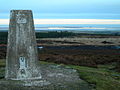
 Greensheen Hill trig - geograph.org.uk - 265626.jpg 640 × 480; 103 KB
-
 Greensheen Hill Trig Point. - geograph.org.uk - 643698.jpg 640 × 480; 81 KB
-
 Hazlerigg Mill - geograph.org.uk - 245203.jpg 640 × 425; 72 KB
-
 Hetton Law Farm - geograph.org.uk - 312654.jpg 640 × 403; 69 KB
-
 Hetton Steads - geograph.org.uk - 245206.jpg 640 × 441; 119 KB
-
 Holburn Moss - geograph.org.uk - 312623.jpg 640 × 475; 113 KB
-
 Horse Dean plantation - geograph.org.uk - 245204.jpg 640 × 480; 80 KB
-
 House at North Lyham - geograph.org.uk - 245193.jpg 640 × 429; 111 KB
-
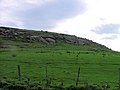 Lyham Hill - geograph.org.uk - 245190.jpg 640 × 480; 85 KB
-
 North Hazlerigg farm - geograph.org.uk - 245199.jpg 640 × 425; 72 KB
-
 On Fawcet Hill - geograph.org.uk - 80204.jpg 640 × 480; 52 KB
-

-
 South Hazlerigg - geograph.org.uk - 245197.jpg 640 × 417; 95 KB
-
 Tree planting on Horton Moor - geograph.org.uk - 312659.jpg 640 × 480; 115 KB


