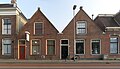
Category:Hoendiepskade 12-13 (Groningen)
Jump to navigation
Jump to search
|
This is a category about a municipal monument in Groningen with number 106304 |
|
This is a category about a municipal monument in Groningen with number 106306 |
| Object location | | View all coordinates using: OpenStreetMap |
|---|
Media in category "Hoendiepskade 12-13 (Groningen)"
The following 3 files are in this category, out of 3 total.
-
 20140401 Hoendiepskade 12-13 Groningen NL.jpg 5,600 × 3,200; 5.48 MB
-
 20140505 Vm verdeelpunt draadomroep Hoendiepskade 11-12 Groningen NL (1).jpg 2,600 × 2,600; 2.37 MB
-
 20140505 Vm verdeelpunt draadomroep Hoendiepskade 11-12 Groningen NL (2).jpg 3,000 × 3,000; 3.69 MB

.jpg)
.jpg)