Category:Hochficht
Jump to navigation
Jump to search
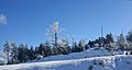
English: Hochficht (Czech: Smrčina) is a mountain in Mühlviertel (Upper Austria) with 1,338 m above sea level.
Deutsch: Der Hochficht (tschechisch: Smrčina) ist ein Berg im Mühlviertel in Oberösterreich mit einer Höhe von 1.338 m ü. A.
Čeština: Smrčina (německy Hochficht) je hora v hornorakouském Mühlviertelu o výšce 1 338 m n.m.
mountain in at the border Upper Austria / Jihočeský kraj  Pohled na Smrčinu ze svahu Plechého | |||||
| Upload media | |||||
| Instance of | |||||
|---|---|---|---|---|---|
| Located in protected area | |||||
| Location |
| ||||
| Mountain range | |||||
| Topographic prominence |
| ||||
| Topographic isolation |
| ||||
| Elevation above sea level |
| ||||
 | |||||
Subcategories
This category has the following 3 subcategories, out of 3 total.
*
S
Media in category "Hochficht"
The following 8 files are in this category, out of 8 total.
-
 Hochficht, kříž 01.jpg 2,640 × 1,409; 2.25 MB
-
 Hochficht.jpg 2,592 × 1,944; 1.64 MB
-
 Klaffer am Hochficht - Freundorf von Süden.jpg 5,838 × 3,891; 16.67 MB
-
 Klaffer am Hochficht Kaltebenfelsen-8872.jpg 3,739 × 4,985; 21.83 MB
-
 National nature reserve Boubinsky prales in 2011 (23).JPG 4,752 × 3,168; 4.71 MB
-
 Smrčina S vrchol.jpg 1,500 × 1,125; 723 KB
-
 WTB 20220723 Ulrichsberg Aussichtsturm Alpenblick - Panorama Klaffer 7903.jpg 46,822 × 3,216; 43.96 MB
-
 WTB 20220723 Ulrichsberg Blick nach N 7869.jpg 5,137 × 3,425; 6.63 MB


.JPG)

