Category:Hobson's Conduit fountainhead
Jump to navigation
Jump to search
This is a category about listed building number 1067788. |
This is a category about listed building number 1006912. |
| Object location | | View all coordinates using: OpenStreetMap |
|---|
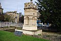
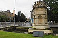
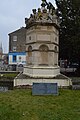
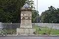
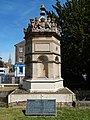
listed monument at the corner of Lensfield Road, Cambridge  | |||||
| Upload media | |||||
| Instance of | |||||
|---|---|---|---|---|---|
| Part of | |||||
| Location | Cambridge, Cambridgeshire, East of England, England | ||||
| Heritage designation |
| ||||
 | |||||
Media in category "Hobson's Conduit fountainhead"
The following 29 files are in this category, out of 29 total.
-
 Cambridge, hobson's conduit.JPG 1,944 × 2,592; 741 KB
-
 Detail on Hobson's Conduit Fountainhead.jpg 4,326 × 2,667; 8.28 MB
-
 Fountainhead at Hobson's Conduit, Cambridge (01).jpg 4,592 × 3,448; 12.77 MB
-
 Fountainhead at Hobson's Conduit, Cambridge (02).jpg 3,231 × 4,487; 12.87 MB
-
 Fountainhead at Hobson's Conduit, Cambridge (Plaque).jpg 3,180 × 2,021; 8.19 MB
-
 Fountainhead, Hobson's Conduit - geograph.org.uk - 4282420.jpg 640 × 430; 91 KB
-
 Hobson's Conduit - geograph.org.uk - 1615907.jpg 475 × 640; 86 KB
-
 Hobson's Conduit - geograph.org.uk - 18047.jpg 480 × 640; 114 KB
-
 Hobson's Conduit - geograph.org.uk - 3861105.jpg 640 × 430; 81 KB
-
 Hobson's Conduit - geograph.org.uk - 3861121.jpg 640 × 430; 84 KB
-
 Hobson's Conduit - geograph.org.uk - 3922368.jpg 640 × 430; 79 KB
-
 Hobson's Conduit - geograph.org.uk - 4028224.jpg 3,872 × 2,592; 3.66 MB
-
 Hobson's Conduit - geograph.org.uk - 4141922.jpg 640 × 430; 94 KB
-
 Hobson's Conduit - geograph.org.uk - 4904320.jpg 640 × 426; 88 KB
-
 Hobson's Conduit - geograph.org.uk - 4986048.jpg 426 × 640; 83 KB
-
 Hobson's Conduit - geograph.org.uk - 4986052.jpg 640 × 426; 78 KB
-
 Hobson's Conduit - geograph.org.uk - 4986053.jpg 426 × 640; 76 KB
-
 Hobson's Conduit - geograph.org.uk - 5641885.jpg 640 × 425; 96 KB
-
 Hobson's Conduit - geograph.org.uk - 5649753.jpg 426 × 640; 80 KB
-
 Hobson's Conduit - geograph.org.uk - 6006927.jpg 1,024 × 681; 232 KB
-
 Hobson's Conduit - geograph.org.uk - 6006928.jpg 1,024 × 681; 202 KB
-
 Hobson's Conduit in Cambridge.jpg 2,448 × 3,264; 3.74 MB
-
 Hobson's Conduit Memorial - geograph.org.uk - 4149320.jpg 1,200 × 1,600; 597 KB
-
 Hobson's Conduit monument, Cambridge, England - DSCF2224.JPG 3,000 × 4,000; 2.76 MB
-
 Hobson's Conduit monument, Cambridge, England - IMG 0709.JPG 3,240 × 4,320; 3.57 MB
-
 Hobson's Conduit.jpg 3,024 × 4,032; 4.44 MB
-
 Hobson'sconduit2.JPG 1,920 × 2,444; 465 KB
-
 Hobsons Conduit Monument Cambridge.jpg 3,672 × 4,896; 3.65 MB
-
 Railings Round Hobson'S Conduit.jpg 4,032 × 3,024; 4.93 MB


.jpg)
.jpg)
.jpg)


