Category:History of Ruhland
Jump to navigation
Jump to search
| Object location | | View all coordinates using: OpenStreetMap |
|---|
Deutsch: Geschichte von Ruhland
Subcategories
This category has the following 25 subcategories, out of 25 total.
2
- 2017 in Ruhland (74 F)
- 2024 in Ruhland (5 F)
B
D
F
G
H
M
N
- Nachtwanderung in Ruhland (1 P, 12 F)
O
- Old sights of Ruhland (18 F)
P
- Polish-Saxon Post distance stones in Ruhland (1 P, 32 F)
S
W
- Wappen Ruhlander Grundherren (4 F)
Media in category "History of Ruhland"
The following 3 files are in this category, out of 3 total.
-
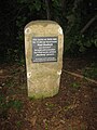 Ruhland, Mordweg-Stein, restauriert 2021, 01.jpg 2,736 × 3,648; 4.67 MB
-
 Ruhland, Mordweg-Stein, restauriert 2021, 02.jpg 3,000 × 4,000; 6.77 MB
-
 Ruhland, Mordweg-Stein, restauriert 2021, 03.jpg 3,000 × 4,000; 5.94 MB


