Category:Historical aerial photographs of Sweden from the Swedish National Land Survey
Jump to navigation
Jump to search
Svenska: Den här kategorin innehåller Historiska ortofoton från Lantmäteriet som är släppta under öppna datalicensen Creative Commons CC0.
English: This category contains historical ortophotos/aerial photographs from the Swedish National Land Survey which have been released under the Creative Commons CC0 license.
Media in category "Historical aerial photographs of Sweden from the Swedish National Land Survey"
The following 59 files are in this category, out of 59 total.
-
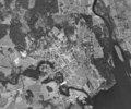
 Almöbron 1975.tif 3,381 × 1,449; 9.34 MB
-
 Alnöbron historiskt ortofoto.png 882 × 449; 434 KB
-
 Arlanda flygplats flygfoto.tif 8,510 × 8,050; 130.67 MB
-
 Bromma flygplats flygfoto.tif 3,986 × 3,824; 14.54 MB
-
 Burön historiskt ortofoto.png 553 × 565; 373 KB
-
 Dekarsön historiskt ortofoto.png 374 × 476; 206 KB
-
 Dynäs industrier historiskt ortofoto.png 1,209 × 563; 878 KB
-
 Falu gruva 1960.tif 3,455 × 2,859; 9.42 MB
-
 Flygfoto Blåhammarens fjällstation.tif 796 × 651; 506 KB
-
 Flygfoto Forshaga 1960.tif 6,192 × 5,904; 69.73 MB
-
 Flygfoto Jönköping 1960.png 3,179 × 2,245; 9.6 MB
-
 Flygfoto Karlstad 1960.tif 14,592 × 12,096; 336.66 MB
-
 Flygfoto Kebnekaise fjällstation.tif 616 × 529; 318 KB
-
 Flygfoto Kiruna.tif 11,904 × 17,120; 388.71 MB
-
 Flygfoto Lammhult 1975.tif 3,648 × 4,544; 31.62 MB
-
 Flygfoto Malmberget.tif 13,968 × 8,560; 228.06 MB
-
 Flygfoto Storulvåns fjällstation.tif 626 × 502; 307 KB
-
 Flygfoto Sylarnas gamla fjällstation.tif 1,132 × 961; 1.04 MB
-
 Flygfoto Växjö 1960.tif 15,040 × 14,624; 419.51 MB
-
 Gamla hisingsbron historiskt ortofoto.png 535 × 535; 301 KB
-
 Gamla Svinesundsbron historiskt ortofoto.png 437 × 446; 262 KB
-
 Göteborgs hamn 1960.tif 10,192 × 4,496; 87.4 MB
-
 Hagfors flottning.png 635 × 1,073; 583 KB
-
 Hagfors flygfoto 1960.png 3,096 × 2,703; 7.02 MB
-
 Helags flygfoto gamla fjällstationen.tif 277 × 240; 130 KB
-
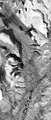
 Helags flygfoto glaciär.tif 1,808 × 2,368; 8.17 MB
-
 Helags flygfoto.tif 9,786 × 8,000; 149.32 MB
-
 Hornön historiskt ortofoto.png 747 × 553; 511 KB
-
 Jäverön flygfoto 1960.tif 8,416 × 9,088; 72.94 MB
-
 Kallaxön historiskt ortofoto.png 640 × 542; 367 KB
-
 Karlskrona flygfoto 1960.tif 10,496 × 13,184; 263.94 MB
-
 Kebnekaise flygbild.tif 12,000 × 8,000; 105.43 MB
-
 Kirunavaara historiskt ortofoto.png 344 × 464; 171 KB
-
 Kramfors flygbild 1960.tif 6,547 × 5,843; 36.48 MB
-
 Kramfors flygbild industrier 1960.tif 4,350 × 3,583; 14.86 MB
-
 Ljungarums trafikplats.png 569 × 560; 408 KB
-
 Lungön historiskt ortofot.png 756 × 521; 418 KB
-
 Malmön historiskt ortofoto.png 347 × 465; 160 KB
-
 Mjältön flygfoto.tif 6,635 × 10,000; 126.55 MB
-
 Mullsjö flygfoto 1975.tif 5,709 × 5,247; 57.14 MB
-
 Porjus flygfoto 1960.tif 5,610 × 5,852; 62.62 MB
-
 Riddarbron historiskt ortofoto.png 618 × 440; 329 KB
-
 Sandöbron historiskt ortofoto.png 540 × 537; 280 KB
-
 Strömsund flygfoto 1960.tif 6,127 × 7,227; 84.46 MB
-
 Sylarna flygfoto 1960.tif 11,552 × 15,488; 341.26 MB
-
 Södersjukhuset flygfoto.tif 1,372 × 936; 1.22 MB
-
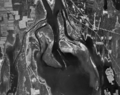
 Timber floating Ångermanälven 2 historiskt ortofoto.png 406 × 691; 356 KB
-
 Timber floating Ångermanälven historiskt ortofoto.png 1,020 × 557; 763 KB
-
 Torsby flygfoto 1960.tif 4,906 × 4,081; 38.19 MB
-
 Trafikplats Djurhagshaus.png 1,070 × 566; 626 KB
-
 Umeälvens delta historiskt ortofoto.png 568 × 450; 330 KB
-
 Umeå flygfoto.tif 20,000 × 10,000; 381.47 MB
-
 Umeå I20.tif 1,685 × 1,472; 2.37 MB
-
 Vistasdalen.tif 1,333 × 3,126; 11.92 MB
-
 Västra fördämningen Suorvadammen flygfoto.tif 1,515 × 1,302; 1.88 MB
-
 Vågsfjärden, Nogrdingrå historiskt ortofoto.png 614 × 411; 327 KB
-
 Åbordsön historiskt ortofoto.png 713 × 562; 467 KB
-
 Åre flygfoto 1960.tif 10,534 × 9,292; 186.7 MB
-
 Ölandsbron 1975.tif 30,000 × 10,000; 572.21 MB


