Category:Historic American Engineering Record images of the Northeast Corridor
Jump to navigation
Jump to search
Subcategories
This category has the following 5 subcategories, out of 5 total.
1
2
H
Media in category "Historic American Engineering Record images of the Northeast Corridor"
The following 200 files are in this category, out of 384 total.
(previous page) (next page)-
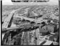
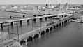
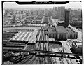
 2. UNION STATION PLAZA. WASHINGTON, D. C. 030164pv.jpg 1,024 × 787; 192 KB
-
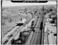
 3. TRACKS, PLATFORMS AND UMBRELLA SHEDS BEHIND UNION STATION. 030165pv.jpg 1,024 × 826; 202 KB
-
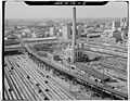
 4. RAIL YARD BEHIND UNION STATION. WASHINGTON, D. C. 030166pv.jpg 1,024 × 815; 231 KB
-
 5. 'A' INTERLOCKING TOWER AND TURNTABLE BEHIND UNION STATION. 030167pv.jpg 1,024 × 785; 212 KB
-
 6. IVY CITY ROUNDHOUSE. WASHINGTON, D. C. 030168pv.jpg 1,024 × 788; 198 KB
-
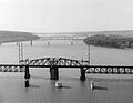
 7. ANACOSTIA RIVER BRIDGE. WASHINGTON, D. C. 030169pv.jpg 1,024 × 785; 168 KB
-
 Aerial view of Attleboro interlocking tower, April 1977.jpg 5,000 × 3,875; 3.51 MB
-
 Aerial view of Dodgeville Mill and Northeast Corridor (1), April 1977.jpg 5,000 × 3,879; 3.8 MB
-
 Aerial view of Dodgeville Mill and Northeast Corridor (2), April 1977.jpg 5,000 × 3,898; 3.63 MB
-
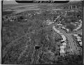
 Aerial view of Hebronville Mill complex and Northeast Corridor, April 1977.jpg 5,000 × 3,880; 3.7 MB
-
 Aerial view of Kingston interlocking tower.jpg 5,000 × 3,870; 3.7 MB
-
 Aerial view of Kingston Railroad Station 1.jpg 5,000 × 3,913; 3.8 MB
-
 Aerial view of Kingston Railroad Station 2.jpg 5,000 × 3,940; 3.97 MB
-
 Aerial view of New London Union Station from north.jpg 5,190 × 4,095; 3.87 MB
-
 Aerial view of New London Union Station from southeast.jpg 5,207 × 4,084; 3.4 MB
-
 Aerial view of New London Union Station from west.jpg 5,212 × 4,083; 3.37 MB
-
 Aerial view of north part of Canton Viaduct, April 1977.jpg 5,000 × 3,849; 3.72 MB
-
 Aerial view of Park Street arches in Attleboro, April 1977.jpg 5,000 × 3,899; 3.42 MB
-
 Aerial view of Readville 1-Yard, April 1977.jpg 5,000 × 3,884; 3.61 MB
-
 Aerial view of Readville bridge, April 1977.jpg 5,000 × 3,874; 3.89 MB
-
 Aerial view of Readville interlocking tower, April 1977.jpg 5,000 × 3,924; 3.34 MB
-
 Aerial view of Readville Shops (1), April 1977.jpg 4,671 × 3,579; 3.33 MB
-
 Aerial view of Readville Shops (2), April 1977.jpg 5,000 × 3,877; 3.52 MB
-
 Aerial view of Readville Shops (3), April 1977.jpg 5,000 × 3,900; 3.35 MB
-
 Aerial view of Readville station and bridge, April 1977.jpg 5,000 × 3,920; 3.7 MB
-
 Amtrak Anacostia River Bridge 1977.jpg 4,810 × 3,635; 2.48 MB
-
 Amtrak Susquehanna Bridge Swing Span.jpg 4,799 × 3,731; 2.26 MB
-
 Amtrak Susquehanna Bridge.jpg 4,872 × 3,516; 2.37 MB
-

-
 Attleboro station and viaduct aerial, April 1977.jpg 5,000 × 3,894; 3.69 MB
-

-

-

-

-

-

-

-

-
-
 B&P Tunnel West 1977.jpg 4,886 × 3,745; 2.73 MB
-

-

-

-

-

-

-

-

-

-

-

-

-

-

-

-

-

-

-

-

-
 Canton Viaduct Wing Wall.PNG 1,097 × 549; 673 KB
-
 Canton Viaduct.jpg 4,686 × 3,582; 2.62 MB
-

-

-

-
 Centre Street Bridge, Newark, NJ.tif 1,358 × 607; 933 KB
-

-

-
 CNJ-NY&NewarkRRoverNEC@Penn.tif 907 × 697; 1.03 MB
-

-

-

-

-

-

-

-

-

-

-
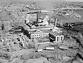 Cos Cob Power Plant, Cos Cob, (Fairfield County, Connecticut).jpg 937 × 708; 241 KB
-

-

-

-

-
 Delaware River Bridge Morrisville HAER PA51-PHILA694-30 cut.jpg 4,717 × 2,649; 1.32 MB
-

-

-
-

-

-
 Dock Bridge 1974 - HAER NJ-40.35.tif 4,767 × 3,626; 17.92 MB
-
 Downtown New Brunswick, NJ 1974 - HAER NJ-40.4.tif 4,730 × 3,563; 18.4 MB
-

-

-
-

-

-

-

-

-

-

-

-

-

-

-

-

-

-

-

-

-

-

-

-

-

-

-

-

-

-

-
 HAER PA,51-PHILA,694-18--West Philadelphia Elevated--north.jpg 5,000 × 3,862; 4.62 MB
-
 HAER PA,51-PHILA,694-8--West-Philadelphia-Elevated--south.jpg 5,000 × 3,883; 3.75 MB
-
 HAER-30thStreetStation-09.jpg 5,000 × 3,883; 4.59 MB
-
 HAER-30thStreetStation-11-USPostalService.jpg 5,000 × 3,872; 4.67 MB
-
 HAER-30thStreetStation-14.jpg 5,000 × 3,873; 4.53 MB
-
 HAER-30thStreetStation-15.jpg 5,000 × 3,824; 4.64 MB
-
 HAER-30thStreetStation-17.jpg 5,000 × 3,764; 4.23 MB
-
 HAER-30thStreetStation-8-Powerhouse-cropped.jpg 2,728 × 3,637; 2.11 MB
-

-

-
-
-

-
 Housatonic River Bridge, Stratford, -Fairfield County, Connecticut).jpg 852 × 680; 173 KB
-

-

-

-

-

-

-

-

-

-

-

-

-

-

-

-

-

-

-

-
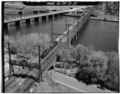
 Hutchinson River Bridge.jpg 1,024 × 793; 181 KB
-

-

-

-

-

-

-

-

-
 Lehigh valley bridge over NEC from air at hunter connection.jpeg 4,712 × 3,800; 5.49 MB
-

-

-

-

-

-
-

-
 Mianus River Bridge, Cos Cob (Fairfield County, Connecticut).jpg 935 × 720; 182 KB
-

-

-
-

-

-
-

-

-
 Mystic River CT LOC 024157pu.jpg 4,971 × 3,739; 7.3 MB
-

-

-

-

-

-

-

-

-

-

-

-

-

-

-
-

-

-


,_April_1977.jpg)
,_April_1977.jpg)


,_April_1977.jpg)
,_April_1977.jpg)
,_April_1977.jpg)


.jpg)


.jpg)


.jpg)

