Category:Hinderclay
Jump to navigation
Jump to search
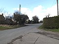
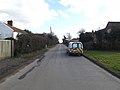
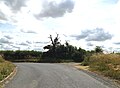
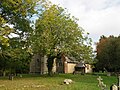
English: Hinderclay is a village and civil parish in the Mid Suffolk district of Suffolk in eastern England. Located around twelve miles north east of Bury St Edmunds, in 2005 its population was 340.[1] The parish also contains the hamlet of Thorpe Street.
village and civil parish in Suffolk, UK  | |||||
| Upload media | |||||
| Instance of | |||||
|---|---|---|---|---|---|
| Location | Mid Suffolk, Suffolk, East of England, England | ||||
 | |||||
- ↑ Cite error: Invalid
<ref>tag; no text was provided for refs namedpopulation
Subcategories
This category has the following 3 subcategories, out of 3 total.
H
- Hinderclay Village Sign (6 F)
- Hinderclay War Memorial (1 F)
S
Media in category "Hinderclay"
The following 121 files are in this category, out of 121 total.
-
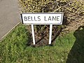 Bells Lane sign - geograph.org.uk - 4377032.jpg 3,072 × 2,304; 1.92 MB
-
 Bells Lane ^ footpath - geograph.org.uk - 4377715.jpg 3,072 × 2,304; 1.86 MB
-
 Bells Lane, Hinderclay - geograph.org.uk - 4375480.jpg 3,072 × 2,304; 1.84 MB
-
 Bells Lane, Hinderclay - geograph.org.uk - 4375732.jpg 3,072 × 2,247; 2.45 MB
-
 Bells Lane, Hinderclay - geograph.org.uk - 4377013.jpg 2,304 × 3,072; 2.74 MB
-
 Bells Lane, Hinderclay - geograph.org.uk - 4377718.jpg 3,072 × 2,304; 1.9 MB
-
 Bells Lane, Hinderclay - geograph.org.uk - 4377719.jpg 3,072 × 2,304; 1.74 MB
-
 Bells Lane, Hinderclay - geograph.org.uk - 4377728.jpg 3,072 × 2,304; 1.8 MB
-
 Bridge Farm - geograph.org.uk - 3792794.jpg 640 × 480; 99 KB
-
 Bus Shelter at Hinderclay - geograph.org.uk - 4377040.jpg 2,240 × 2,978; 2.83 MB
-
 Byway to Crackthorn Corner - geograph.org.uk - 4375457.jpg 3,072 × 2,304; 1.8 MB
-
 Byway to Crackthorn Corner - geograph.org.uk - 4377734.jpg 3,072 × 2,304; 1.83 MB
-
 C637 Church Lane, Thelnetham - geograph.org.uk - 5029651.jpg 3,072 × 2,304; 1.94 MB
-
 Concrete apron by Bells Lane - geograph.org.uk - 3792779.jpg 640 × 480; 87 KB
-
 Crackthorn Bridge on Hinderclay Road - geograph.org.uk - 4375376.jpg 3,072 × 2,304; 1.95 MB
-
 Entering Hinderclay on Hinderclay Rosad - geograph.org.uk - 4375372.jpg 3,072 × 2,304; 3.73 MB
-
 Entering Hinderclay on School Road - geograph.org.uk - 5062944.jpg 3,072 × 2,304; 1.71 MB
-
 Entering Hinderclay on School Road - geograph.org.uk - 5062966.jpg 3,072 × 2,304; 1.92 MB
-
 Entering Rickinghall on School Road - geograph.org.uk - 5064582.jpg 2,893 × 2,170; 4.24 MB
-
 Entrance of St.Mary's Church - geograph.org.uk - 4376818.jpg 3,072 × 2,304; 1.79 MB
-
 Entrance to Hinderclay Fishing Lakes - geograph.org.uk - 4443808.jpg 1,024 × 768; 316 KB
-
 Entrance to Hinderclay Lakes - geograph.org.uk - 5062903.jpg 3,072 × 2,304; 1.78 MB
-
 Fen Road Junction - geograph.org.uk - 1262936.jpg 640 × 480; 101 KB
-
 Fen Road sign - geograph.org.uk - 4375399.jpg 3,072 × 2,304; 1.88 MB
-
 Fen Road, Hinderclay - geograph.org.uk - 4375395.jpg 3,072 × 2,304; 1.74 MB
-
 Fen Road, Hinderclay - geograph.org.uk - 4375401.jpg 3,072 × 2,304; 1.85 MB
-
 Field off Thorpe Street - geograph.org.uk - 4377740.jpg 3,072 × 2,304; 1.92 MB
-
 Footpath to Mill Lane - geograph.org.uk - 5062887.jpg 3,072 × 2,304; 1.87 MB
-
 Footpath to Redgrave Green - geograph.org.uk - 5062969.jpg 3,072 × 2,304; 1.9 MB
-
 Gobbett's Lane, Hinderclay - geograph.org.uk - 4377859.jpg 2,879 × 2,157; 1.31 MB
-
 Gobbetts Lane sign - geograph.org.uk - 4376949.jpg 3,072 × 2,304; 1.94 MB
-
 Grazing Deer off Thorpe Street - geograph.org.uk - 4377743.jpg 3,072 × 2,304; 1.62 MB
-
 Heap of sugar beet - geograph.org.uk - 3792756.jpg 640 × 480; 82 KB
-
 Hinderclay Lakes sign - geograph.org.uk - 5062941.jpg 2,928 × 2,196; 3.86 MB
-
 Hinderclay Road, Hinderclay - geograph.org.uk - 4375390.jpg 3,072 × 2,222; 3.69 MB
-
 Hinderclay Road, Hinderclay - geograph.org.uk - 4375406.jpg 3,072 × 2,304; 1.91 MB
-
 Hinderclay Road, Hinderclay - geograph.org.uk - 5085230.jpg 3,072 × 2,304; 1.87 MB
-
 Hinderclay Road, Hinderclay - geograph.org.uk - 5085239.jpg 3,072 × 2,304; 1.73 MB
-
 Hinderclay Road, Hinderclay - geograph.org.uk - 5085262.jpg 3,072 × 2,304; 1.76 MB
-
 Hinderclay Road, Wattisfield - geograph.org.uk - 5085328.jpg 3,072 × 2,304; 1.67 MB
-
 Hinderclay Telephone Box - geograph.org.uk - 4375833.jpg 2,304 × 3,072; 2.61 MB
-
 Hinderclay Village Hall - geograph.org.uk - 4377021.jpg 3,072 × 2,304; 1.76 MB
-
 Hinderclay Village Hall - geograph.org.uk - 5062970.jpg 3,072 × 2,304; 1.86 MB
-
 Hinderclay Village Hall - geograph.org.uk - 6031544.jpg 1,024 × 768; 154 KB
-
 Hinderclay Village Hall ^ Gobbetts Lane sign - geograph.org.uk - 4377721.jpg 3,072 × 2,304; 1.91 MB
-
 Hinderclay Village Name sign - geograph.org.uk - 4375373.jpg 3,072 × 2,304; 2.02 MB
-
 Hinderclay Village Name sign on School Road - geograph.org.uk - 5062946.jpg 3,072 × 2,304; 1.96 MB
-
 Hinderclay Village Name sign on School Road - geograph.org.uk - 5062967.jpg 3,072 × 2,304; 1.93 MB
-
 Hinderclay village sign - geograph.org.uk - 5311905.jpg 2,592 × 3,456; 3.11 MB
-
 Hinderclay village sign, detail - geograph.org.uk - 5311908.jpg 3,456 × 2,592; 1.03 MB
-
 Lodge Farm - geograph.org.uk - 3792812.jpg 640 × 480; 67 KB
-
 Lonesome Pines - geograph.org.uk - 1809524.jpg 1,600 × 1,200; 451 KB
-
 Pumping Station off Gobbett's Lane - geograph.org.uk - 4377868.jpg 2,970 × 2,225; 1.97 MB
-
 Pumping Station off Gobbett's Lane - geograph.org.uk - 4377870.jpg 2,889 × 2,165; 2 MB
-
 Rickinghall Road sign - geograph.org.uk - 4376937.jpg 3,072 × 2,304; 1.85 MB
-
 Rickinghall Road ^ footpath - geograph.org.uk - 5062968.jpg 3,072 × 2,304; 1.8 MB
-
 Rickinghall Road ^ Hinderclay Village Sign - geograph.org.uk - 4377574.jpg 3,072 × 2,304; 1.92 MB
-
 Rickinghall Road, Hinderclay - geograph.org.uk - 4376874.jpg 3,072 × 2,304; 1.62 MB
-
 Rickinghall Road, Hinderclay - geograph.org.uk - 4376888.jpg 2,970 × 2,225; 2.74 MB
-
 Rickinghall Road, Hinderclay - geograph.org.uk - 4376926.jpg 3,072 × 2,304; 1.78 MB
-
 Rickinghall Village Name sign on School Road - geograph.org.uk - 5064590.jpg 2,966 × 2,224; 3.8 MB
-
 Road Junction - geograph.org.uk - 1262903.jpg 640 × 480; 69 KB
-
 Road sign on Rickinghall Road - geograph.org.uk - 4375850.jpg 2,190 × 2,915; 2.61 MB
-
 Roadsign at Thorpe Street - geograph.org.uk - 4377816.jpg 2,304 × 3,072; 3.23 MB
-
 Roadsign on Gobbett's Lane - geograph.org.uk - 4376991.jpg 2,304 × 3,072; 3.54 MB
-
 Roadsign on Hinderclay Road - geograph.org.uk - 4375412.jpg 2,228 × 2,962; 4.52 MB
-
 Roadsign on Wash Lane - geograph.org.uk - 4375473.jpg 2,192 × 2,914; 2.7 MB
-
 Roadsign on Wattisfield Road - geograph.org.uk - 5085250.jpg 3,072 × 2,304; 1.98 MB
-
 School Road ^ Bridge - geograph.org.uk - 5062943.jpg 3,072 × 2,031; 4.65 MB
-
 School Road ^ Byway - geograph.org.uk - 5064617.jpg 3,072 × 2,264; 3.24 MB
-
 School Road ^ footpath - geograph.org.uk - 5062884.jpg 3,072 × 2,188; 5.21 MB
-
 School Road, Hinderclay - geograph.org.uk - 5062900.jpg 3,072 × 2,304; 1.98 MB
-
 School Road, Hinderclay - geograph.org.uk - 5062965.jpg 3,072 × 2,304; 1.8 MB
-
 School Road, Rickinghall - geograph.org.uk - 5077055.jpg 3,072 × 2,304; 1.73 MB
-
 Small Bridge - geograph.org.uk - 1260292.jpg 640 × 480; 133 KB
-
 St Mary, Hinderclay - Chancel - geograph.org.uk - 5989093.jpg 1,000 × 750; 363 KB
-
 St Mary, Hinderclay - Churchyard - geograph.org.uk - 5989085.jpg 1,000 × 689; 549 KB
-
 St Mary, Hinderclay - Font - geograph.org.uk - 5989098.jpg 785 × 1,000; 329 KB
-
 St Mary, Hinderclay - geograph.org.uk - 5989086.jpg 1,000 × 756; 520 KB
-
 St Mary, Hinderclay - geograph.org.uk - 5989089.jpg 1,000 × 750; 456 KB
-
 St Mary, Hinderclay - Organ - geograph.org.uk - 5989099.jpg 617 × 1,000; 272 KB
-
 St Mary, Hinderclay - Pulpit - geograph.org.uk - 5989100.jpg 744 × 1,000; 292 KB
-
 St Mary, Hinderclay - South aisle - geograph.org.uk - 5989090.jpg 1,000 × 721; 300 KB
-
 St Mary, Hinderclay - South aisle - geograph.org.uk - 5989105.jpg 1,000 × 693; 346 KB
-
 St Mary, Hinderclay - Stained glass window - geograph.org.uk - 5989106.jpg 788 × 1,000; 433 KB
-
 St Mary, Hinderclay - Stained glass window - geograph.org.uk - 5989107.jpg 865 × 1,000; 498 KB
-
 St Mary, Hinderclay - Stained glass window - geograph.org.uk - 5989108.jpg 664 × 1,000; 433 KB
-
 St Mary, Hinderclay - Stained glass window - geograph.org.uk - 5989109.jpg 720 × 1,000; 434 KB
-
 St Mary, Hinderclay - Stained glass window - geograph.org.uk - 5989111.jpg 1,000 × 746; 374 KB
-
 St Mary, Hinderclay - West end - geograph.org.uk - 5989103.jpg 1,000 × 697; 296 KB
-
 St.Mary's Church Notice Board - geograph.org.uk - 4376471.jpg 2,181 × 2,900; 3.83 MB
-
 The Angles Way, crossing Hinderclay Fen - geograph.org.uk - 2152032.jpg 1,024 × 768; 249 KB
-
 The Old Post Office, Hinderclay - geograph.org.uk - 5064272.jpg 3,072 × 2,304; 1.96 MB
-
 The Street Postbox - geograph.org.uk - 5063477.jpg 3,072 × 2,304; 1.92 MB
-
 The Street Postbox - geograph.org.uk - 5063480.jpg 3,072 × 2,304; 1.9 MB
-
 The Street Postbox - geograph.org.uk - 5063632.jpg 3,072 × 2,304; 2.02 MB
-
 The Street Postbox - geograph.org.uk - 5063636.jpg 2,304 × 3,072; 6.43 MB
-
 The Street Postbox - geograph.org.uk - 5064277.jpg 2,216 × 2,947; 4.6 MB
-
 The Street Postbox - geograph.org.uk - 5064278.jpg 2,192 × 2,914; 6.76 MB
-
 The Street sign - geograph.org.uk - 4377005.jpg 3,046 × 2,282; 5.71 MB
-
 The Street ^ The Street Postbox - geograph.org.uk - 5063483.jpg 3,072 × 2,304; 2.04 MB
-
 The Street ^ The Street Postbox - geograph.org.uk - 5064274.jpg 3,072 × 2,304; 1.87 MB
-
 The Street, Hinderclay - geograph.org.uk - 4376892.jpg 3,072 × 2,304; 2.02 MB
-
 The Street, Hinderclay - geograph.org.uk - 4377705.jpg 3,072 × 2,304; 3.16 MB
-
 The Street, Hinderclay - geograph.org.uk - 4377710.jpg 2,304 × 2,984; 1.98 MB
-
 The Street, Hinderclay - geograph.org.uk - 4377713.jpg 3,072 × 2,304; 1.9 MB
-
 The Street, Hinderclay - geograph.org.uk - 4377723.jpg 3,072 × 2,304; 2.13 MB
-
 Thorpe Street, Hinderclay - geograph.org.uk - 4375715.jpg 3,072 × 2,304; 1.89 MB
-
 Thorpe Street, Thorpe Street - geograph.org.uk - 4377802.jpg 3,072 × 2,304; 3.52 MB
-
 Thorpe Street, Thorpe Street - geograph.org.uk - 4377826.jpg 3,072 × 2,304; 2.92 MB
-
 Town House Lane, Wattisfield - geograph.org.uk - 5085139.jpg 3,072 × 2,304; 1.88 MB
-
 Wash Lane, Hinderclay - geograph.org.uk - 4375415.jpg 3,072 × 2,304; 1.9 MB
-
 Wash Lane, Hinderclay - geograph.org.uk - 4375458.jpg 3,072 × 2,304; 1.72 MB
-
 Wash Lane, Hinderclay - geograph.org.uk - 4375485.jpg 3,072 × 2,304; 1.91 MB
-
 Wash Lane, Hinderclay - geograph.org.uk - 4377852.jpg 3,062 × 2,242; 3.44 MB
-
 Wattisfield Road, Hinderclay - geograph.org.uk - 5085270.jpg 3,072 × 2,304; 1.89 MB
-
 Wattisfield Road, Hinderclay - geograph.org.uk - 5085315.jpg 3,072 × 2,094; 2.04 MB
-
 Wood Sculpture at Hinderclay - geograph.org.uk - 4376918.jpg 2,304 × 3,072; 3.89 MB
-
 Wooden Seat - geograph.org.uk - 1260362.jpg 640 × 480; 124 KB
-
 Byway to Hinderclay - geograph.org.uk - 338102.jpg 640 × 427; 66 KB
-
 Byway to Holiday Farm - geograph.org.uk - 338103.jpg 640 × 423; 58 KB


