Category:Hildegard (ship, 1907)
Jump to navigation
Jump to search
| Object location | | View all coordinates using: OpenStreetMap |
|---|
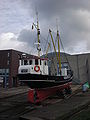
German buoy tender  | |||||
| Upload media | |||||
| Instance of | |||||
|---|---|---|---|---|---|
| Location | Husum, Nordfriesland district, Schleswig-Holstein, Germany | ||||
| Has use | |||||
| Country of registry | |||||
| Service entry |
| ||||
 | |||||
Media in category "Hildegard (ship, 1907)"
The following 9 files are in this category, out of 9 total.
-
 Husum - Am Binnenhafen - Hildegard 01 ies.jpg 5,050 × 3,744; 3.88 MB
-
 Husum - Am Binnenhafen - Slipanlage+Rathaus+Hildegard 01 ies.jpg 5,616 × 3,744; 10.03 MB
-
 HUSUM HAFEN Abend 03 Panorama.jpg 13,752 × 6,876; 69.53 MB
-
 Husum Tonnenleger Hildegard-01.jpg 5,544 × 3,696; 2.4 MB
-
 Husum Tonnenleger Hildegard.jpg 6,000 × 4,000; 2.22 MB
-
 Husum-Hafen Panorama.jpg 4,588 × 800; 928 KB
-
 Tonnenleger Hildegard Husum.JPG 2,448 × 3,264; 1.43 MB
-
 Tonnenleger-Hildegard-2020.jpg 5,120 × 3,840; 6.52 MB
-
 Tonnenleger-Hildegard-Husum-2018.jpg 4,608 × 3,456; 3.2 MB


