Category:High Melton
Jump to navigation
Jump to search
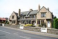
English: High Melton is a village and civil parish in the Metropolitan Borough of Doncaster in South Yorkshire, England. It has a population of 339.
Nederlands: High Melton is een dorp (village) en civil parish in het bestuurlijke gebied Doncaster, in het Engelse graafschap South Yorkshire. De civil parish telt
village and civil parish in South Yorkshire, UK | |||||
| Upload media | |||||
| Instance of | |||||
|---|---|---|---|---|---|
| Location | Doncaster, South Yorkshire, Yorkshire and the Humber, England | ||||
 | |||||
Subcategories
This category has only the following subcategory.
H
- St James Church, High Melton (11 F)
Media in category "High Melton"
The following 83 files are in this category, out of 83 total.
-
 A Large Rape Field, Melton Wood Beyond - geograph.org.uk - 2396845.jpg 3,264 × 2,448; 2.37 MB
-
 A Power Cut in Waiting - geograph.org.uk - 2396873.jpg 3,264 × 2,448; 1.96 MB
-
 Avenue of trees - geograph.org.uk - 116926.jpg 640 × 480; 155 KB
-
 Benchmark(s) on St James Church, High Melton - geograph.org.uk - 3205383.jpg 2,048 × 1,536; 541 KB
-
 Bridge view - geograph.org.uk - 926276.jpg 640 × 427; 111 KB
-
 Bridleway and Bales - geograph.org.uk - 5106862.jpg 4,608 × 3,456; 4.32 MB
-
 Bridleway junction north of High Melton - geograph.org.uk - 3205380.jpg 2,048 × 1,536; 584 KB
-
 Bridleway through Melton Wood Country Park - geograph.org.uk - 4015664.jpg 3,000 × 4,000; 4.01 MB
-
 Bridleway towards High Melton - geograph.org.uk - 5496898.jpg 4,608 × 3,456; 3.89 MB
-
 Bulrushes at Denaby Ings Nature Reserve - geograph.org.uk - 2991539.jpg 4,608 × 3,072; 3.25 MB
-
 Cadeby Lane towards Cadeby - geograph.org.uk - 2425774.jpg 1,600 × 1,200; 389 KB
-
 Dearne Bridge east of Mexborough - geograph.org.uk - 3205422.jpg 2,048 × 1,536; 533 KB
-

-
 Denaby Ings Nature Reserve - geograph.org.uk - 5238111.jpg 4,608 × 3,456; 4.28 MB
-
 Doncaster Road leaving High Melton - geograph.org.uk - 3205404.jpg 2,048 × 1,536; 579 KB
-
 Doncaster Road towards High Melton - geograph.org.uk - 2425765.jpg 1,600 × 1,200; 525 KB
-
 End of the pavement, Melton Road, Sprotbrough - geograph.org.uk - 4118196.jpg 1,024 × 768; 152 KB
-
 Estate Cottages - geograph.org.uk - 929558.jpg 640 × 427; 69 KB
-

-
 Farm Track off Pasture Lane - geograph.org.uk - 2425742.jpg 1,600 × 1,200; 551 KB
-
 Farmland near High Melton - geograph.org.uk - 5238185.jpg 4,608 × 3,456; 3.92 MB
-
 Farmland off Melton Hill Lane - geograph.org.uk - 2425763.jpg 1,600 × 1,200; 424 KB
-
 Farmland off Pasture Lane - geograph.org.uk - 2425745.jpg 1,600 × 1,200; 591 KB
-
 Farmland off Sheep Lane, High Melton - geograph.org.uk - 2425772.jpg 640 × 480; 66 KB
-
 Farmland towards Melton Wood - geograph.org.uk - 2616201.jpg 1,600 × 1,200; 289 KB
-
 Field of Straw Bales - geograph.org.uk - 5106868.jpg 4,608 × 3,456; 4.34 MB
-
 Flat Arable toward High Melton - geograph.org.uk - 2396860.jpg 3,264 × 2,448; 1.22 MB
-
 Footpath and Crop Field near High Melton - geograph.org.uk - 5238137.jpg 1,024 × 768; 290 KB
-
 Footpath and Line of Trees near High Melton - geograph.org.uk - 5238179.jpg 4,608 × 3,456; 4.16 MB
-
 Footpath Corner, Turn Right. - geograph.org.uk - 2396830.jpg 3,264 × 2,448; 1.4 MB
-
 Footpath through field near Bath House Farm - geograph.org.uk - 4015679.jpg 3,000 × 4,000; 2.77 MB
-
 Footpath to High Melton - geograph.org.uk - 116907.jpg 480 × 640; 126 KB
-
 Footpath towards Dearne Bridge - geograph.org.uk - 3205418.jpg 2,048 × 1,536; 510 KB
-
 Hangman Stone Lane in High Melton - geograph.org.uk - 5238160.jpg 4,608 × 3,456; 3.56 MB
-
 Hangman Stone Lane towards High Melton - geograph.org.uk - 3205378.jpg 2,048 × 1,536; 433 KB
-
 Hezlock Field Plantation - geograph.org.uk - 3215875.jpg 4,320 × 2,432; 453 KB
-
 High Melton poppies - geograph.org.uk - 5007526.jpg 1,024 × 612; 148 KB
-
 Junction of paths north of High Melton - geograph.org.uk - 2991524.jpg 3,072 × 4,608; 3.44 MB
-
 Leylands Farm, High Melton - geograph.org.uk - 3205413.jpg 2,048 × 1,536; 583 KB
-

-
 Melton Brand Farm - geograph.org.uk - 2396792.jpg 3,264 × 2,448; 1.62 MB
-
 Melton Brand Farm - geograph.org.uk - 2425782.jpg 1,600 × 1,200; 293 KB
-
 Melton Brand in High Melton - geograph.org.uk - 534190.jpg 640 × 480; 94 KB
-
 Melton Road - Sheep Lane bus stop, Sprotbrough - geograph.org.uk - 4118184.jpg 1,024 × 768; 150 KB
-
 Melton Road verge dropping down to a drain - geograph.org.uk - 4118203.jpg 1,024 × 768; 148 KB
-
 Melton Wood .The Crossroads - geograph.org.uk - 2396810.jpg 3,264 × 2,448; 3.13 MB
-
 Melton Wood Over Rape. - geograph.org.uk - 2396822.jpg 3,264 × 2,448; 2.11 MB
-
 Mexborough from the air - geograph.org.uk - 5953718.jpg 1,024 × 578; 319 KB
-
 Mexborough from the air - geograph.org.uk - 5953720.jpg 1,024 × 768; 399 KB
-
 Milestone in High Melton - geograph.org.uk - 3205412.jpg 2,048 × 1,536; 575 KB
-
 Milestone, High Melton.jpg 1,200 × 1,600; 326 KB
-
 Nothing to chase - geograph.org.uk - 1654499.jpg 480 × 640; 61 KB
-
 Old quarry - geograph.org.uk - 4862209.jpg 1,024 × 768; 332 KB
-
 Open country - geograph.org.uk - 1654495.jpg 480 × 640; 20 KB
-
 Ordnance Survey Cut Mark - geograph.org.uk - 4016101.jpg 4,000 × 3,000; 2.84 MB
-
 Ox Pasture near High Melton - geograph.org.uk - 5238174.jpg 4,608 × 3,456; 3.93 MB
-
 Parclose Screen - geograph.org.uk - 5225937.jpg 1,024 × 683; 221 KB
-
 Path In Melton Wood - geograph.org.uk - 5238202.jpg 4,608 × 3,456; 4 MB
-
 Path to the east of High Melton village - geograph.org.uk - 2991530.jpg 3,072 × 4,608; 3.07 MB
-
 Poppy in barley field near High Melton - geograph.org.uk - 2991533.jpg 4,298 × 3,070; 2.16 MB
-
 Public footpath - geograph.org.uk - 1757446.jpg 480 × 640; 51 KB
-
 Public Footpath to High Melton - geograph.org.uk - 1382888.jpg 640 × 480; 98 KB
-
 Rape Field at Barnburgh Grange - geograph.org.uk - 2387918.jpg 3,264 × 2,448; 1.98 MB
-
 Reredos - geograph.org.uk - 5225946.jpg 1,024 × 683; 381 KB
-
 River Dearne, Dearne Bridge - geograph.org.uk - 2425758.jpg 1,600 × 1,200; 913 KB
-
 Rood Screen - geograph.org.uk - 5225945.jpg 1,024 × 683; 249 KB
-
 Sheep Lane Skirting Meton Wood - geograph.org.uk - 5238196.jpg 4,608 × 3,456; 3.96 MB
-
 Sheep Lane towards Cusworth - geograph.org.uk - 2425786.jpg 1,600 × 1,200; 351 KB
-
 St James Church, High Melton - geograph.org.uk - 3205387.jpg 2,048 × 1,536; 716 KB
-
 St James's Church, High Melton - geograph.org.uk - 2991532.jpg 4,431 × 2,954; 2.71 MB
-
 St.James' church - geograph.org.uk - 5192658.jpg 1,024 × 683; 218 KB
-
 St.James' nave - geograph.org.uk - 5192665.jpg 1,024 × 683; 200 KB
-
 Sunny Croft Farm beside Sheep Lane - geograph.org.uk - 5496891.jpg 1,600 × 1,200; 769 KB
-
 Swans and Cygnet near Denaby Ings - geograph.org.uk - 5238149.jpg 4,164 × 2,918; 2.58 MB
-
 The Church of St James at High Melton - geograph.org.uk - 4015674.jpg 3,000 × 4,000; 2.17 MB
-

-
 The Old Vicarage, High Melton - geograph.org.uk - 2991527.jpg 4,321 × 2,881; 2.89 MB
-
 Track along the east side of Melton Wood - geograph.org.uk - 5496894.jpg 4,608 × 3,456; 4.53 MB
-
 Track beside Melton Wood - geograph.org.uk - 2425778.jpg 1,600 × 1,200; 485 KB
-
 Track in Melton Wood Country Park - geograph.org.uk - 2396799.jpg 3,264 × 2,448; 2.88 MB
-
 View to High Melton - geograph.org.uk - 2129480.jpg 1,024 × 730; 81 KB
-
 Wheatfield, south side of Melton Road - geograph.org.uk - 4118199.jpg 1,024 × 768; 172 KB
-
 Footpath entering High Melton - geograph.org.uk - 116910.jpg 640 × 480; 90 KB


_on_St_James_Church,_High_Melton_-_geograph.org.uk_-_3205383.jpg)


_-_geograph.org.uk_-_2616198.jpg)


