Category:Hervormde Kerk, Ravenswaaij
Jump to navigation
Jump to search
| Object location | | View all coordinates using: OpenStreetMap |
|---|
church building in Buren, Netherlands  | |||||
| Upload media | |||||
| Instance of | |||||
|---|---|---|---|---|---|
| Location | Ravenswaaij, Buren, Gelderland, Netherlands | ||||
| Street address |
| ||||
| Located on street |
| ||||
| Heritage designation |
| ||||
 | |||||
Kerk:
|
This is a category about rijksmonument number 28314
|
Toren:
|
This is a category about rijksmonument number 28315
|
| Address |
|
Subcategories
This category has the following 2 subcategories, out of 2 total.
Media in category "Hervormde Kerk, Ravenswaaij"
The following 92 files are in this category, out of 92 total.
-
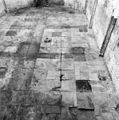
 Bovenkant vloer onderste verdieping - Ravenswaaij - 20184872 - RCE.jpg 1,190 × 1,200; 366 KB
-
 Bovenste verdieping toren - Ravenswaaij - 20184870 - RCE.jpg 1,183 × 1,200; 308 KB
-
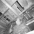
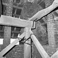
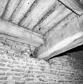
 Detail balklaag boven klokkenzolder - Ravenswaaij - 20184873 - RCE.jpg 1,195 × 1,200; 271 KB
-
 Detail balklaag boven klokkenzolder - Ravenswaaij - 20184874 - RCE.jpg 1,186 × 1,200; 289 KB
-
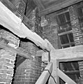
 Detail bovenste verdieping en klokkenzolder - Ravenswaaij - 20184875 - RCE.jpg 1,190 × 1,200; 265 KB
-
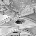
 Detail gewelf - Ravenswaaij - 20184947 - RCE.jpg 1,197 × 1,200; 254 KB
-
 Detail gewelfrib - Ravenswaaij - 20184886 - RCE.jpg 1,195 × 1,200; 269 KB
-
 Detail gewelfschildering van restauratie - Ravenswaaij - 20184956 - RCE.jpg 1,200 × 1,197; 346 KB
-
 Detail gewelfschildering van restauratie - Ravenswaaij - 20184957 - RCE.jpg 1,200 × 1,195; 303 KB
-
 Detail gewelfschildering van restauratie - Ravenswaaij - 20184958 - RCE.jpg 1,190 × 1,200; 282 KB
-
 Detail gewelfschildering van restauratie - Ravenswaaij - 20184960 - RCE.jpg 1,195 × 1,200; 267 KB
-
 Detail gewelfschildering van restauratie - Ravenswaaij - 20184961 - RCE.jpg 1,200 × 1,197; 301 KB
-
 Detail gewelfschildering van restauratie - Ravenswaaij - 20184962 - RCE.jpg 1,195 × 1,200; 364 KB
-
 Detail gewelfschildering van restauratie - Ravenswaaij - 20184963 - RCE.jpg 1,195 × 1,200; 331 KB
-
 Detail gewelfsehildering van restauratie - Ravenswaaij - 20184959 - RCE.jpg 1,200 × 1,200; 343 KB
-
 Detail grafkelder - Ravenswaaij - 20184965 - RCE.jpg 1,195 × 1,200; 359 KB
-
 Detail interieur bovenste verdieping toren - Ravenswaaij - 20184871 - RCE.jpg 1,190 × 1,200; 256 KB
-
 Detail kapspant boven het schip - Ravenswaaij - 20184898 - RCE.jpg 1,195 × 1,200; 349 KB
-
 Detail klokkenstoel - Ravenswaaij - 20184882 - RCE.jpg 1,183 × 1,200; 321 KB
-
 Detail klokkenstoel - Ravenswaaij - 20184883 - RCE.jpg 1,197 × 1,200; 252 KB
-
 Detail klokkenstoel - Ravenswaaij - 20184884 - RCE.jpg 1,195 × 1,200; 307 KB
-
 Detail klokkenzolder - Ravenswaaij - 20184876 - RCE.jpg 1,192 × 1,200; 285 KB
-
 Detail klokkenzolder - Ravenswaaij - 20184877 - RCE.jpg 1,188 × 1,200; 273 KB
-
 Detail oostzijde toren - Ravenswaaij - 20184887 - RCE.jpg 1,195 × 1,200; 397 KB
-
 Detail oostzijde toren - Ravenswaaij - 20184888 - RCE.jpg 1,200 × 1,197; 451 KB
-
 Detail oostzijde toren - Ravenswaaij - 20184889 - RCE.jpg 1,183 × 1,200; 437 KB
-
 Detail vloer constructie klokkenzolder - Ravenswaaij - 20184880 - RCE.jpg 1,197 × 1,200; 331 KB
-
 Exterieur afgehakte plint noordgevel - Ravenswaaij - 20184901 - RCE.jpg 1,195 × 1,200; 482 KB
-
 Exterieur gedeelte noordzijde westgevel - Ravenswaaij - 20184902 - RCE.jpg 1,193 × 1,200; 517 KB
-
 Gewelf - Ravenswaaij - 20184945 - RCE.jpg 1,188 × 1,200; 215 KB
-
 Gewelf - Ravenswaaij - 20184946 - RCE.jpg 1,200 × 1,190; 208 KB
-
 Gewelf sluiting koor - Ravenswaaij - 20184955 - RCE.jpg 1,197 × 1,200; 340 KB
-
 Grafkelder - Ravenswaaij - 20184964 - RCE.jpg 1,200 × 1,200; 255 KB
-
 Interieur detail zuidgevel - Ravenswaaij - 20184905 - RCE.jpg 1,200 × 1,200; 330 KB
-
 Interieur dichtgemetselde toegang traptoren - Ravenswaaij - 20184906 - RCE.jpg 1,193 × 1,200; 407 KB
-
 Interieur gedeelte zuidgevel - Ravenswaaij - 20184904 - RCE.jpg 1,197 × 1,200; 307 KB
-
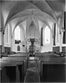 Interieur koor - Ravenswaaij - 20184867 - RCE.jpg 956 × 1,200; 164 KB
-
 Interieur naar het oosten - Ravenswaaij - 20184972 - RCE.jpg 1,183 × 1,200; 218 KB
-
 Interieur naar het oosten - Ravenswaaij - 20184973 - RCE.jpg 1,195 × 1,200; 208 KB
-
 Interieur naar het oosten - Ravenswaaij - 20184974 - RCE.jpg 1,192 × 1,200; 222 KB
-
 Interieur naar het westen - Ravenswaaij - 20184970 - RCE.jpg 1,190 × 1,200; 232 KB
-
 Interieur overzicht zerkenvloer - Ravenswaaij - 20184907 - RCE.jpg 1,192 × 1,200; 377 KB
-
-
 Interieur overzicht zerkenvloer westzijde - Ravenswaaij - 20184916 - RCE.jpg 1,200 × 1,190; 372 KB
-

-

-
 Kap gezien naar de toren noord-zijde - Ravenswaaij - 20184894 - RCE.jpg 1,200 × 1,200; 346 KB
-
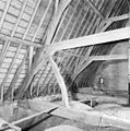
 Kap van het koor - Ravenswaaij - 20184890 - RCE.jpg 1,200 × 1,200; 365 KB
-
 Kap van het koor - Ravenswaaij - 20184891 - RCE.jpg 1,192 × 1,200; 374 KB
-
 Kap van het koor - Ravenswaaij - 20184892 - RCE.jpg 1,192 × 1,200; 364 KB
-
 Kap van het koor - Ravenswaaij - 20184893 - RCE.jpg 1,190 × 1,200; 357 KB
-
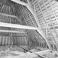
 Kap van het schip gezien naar de toren - Ravenswaaij - 20184895 - RCE.jpg 1,190 × 1,200; 345 KB
-
 Kap van het schip gezien naar de toren - Ravenswaaij - 20184896 - RCE.jpg 1,197 × 1,200; 346 KB
-
 Kap van het schip gezien naar de toren - Ravenswaaij - 20184897 - RCE.jpg 1,190 × 1,200; 331 KB
-
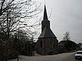
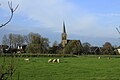
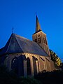
 Kerk naar het noord-oosten - Ravenswaaij - 20184862 - RCE.jpg 957 × 1,200; 226 KB
-
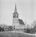
 Kerk vanuit het noord-westen - Ravenswaaij - 20184861 - RCE.jpg 911 × 1,200; 220 KB
-
 Klaviatuur orgel - Ravenswaaij - 20184967 - RCE.jpg 1,190 × 1,200; 178 KB
-
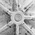
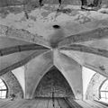 Koorgewelf - Ravenswaaij - 20184942 - RCE.jpg 1,200 × 1,200; 269 KB
-
 Koorgewelf - Ravenswaaij - 20184943 - RCE.jpg 1,198 × 1,200; 232 KB
-
 Koorgewelf - Ravenswaaij - 20184944 - RCE.jpg 1,186 × 1,200; 270 KB
-
 Kraagsteen - Ravenswaaij - 20184865 - RCE.jpg 957 × 1,200; 164 KB
-
 Kraagsteen - Ravenswaaij - 20184866 - RCE.jpg 956 × 1,200; 109 KB
-
 Kruis op koorkap - Ravenswaaij - 20184885 - RCE.jpg 1,197 × 1,200; 261 KB
-
 Luibalk met klok - Ravenswaaij - 20184881 - RCE.jpg 1,200 × 1,195; 259 KB
-
 N-H Nicolaas-kerk Ravenswaaij 2.jpg 3,264 × 2,448; 1.64 MB
-
 N-H Nicolaas-kerk Ravenswaaij.jpg 2,448 × 3,264; 1.54 MB
-
 Noordgevel - Ravenswaaij - 20184975 - RCE.jpg 953 × 1,200; 188 KB
-
 Onderkant vloer klokkenzolder - Ravenswaaij - 20184878 - RCE.jpg 1,178 × 1,200; 351 KB
-
 Onderkant vloer klokkenzolder - Ravenswaaij - 20184879 - RCE.jpg 1,192 × 1,200; 313 KB
-
 Opening in gewelf - Ravenswaaij - 20184948 - RCE.jpg 1,197 × 1,200; 183 KB
-
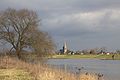 Over rivier de Lek zien we het dorp Ravenswaaij.jpg 4,770 × 3,177; 4.09 MB
-
 Overzicht interieur zerkenvloer naar het oosten - Ravenswaaij - 20184913 - RCE.jpg 1,200 × 1,197; 422 KB
-
 Overzicht interieur zerkenvloer westzijde - Ravenswaaij - 20184915 - RCE.jpg 1,200 × 1,191; 421 KB
-
 Overzicht zerkenvloer gezien naar het zuid-oosten - Ravenswaaij - 20184908 - RCE.jpg 1,197 × 1,200; 412 KB
-
 Overzicht zerkenvloer naar het oosten - Ravenswaaij - 20184910 - RCE.jpg 1,192 × 1,200; 342 KB
-
 Overzicht zerkenvloer noord-oost zijde - Ravenswaaij - 20184909 - RCE.jpg 1,193 × 1,200; 366 KB
-
 Overzicht zerkenvloer oostzijde - Ravenswaaij - 20184911 - RCE.jpg 1,200 × 1,191; 392 KB
-
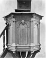 Preekstoel - Ravenswaaij - 20184868 - RCE.jpg 954 × 1,200; 230 KB
-
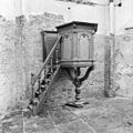 Preekstoel - Ravenswaaij - 20184903 - RCE.jpg 1,200 × 1,197; 367 KB
-
 Preekstoel - Ravenswaaij - 20184969 - RCE.jpg 1,191 × 1,200; 244 KB
-
 Ravenswaaij aan de Lek..JPG 1,600 × 1,067; 496 KB
-
 RAVENSWAAY HERVORMDE KERK 2.jpg 4,608 × 3,456; 2.74 MB
-
 RAVENSWAAY HERVORMDE KERK.jpg 3,456 × 4,608; 2.04 MB
-
 Rechter zij- en achterkant met klaviatuur orgelkas - Ravenswaaij - 20184900 - RCE.jpg 1,188 × 1,200; 259 KB
-
 Rechter zijkant orgelkast - Ravenswaaij - 20184899 - RCE.jpg 1,188 × 1,200; 239 KB
-
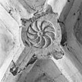
 Sluitsteen - Ravenswaaij - 20184949 - RCE.jpg 1,200 × 1,200; 266 KB
-
 Sluitsteen - Ravenswaaij - 20184950 - RCE.jpg 1,192 × 1,200; 289 KB
-
 Sluitsteen - Ravenswaaij - 20184951 - RCE.jpg 1,200 × 1,197; 326 KB
-
 Sluitsteen - Ravenswaaij - 20184952 - RCE.jpg 1,200 × 1,197; 304 KB
-
 Sluitsteen - Ravenswaaij - 20184953 - RCE.jpg 1,200 × 1,200; 289 KB
-
 Sluitsteen - Ravenswaaij - 20184954 - RCE.jpg 1,200 × 1,199; 332 KB
-
 West- en zuidgevel - Ravenswaaij - 20184966 - RCE.jpg 1,192 × 1,200; 314 KB


_-_Ravenswaaij_-_20184912_-_RCE.jpg)


