Category:Henley-on-Thames
Jump to navigation
Jump to search
town in Oxfordshire, England   | |||||
| Upload media | |||||
| Instance of | |||||
|---|---|---|---|---|---|
| Location | Henley-on-Thames, South Oxfordshire, Oxfordshire, South East England, England | ||||
| Located in or next to body of water | |||||
| Population |
| ||||
| Area |
| ||||
| official website | |||||
 | |||||
Subcategories
This category has the following 20 subcategories, out of 20 total.
*
B
- Buses in Henley-on-Thames (20 F)
D
E
- Raymond Etherington-Smith (1 F)
F
H
- Henley Golf Club, Harpsden (7 F)
- Henley-on-Thames railway station (50 F)
- Highlands Farm Pit (8 F)
L
- William Lenthall (7 F)
M
P
R
S
- Signs in Henley-on-Thames (19 F)
T
- Town Rod Eyot (1 F)
Media in category "Henley-on-Thames"
The following 200 files are in this category, out of 918 total.
(previous page) (next page)-
 "The New Orleans" - geograph.org.uk - 525432.jpg 480 × 640; 80 KB
-
 1 1-4 mile marker - geograph.org.uk - 5937844.jpg 1,024 × 681; 198 KB
-
 1, Wharfe Lane - geograph.org.uk - 5997836.jpg 1,024 × 681; 174 KB
-

-
 2, 4, Fairmile - geograph.org.uk - 5965165.jpg 1,024 × 681; 149 KB
-
 2019 Women's Tour - Team TIBCO-Silicon Valley Bank.JPG 1,366 × 910; 590 KB
-
 2019 Women's Tour - Team Virtu Cycling.JPG 1,366 × 910; 546 KB
-
 2019 Women's Tour stage 3 - 001 Coryn Rivera.JPG 1,366 × 910; 511 KB
-
 2019 Women's Tour stage 3 - 011 Marianne Vos.JPG 1,366 × 910; 334 KB
-
 2019 Women's Tour stage 3 - 025 Christine Majerus.JPG 1,366 × 910; 384 KB
-
 2019 Women's Tour stage 3 - 101 Lisa Brennauer.JPG 1,024 × 1,366; 498 KB
-
 2019 Women's Tour stage 3 - 121 Lizzie Deignan signing in.JPG 1,366 × 910; 432 KB
-
 2019 Women's Tour stage 3 - 121 Lizzie Deignan.JPG 1,366 × 1,024; 385 KB
-
 23, Reading Road, previously Kim's Kennel - geograph.org.uk - 1769928.jpg 1,024 × 679; 159 KB
-
 59 Reading Road, 2016 - geograph.org.uk - 4856254.jpg 5,539 × 3,956; 4.26 MB
-
 A 1969 BMW 2500 and a brick built shed amongst laurels - geograph.org.uk - 4288667.jpg 3,088 × 3,000; 4.17 MB
-
 A Baby Bentley - geograph.org.uk - 4084253.jpg 2,848 × 2,134; 1.52 MB
-
 A balloon race organised by the local Baha'i community - geograph.org.uk - 6301287.jpg 1,541 × 2,470; 1.8 MB
-
 A balloon race organised by the local Baha'i community - geograph.org.uk - 6301291.jpg 1,715 × 2,580; 2.09 MB
-
 A bench beside the river - geograph.org.uk - 3438437.jpg 640 × 480; 108 KB
-
 A brewery entrance - geograph.org.uk - 3160885.jpg 533 × 800; 99 KB
-

-
 A former sub-post office at 100 Reading Road, Henley - geograph.org.uk - 3953242.jpg 2,335 × 3,115; 3.37 MB
-
 A glimpse of the Thames from the edge of Remenham Wood - geograph.org.uk - 6010967.jpg 4,592 × 3,056; 7.16 MB
-
 A grade II listed building in Hart Street, Henley on Thames - geograph.org.uk - 6334759.jpg 5,253 × 3,501; 4.76 MB
-
 A Leaning Pine - geograph.org.uk - 2734210.jpg 3,464 × 2,240; 1.06 MB
-

-
 A passage between Vicarage road and St. Andrews road - geograph.org.uk - 3953238.jpg 4,000 × 6,000; 5.31 MB
-
 A post box ^ bus shelter on Harpsden Road - geograph.org.uk - 3498368.jpg 1,600 × 1,200; 618 KB
-

-

-

-
 A4130 - A4155 junction - geograph.org.uk - 5960999.jpg 1,024 × 681; 183 KB
-
 A4130 Fairmile, Henley - geograph.org.uk - 6236336.jpg 1,024 × 684; 354 KB
-
 A4130 towards Wallingford - geograph.org.uk - 6236343.jpg 1,024 × 684; 342 KB
-
 Access road by the Fair Mile - geograph.org.uk - 6132840.jpg 743 × 1,024; 326 KB
-
 Access road through Townlands Hospital, Henley - geograph.org.uk - 3665421.jpg 2,048 × 1,536; 1.53 MB
-
 Across Marsh Meadows - geograph.org.uk - 2169510.jpg 640 × 427; 196 KB
-
 African Queen - geograph.org.uk - 5991937.jpg 1,024 × 681; 167 KB
-
 Alley to the back - geograph.org.uk - 3150467.jpg 1,024 × 683; 154 KB
-
 Alley to the back - geograph.org.uk - 3161148.jpg 533 × 800; 109 KB
-

-
 Along the boathouse - geograph.org.uk - 2097954.jpg 600 × 800; 115 KB
-
 Along the Fair Mile - geograph.org.uk - 2688626.jpg 1,024 × 683; 145 KB
-

-

-
 An autumnal view of Reading Road at Upton Close - geograph.org.uk - 2689040.jpg 1,024 × 680; 307 KB
-
-

-
 An old Entrance - geograph.org.uk - 3150171.jpg 1,024 × 683; 125 KB
-
 Ancastle Green - geograph.org.uk - 5982485.jpg 1,024 × 681; 209 KB
-
 Anchor Inn - geograph.org.uk - 5994924.jpg 1,024 × 681; 134 KB
-
 Antiques in Henley on Thames - geograph.org.uk - 3198766.jpg 4,000 × 3,000; 3.24 MB
-
 Approaching Marsh Lock - geograph.org.uk - 2513993.jpg 1,024 × 680; 224 KB
-
 Approaching Marsh Lock, Henley on Thames - geograph.org.uk - 5048409.jpg 640 × 480; 106 KB
-
 Artistic item near to Friar Park - geograph.org.uk - 5546799.jpg 4,608 × 3,456; 3.91 MB
-
 At Henley-on-Thames (NBY 442851).jpg 3,600 × 2,338; 1.93 MB
-
 Avenue of trees - geograph.org.uk - 2689183.jpg 1,024 × 683; 266 KB
-
 Back of the boathouse - geograph.org.uk - 2097945.jpg 1,024 × 768; 158 KB
-
 Back of the school - geograph.org.uk - 3152189.jpg 533 × 800; 129 KB
-
 Baglady moored at Henley-on-Thames - geograph.org.uk - 2729179.jpg 1,024 × 680; 241 KB
-
 Baltic House - geograph.org.uk - 5987835.jpg 1,024 × 681; 130 KB
-
 Bandstand, Henley-on-Thames - geograph.org.uk - 1709690.jpg 800 × 600; 108 KB
-
 Bandstand, Mill Meadows - geograph.org.uk - 5991932.jpg 1,024 × 681; 153 KB
-

-
 Barclays Bank - geograph.org.uk - 5997816.jpg 1,024 × 681; 158 KB
-
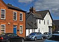
 Barnaby Cottages - geograph.org.uk - 2105385.jpg 600 × 800; 77 KB
-
 Barnby Cottages - geograph.org.uk - 5960764.jpg 1,024 × 681; 163 KB
-
 Barry Keene Gallery.JPG 3,216 × 4,288; 3.65 MB
-
 Bench mark near the door - geograph.org.uk - 2097918.jpg 1,024 × 768; 257 KB
-
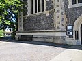
 Bench mark on St Mary the Virgin - geograph.org.uk - 2097929.jpg 600 × 800; 176 KB
-
 Benchmark on 'Delphi House', Deanfield Avenue - geograph.org.uk - 4722220.jpg 683 × 1,024; 242 KB
-
 Benchmark on former school annex, Greys Road - geograph.org.uk - 4722300.jpg 683 × 1,024; 264 KB
-

-
 Benchmark on Henley Bridge - geograph.org.uk - 3159185.jpg 533 × 800; 190 KB
-
 Benchmark on Saracen's Head - geograph.org.uk - 4719485.jpg 683 × 1,024; 146 KB
-
 Benchmark on St Mary's Church - geograph.org.uk - 4719425.jpg 683 × 1,024; 263 KB
-
 Benchmark on wall of Harpsden Road - geograph.org.uk - 4721894.jpg 1,024 × 683; 299 KB
-
 Benchmark on wall outside ^105 Reading Road - geograph.org.uk - 4721958.jpg 623 × 1,024; 248 KB
-
 Benchmark on ^1 Reading Road, Lloyds Bank - geograph.org.uk - 4720154.jpg 683 × 1,024; 285 KB
-
 Benchmark on ^105 Greys Road - geograph.org.uk - 4722179.jpg 1,024 × 683; 311 KB
-
 Bend in Kings Road - geograph.org.uk - 3162449.jpg 1,024 × 683; 126 KB
-
 Beside the Fair Mile, Henley - geograph.org.uk - 1065433.jpg 640 × 480; 207 KB
-
 Bird in Hand and former school on Greys Road - geograph.org.uk - 4722318.jpg 1,024 × 683; 166 KB
-
 Bird life on the river at Henley-on-Thames - geograph.org.uk - 2829949.jpg 3,968 × 2,976; 2.96 MB
-
 Blue Plaque at the Manse - geograph.org.uk - 3157530.jpg 1,024 × 683; 174 KB
-
 Boat fuel stop - geograph.org.uk - 5987860.jpg 1,024 × 681; 170 KB
-
 Boathouse, River Thames - geograph.org.uk - 5991993.jpg 1,024 × 681; 234 KB
-
 Boathouses across the River Thames - geograph.org.uk - 4740538.jpg 640 × 426; 62 KB
-
 Boathouses across the River Thames - geograph.org.uk - 4740561.jpg 640 × 426; 58 KB
-
 Boathouses, Henley - geograph.org.uk - 5937866.jpg 1,024 × 681; 162 KB
-
 Boats at the finish line, Henley Royal Regatta - geograph.org.uk - 3539150.jpg 4,485 × 2,990; 4.51 MB
-
 Boats for hire - geograph.org.uk - 5407902.jpg 600 × 800; 119 KB
-
 Boats for Hire, Henley-On-Thames - geograph.org.uk - 504759.jpg 480 × 605; 370 KB
-
 Boats moored on the River Thames - geograph.org.uk - 5564467.jpg 640 × 426; 81 KB
-
 Boats moored on the Thames - geograph.org.uk - 2350670.jpg 640 × 480; 68 KB
-
 Boats on the Thames at Henley - geograph.org.uk - 4971399.jpg 2,048 × 1,536; 1.44 MB
-
 Boats on the Thames at Henley - geograph.org.uk - 4971403.jpg 2,048 × 1,536; 1.51 MB
-
 Boats on the Thames at Henley - geograph.org.uk - 5090087.jpg 640 × 427; 88 KB
-
 Bonhams - geograph.org.uk - 3161155.jpg 1,024 × 683; 212 KB
-
 Bonhams - geograph.org.uk - 3162315.jpg 1,024 × 683; 152 KB
-
 Boots, Henley - geograph.org.uk - 5997822.jpg 1,024 × 681; 160 KB
-
 Boston Road, Henley, where once was Mayfield Dairy - geograph.org.uk - 3942824.jpg 2,050 × 1,464; 1.86 MB
-
 Bridge and Boat House, Henley - geograph.org.uk - 2774280.jpg 1,600 × 1,067; 299 KB
-
 Broadgates - geograph.org.uk - 3150827.jpg 1,024 × 683; 149 KB
-
 Buddleia under the windows - geograph.org.uk - 3150480.jpg 1,024 × 683; 210 KB
-

-
 Building beside Bonham's - geograph.org.uk - 3162317.jpg 1,024 × 683; 184 KB
-
 Building near the register office - geograph.org.uk - 3162320.jpg 1,024 × 683; 153 KB
-
-

-
 Byway through the trees - geograph.org.uk - 2688625.jpg 1,024 × 683; 301 KB
-
 Cabin cruisers moored in Henley - geograph.org.uk - 1345518.jpg 640 × 417; 72 KB
-
 Caesarea 1797 5.jpg 3,299 × 1,942; 6.37 MB
-
 Caesarea 1797 6.jpg 3,402 × 1,520; 4.64 MB
-
 Cambridge Swimmer - geograph.org.uk - 5937869.jpg 1,024 × 681; 205 KB
-

-
 Canoes, Henley Reach - geograph.org.uk - 4740605.jpg 640 × 426; 70 KB
-
 Car Park for the Regatta - geograph.org.uk - 1069927.jpg 640 × 415; 86 KB
-

-
 Car park in the centre of Henley - geograph.org.uk - 4939338.jpg 2,304 × 1,728; 847 KB
-
 Chiltern Cars on Greys Road, Henley - geograph.org.uk - 4939341.jpg 2,304 × 1,728; 883 KB
-
 Chimneys in Hop Gardens - geograph.org.uk - 2727805.jpg 1,600 × 1,220; 737 KB
-
 Christ Church United Reformed Church Hall, Henley-on-Thames - geograph.org.uk - 3663062.jpg 3,144 × 2,640; 1.44 MB
-
 Christmas Cottage - geograph.org.uk - 5982807.jpg 1,024 × 681; 196 KB
-
 Church Avenue - geograph.org.uk - 5994950.jpg 1,024 × 681; 138 KB
-
 Church in Henley on Thames - geograph.org.uk - 4740577.jpg 640 × 426; 55 KB
-
 Church of St Mary - geograph.org.uk - 5937860.jpg 1,024 × 681; 121 KB
-

-
 Clock on the wall - geograph.org.uk - 3160883.jpg 1,024 × 683; 137 KB
-
 Close of Kings Road - geograph.org.uk - 3162623.jpg 1,024 × 683; 171 KB
-
 Close up of the Lloyds Bank benchmark - geograph.org.uk - 3159129.jpg 533 × 800; 174 KB
-
 Coffee Brake - geograph.org.uk - 3157032.jpg 1,024 × 683; 204 KB
-
 College Benchmark - geograph.org.uk - 3152005.jpg 533 × 800; 192 KB
-
 Colourful doors - geograph.org.uk - 3157511.jpg 533 × 800; 110 KB
-

-
 Converted to houses - geograph.org.uk - 3162434.jpg 1,024 × 683; 177 KB
-
 Cooper Ward, Townlands Hospital, Henley on Thames 1952 - geograph.org.uk - 5247410.jpg 2,044 × 1,363; 1.05 MB
-
 Coppa Club - geograph.org.uk - 5960989.jpg 1,024 × 681; 150 KB
-
 Cottage along Northfield - geograph.org.uk - 3162322.jpg 533 × 800; 126 KB
-
 Cottages along Northfield - geograph.org.uk - 3162431.jpg 1,024 × 683; 155 KB
-
 Cottages on Greys Road, Henley on Thames - geograph.org.uk - 5648282.jpg 2,304 × 1,728; 1.1 MB
-
 Courtyard, Hotel Du Vin - geograph.org.uk - 5997833.jpg 1,024 × 681; 140 KB
-
 Crossroads in Henley - geograph.org.uk - 5997818.jpg 1,024 × 681; 104 KB
-
 Crown on the weathervane - geograph.org.uk - 3156755.jpg 533 × 800; 83 KB
-
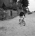 Cycling in Western Road in 1960 - geograph.org.uk - 4771655.jpg 1,560 × 1,612; 1.26 MB
-
 D-two - geograph.org.uk - 5987749.jpg 681 × 1,024; 163 KB
-
 D3 on the corner - geograph.org.uk - 3152188.jpg 533 × 800; 135 KB
-
 De Gooi- en Eemlander vol 064 no 159 De Henley-Regatta.jpg 1,523 × 1,128; 762 KB
-
 Delphi House, Deanfield Avenue - geograph.org.uk - 4722267.jpg 1,024 × 683; 146 KB
-
 Down to Harpsden - geograph.org.uk - 2169674.jpg 640 × 427; 222 KB
-
 Dredger by Town Rod Eyot - geograph.org.uk - 5991982.jpg 1,024 × 681; 243 KB
-
 DSC8721 - panoramio.jpg 1,573 × 1,050; 535 KB
-
 DSC8744 - panoramio.jpg 1,573 × 1,050; 336 KB
-
 Ducks on the boat - geograph.org.uk - 3160799.jpg 533 × 800; 145 KB
-
 Ducks on the river at Henley-on-Thames - geograph.org.uk - 2829960.jpg 3,968 × 2,976; 3.06 MB
-

-
 Dunkirk Little Ships Thames Traditional Boat Festival Henley.jpg 3,024 × 4,032; 3.54 MB
-
 Dutch barge passing Henley - geograph.org.uk - 947904.jpg 636 × 423; 191 KB
-
 Entrance to Smiths - geograph.org.uk - 2692134.jpg 1,024 × 683; 179 KB
-
 Entrance to the college - geograph.org.uk - 3151996.jpg 1,024 × 683; 220 KB
-
 Entry Radnor Close - panoramio.jpg 1,600 × 1,200; 309 KB
-
 Faded Benchmark - geograph.org.uk - 3152000.jpg 533 × 800; 137 KB
-
 Fair Mile by Lower Assendon - geograph.org.uk - 5262782.jpg 1,500 × 1,125; 144 KB
-
 Fair Mile out of Henley - geograph.org.uk - 5256446.jpg 1,500 × 1,125; 141 KB
-
 Fair Mile out of Henley - geograph.org.uk - 5256447.jpg 1,500 × 1,125; 139 KB
-
 Fair Mile to Henley - geograph.org.uk - 2692110.jpg 1,024 × 683; 159 KB
-
 Fair Mile, Henley - geograph.org.uk - 1824335.jpg 640 × 433; 60 KB
-
 Fair Mile, Henley on Thames - geograph.org.uk - 3665512.jpg 2,048 × 1,536; 1.52 MB
-
 Fair Mile, Lower Assendon - geograph.org.uk - 3665544.jpg 2,048 × 1,536; 1.52 MB
-
 Falaise Square - geograph.org.uk - 2819585.jpg 3,648 × 2,736; 1.69 MB
-
 Fence on the Hospital - geograph.org.uk - 2692020.jpg 1,024 × 683; 276 KB
-
 Fencing on the Carpark - geograph.org.uk - 5319848.jpg 1,024 × 768; 132 KB
-
 Field and woodland - geograph.org.uk - 5965166.jpg 1,024 × 681; 124 KB
-
 Field in Remenham - geograph.org.uk - 875208.jpg 640 × 480; 131 KB
-
 Finished - geograph.org.uk - 5564471.jpg 640 × 426; 80 KB
-
 Fish and Thunder Pizza - geograph.org.uk - 2727456.jpg 1,600 × 1,200; 376 KB
-
-
 Floating Grandstand - geograph.org.uk - 4277934.jpg 4,000 × 3,000; 2.04 MB
-
 Flood Mark - geograph.org.uk - 3159468.jpg 1,024 × 683; 189 KB
-
 Floral display and bunting at Henley on Thamesb - geograph.org.uk - 5546780.jpg 4,608 × 3,456; 3.5 MB
-
 Floral display by the River Thames, Henley - geograph.org.uk - 5123966.jpg 4,608 × 3,456; 4.55 MB
-
 Flowers in Mill Meadows - Henley - geograph.org.uk - 2526143.jpg 1,600 × 1,200; 789 KB
-
 Food fayer in Falaise Square - geograph.org.uk - 5592483.jpg 4,000 × 3,000; 3.93 MB
-
 Footbridge near Marsh Lock - geograph.org.uk - 2515246.jpg 1,024 × 680; 236 KB
-

-
 Footbridge over the River Thames - geograph.org.uk - 4084180.jpg 4,964 × 1,832; 1.95 MB
-
 Footpath from Harpsden - geograph.org.uk - 2169529.jpg 640 × 426; 253 KB
-
 Footpath off A4155 - geograph.org.uk - 5960784.jpg 1,024 × 681; 182 KB
-
 Footpath off Gravel Hill - geograph.org.uk - 5982481.jpg 1,024 × 681; 184 KB
-
 Footpath to Bix - geograph.org.uk - 2689254.jpg 1,024 × 683; 195 KB
-
 Footpath towards Henley - geograph.org.uk - 3521470.jpg 640 × 427; 236 KB
-
 Forest Light Fuji X-T1 by Scott Wylie.jpg 4,896 × 2,754; 6.73 MB
-
 Former Chapel - geograph.org.uk - 3150833.jpg 533 × 800; 101 KB
-
 Former Henley-on-Thames Congregational Chapel - geograph.org.uk - 3662889.jpg 3,479 × 2,622; 1.23 MB
-
 Former Stables to rear of 32, 34 and 36 Market Place - geograph.org.uk - 4216246.jpg 3,888 × 2,592; 2.59 MB
-
 Four small tree-clad islands in the Thames at Henley - geograph.org.uk - 5546807.jpg 4,608 × 3,456; 3.93 MB
-
 Freemans Meadow - geograph.org.uk - 5220563.jpg 3,577 × 2,886; 3.2 MB
-
 Freemans Meadow - geograph.org.uk - 5965163.jpg 1,024 × 681; 218 KB
-
 French Market, Falaise Square, Henley - geograph.org.uk - 2773384.jpg 2,592 × 2,300; 1.13 MB


%27_(11297480765).jpg)


.jpg)


