Category:Helmington Row
Jump to navigation
Jump to search
English: Helmington Row is a village in County Durham, in England. It is situated between Crook and Willington.
village in United Kingdom  | |||||
| Upload media | |||||
| Instance of | |||||
|---|---|---|---|---|---|
| Location | County Durham, North East England, England | ||||
 | |||||
Media in category "Helmington Row"
The following 34 files are in this category, out of 34 total.
-
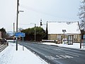 A689 entering Helmington Row - geograph.org.uk - 3296532.jpg 1,500 × 1,125; 1.14 MB
-
 A690 towards Crook - geograph.org.uk - 2056589.jpg 640 × 480; 65 KB
-
 Bowden House - geograph.org.uk - 3897859.jpg 1,500 × 1,011; 1.4 MB
-
 Bus Shelter - High Job's Hill - geograph.org.uk - 6198430.jpg 4,092 × 2,941; 4.44 MB
-
 Close up, Elizabeth II postbox, Helmington Row - geograph.org.uk - 5890737.jpg 2,320 × 3,366; 1.21 MB
-
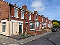
 Coronation Terrace, Helmington Row - geograph.org.uk - 2056583.jpg 640 × 480; 63 KB
-
 Coronation Terrace, Helmington Row - geograph.org.uk - 5865474.jpg 1,024 × 768; 207 KB
-
 Coronation Terrace, Helmington Row - geograph.org.uk - 5889888.jpg 640 × 480; 66 KB
-
 East View, Helmington Row - geograph.org.uk - 5865473.jpg 1,024 × 768; 200 KB
-
 Elizabeth II postbox and recreation ground, Helmington Row - geograph.org.uk - 5890735.jpg 3,648 × 2,736; 1.63 MB
-
 Field east of Holy Well Lane - geograph.org.uk - 3740488.jpg 1,500 × 1,022; 2.26 MB
-
 Field east of Holy Well Lane - geograph.org.uk - 5865512.jpg 1,024 × 768; 255 KB
-
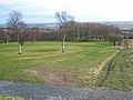
 Field near Helmington Grange Farm - geograph.org.uk - 5865482.jpg 1,024 × 768; 320 KB
-
 Footpath above Crook Golf Club - geograph.org.uk - 5865443.jpg 1,024 × 768; 263 KB
-
 Footpath at Crook Golf Course - geograph.org.uk - 5865446.jpg 1,024 × 768; 266 KB
-
 Footpath to Helmington Row - geograph.org.uk - 5865475.jpg 1,024 × 768; 282 KB
-
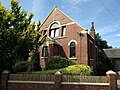 Former Methodist Church, Helmington Row - geograph.org.uk - 5865463.jpg 1,024 × 768; 250 KB
-
 Front Street, Crook - geograph.org.uk - 5889881.jpg 640 × 480; 66 KB
-
 Holy Well Lane near Crook - geograph.org.uk - 2056594.jpg 640 × 480; 58 KB
-
 Houses on Front Street, Crook - geograph.org.uk - 5889879.jpg 640 × 480; 60 KB
-

-
 Service Station - Helmington Row - geograph.org.uk - 6198431.jpg 4,608 × 3,072; 4.52 MB
-

-
 The Old Chapel, Helmington Row - geograph.org.uk - 5865454.jpg 1,024 × 768; 245 KB
-
 War Memorial, Crook - geograph.org.uk - 5889877.jpg 640 × 480; 127 KB
-
 West Road (A690) towards Willington - geograph.org.uk - 5889894.jpg 640 × 480; 54 KB
-
 Wind turbine above Crook Golf Club - geograph.org.uk - 5865416.jpg 1,024 × 768; 164 KB
-
 Crook Golf Club - geograph.org.uk - 338231.jpg 640 × 480; 68 KB
-
 Helmington Row - geograph.org.uk - 338236.jpg 640 × 480; 57 KB
-
 High Job's Hill, Crook - geograph.org.uk - 338223.jpg 640 × 480; 86 KB
-
 Lions at the gate, Hill House - geograph.org.uk - 338248.jpg 640 × 480; 74 KB
-
 Lower end of Crook Golf Club - geograph.org.uk - 338250.jpg 640 × 480; 67 KB
-
 Stonechester - geograph.org.uk - 338268.jpg 640 × 480; 70 KB
-
 Woodland walk below Northwood House - geograph.org.uk - 338270.jpg 640 × 480; 91 KB


_towards_Willington_-_geograph.org.uk_-_5889894.jpg)


