Category:Hednesford
Jump to navigation
Jump to search
English: Hednesford (pronounced "Hensford") is a small town and civil parish in Staffordshire, England, within Cannock Chase District. It adjoins Cannock Chase to the north, and the town of Cannock to the south. At the 2001 census it had a population of 16,598.
Italiano: Hednesford è una cittadina di 6.312 abitanti, situata nella contea dello Staffordshire in Inghilterra.
Lietuvių: Hensfordas – miestas vidurio vakarų Anglijoje. Geležinkelio stotis. Veikia technologijos kolegija. Nuo XIX a. mieste vyravo anglies pramonė, bet ilgainiui ji savo svarbą prarado.
Svenska: Hednesford är ett samhälle med 6 312 invånare i Staffordshire i England, i distriktet Cannock Chase. Samhället gränsar till naturområdet Cannock Chase i norr och staden Cannock i söder. Både under första och andra världskriget har det byggts upp stora träningsläger för armén i närheten av orten, bland annat för Royal Air Force.
town in Staffordshire, England  | |||||
| Upload media | |||||
| Instance of | |||||
|---|---|---|---|---|---|
| Location | Cannock Chase, Staffordshire, West Midlands, England | ||||
 | |||||
Subcategories
This category has the following 4 subcategories, out of 4 total.
H
- Hednesford Hills Raceway (125 F)
- Hednesford War Memorial (1 F)
Media in category "Hednesford"
The following 200 files are in this category, out of 232 total.
(previous page) (next page)-
 'Cross Cannock Chase' Walk - geograph.org.uk - 794833.jpg 640 × 480; 90 KB
-
 'Life At RAF Hednesford' - geograph.org.uk - 367715.jpg 640 × 480; 122 KB
-
 A larger roundabout - geograph.org.uk - 3497909.jpg 1,142 × 857; 356 KB
-
 A.Dunford ^ Son, Tree Surgeons. - geograph.org.uk - 2435534.jpg 640 × 428; 86 KB
-
 ABC Day Nursery - geograph.org.uk - 3784988.jpg 1,600 × 1,064; 423 KB
-
 Aldi's coming to Hednesford - geograph.org.uk - 3502831.jpg 1,306 × 979; 365 KB
-
 AmandaMilling.jpg 5,312 × 2,988; 5.94 MB
-
 Anglesey Business Park - geograph.org.uk - 5382929.jpg 1,280 × 851; 392 KB
-
 Anglesey Court, Hednesford - geograph.org.uk - 836694.jpg 640 × 480; 234 KB
-
 Anglesey Lodge, Hednesford - geograph.org.uk - 835968.jpg 640 × 480; 263 KB
-
 Apartments, Hednesford - geograph.org.uk - 3420593.jpg 640 × 480; 72 KB
-
 Arriving at Hednesford Station - geograph.org.uk - 3177533.jpg 640 × 439; 150 KB
-
 Automatic Transmission Factory - geograph.org.uk - 2425378.jpg 640 × 428; 59 KB
-
 Beaudesert Old Park - geograph.org.uk - 681669.jpg 640 × 480; 116 KB
-
 Beaudesert View, Rawnsley - geograph.org.uk - 657519.jpg 640 × 480; 63 KB
-
 Belt Road, West Chadsmoor - geograph.org.uk - 3863172.jpg 1,142 × 857; 323 KB
-
 Bingo Hall and Cadet Hut, Hednesford (geograph 2426869).jpg 640 × 428; 73 KB
-

-
 Bond Way, Pye Green - geograph.org.uk - 2426769.jpg 640 × 428; 66 KB
-
 Brindley Road - geograph.org.uk - 3858277.jpg 640 × 480; 312 KB
-
 Brindley Road leaving Pye Green - geograph.org.uk - 6158540.jpg 640 × 480; 83 KB
-
 Broadhurst Green - geograph.org.uk - 2655777.jpg 2,560 × 1,920; 2.35 MB
-
 Broadhurst Green - geograph.org.uk - 3858252.jpg 640 × 480; 251 KB
-
 Broadhurst Green - geograph.org.uk - 3858259.jpg 640 × 480; 282 KB
-
 Broadhurst Green - geograph.org.uk - 4030732.jpg 4,167 × 2,957; 5.28 MB
-
 Bungalow on Brindley Road, Pye Green - geograph.org.uk - 6158537.jpg 800 × 498; 64 KB
-
 Cannock Chase Boundary Marker - geograph.org.uk - 2899246.jpg 480 × 640; 78 KB
-

-
 Centenary Hall, Hednesford - geograph.org.uk - 3420596.jpg 640 × 480; 68 KB
-
 Chase Footpath - geograph.org.uk - 1519444.jpg 480 × 640; 139 KB
-
 Chase Path - geograph.org.uk - 1519430.jpg 640 × 480; 75 KB
-
 Chillington Hall - geograph.org.uk - 4677228.jpg 3,264 × 2,448; 4.48 MB
-
 Church Hill Mews - geograph.org.uk - 3502833.jpg 1,142 × 857; 343 KB
-
 Corsican Drive - geograph.org.uk - 479652.jpg 640 × 480; 84 KB
-

-

-
 Croft Avenue, Pye Green - geograph.org.uk - 3861650.jpg 1,142 × 857; 352 KB
-
 Cross Keys, Hednesford.jpg 1,600 × 1,064; 267 KB
-
 Crossing Gates - geograph.org.uk - 281946.jpg 640 × 480; 108 KB
-

-
 Down Thornhill Road - geograph.org.uk - 3861664.jpg 1,142 × 857; 330 KB
-
 Eskrett Street, Hednesford - geograph.org.uk - 1192757.jpg 640 × 480; 71 KB
-
 Fieldhouse Road, Pye Green - geograph.org.uk - 3861665.jpg 1,306 × 979; 341 KB
-
 Footpath on former mineral railway at Hednesford. - geograph.org.uk - 1775846.jpg 3,638 × 2,035; 836 KB
-
 Footpath onto Hednesford Hills - geograph.org.uk - 3733547.jpg 1,064 × 1,600; 542 KB
-
 Footpath, Old Brickworks Nature Reserve - geograph.org.uk - 657525.jpg 480 × 640; 115 KB
-
 Forestry track at Broadhurst Green - geograph.org.uk - 2899225.jpg 480 × 640; 70 KB
-
-

-
 Gorse on Hednesford Hills - geograph.org.uk - 5382743.jpg 851 × 1,280; 364 KB
-
 Green Heath Road - Hednesford - geograph.org.uk - 4030748.jpg 3,683 × 2,706; 3.75 MB
-
 Hednesford 1st railway station (site), Staffordshire - geograph.org.uk - 6034141.jpg 1,600 × 1,199; 725 KB
-
 Hednesford Hills - geograph.org.uk - 403254.jpg 640 × 480; 82 KB
-
 Hednesford Hills - geograph.org.uk - 403274.jpg 640 × 480; 94 KB
-
 Hednesford Hills - geograph.org.uk - 5382724.jpg 1,280 × 851; 697 KB
-
 Hednesford Hills - geograph.org.uk - 5382731.jpg 1,280 × 851; 744 KB
-
 Hednesford Hills - geograph.org.uk - 5382755.jpg 1,280 × 851; 462 KB
-
 Hednesford Hills - geograph.org.uk - 5382771.jpg 1,280 × 851; 508 KB
-
 Hednesford Hills - geograph.org.uk - 5382795.jpg 1,280 × 851; 708 KB
-
 Hednesford Hills Raceway - geograph.org.uk - 5382619.jpg 1,280 × 851; 528 KB
-
 Hednesford Hills Raceway - geograph.org.uk - 5382629.jpg 1,280 × 851; 618 KB
-
 Hednesford MMB 01.jpg 3,783 × 2,460; 1.74 MB
-

-
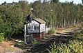
 Hednesford No.1 Signalbox - geograph.org.uk - 1775799.jpg 3,648 × 1,952; 808 KB
-
 Hednesford Park - geograph.org.uk - 5382554.jpg 1,280 × 851; 572 KB
-
 Hednesford Park Pavilion - geograph.org.uk - 3386428.jpg 640 × 480; 102 KB
-
 Hednesford Pentecostal Church - geograph.org.uk - 3496109.jpg 1,469 × 1,102; 375 KB
-
 Hednesford railway station, Staffordshire, 2011 - geograph.org.uk - 3381671.jpg 1,024 × 768; 267 KB
-
 Hednesford Station - geograph.org.uk - 5382972.jpg 1,280 × 851; 635 KB
-
 Hednesford Town FC - geograph.org.uk - 3676259.jpg 1,600 × 1,200; 292 KB
-
-
 Hill Street (B4154) - geograph.org.uk - 3420591.jpg 640 × 480; 60 KB
-
 Houses on Limepit Lane, Cannock - geograph.org.uk - 6158453.jpg 800 × 473; 60 KB
-
 Houses on Rugeley Road - geograph.org.uk - 3420602.jpg 640 × 480; 72 KB
-
 Houses on Thornhill Road, Hednesford - geograph.org.uk - 6158463.jpg 800 × 492; 75 KB
-
 Housing on Stafford Lane - geograph.org.uk - 3497916.jpg 1,306 × 979; 364 KB
-

-

-
 Keys Park November 2013.jpg 2,845 × 1,902; 1.38 MB
-
 Kingsmead Independent Baptist Church - geograph.org.uk - 3806511.jpg 1,600 × 1,064; 350 KB
-
 Laser Process Ltd - geograph.org.uk - 3676200.jpg 1,600 × 1,064; 609 KB
-
 Limepit Lane, Cannock - geograph.org.uk - 6158456.jpg 800 × 600; 109 KB
-
 Linwood Drive, Pye Green - geograph.org.uk - 3861656.jpg 1,142 × 857; 297 KB
-
 Littleworth from Hednesford Hills - geograph.org.uk - 5382779.jpg 1,280 × 851; 680 KB
-
 Littleworth Road - geograph.org.uk - 657100.jpg 640 × 480; 65 KB
-
 Littleworth Road Junction, Rawnsley - geograph.org.uk - 657128.jpg 640 × 480; 70 KB
-
 Local Store. Pye Green - geograph.org.uk - 2426845.jpg 640 × 428; 60 KB
-
 Looking down Pye Green Valley - geograph.org.uk - 2899185.jpg 640 × 480; 89 KB
-
 Lower Market Street. Hednesford - geograph.org.uk - 2425818.jpg 640 × 428; 84 KB
-
 Market Street, Hednesford - geograph.org.uk - 3507758.jpg 1,142 × 857; 340 KB
-
 Market Street, Hednesford - geograph.org.uk - 5382542.jpg 1,280 × 851; 424 KB
-
 Mini roundabout - geograph.org.uk - 3497906.jpg 1,204 × 834; 295 KB
-
 Mining memorial, Hednesford - geograph.org.uk - 835994.jpg 480 × 640; 242 KB
-
 Mount Street, Hednesford - geograph.org.uk - 881127.jpg 640 × 480; 58 KB
-
 Museum of Cannock Chase - geograph.org.uk - 3386419.jpg 3,488 × 2,616; 1.96 MB
-
 Museum of Cannock Chase - geograph.org.uk - 5382582.jpg 1,280 × 851; 533 KB
-
 Museum of Cannock Chase - geograph.org.uk - 6109653.jpg 4,032 × 3,024; 3.9 MB
-
 New apartments, Hednesford - geograph.org.uk - 3420598.jpg 640 × 480; 78 KB
-

-

-

-

-

-

-
-

-

-

-

-

-

-
 New Signals in place - geograph.org.uk - 3177535.jpg 640 × 411; 136 KB
-

-

-
 Play area in Hednesford Park - geograph.org.uk - 3386443.jpg 2,796 × 2,097; 1.3 MB
-
 Play equipment in Hednesford Park - geograph.org.uk - 3386449.jpg 2,641 × 1,981; 1.23 MB
-
 Post Office Tower - geograph.org.uk - 3858284.jpg 640 × 853; 464 KB
-
 Print shop, Hednesford - geograph.org.uk - 3420597.jpg 1,021 × 822; 207 KB
-
 Pye Green Communications Tower - geograph.org.uk - 2899217.jpg 480 × 640; 88 KB
-

-
 Pye Green Community Centre - geograph.org.uk - 4030737.jpg 4,393 × 1,792; 3.78 MB
-
 Pye Green Cross Roads - geograph.org.uk - 2425843.jpg 640 × 428; 54 KB
-
 Pye Green Road - geograph.org.uk - 479631.jpg 640 × 480; 78 KB
-
 Pye Green Road roundabout - geograph.org.uk - 3861653.jpg 1,142 × 857; 355 KB
-
 Pye Green Road, Hednesford - geograph.org.uk - 6158532.jpg 800 × 600; 129 KB
-
 Pye Green Valley School - geograph.org.uk - 2899172.jpg 640 × 480; 84 KB
-
 Pye Green water tower - geograph.org.uk - 3858270.jpg 640 × 480; 249 KB
-
 Pye Green Water Tower - geograph.org.uk - 3861646.jpg 832 × 1,112; 350 KB
-
 Pye Green Water Tower - geograph.org.uk - 6158539.jpg 573 × 800; 74 KB
-
 Pyegreen Valley - geograph.org.uk - 3862880.jpg 640 × 480; 236 KB
-

-
 Rawnsley Road - geograph.org.uk - 4030382.jpg 2,717 × 1,967; 2.19 MB
-
 Right on the edge of the forest - geograph.org.uk - 3861643.jpg 979 × 734; 390 KB
-
 Road ^ Foot Crossings. - geograph.org.uk - 2435525.jpg 640 × 428; 73 KB
-
 Roundabout Hawks Green - geograph.org.uk - 278973.jpg 640 × 480; 51 KB
-
 Rugeley Road (A460) - geograph.org.uk - 3420604.jpg 640 × 480; 71 KB
-

-

-
 Shops on Sharon Way, Hednesford - geograph.org.uk - 3420590.jpg 996 × 759; 160 KB
-

-
 Sled Dog Training Area. - geograph.org.uk - 2439122.jpg 640 × 428; 89 KB
-
 St Peter's Church, Hednesford - geograph.org.uk - 3502836.jpg 1,142 × 857; 428 KB
-
 St Peter's Church, Hednesford - geograph.org.uk - 5382957.jpg 1,280 × 851; 506 KB
-
 St Saviour's in Green Heath - geograph.org.uk - 3497957.jpg 1,306 × 979; 369 KB
-
 St. Michael's Church, Rawnsley - geograph.org.uk - 657098.jpg 640 × 480; 65 KB
-
 St. Peter's Church, Hednesford - geograph.org.uk - 332695.jpg 640 × 480; 115 KB
-
 Staffordshire University Academy - geograph.org.uk - 3863833.jpg 1,306 × 979; 385 KB
-
 Stanley Road crosses the Pyegreen valley - geograph.org.uk - 3497938.jpg 1,142 × 857; 358 KB
-
 Station Road Hednesford - geograph.org.uk - 2425833.jpg 640 × 428; 73 KB
-
 Station Road, Hednesford - geograph.org.uk - 3862629.jpg 640 × 480; 250 KB
-
 Statue at Laser Process Ltd - geograph.org.uk - 3676229.jpg 1,064 × 1,600; 419 KB
-
 Stringershill - geograph.org.uk - 4030376.jpg 3,243 × 3,456; 3.87 MB
-
 Telecoms Towers - Pye Green - geograph.org.uk - 4030683.jpg 2,242 × 2,273; 2.59 MB
-
 Tennis courts in Hednesford Park - geograph.org.uk - 3386433.jpg 3,488 × 2,616; 2.16 MB
-
 Terraced cottages on Church Hill - geograph.org.uk - 3502838.jpg 1,142 × 857; 310 KB
-
 The Aquarius - geograph.org.uk - 2425403.jpg 640 × 428; 50 KB
-
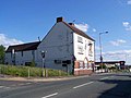
 The Bell and Bottle, Mount Street - geograph.org.uk - 3497964.jpg 1,315 × 964; 319 KB
-

-
 The Bridge - geograph.org.uk - 3497918.jpg 1,142 × 857; 434 KB
-
 The Cross Keys Hotel - geograph.org.uk - 4030761.jpg 1,494 × 1,415; 884 KB
-
 The Cross Keys pub - geograph.org.uk - 3420589.jpg 640 × 480; 59 KB
-
 The Globe, Hednesford - geograph.org.uk - 799001.jpg 640 × 480; 67 KB
-

-
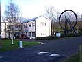 The Museum of Cannock Chase - geograph.org.uk - 291424.jpg 640 × 480; 80 KB
-

-
 The Old Post Office - geograph.org.uk - 2448901.jpg 640 × 428; 55 KB
-
 The old Queen's Arms - geograph.org.uk - 3497913.jpg 1,306 × 979; 345 KB
-
 The Plough and Harrow, Hednesford - geograph.org.uk - 1317384.jpg 640 × 480; 60 KB
-
 The Pyegreen brook - geograph.org.uk - 3497947.jpg 979 × 734; 355 KB
-
 The Queen's Arms, B4154, Hednesford - geograph.org.uk - 1317390.jpg 640 × 480; 72 KB
-

-
 The Tackeroo, Hednesford - geograph.org.uk - 1100196.jpg 640 × 480; 49 KB
-
 The Tower Garage ^ Motor Company - geograph.org.uk - 3861648.jpg 1,142 × 857; 333 KB
-

-
 Thornhill Road, Hednesford - geograph.org.uk - 6158466.jpg 800 × 536; 87 KB
-
 Track, Badger's Hills - geograph.org.uk - 3875037.jpg 640 × 853; 487 KB
-
 Track, Pye Green - geograph.org.uk - 4022734.jpg 640 × 480; 314 KB
-
 Trinity Church - geograph.org.uk - 3862636.jpg 640 × 480; 307 KB
-
 Tudor Road - geograph.org.uk - 3858240.jpg 640 × 480; 269 KB
-
 Tudor Road - geograph.org.uk - 3858246.jpg 640 × 480; 277 KB
-
 Tudor Road, Pye Green - geograph.org.uk - 3861651.jpg 1,142 × 857; 363 KB
-
 Up Thornhill Road - geograph.org.uk - 3861661.jpg 1,142 × 857; 363 KB
-
 Uxbridge Street, Hednesford - geograph.org.uk - 3420599.jpg 640 × 480; 61 KB
-
 View to Sandy Slade - geograph.org.uk - 3733540.jpg 1,600 × 1,067; 435 KB
-
 Wesleyan Mission chapel - geograph.org.uk - 3506081.jpg 1,142 × 857; 393 KB
-
 West Cannock Sports Club. - geograph.org.uk - 2435565.jpg 640 × 428; 84 KB
-
 West Hill Primary School, Green Heath Road - geograph.org.uk - 3506043.jpg 1,142 × 857; 351 KB
-

-
 Woodland, Badger's Hills - geograph.org.uk - 3858071.jpg 640 × 480; 346 KB
-

-
 Beau Desert Golf Course - geograph.org.uk - 283335.jpg 640 × 480; 112 KB
-
 Brindley Bottom, Cannock Chase - geograph.org.uk - 275329.jpg 640 × 480; 114 KB
-
 Brindley Heath, Cannock Chase - geograph.org.uk - 275330.jpg 640 × 480; 113 KB
-
 Brindley Heath, Cannock Chase - geograph.org.uk - 276331.jpg 640 × 480; 80 KB
-
 Brindley Heath, Cannock Chase - geograph.org.uk - 276333.jpg 640 × 480; 103 KB
-
 Brindley Valley, Cannock Chase - geograph.org.uk - 240595.jpg 640 × 480; 129 KB
-
 Cannock Chase - geograph.org.uk - 367695.jpg 640 × 480; 90 KB
-
 Cannock Chase Visitor Centre - geograph.org.uk - 240585.jpg 640 × 480; 106 KB
-
 Chase Stone - geograph.org.uk - 1519436.jpg 640 × 480; 145 KB
-
 Chase View - geograph.org.uk - 281940.jpg 640 × 480; 143 KB


.jpg)


,_Staffordshire_-_geograph.org.uk_-_6034141.jpg)


_-_geograph.org.uk_-_959252.jpg)


_-_geograph.org.uk_-_3420591.jpg)


_-_geograph.org.uk_-_3420604.jpg)


