Category:Heanton Punchardon
Jump to navigation
Jump to search
English: Heanton Punchardon is a village near Braunton, Devon. Historically it formed part of Braunton Hundred. It falls within Barnstaple Deanery for ecclesiastical purposes. The Deaneries are used to arrange the typescript Church Notes of B. F. Cresswell which are held in the Westcountry Studies Library. The population was 418 in 1801 and 404 in 1901. Figures for other years are available on the local studies website.
village in United Kingdom  | |||||
| Upload media | |||||
| Instance of | |||||
|---|---|---|---|---|---|
| Location | North Devon, Devon, South West England, England | ||||
 | |||||
Subcategories
This category has the following 5 subcategories, out of 5 total.
Media in category "Heanton Punchardon"
The following 200 files are in this category, out of 294 total.
(previous page) (next page)-
 'Bellisima' - geograph.org.uk - 5953044.jpg 1,024 × 768; 109 KB
-
 A boat at Pill's Mouth - geograph.org.uk - 1353201.jpg 640 × 480; 76 KB
-
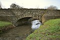
 A bridge carrying Velator Road over Knowl Water - geograph.org.uk - 2256124.jpg 1,024 × 683; 215 KB
-
 A bridge carrying Velator Road over Knowl Water - geograph.org.uk - 2256128.jpg 1,024 × 680; 188 KB
-

-

-
 A bridge over Knowl Water at Heanton Mill - geograph.org.uk - 2262330.jpg 1,024 × 683; 286 KB
-
 A bridge over Knowl Water at Heanton Mill - geograph.org.uk - 2262335.jpg 1,024 × 683; 317 KB
-

-
 A bridge over Knowl Water near Pippacott - geograph.org.uk - 2261985.jpg 1,024 × 680; 207 KB
-
 A bridge over Knowl Water near Pippacott - geograph.org.uk - 2261997.jpg 1,024 × 680; 215 KB
-

-

-
-
 A disused building on Braunton Marsh - geograph.org.uk - 2201601.jpg 1,024 × 680; 131 KB
-
 A field of grass alongside the A361 at Chivenor - geograph.org.uk - 5691019.jpg 6,000 × 4,000; 5.75 MB
-
 A footbridge on Knowl Water - geograph.org.uk - 2262312.jpg 1,024 × 683; 292 KB
-
 A footbridge over Knowl Water - geograph.org.uk - 2262305.jpg 1,024 × 680; 272 KB
-
 A footpath at Heanton Punchardon - geograph.org.uk - 5688243.jpg 1,024 × 768; 179 KB
-

-

-

-
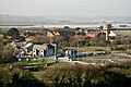 A new housing ^ retail development at Chivenor Cross - geograph.org.uk - 5310856.jpg 6,000 × 4,000; 4.95 MB
-
 A new housing ^ retail development at Chivenor Cross - geograph.org.uk - 5310859.jpg 5,890 × 3,927; 4.99 MB
-
 A new housing ^ retail development at Chivenor Cross - geograph.org.uk - 5310866.jpg 6,000 × 4,000; 4.76 MB
-
 A new housing ^ retail development at Chivenor Cross - geograph.org.uk - 5310872.jpg 6,000 × 4,000; 5.6 MB
-
 A new housing ^ retail development at Chivenor Cross - geograph.org.uk - 5310879.jpg 6,000 × 4,000; 4.41 MB
-
 A new housing ^ retail development at Chivenor Cross - geograph.org.uk - 5310883.jpg 6,000 × 4,000; 4.92 MB
-
 A plaque on Heanton Bridge - geograph.org.uk - 2255684.jpg 1,024 × 683; 234 KB
-
 A stile near Heanton Mill - geograph.org.uk - 2262350.jpg 1,024 × 680; 299 KB
-
-

-
 A tree and a church - geograph.org.uk - 5688245.jpg 1,024 × 768; 161 KB
-
 A valley through which runs Knowl Water - geograph.org.uk - 2265222.jpg 1,024 × 683; 198 KB
-
 A view of Sampson's Plantation, Fremington - geograph.org.uk - 2058453.jpg 1,024 × 769; 166 KB
-
 A weir and sluice on Knowl Water near Wrafton - geograph.org.uk - 2255605.jpg 1,024 × 659; 192 KB
-
 A weir on Knowl Water at Wrafton - geograph.org.uk - 2255703.jpg 1,024 × 680; 234 KB
-

-

-
 Anchored on the Taw - geograph.org.uk - 42700.jpg 640 × 427; 57 KB
-
 And the time is - geograph.org.uk - 5693369.jpg 1,024 × 768; 305 KB
-
 Approaching Knowlwater Bridge - geograph.org.uk - 722160.jpg 640 × 425; 107 KB
-
 BassetArms.jpg 207 × 260; 9 KB
-
 Bassett's Ridge - geograph.org.uk - 5762060.jpg 3,264 × 2,448; 1.8 MB
-
 Block of flats, Wrafton - geograph.org.uk - 5388017.jpg 1,024 × 765; 156 KB
-
 Boats on the Taw at Chivenor - geograph.org.uk - 1477480.jpg 640 × 480; 112 KB
-
 Branch Farm, Pippacott - geograph.org.uk - 5310844.jpg 6,000 × 4,000; 5.44 MB
-
 Braunton Great Field, aerial 2018 - geograph.org.uk - 5952598.jpg 800 × 533; 94 KB
-
 Braunton Inn - geograph.org.uk - 5388062.jpg 1,024 × 768; 210 KB
-
 Braunton Inn - geograph.org.uk - 5762057.jpg 3,072 × 2,304; 1.72 MB
-
 Bridge and drain, Braunton Marsh - geograph.org.uk - 4720664.jpg 1,600 × 1,200; 1.61 MB
-
 Bridge on Velator Road - geograph.org.uk - 5387988.jpg 1,024 × 768; 250 KB
-
 Bridge over creek, Horsey Island - geograph.org.uk - 1305131.jpg 640 × 480; 111 KB
-

-
-
 Bridge over the Tarka Trail - geograph.org.uk - 1360743.jpg 640 × 480; 117 KB
-

-
 Bright Start Nursery, Chivenor - geograph.org.uk - 6086246.jpg 1,024 × 768; 140 KB
-
 Bus stop and shelter near Chivenor - geograph.org.uk - 3442156.jpg 1,024 × 768; 238 KB
-
 Bus stop and shelter, Wrafton - geograph.org.uk - 3442140.jpg 1,024 × 768; 170 KB
-
 Bus stop at West Ashford - geograph.org.uk - 1889570.jpg 2,560 × 1,920; 1.05 MB
-
 Chivenor airfield - geograph.org.uk - 42698.jpg 640 × 427; 59 KB
-
 Coast path and Taw estuary - geograph.org.uk - 1397928.jpg 640 × 480; 92 KB
-
 Confluence of the Rivers Caen and Taw - geograph.org.uk - 1358559.jpg 640 × 480; 101 KB
-
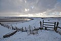
 Cows and a field boundary, Horsey Island, Braunton Marsh - geograph.org.uk - 4720672.jpg 1,200 × 1,600; 1.75 MB
-

-

-
 Cycle Path past RAF Chivenor - geograph.org.uk - 315062.jpg 640 × 480; 126 KB
-
 Cyclist on the Tarka Trail - geograph.org.uk - 1331542.jpg 640 × 480; 164 KB
-
 Dike by Horsey Island - geograph.org.uk - 4720922.jpg 1,600 × 1,200; 1.59 MB
-
 Dike by Horsey Island, Braunton Marsh - geograph.org.uk - 4720906.jpg 1,600 × 1,200; 1.66 MB
-
 Electricity sub-station near Windy Cross - geograph.org.uk - 5953041.jpg 1,024 × 768; 200 KB
-
 Entrance to RAF Chivenor - geograph.org.uk - 1360733.jpg 640 × 480; 89 KB
-
 Entrance to RAF Chivenor - geograph.org.uk - 33461.jpg 640 × 480; 72 KB
-
 Facing downstream by a footbridge on Knowlwater - geograph.org.uk - 2262318.jpg 1,024 × 680; 266 KB
-
 Facing upstream by a footbridge over Knowl Water - geograph.org.uk - 2262324.jpg 1,024 × 680; 290 KB
-
 Farmland above the Taw estuary - geograph.org.uk - 5953039.jpg 1,024 × 781; 193 KB
-
 Field with sheep, Heanton Punchardon - geograph.org.uk - 332916.jpg 640 × 427; 118 KB
-
 Filling station west of Wrafton - geograph.org.uk - 3442129.jpg 1,024 × 768; 125 KB
-
 Foreshore on Horsey Ridge - geograph.org.uk - 4720925.jpg 1,600 × 1,200; 1.69 MB
-
 Former R.A.F. Chivenor, aerial 2018 - geograph.org.uk - 5952570.jpg 800 × 533; 86 KB
-
 Fremington Quay, aerial 2018 (2) - geograph.org.uk - 5952565.jpg 800 × 533; 85 KB
-
 Fremington Reach - geograph.org.uk - 5762076.jpg 3,264 × 2,448; 1.75 MB
-
 Fullabrook Wind Farm Electricity Sub-Station - geograph.org.uk - 5952223.jpg 1,024 × 778; 188 KB
-
 Gate on the Tarka Trail - geograph.org.uk - 1360737.jpg 640 × 480; 124 KB
-
 Gateway for Higher Mainstone Equestrian Centre - geograph.org.uk - 4725714.jpg 1,600 × 1,200; 1.75 MB
-
 Gradient post on the Tarka Trail - geograph.org.uk - 1360709.jpg 640 × 480; 93 KB
-

-

-
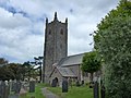
 Heanton Church - geograph.org.uk - 2375372.jpg 1,024 × 683; 112 KB
-
 Heanton Hill - geograph.org.uk - 2701792.jpg 640 × 480; 86 KB
-
 Heanton Hill Phone Box - geograph.org.uk - 5688237.jpg 1,024 × 768; 236 KB
-
 Heanton Punchardon - geograph.org.uk - 495568.jpg 640 × 353; 86 KB
-
 Heanton Punchardon Telephone Box - geograph.org.uk - 629843.jpg 640 × 480; 103 KB
-
 Heanton Punchardon, Knowl Water - geograph.org.uk - 514197.jpg 640 × 427; 295 KB
-
 Heanton Punchardon, Knowl Water valley - geograph.org.uk - 514249.jpg 640 × 427; 227 KB
-
 Heanton Punchardon, Luscott Barton - geograph.org.uk - 514198.jpg 640 × 427; 192 KB
-

-
 Heanton Punchardon, public footpath - geograph.org.uk - 514177.jpg 427 × 640; 275 KB
-

-

-
 Heanton School, Heanton Punchardon - geograph.org.uk - 495535.jpg 630 × 640; 56 KB
-
 Heanton School, Heanton Punchardon - geograph.org.uk - 495539.jpg 640 × 640; 76 KB
-
 Heanton Square - geograph.org.uk - 2266012.jpg 1,024 × 680; 206 KB
-

-
 Hoof Inn, RMB Chivenor - geograph.org.uk - 6086239.jpg 1,024 × 768; 132 KB
-
 Horsey Island - geograph.org.uk - 1305056.jpg 640 × 480; 101 KB
-
 Horsey Island - geograph.org.uk - 1397931.jpg 640 × 480; 125 KB
-
 Horsey Island - geograph.org.uk - 717796.jpg 640 × 314; 214 KB
-
 Horsey Island Embankment - geograph.org.uk - 302252.jpg 640 × 426; 73 KB
-
 Horsey Island near Braunton - geograph.org.uk - 31630.jpg 640 × 487; 127 KB
-
 Horsey Island, Braunton Marsh - geograph.org.uk - 4720905.jpg 1,600 × 1,200; 1.65 MB
-
 Horsey Island, Braunton Marsh and view north-west - geograph.org.uk - 4720919.jpg 1,600 × 1,200; 1.57 MB
-
 Houses in Fremington - geograph.org.uk - 5309864.jpg 6,000 × 2,987; 5.26 MB
-
 Hovercraft from Chivenor on exercises on the tidal River Taw - geograph.org.uk - 4720684.jpg 1,600 × 1,200; 1.39 MB
-

-

-

-

-

-

-

-

-

-

-

-

-

-
-

-
-

-

-

-
 Jetty jutting into River Caen - geograph.org.uk - 4720666.jpg 1,600 × 1,200; 1.56 MB
-
 Jetty on the River Caen, near Wrafton - geograph.org.uk - 4117080.jpg 2,560 × 1,920; 2.13 MB
-
 Junction of Limekiln Lane with A361 - geograph.org.uk - 3442172.jpg 1,024 × 768; 118 KB
-
 Junction with Waterlake Lane - geograph.org.uk - 5952208.jpg 1,024 × 768; 230 KB
-
 Keeping your feet dry - geograph.org.uk - 5692189.jpg 1,024 × 768; 351 KB
-
 Knowlwater Bridge - geograph.org.uk - 4724388.jpg 1,600 × 1,200; 1.63 MB
-
 Knowlwater Bridge - geograph.org.uk - 5952214.jpg 1,024 × 768; 210 KB
-
 Knowlwater bridge as seen from downstream - geograph.org.uk - 2262274.jpg 1,024 × 680; 241 KB
-
 Knowlwater Bridge as seen from upstream - geograph.org.uk - 2262287.jpg 1,024 × 680; 278 KB
-
 Knowlwater Bridge on Knowl Water - geograph.org.uk - 2262029.jpg 1,024 × 680; 218 KB
-
 Knowlwater Bridge on Knowl Water - geograph.org.uk - 2262034.jpg 1,024 × 680; 224 KB
-
 Knowlwater wind turbine sub station - geograph.org.uk - 5693362.jpg 640 × 480; 65 KB
-
-

-
 Low tide on River Caen with a jetty - geograph.org.uk - 4720639.jpg 1,600 × 1,200; 1.53 MB
-
 Luscott Barton and surrounding properties - geograph.org.uk - 5309870.jpg 6,000 × 4,000; 5.75 MB
-
 Luscott Barton turn - geograph.org.uk - 722149.jpg 640 × 425; 77 KB
-
 Mainstone Cross - geograph.org.uk - 1627192.jpg 640 × 480; 65 KB
-
 Marsh by Pill's Mouth - geograph.org.uk - 4720677.jpg 1,600 × 1,200; 1.58 MB
-
 Minor road to Ashford - geograph.org.uk - 5953037.jpg 1,024 × 768; 277 KB
-
 Misty morning on the River Taw - geograph.org.uk - 336972.jpg 640 × 426; 100 KB
-
 Moored along the Taw - geograph.org.uk - 726115.jpg 640 × 474; 90 KB
-
 North Devon , River Taw Estuary - geograph.org.uk - 3956784.jpg 4,074 × 2,706; 6.22 MB
-

-

-

-
 Ordnance Survey Cut Mark - geograph.org.uk - 3723879.jpg 4,000 × 3,000; 3.14 MB
-
 Ordnance Survey Cut Mark - geograph.org.uk - 3860148.jpg 480 × 640; 120 KB
-
 Outlet from drains on Braunton Marsh - geograph.org.uk - 4720669.jpg 1,600 × 1,200; 1.57 MB
-
 Perrigo Health Care Products, Wrafton - geograph.org.uk - 2265212.jpg 1,024 × 683; 181 KB
-
 PeryamArms.JPG 278 × 305; 17 KB
-
 Pill's Mouth - geograph.org.uk - 3556002.jpg 1,024 × 768; 141 KB
-
 Pill's Mouth - geograph.org.uk - 817827.jpg 640 × 425; 48 KB
-
 Pill's Mouth, River Taw - geograph.org.uk - 127166.jpg 640 × 480; 85 KB
-
 Pill's Mouth, the end of the River Caen - geograph.org.uk - 4720678.jpg 1,600 × 1,200; 1.63 MB
-
 Pills Mouth - geograph.org.uk - 1274500.jpg 640 × 425; 61 KB
-
 Pills Mouth - geograph.org.uk - 1274506.jpg 640 × 426; 124 KB
-
 Pippacott Cross on the Waterlake Road - geograph.org.uk - 778493.jpg 640 × 427; 87 KB
-
 Pond on Horsey Island - geograph.org.uk - 4720926.jpg 1,600 × 1,200; 1.49 MB
-
 PontchardonNormandyMap.PNG 445 × 330; 9 KB
-
 Railway gradient marker - geograph.org.uk - 671689.jpg 640 × 430; 126 KB
-
 River Caen at low tide - geograph.org.uk - 1358570.jpg 640 × 480; 96 KB
-
 River Caen out of Braunton - geograph.org.uk - 31816.jpg 640 × 476; 68 KB
-
 River Taw. Lower Yelland - geograph.org.uk - 790817.jpg 640 × 426; 81 KB
-
 Road to Windy Cross - geograph.org.uk - 722211.jpg 640 × 425; 121 KB
-

-

-
 Rush hour in Heanton Punchardon, - geograph.org.uk - 4564747.jpg 640 × 480; 77 KB
-
 Sampson's Plantation, Fremington, EX31 3FF - geograph.org.uk - 5309859.jpg 5,968 × 2,969; 5.17 MB
-
 Second world war pillbox overlooking River Caen - geograph.org.uk - 4720658.jpg 1,600 × 1,200; 1.38 MB
-
 Services housing, Chivenor - geograph.org.uk - 6086236.jpg 1,024 × 774; 189 KB
-
 Sign for the Tarka Inn - geograph.org.uk - 726105.jpg 480 × 640; 53 KB
-
 South West Coast Path in the Taw estuary - geograph.org.uk - 1358567.jpg 640 × 480; 117 KB
-

-

-

-

-

-

-

-
-

-

-
-

-


_-_geograph.org.uk_-_5952586.jpg)
_-_geograph.org.uk_-_5952583.jpg)


_-_geograph.org.uk_-_5952565.jpg)


_-_geograph.org.uk_-_4564819.jpg)
_-_geograph.org.uk_-_4564822.jpg)
_-_geograph.org.uk_-_4564823.jpg)
_-_geograph.org.uk_-_4564824.jpg)
_-_geograph.org.uk_-_4564825.jpg)
_-_geograph.org.uk_-_4564826.jpg)
_-_geograph.org.uk_-_4564827.jpg)
_-_geograph.org.uk_-_4564828.jpg)
_-_geograph.org.uk_-_4564830.jpg)
_-_geograph.org.uk_-_4564832.jpg)
_-_geograph.org.uk_-_4564834.jpg)
_-_geograph.org.uk_-_4564840.jpg)
_-_geograph.org.uk_-_4564842.jpg)
_-_geograph.org.uk_-_4564843.jpg)
_-_geograph.org.uk_-_4564846.jpg)
_-_geograph.org.uk_-_4564829.jpg)
_-_geograph.org.uk_-_4564835.jpg)
_-_geograph.org.uk_-_4564837.jpg)
_-_geograph.org.uk_-_4564839.jpg)


_-_geograph.org.uk_-_4564751.jpg)
_-_geograph.org.uk_-_4564752.jpg)
_-_geograph.org.uk_-_4564753.jpg)
_-_geograph.org.uk_-_4564754.jpg)
_-_geograph.org.uk_-_4564773.jpg)
_-_geograph.org.uk_-_4564755.jpg)
_-_geograph.org.uk_-_4564758.jpg)
_-_geograph.org.uk_-_4564761.jpg)
_-_geograph.org.uk_-_4564770.jpg)
_-_geograph.org.uk_-_4564774.jpg)