Category:Healing, Lincolnshire
Jump to navigation
Jump to search
English: Healing is a village near Grimsby in North East Lincolnshire, England, between Stallingborough and Great Coates. Its population at the 2001 census was 2,601.
human settlement in United Kingdom  | |||||
| Upload media | |||||
| Instance of | |||||
|---|---|---|---|---|---|
| Location | North East Lincolnshire, Lincolnshire, Yorkshire and the Humber, England | ||||
| Said to be the same as | Healing (Wikimedia duplicated page, civil parish) | ||||
 | |||||
Subcategories
This category has the following 6 subcategories, out of 6 total.
Media in category "Healing, Lincolnshire"
The following 200 files are in this category, out of 264 total.
(previous page) (next page)-
 185.123 between Healing and Great Coates - geograph.org.uk - 2525936.jpg 1,024 × 768; 193 KB
-
 A bit of fly tip by Wells Road - geograph.org.uk - 3782851.jpg 800 × 450; 203 KB
-
 A drain outfall into the Humber - geograph.org.uk - 2089726.jpg 800 × 600; 311 KB
-

-
 A new crossing keeper for Healing^ - geograph.org.uk - 4978388.jpg 640 × 427; 74 KB
-
 A outfall pipe goes into the Humber - geograph.org.uk - 2089713.jpg 800 × 600; 247 KB
-
 A outflow into the Humber - geograph.org.uk - 2089732.jpg 800 × 600; 303 KB
-
 A public footpath at Pyewipe, Grimsby - geograph.org.uk - 2054528.jpg 800 × 600; 252 KB
-
 A public footpath in Europarc, Grimsby - geograph.org.uk - 2054461.jpg 800 × 600; 231 KB
-
 A Pylon near the B1210 - geograph.org.uk - 2022765.jpg 800 × 600; 173 KB
-
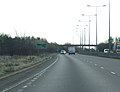
 A1136 junction from the A180 westbound - geograph.org.uk - 3182652.jpg 1,024 × 651; 82 KB
-
 A1136 rising to bridge railway line - geograph.org.uk - 5380054.jpg 1,478 × 1,069; 581 KB
-
 A1136 toward the A180 - geograph.org.uk - 5380047.jpg 1,880 × 1,385; 772 KB
-
 A180 - A1136 Junction - geograph.org.uk - 385387.jpg 640 × 480; 110 KB
-
 A180 - A1136 Junction - geograph.org.uk - 391401.jpg 640 × 480; 81 KB
-
 A180 at Great Cotes Interchange - geograph.org.uk - 3673337.jpg 640 × 481; 49 KB
-
 A180 east of Stallingborough - geograph.org.uk - 2744881.jpg 1,024 × 580; 64 KB
-
 A180 eastbound - geograph.org.uk - 2744889.jpg 640 × 489; 47 KB
-
 A180 layby heading East - geograph.org.uk - 3408346.jpg 1,024 × 768; 110 KB
-
 A180 westbound - geograph.org.uk - 3673342.jpg 640 × 480; 39 KB
-
 Access drive off Wells Road, near Healing - geograph.org.uk - 3199217.jpg 3,088 × 2,056; 2.35 MB
-
 Across the corner of the square - geograph.org.uk - 2083465.jpg 1,024 × 768; 160 KB
-
 Aylesby Lane - geograph.org.uk - 147102.jpg 640 × 480; 111 KB
-
 Aylesby Lane - geograph.org.uk - 3199230.jpg 3,088 × 2,056; 1.54 MB
-
 Aylesby Lane - geograph.org.uk - 3388280.jpg 1,200 × 900; 295 KB
-
-
 Barn to the south of The Manor, Healing - geograph.org.uk - 5545541.jpg 1,600 × 1,065; 664 KB
-
 BASF factory at Europarc - geograph.org.uk - 5619469.jpg 1,600 × 1,064; 497 KB
-
 BASF factory at Europarc - geograph.org.uk - 5620699.jpg 1,600 × 1,064; 571 KB
-
 BASF works, near Immingham - geograph.org.uk - 3716844.jpg 1,024 × 768; 129 KB
-
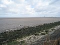
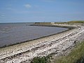
 Beach along the Humber estuary - geograph.org.uk - 5298659.jpg 800 × 508; 107 KB
-
 Bend in B1210 at Aylesby Lane - geograph.org.uk - 3522967.jpg 640 × 407; 73 KB
-
 Bend in Wells Road - geograph.org.uk - 3782854.jpg 800 × 450; 213 KB
-
 Blind summit on Wells Road, Healing - geograph.org.uk - 4278645.jpg 640 × 427; 76 KB
-
 Bridge over Mawmbridge Drain - geograph.org.uk - 5619472.jpg 1,600 × 1,064; 901 KB
-
 Bridge over the A180 - geograph.org.uk - 2744886.jpg 640 × 480; 43 KB
-
 British Gas building, Europarc - geograph.org.uk - 5620651.jpg 1,600 × 1,064; 502 KB
-
 Bus stop on Great Coates Road, Healing - geograph.org.uk - 3802527.jpg 1,024 × 768; 224 KB
-
 Car Park at Healing sports ground - geograph.org.uk - 3008749.jpg 640 × 458; 55 KB
-
 Ciba Geigy - geograph.org.uk - 385383.jpg 640 × 480; 91 KB
-
 Cleethorpes bound train at Great Coates Station - geograph.org.uk - 5620004.jpg 1,600 × 1,064; 605 KB
-
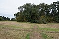
 Clump of pine trees in a field - geograph.org.uk - 4961688.jpg 1,024 × 768; 156 KB
-
 Cottages at Manor Farm, Healing - geograph.org.uk - 4962049.jpg 1,024 × 768; 309 KB
-

-
 Crossing the pipelines - geograph.org.uk - 2525118.jpg 1,024 × 768; 219 KB
-
 Curlew on the Pyewipe Mudflats - geograph.org.uk - 5049502.jpg 800 × 575; 144 KB
-
 Cut Bench Mark on Former Courtaulds Office Block - geograph.org.uk - 5929666.jpg 960 × 1,280; 1.89 MB
-
 Cycleway and footpath in Healing - geograph.org.uk - 5313021.jpg 800 × 553; 121 KB
-
-
 Disused farm bridge over Mawmbridge Drain - geograph.org.uk - 5620707.jpg 1,600 × 1,064; 791 KB
-
 Ditch and harvested field - geograph.org.uk - 2525211.jpg 1,024 × 768; 170 KB
-
 Diverted footpath - geograph.org.uk - 2524981.jpg 1,024 × 768; 240 KB
-

-

-

-
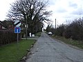
 Entering Healing on Healing Road - geograph.org.uk - 3522965.jpg 640 × 299; 98 KB
-
 Europarc industrial estate - geograph.org.uk - 3236265.jpg 1,024 × 548; 58 KB
-
 Farm bridge over the A180 - geograph.org.uk - 5619464.jpg 1,600 × 1,064; 507 KB
-
 Farm bridge over the A180 - geograph.org.uk - 5620047.jpg 1,600 × 1,064; 642 KB
-
 Farm buildings, Manor Farm - geograph.org.uk - 3388286.jpg 640 × 480; 75 KB
-
 Farm road off Great Coates Road - geograph.org.uk - 3388276.jpg 640 × 480; 94 KB
-
 Farm track near Healing railway station - geograph.org.uk - 5045000.jpg 1,024 × 768; 136 KB
-
 Farm track towards the Novartis factory - geograph.org.uk - 5620720.jpg 1,600 × 1,064; 656 KB
-
 Farmland and industry off the A180 - geograph.org.uk - 2744885.jpg 640 × 480; 38 KB
-
 Farmland north of Great Coates Road - geograph.org.uk - 3388275.jpg 1,200 × 900; 239 KB
-
 Farmland off Great Coates Road - geograph.org.uk - 3388272.jpg 1,200 × 900; 288 KB
-
 Farmland off Wells Road - geograph.org.uk - 3388290.jpg 1,200 × 900; 219 KB
-
 Field on the edge of Healing - geograph.org.uk - 4962042.jpg 1,024 × 768; 167 KB
-
 Fingerpost near the Novartis factory - geograph.org.uk - 5620723.jpg 1,600 × 1,064; 679 KB
-
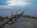
 Flood Barrier - geograph.org.uk - 361344.jpg 640 × 480; 99 KB
-
 Footbridge near Maud Hole Covert - geograph.org.uk - 5545515.jpg 1,600 × 1,066; 1.08 MB
-

-
 Footbridge over pipeline near Moody Lane - geograph.org.uk - 5620676.jpg 1,600 × 1,064; 585 KB
-
 Footbridge over Town's Croft Drain - geograph.org.uk - 5619466.jpg 1,600 × 1,064; 902 KB
-
 Footbridge over unnamed drain - geograph.org.uk - 5620663.jpg 1,600 × 1,064; 619 KB
-
 Footpath alongside Mawmbridge Drain - geograph.org.uk - 2083486.jpg 1,024 × 768; 181 KB
-
 Footpath alongside the railway - geograph.org.uk - 2526016.jpg 1,024 × 768; 173 KB
-
 Footpath and bridge - geograph.org.uk - 2525093.jpg 1,024 × 768; 222 KB
-
 Footpath and bridleway sign - geograph.org.uk - 3817310.jpg 1,024 × 768; 147 KB
-
 Footpath to Great Coates - geograph.org.uk - 2525133.jpg 1,024 × 768; 195 KB
-
 Footpath to the Humber - geograph.org.uk - 146134.jpg 640 × 480; 109 KB
-
 Former Office Building of Courtaulds Factory - geograph.org.uk - 5929663.jpg 3,264 × 2,448; 5.41 MB
-
 Former watercress beds at Healing - geograph.org.uk - 4978395.jpg 640 × 427; 78 KB
-
 Glorious Humber mud and a ship - geograph.org.uk - 4594275.jpg 1,024 × 768; 134 KB
-
 Goats at Meadows Farm near Healing - geograph.org.uk - 5547093.jpg 1,600 × 1,065; 585 KB
-
 Great Coates Interchange overbridge - geograph.org.uk - 3529814.jpg 640 × 364; 81 KB
-
 Great Coates Interchange turn off - geograph.org.uk - 3529808.jpg 640 × 416; 39 KB
-
 Great Coates Road (B1210) - geograph.org.uk - 3388278.jpg 1,200 × 900; 293 KB
-
 Great Coates Road (B1210) - geograph.org.uk - 3388279.jpg 640 × 480; 101 KB
-
 Great Coates Road (B1210), Healing - geograph.org.uk - 3388285.jpg 640 × 480; 86 KB
-
 Great Coates Road off the A1136 roundabout - geograph.org.uk - 5376604.jpg 1,909 × 1,431; 839 KB
-
 Great Coates, Fibres Factory Water Meter House - geograph.org.uk - 5928524.jpg 3,264 × 2,448; 3.12 MB
-

-
 Grimsby Docks, aerial 2018 - geograph.org.uk - 5916698.jpg 800 × 376; 68 KB
-
 Grimsby North Wall - geograph.org.uk - 2111299.jpg 2,048 × 1,536; 175 KB
-
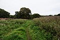
 Healing farmland - geograph.org.uk - 3410903.jpg 1,024 × 768; 113 KB
-
 Healing Methodist Church - geograph.org.uk - 5546863.jpg 1,600 × 1,065; 456 KB
-
 Healing railway station - geograph.org.uk - 5044998.jpg 1,024 × 768; 140 KB
-
 Healing Railway Station - geograph.org.uk - 5546909.jpg 1,600 × 1,065; 531 KB
-
 Healing railway station, Lincolnshire - geograph.org.uk - 3388069.jpg 1,024 × 768; 175 KB
-
 Healing Road - geograph.org.uk - 3782840.jpg 800 × 450; 182 KB
-
 Healing Road at Wells Road junction - geograph.org.uk - 3008724.jpg 640 × 460; 49 KB
-
 Healing Royal British Legion club - geograph.org.uk - 3008751.jpg 640 × 448; 76 KB
-
 Healing School - geograph.org.uk - 3388284.jpg 640 × 480; 63 KB
-
 Healing Sports Ground - geograph.org.uk - 2525210.jpg 1,024 × 768; 179 KB
-
 Healing station towards Grimsby - geograph.org.uk - 3008736.jpg 640 × 480; 71 KB
-
 Healing Village Hall - geograph.org.uk - 3388282.jpg 640 × 480; 61 KB
-

-
 Healing Village sign on Wells Road - geograph.org.uk - 3410910.jpg 1,024 × 768; 216 KB
-
 Healing ^ District Men's Social Club - geograph.org.uk - 5546808.jpg 1,600 × 1,065; 622 KB
-
 Healing, aerial 2018 (1) - geograph.org.uk - 5722327.jpg 640 × 427; 70 KB
-
 Healing, aerial 2018 (2) - geograph.org.uk - 5722330.jpg 800 × 533; 104 KB
-
 Houses off Healing Road, Healing - geograph.org.uk - 5397126.jpg 1,200 × 799; 335 KB
-
 Huge layby or course of old road near Healing^ - geograph.org.uk - 4311599.jpg 1,024 × 654; 294 KB
-
 Humber Bank sea wall - geograph.org.uk - 4475420.jpg 1,280 × 960; 425 KB
-
 Humber bank, Grimsby - geograph.org.uk - 5969799.jpg 1,024 × 768; 101 KB
-
 Humber mud^ - geograph.org.uk - 3817329.jpg 1,024 × 768; 124 KB
-
 Humber shore (2) - geograph.org.uk - 2525698.jpg 1,024 × 768; 212 KB
-
 Industry along the River Humber - geograph.org.uk - 5049529.jpg 800 × 648; 147 KB
-

-
 Lay-by On The A180 - geograph.org.uk - 546464.jpg 640 × 480; 62 KB
-
 Level crossing at Healing Station - geograph.org.uk - 3008726.jpg 640 × 392; 75 KB
-

-

-
 Looking Northeast - geograph.org.uk - 146765.jpg 640 × 426; 105 KB
-

-
 Looking towards Pyewipe - geograph.org.uk - 2054497.jpg 800 × 600; 204 KB
-
 Looking up the Humber towards Immingham - geograph.org.uk - 2054508.jpg 800 × 600; 184 KB
-
 Low tide and outfall - geograph.org.uk - 2083474.jpg 1,024 × 768; 133 KB
-
 Low tide on the Humber - geograph.org.uk - 2054519.jpg 800 × 600; 277 KB
-
 Marker beacon on Grimsby's North Wall - geograph.org.uk - 3817289.jpg 1,024 × 768; 181 KB
-
 Marker post - geograph.org.uk - 3817325.jpg 1,024 × 768; 145 KB
-
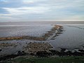
 Mawmbridge Drain along the Humber coast - geograph.org.uk - 5298648.jpg 800 × 582; 133 KB
-

-
 Mawmbridge drain outfall into The Humber - geograph.org.uk - 3817315.jpg 1,024 × 768; 170 KB
-
 Mud at low tide on the Humber - geograph.org.uk - 2089711.jpg 800 × 600; 229 KB
-
 Navigation light in the Humber - geograph.org.uk - 4594287.jpg 1,024 × 768; 94 KB
-
 Navigation marker - geograph.org.uk - 2525711.jpg 1,024 × 768; 138 KB
-
 Near Healing Station - geograph.org.uk - 67517.jpg 640 × 480; 119 KB
-
-
 Novartis factory complex - geograph.org.uk - 5045044.jpg 1,024 × 768; 118 KB
-
 Novartis factory, Pyewipe - geograph.org.uk - 5620848.jpg 1,600 × 1,064; 609 KB
-
 Oak Road, Healing - geograph.org.uk - 5546905.jpg 1,600 × 1,065; 521 KB
-
 Oilseed rape and pylons - geograph.org.uk - 4961790.jpg 1,024 × 768; 171 KB
-
 Old farm buildings, Manor Farm, Healing - geograph.org.uk - 4962053.jpg 1,024 × 768; 227 KB
-
 Old Fleet Drain near Meadows Farm - geograph.org.uk - 5547089.jpg 1,600 × 1,065; 685 KB
-
 Oldfleet Drain - geograph.org.uk - 2525221.jpg 1,024 × 768; 239 KB
-
 Oldfleet Drain - geograph.org.uk - 649273.jpg 640 × 427; 81 KB
-
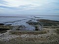
 Oldfleet Drain on the Humber coast - geograph.org.uk - 5298668.jpg 800 × 587; 136 KB
-
 Oldfleet Drain, Healing - geograph.org.uk - 4978405.jpg 640 × 427; 79 KB
-
 One in one out - geograph.org.uk - 3012054.jpg 800 × 600; 58 KB
-
 Outfall into the Humber - geograph.org.uk - 2524968.jpg 1,024 × 768; 201 KB
-
 Outfall marker, River Humber - geograph.org.uk - 5969796.jpg 1,024 × 768; 162 KB
-
 Outfall pipe - geograph.org.uk - 2525714.jpg 1,024 × 768; 164 KB
-
 Outfall Pipe at the Novartis Factory - geograph.org.uk - 5619490.jpg 1,600 × 1,064; 541 KB
-
 Outfall pipe in the Humber estuary - geograph.org.uk - 5049551.jpg 800 × 636; 110 KB
-
 Outfall pipe, River Humber - geograph.org.uk - 5969832.jpg 1,024 × 768; 139 KB
-
 Passing lay-by on the A180 eastbound - geograph.org.uk - 2744883.jpg 640 × 480; 36 KB
-
 Path alongside Mawmbridge Drain - geograph.org.uk - 5620713.jpg 1,600 × 1,064; 1.05 MB
-
 Path leading to Genesis Way, Europarc - geograph.org.uk - 5620638.jpg 1,600 × 1,064; 447 KB
-
 Path leading to Genesis Way, Europarc - geograph.org.uk - 5620640.jpg 1,600 × 1,064; 559 KB
-
 Path leading to Genesis Way, Europarc - geograph.org.uk - 5620646.jpg 1,600 × 1,064; 885 KB
-
 Path leading to Healing - geograph.org.uk - 5397128.jpg 1,200 × 799; 413 KB
-
 Path leading to Lakeside (road), Europarc - geograph.org.uk - 5620606.jpg 1,600 × 1,064; 902 KB
-
 Path leading to Mawmbridge Drain - geograph.org.uk - 5620653.jpg 1,600 × 1,064; 676 KB
-
 Path leading to Mawmbridge Drain - geograph.org.uk - 5620655.jpg 1,600 × 1,064; 614 KB
-
 Path leading to Mawmbridge Drain - geograph.org.uk - 5620697.jpg 1,600 × 1,064; 597 KB
-
 Path leading to Mawmbridge Drain - geograph.org.uk - 5620702.jpg 1,600 × 1,064; 566 KB
-
 Path leading to Rookery Road, Healing - geograph.org.uk - 5546798.jpg 1,600 × 1,065; 836 KB
-
 Path leading to Rookery Road, Healing - geograph.org.uk - 5546802.jpg 1,600 × 1,065; 781 KB
-
 Path leading to Stallingborough - geograph.org.uk - 5546958.jpg 1,600 × 1,065; 824 KB
-
 Path leading to Stallingborough - geograph.org.uk - 5547008.jpg 1,600 × 1,065; 626 KB
-
 Path leading to Stallingborough - geograph.org.uk - 5547010.jpg 1,600 × 1,065; 954 KB
-
 Path leading to Stallingborough - geograph.org.uk - 5547013.jpg 1,600 × 1,065; 647 KB
-
 Path leading to Stallingborough - geograph.org.uk - 5547082.jpg 1,600 × 1,065; 547 KB
-
 Path leading to Stallingborough - geograph.org.uk - 5547090.jpg 1,600 × 1,065; 516 KB
-
 Path leading towards Europarc - geograph.org.uk - 5620035.jpg 1,600 × 1,064; 827 KB
-
 Path leading towards Europarc - geograph.org.uk - 5620041.jpg 1,600 × 1,064; 681 KB
-
 Path leading towards Stallingborough Road - geograph.org.uk - 5545519.jpg 1,600 × 1,065; 905 KB
-
 Path leading towards the River Humber - geograph.org.uk - 5620716.jpg 1,600 × 1,064; 604 KB
-
 Path to Wisteria Drive, Healing - geograph.org.uk - 5545555.jpg 1,600 × 1,065; 810 KB
-
 Path towards Stallingborough Road, Healing - geograph.org.uk - 5545527.jpg 1,600 × 1,065; 665 KB
-
 Path towards Stallingborough Road, Healing - geograph.org.uk - 5545529.jpg 1,600 × 1,065; 800 KB
-
 Path towards Stallingborough Road, Healing - geograph.org.uk - 5545534.jpg 1,600 × 1,065; 1.05 MB
-
 Path towards Stallingborough Road, Healing - geograph.org.uk - 5545538.jpg 1,600 × 1,065; 760 KB
-
 Path towards Stallingborough Road, Healing - geograph.org.uk - 5545546.jpg 1,600 × 1,065; 663 KB
-
 Path towards Stallingborough Road, Healing - geograph.org.uk - 5545549.jpg 1,600 × 1,065; 773 KB
-
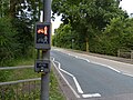 Pedestrian crossing on Great Coates Road - geograph.org.uk - 5313022.jpg 800 × 600; 163 KB
-
 Pegasus Way, Europarc, Grimsby - geograph.org.uk - 2054407.jpg 800 × 600; 208 KB
-
 Pipeline into The Humber Estuary - geograph.org.uk - 3817322.jpg 1,024 × 768; 181 KB
-
 Pipeline on the Humber coast - geograph.org.uk - 5298654.jpg 800 × 600; 126 KB
-
 Poplar Road off Station Road, Healing - geograph.org.uk - 5546870.jpg 1,600 × 1,065; 499 KB
-
 Public footpath at crosses Moody Lane - geograph.org.uk - 5620695.jpg 1,600 × 1,064; 472 KB
-
 Public footpath to Moody Lane - geograph.org.uk - 5286766.jpg 800 × 591; 154 KB
-
 Public footpath towards Europarc - geograph.org.uk - 5620599.jpg 1,600 × 1,064; 441 KB
-
 Public footpath towards Europarc - geograph.org.uk - 5620602.jpg 1,600 × 1,064; 773 KB
-
 Railway and Pipelines - geograph.org.uk - 2525124.jpg 1,024 × 768; 228 KB
-
 Railway line near Europarc - geograph.org.uk - 5620678.jpg 1,600 × 1,064; 713 KB
-
 Red gate to farm track - geograph.org.uk - 3410907.jpg 1,024 × 768; 141 KB
-
 Riby Road junction - geograph.org.uk - 3782844.jpg 800 × 450; 206 KB


_-_geograph.org.uk_-_3388278.jpg)
_-_geograph.org.uk_-_3388279.jpg)
,_Healing_-_geograph.org.uk_-_3388285.jpg)


_-_geograph.org.uk_-_5722327.jpg)
_-_geograph.org.uk_-_5722330.jpg)


_-_geograph.org.uk_-_2525698.jpg)


,_Europarc_-_geograph.org.uk_-_5620606.jpg)


