Category:Healeyfield
Jump to navigation
Jump to search
Main Wikipedia article: Healeyfield.
village and civil parish in County Durham, United Kingdom | |||||
| Upload media | |||||
| Instance of | |||||
|---|---|---|---|---|---|
| Location | County Durham, North East England, England | ||||
 | |||||
Subcategories
This category has the following 2 subcategories, out of 2 total.
F
- Fell Close Cottage (2 F)
H
- Hownsgill Viaduct (18 F)
Media in category "Healeyfield"
The following 200 files are in this category, out of 418 total.
(previous page) (next page)-
 4 Concrete Pylon Supports - geograph.org.uk - 4815011.jpg 3,264 × 2,448; 3.57 MB
-
 A good crop of berries - geograph.org.uk - 6344433.jpg 4,608 × 3,456; 6.35 MB
-
 A prospect of Castleside - geograph.org.uk - 2471230.jpg 640 × 480; 100 KB
-
 A68 at Castleside village boundary - geograph.org.uk - 5848998.jpg 1,024 × 680; 93 KB
-
 A68 at Rowley village boundary - geograph.org.uk - 5849020.jpg 1,024 × 769; 124 KB
-
 A68 climbing Rowley Bank, Castleside - geograph.org.uk - 5849009.jpg 1,024 × 749; 134 KB
-
 A68 in Rowley - geograph.org.uk - 2000392.jpg 1,024 × 768; 109 KB
-
 A68 reaching Rowley from the south. - geograph.org.uk - 3550526.jpg 1,500 × 974; 1.36 MB
-
 A68 south of Rowley - geograph.org.uk - 5849031.jpg 1,024 × 702; 65 KB
-
 A68 southbound near High Alderheads - geograph.org.uk - 5849053.jpg 1,024 × 742; 114 KB
-
 A68 towards Darlington - geograph.org.uk - 4984408.jpg 640 × 480; 73 KB
-
 Across valley of Hisehope Burn - geograph.org.uk - 5199949.jpg 1,500 × 1,001; 1.46 MB
-
 Allensford - geograph.org.uk - 1957155.jpg 2,511 × 3,833; 1.65 MB
-
 Allensford Bridge over the River Derwent - geograph.org.uk - 2948477.jpg 1,427 × 843; 437 KB
-

-
 Arable field near Castleside - geograph.org.uk - 5642070.jpg 640 × 427; 126 KB
-
 Autumn hedge along the lane - geograph.org.uk - 6283972.jpg 4,608 × 3,456; 6.43 MB
-
 Autumn scene on the old railway - geograph.org.uk - 6343702.jpg 4,251 × 3,189; 4.5 MB
-
 Autumn scene on the track from Dean Howl - geograph.org.uk - 6303117.jpg 4,385 × 3,289; 3.15 MB
-
 Autumn view of Wharnley Burn - geograph.org.uk - 5582471.jpg 4,415 × 3,311; 2.92 MB
-
 Backgill Burn, Knitsley - geograph.org.uk - 4779602.jpg 4,608 × 3,456; 7.35 MB
-
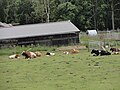
 Barns at Dyke Nook farm - geograph.org.uk - 5940312.jpg 4,608 × 3,456; 3.27 MB
-
 Bend in Healeyfield Lane - geograph.org.uk - 4983529.jpg 640 × 480; 55 KB
-
 Bessy's Bank - geograph.org.uk - 904392.jpg 426 × 640; 126 KB
-
 Black swans at Middle Head Farm - geograph.org.uk - 3844481.jpg 640 × 480; 121 KB
-
 Boggy pasture - geograph.org.uk - 897557.jpg 640 × 427; 102 KB
-
 Bottom of Knitsley Lane - geograph.org.uk - 4779743.jpg 4,608 × 3,456; 6.62 MB
-
 Bridge over Horsleyhope Burn - geograph.org.uk - 3379459.jpg 1,200 × 1,600; 1.07 MB
-
 Bridge over the Waskerley Way - geograph.org.uk - 2392751.jpg 427 × 640; 313 KB
-
 Bull in field - geograph.org.uk - 5389386.jpg 4,608 × 3,456; 5.3 MB
-

-
 Cambridge Avenue, Moorside - geograph.org.uk - 5580018.jpg 4,600 × 3,446; 4.26 MB
-
 Camping at David's Town - geograph.org.uk - 6242288.jpg 3,612 × 2,385; 1.88 MB
-
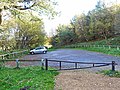 Car park on the Waskerley Way - geograph.org.uk - 3727559.jpg 640 × 480; 124 KB
-
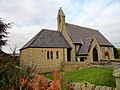 Castleside Church - geograph.org.uk - 6321078.jpg 4,503 × 3,377; 2.69 MB
-
 Cattle around feeder - geograph.org.uk - 5429817.jpg 4,608 × 3,456; 7.52 MB
-
 Cattle at Castle Croft - geograph.org.uk - 5807892.jpg 4,608 × 3,456; 5.52 MB
-
 Cattle at High House - geograph.org.uk - 6230105.jpg 3,631 × 2,736; 2.11 MB
-
 Cattle at Knitsley Lane - geograph.org.uk - 6138984.jpg 2,653 × 1,940; 1.05 MB
-
 Cattle in field - geograph.org.uk - 4972281.jpg 4,608 × 3,456; 4.8 MB
-
 Charlton Howl - geograph.org.uk - 2441437.jpg 3,072 × 2,304; 3.03 MB
-
 Chewing the cud - geograph.org.uk - 6283996.jpg 1,265 × 984; 280 KB
-
 Chickens at Knitsley - geograph.org.uk - 4972699.jpg 4,608 × 3,456; 5.35 MB
-
 Close up of the waterfall at Wharnley Burn - geograph.org.uk - 5807900.jpg 3,857 × 3,089; 2.92 MB
-
 Comb Bridges - geograph.org.uk - 3727534.jpg 640 × 480; 126 KB
-
 Consett Road, Castleside - geograph.org.uk - 5580022.jpg 4,391 × 3,293; 2.88 MB
-
 Corner of fenced field near Castleside - geograph.org.uk - 2607647.jpg 1,500 × 983; 1.19 MB
-
 Cottage on Outputs Lane - geograph.org.uk - 2801013.jpg 3,264 × 2,448; 2.66 MB
-
 Country road near Middles Farm - geograph.org.uk - 3845185.jpg 640 × 480; 98 KB
-
 Cresting the steep hill from Allensford - geograph.org.uk - 2966757.jpg 1,317 × 970; 315 KB
-
 Crooked Oak - geograph.org.uk - 1957177.jpg 3,888 × 2,272; 981 KB
-
 Crop field off Longedge Lane - geograph.org.uk - 4984463.jpg 640 × 480; 58 KB
-
 Crop field, Healeyfield - geograph.org.uk - 4983538.jpg 640 × 480; 62 KB
-
 Crossroads on Longedge Lane - geograph.org.uk - 2807420.jpg 3,264 × 2,448; 1.21 MB
-
 Crossroads on Longedge Lane - geograph.org.uk - 2933286.jpg 4,608 × 3,456; 5.8 MB
-

-
 Dean Bridge House - geograph.org.uk - 2239475.jpg 2,000 × 1,500; 2.9 MB
-
 Dean Bridge House, Rowley - geograph.org.uk - 4974246.jpg 4,608 × 3,456; 5.53 MB
-
 Dean Howl Farm - geograph.org.uk - 4312502.jpg 4,608 × 3,456; 6.63 MB
-
 Dene Howl - geograph.org.uk - 2354763.jpg 640 × 480; 75 KB
-
 Derelict cottages at Dean Howl - geograph.org.uk - 6319155.jpg 4,455 × 3,341; 4 MB
-
 Derwent Grange - geograph.org.uk - 1957164.jpg 3,888 × 2,236; 1.37 MB
-
 Derwent Grange Farm - geograph.org.uk - 3727551.jpg 640 × 480; 75 KB
-
-
 Dismantled Railway - geograph.org.uk - 1968534.jpg 3,888 × 2,464; 1.67 MB
-
 Disused Pit on edge of Bog Wood - geograph.org.uk - 4967543.jpg 3,264 × 2,448; 4.12 MB
-
 Disused quarry, Hownsgill - geograph.org.uk - 5955029.jpg 768 × 1,024; 393 KB
-
 Ditch clearing - geograph.org.uk - 4296442.jpg 4,608 × 3,456; 5.53 MB
-
 Ditch clearing on the old railway - geograph.org.uk - 6343706.jpg 4,015 × 3,011; 3.32 MB
-
 Dkye Nook Cottages - geograph.org.uk - 4763964.jpg 4,430 × 3,206; 5.06 MB
-
 Dog walker - geograph.org.uk - 5389365.jpg 2,141 × 1,837; 2.52 MB
-
 Down the Lane - geograph.org.uk - 2340107.jpg 3,264 × 2,448; 2.02 MB
-
 Dry stone wall along Knitsley Lane - geograph.org.uk - 6344490.jpg 4,608 × 3,456; 3.13 MB
-
 Dyke Nook Farm - geograph.org.uk - 2405681.jpg 1,500 × 1,125; 2.04 MB
-
 Dyke Nook farm from the west - geograph.org.uk - 4763983.jpg 4,442 × 3,222; 6.51 MB
-
 End view of Castleside Church - geograph.org.uk - 6321085.jpg 3,192 × 2,559; 1.62 MB
-
 Entrance to Castleside Vicarage - geograph.org.uk - 4766199.jpg 4,608 × 3,456; 5.74 MB
-
 Entrance to Middles Farm - geograph.org.uk - 4307299.jpg 4,608 × 3,456; 7.73 MB
-
 Entrance to Rowley Baptist Church - geograph.org.uk - 3376475.jpg 4,608 × 3,456; 5.33 MB
-
 Evening over Windybank Wood - geograph.org.uk - 5245374.jpg 1,280 × 903; 297 KB
-
 Evening view of Castleside - geograph.org.uk - 5245377.jpg 1,280 × 841; 219 KB
-
 Exposed face of rock debris - geograph.org.uk - 6055339.jpg 1,600 × 1,200; 761 KB
-
 Fallen tree in Rabbitbank Wood - geograph.org.uk - 3846477.jpg 4,608 × 3,456; 5.67 MB
-
 Farm road over the railway - geograph.org.uk - 6134127.jpg 4,608 × 3,456; 6.13 MB
-
 Farm road to Dene Howl - geograph.org.uk - 4993887.jpg 4,212 × 2,914; 7.39 MB
-
 Farmer harrowing a field near Rowley - geograph.org.uk - 4974167.jpg 1,441 × 1,077; 870 KB
-
 Farmhouse at Fox Holes - geograph.org.uk - 3020477.jpg 4,608 × 3,456; 5.28 MB
-
 Farmhouse ruin at Fell Close - geograph.org.uk - 4766234.jpg 4,608 × 3,456; 6.54 MB
-
 Farmhouse, High Alderheads Farm - geograph.org.uk - 4984417.jpg 640 × 480; 62 KB
-
 Farmland near Low Alders - geograph.org.uk - 4984390.jpg 640 × 480; 75 KB
-
 Farmland near Whitehall - geograph.org.uk - 4984387.jpg 640 × 480; 70 KB
-

-
 Farmyard at Derwent Grange - geograph.org.uk - 3020474.jpg 4,608 × 3,456; 5.37 MB
-
 Feeding time - geograph.org.uk - 3845193.jpg 640 × 480; 113 KB
-
 Felling Operation on Waskerley Way - geograph.org.uk - 3146628.jpg 600 × 450; 144 KB
-
 Field adjacent to Waskerley Way - geograph.org.uk - 2239522.jpg 2,000 × 1,362; 2.92 MB
-
 Field beside Outputs Lane - geograph.org.uk - 4974923.jpg 4,608 × 3,456; 5.38 MB
-
 Field descending towards farm at Spring Well - geograph.org.uk - 5199972.jpg 1,500 × 664; 1.02 MB
-

-

-
 Field entrance near Whitehall - geograph.org.uk - 4984364.jpg 640 × 480; 89 KB
-
 Field entrance off Longedge Lane - geograph.org.uk - 4984945.jpg 640 × 480; 71 KB
-
 Field entrance off the A68 - geograph.org.uk - 4984412.jpg 640 × 480; 108 KB
-
 Field gate on Outputs Lane - geograph.org.uk - 4974887.jpg 4,608 × 3,456; 6.82 MB
-
 Field gateway on Knitsley Lane - geograph.org.uk - 6344465.jpg 4,608 × 3,456; 3.16 MB
-
 Field near Middles Farm - geograph.org.uk - 3845182.jpg 640 × 480; 65 KB
-
 Field of Outputs Allotments - geograph.org.uk - 4188446.jpg 1,500 × 1,125; 1.75 MB
-
 Field path beside old quarry - geograph.org.uk - 5581022.jpg 4,608 × 3,456; 3.08 MB
-
 Field path south of Watergate Burn, Castleside - geograph.org.uk - 5013943.jpg 4,608 × 3,456; 6.22 MB
-
 Fields at High Knitsley - geograph.org.uk - 4784788.jpg 4,608 × 3,456; 5.55 MB
-
 Fields beside the A68 - geograph.org.uk - 4306267.jpg 4,520 × 3,336; 4.8 MB
-
 Fishing pond at Dyke Nook - geograph.org.uk - 6230080.jpg 4,608 × 3,456; 3.4 MB
-
 Fishpond on Outputs Lane - geograph.org.uk - 2806514.jpg 3,264 × 2,448; 1.77 MB
-
 Five ways junction on Longedge Lane - geograph.org.uk - 6242089.jpg 4,608 × 3,456; 3.66 MB
-
 Footbridge in the wood - geograph.org.uk - 6384980.jpg 4,385 × 3,289; 5.25 MB
-
 Footbridge on Wharnley Burn - geograph.org.uk - 4803020.jpg 3,264 × 2,448; 3.49 MB
-
 Footbridge over the Wharnley Burn - geograph.org.uk - 4906957.jpg 3,420 × 2,669; 6.26 MB
-
 Footpath and stile north of Charlton Howl - geograph.org.uk - 2607656.jpg 1,500 × 1,125; 1.43 MB
-
 Footpath off Healeyfield Lane - geograph.org.uk - 4983519.jpg 640 × 480; 79 KB
-
 Footpath round Lyar Dene - geograph.org.uk - 3844468.jpg 480 × 640; 120 KB
-
 Footpath to Bessy's Bank - geograph.org.uk - 2354685.jpg 480 × 640; 132 KB
-
 Footpaths junction - geograph.org.uk - 4975970.jpg 4,608 × 3,456; 7.65 MB
-
 Footway by the A68 - geograph.org.uk - 3728454.jpg 640 × 480; 112 KB
-
 Ford over the Horsleyhope Burn - geograph.org.uk - 4487172.jpg 3,763 × 2,832; 6.73 MB
-
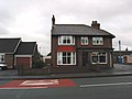
 Former pub being converted - geograph.org.uk - 5815126.jpg 4,608 × 3,456; 2.86 MB
-
 Front Street, Castleside - geograph.org.uk - 4098277.jpg 1,600 × 1,044; 430 KB
-
 Frozen pool with tree at Middle Heads Farm - geograph.org.uk - 2244752.jpg 2,000 × 1,562; 3.23 MB
-
 Garden at Oliver Ford - geograph.org.uk - 2807413.jpg 3,264 × 2,448; 2.15 MB
-
 Garden entrance to Allensford House - geograph.org.uk - 4908202.jpg 4,056 × 2,921; 6.79 MB
-
 Gorse at Lyerdene Sike - geograph.org.uk - 4307274.jpg 4,608 × 3,456; 7.6 MB
-
 Grazing and hedgerow - geograph.org.uk - 4984940.jpg 640 × 480; 59 KB
-
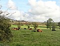
 Grazing cattle - geograph.org.uk - 5389345.jpg 4,608 × 3,456; 5.52 MB
-
 Grazing cattle - geograph.org.uk - 5429827.jpg 4,608 × 3,456; 5.22 MB
-
 Grazing field at High House - geograph.org.uk - 6230130.jpg 4,421 × 3,315; 2.99 MB
-
 Grazing fields at Dyke Nok farm - geograph.org.uk - 6230089.jpg 4,503 × 3,377; 2.69 MB
-
 Grazing fields beside Knitsley Lane - geograph.org.uk - 6379310.jpg 4,608 × 3,456; 2.87 MB
-
 Grazing off Healeyfield Lane - geograph.org.uk - 4983524.jpg 640 × 480; 74 KB
-
 Grazing off Longedge Lane - geograph.org.uk - 4984937.jpg 640 × 480; 52 KB
-
 Grazing off Longedge Lane - geograph.org.uk - 4984942.jpg 640 × 480; 64 KB
-
 Grazing off Millershill Lane - geograph.org.uk - 4984462.jpg 640 × 480; 65 KB
-

-
 Grazing pasture south of the railway path - geograph.org.uk - 5199900.jpg 4,608 × 3,456; 6.34 MB
-
 Grazing sheep beside Outputs Lane - geograph.org.uk - 6384947.jpg 4,608 × 3,456; 3.34 MB
-
 Grazing towards New House Farm - geograph.org.uk - 4984935.jpg 640 × 480; 51 KB
-
 Grazing, Rowley Bank - geograph.org.uk - 4984394.jpg 640 × 480; 80 KB
-
 Grazing, Springwell House Farm - geograph.org.uk - 4983517.jpg 640 × 480; 64 KB
-
 Green barn - geograph.org.uk - 4681725.jpg 1,500 × 1,000; 1.24 MB
-
 Greenside from south of Charlton Howl - geograph.org.uk - 2607660.jpg 1,500 × 1,058; 1.52 MB
-

-

-

-
 Heading south east on Longedge Lane - geograph.org.uk - 4984932.jpg 640 × 480; 95 KB
-
 Heading south east on Longedge Lane - geograph.org.uk - 4984946.jpg 640 × 480; 71 KB
-
 Heading south east towards the A68 - geograph.org.uk - 4984359.jpg 640 × 480; 81 KB
-
 Fell Close - geograph.org.uk - 171069.jpg 640 × 480; 90 KB
-
 Healeyfield - geograph.org.uk - 1968434.jpg 2,787 × 1,273; 461 KB
-
 Healeyfield Bridge - geograph.org.uk - 3510783.jpg 4,608 × 3,456; 5.05 MB
-
 Healeyfield Farm - geograph.org.uk - 2832097.jpg 3,264 × 2,448; 1.19 MB
-
 Healeyfield Farm - geograph.org.uk - 4983535.jpg 640 × 480; 59 KB
-
 Healeyfield Lane - geograph.org.uk - 4984355.jpg 640 × 480; 68 KB
-
 Healeyfield lane at Cockshot Bank - geograph.org.uk - 5329018.jpg 4,000 × 3,000; 3.45 MB
-
 Healeyfield Lane towards Waskerley - geograph.org.uk - 3692219.jpg 3,648 × 2,736; 1.79 MB
-

-
 Heather Lea - geograph.org.uk - 5953805.jpg 640 × 480; 376 KB
-
 Hedleyfield lane at Low Alders - geograph.org.uk - 5329007.jpg 4,000 × 3,000; 2.38 MB
-
 High Alderheads - geograph.org.uk - 4296435.jpg 4,608 × 3,456; 5.54 MB
-
 High Alderheads Farm - geograph.org.uk - 4984414.jpg 640 × 480; 47 KB
-
 High Knitsley farm - geograph.org.uk - 2305527.jpg 3,264 × 2,448; 1.81 MB
-
 High Knitsley farmhouse - geograph.org.uk - 5235474.jpg 4,608 × 3,456; 5.67 MB
-
 Highland Cattle - geograph.org.uk - 5953806.jpg 640 × 480; 360 KB
-
 Honey Hill - geograph.org.uk - 1957374.jpg 3,888 × 2,592; 2.11 MB
-
 Horsleyhope burn - geograph.org.uk - 3379460.jpg 1,600 × 1,200; 1.06 MB
-
 Houses in Castleside - geograph.org.uk - 4681584.jpg 1,500 × 1,000; 1.56 MB
-
 Hown's Gill - geograph.org.uk - 1505620.jpg 640 × 480; 118 KB
-
 Hown's Gill - geograph.org.uk - 2217016.jpg 3,859 × 2,210; 1.44 MB
-
 Hown's Gill wooded valley - geograph.org.uk - 4365599.jpg 3,264 × 2,448; 4.13 MB
-
 Hown's Wood from the railway path. - geograph.org.uk - 4975885.jpg 4,608 × 3,456; 6.15 MB
-
 Hownsgill Caves - geograph.org.uk - 5955037.jpg 768 × 1,024; 264 KB
-
 Hownsgill Farm Tearoom - geograph.org.uk - 4454585.jpg 640 × 480; 357 KB
-
 Hownsgill Quarry and Viaduct - geograph.org.uk - 5955056.jpg 1,024 × 768; 322 KB
-
 Hownsgill Viaduct - geograph.org.uk - 5955045.jpg 768 × 1,024; 339 KB
-
 Hownsgill Viaduct - geograph.org.uk - 6011309.jpg 3,456 × 4,608; 7.02 MB
-
 Hownsgill Viaduct Arches - geograph.org.uk - 4365582.jpg 3,264 × 2,448; 3.7 MB
-
 Hownsgill Viaduct Arches - geograph.org.uk - 4365667.jpg 3,264 × 2,448; 4.31 MB
-
 Hownsgill Viaduct Piers - geograph.org.uk - 5955049.jpg 768 × 1,024; 252 KB
-
 Interior of Fell Close - geograph.org.uk - 4467226.jpg 4,608 × 3,456; 5.53 MB
-
 Key West - geograph.org.uk - 1968573.jpg 3,861 × 2,551; 1.25 MB
-
 Knitsley Bridge - geograph.org.uk - 4386017.jpg 4,000 × 3,000; 5.18 MB
-
 Knitsley Lane at Middle Dene - geograph.org.uk - 6344727.jpg 4,608 × 3,456; 5.69 MB
-
 Knitsley Mill - geograph.org.uk - 4386006.jpg 4,000 × 3,000; 2.68 MB
-
 Lambs Frollicking - geograph.org.uk - 2392753.jpg 427 × 640; 272 KB
-
 Lanchester Railway Walk in winter - geograph.org.uk - 6379257.jpg 4,421 × 3,315; 4.02 MB
-
 Lanchester Valley Railway Path - geograph.org.uk - 3225563.jpg 640 × 480; 110 KB
-
 Lane at Wharnley Hill - geograph.org.uk - 3019814.jpg 4,608 × 3,456; 5.2 MB
-
 Lime Kiln - geograph.org.uk - 950595.jpg 614 × 461; 143 KB
-
 Little valley at Middle Dene - geograph.org.uk - 6344719.jpg 4,608 × 3,456; 5.34 MB
-
 Little valley south of Outputs Lane - geograph.org.uk - 5940294.jpg 4,304 × 3,227; 3.07 MB
-
 Longedge Lane - geograph.org.uk - 4984461.jpg 640 × 480; 85 KB
-
 Longedge Lane - geograph.org.uk - 4984930.jpg 640 × 480; 101 KB
-
 Longedge Lane - geograph.org.uk - 4984944.jpg 640 × 480; 91 KB


_cycle_route_through_Rowley_-_geograph.org.uk_-_1307238.jpg)


_-_geograph.org.uk_-_3146607.jpg)


