Category:Heřmanice (Havlíčkův Brod District)
Jump to navigation
Jump to search
village in Havlíčkův Brod District of Vysočina region  Obecní úřad a kostel svatého Bartoloměje | |||||
| Upload media | |||||
| Instance of | |||||
|---|---|---|---|---|---|
| Location |
| ||||
| Population |
| ||||
| Area |
| ||||
| Elevation above sea level |
| ||||
| official website | |||||
 | |||||
Subcategories
This category has the following 3 subcategories, out of 3 total.
B
- Bučovice (Heřmanice) (21 F)
O
- Obecní rybník (Heřmanice) (1 F)
Media in category "Heřmanice (Havlíčkův Brod District)"
The following 9 files are in this category, out of 9 total.
-
 Heřmanice - obecní úřad.jpg 5,472 × 3,648; 3.72 MB
-
 Heřmanice návesní rybníček.jpg 5,472 × 3,648; 3.74 MB
-
 Heřmanice č. 15.jpg 5,472 × 3,648; 2.94 MB
-
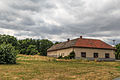
 Heřmanice č. 6.jpg 5,472 × 3,648; 2.78 MB
-
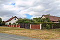
 Heřmanice čp. 10.jpg 5,472 × 3,648; 2.58 MB
-
 Heřmanice čp. 11.jpg 5,472 × 3,648; 2.98 MB
-
 Heřmanice čp. 17.jpg 5,472 × 3,648; 3.22 MB
-
 Heřmanice čp. 6.jpg 5,472 × 3,648; 2.99 MB
-
 Heřmanice čp. 9.jpg 5,472 × 3,648; 3.13 MB


