Category:Hazlerigg
Jump to navigation
Jump to search
village and civil parish in Newcastle upon Tyne, north east England  | |||||
| Upload media | |||||
| Instance of |
| ||||
|---|---|---|---|---|---|
| Location |
| ||||
| Area |
| ||||
| Said to be the same as | Hazlerigg (Wikimedia duplicated page, civil parish) | ||||
 | |||||
English: Hazlerigg (often mis-spelled Hazelrigg) is a village and civil parish in the City of Newcastle upon Tyne in Tyne and Wear, England. It is about north of the city centre, on the A1. It is split between Newcastle upon Tyne and North Tyneside, each side of the A1 being a different district. The parish council administer the Newcastle side, whereas the area located in North Tyneside is unparished. Much of the Newcastle Great Park development is within the area administered by the Hazlerigg Parish Council.
Media in category "Hazlerigg"
The following 33 files are in this category, out of 33 total.
-
 Arable Land next to Havannah Nature Reserve - geograph.org.uk - 5261869.jpg 2,000 × 1,500; 434 KB
-
 Bridleway, Havannah Nature Reserve - geograph.org.uk - 5260729.jpg 2,000 × 1,500; 906 KB
-
 Coach Lane heading west - geograph.org.uk - 3583824.jpg 640 × 480; 65 KB
-
 Community hall and play park, Hazelrigg - geograph.org.uk - 5260724.jpg 2,000 × 1,500; 379 KB
-
 Farm Track - geograph.org.uk - 45327.jpg 640 × 480; 142 KB
-
 Grass in Hazlerigg, Northumberland - geograph-5260716.jpg 2,000 × 1,500; 625 KB
-
 Great Parkway - geograph.org.uk - 3649804.jpg 4,286 × 2,935; 1.71 MB
-
 Havannah Nature Reserve - geograph.org.uk - 2150947.jpg 1,824 × 1,216; 925 KB
-
 Havannah Nature Reserve - geograph.org.uk - 2150964.jpg 1,824 × 1,216; 887 KB
-
 Havannah Nature Reserve - geograph.org.uk - 3004943.jpg 640 × 480; 109 KB
-
 Hazlerigg1.jpg 1,280 × 960; 443 KB
-
 Hazlerigg2.jpg 1,280 × 960; 445 KB
-
 Newcastle Great Park - geograph.org.uk - 57888.jpg 640 × 475; 82 KB
-
 Non working phone box, Hazelrigg - geograph.org.uk - 5260710.jpg 3,000 × 4,000; 4.49 MB
-
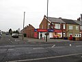 One Stop shop, Hazelrigg - geograph.org.uk - 5260715.jpg 2,000 × 1,500; 410 KB
-

-
 Pond in Havannah Nature Reserve - geograph.org.uk - 2946802.jpg 640 × 480; 96 KB
-
 Pond in Havannah Nature Reserve - geograph.org.uk - 2946805.jpg 640 × 480; 72 KB
-
 Pond in Havannah Nature Reserve - geograph.org.uk - 2946810.jpg 640 × 480; 115 KB
-
 Pond, Havannah Nature Reserve - geograph.org.uk - 5260734.jpg 2,000 × 1,500; 445 KB
-
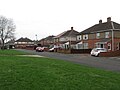 Ryall Avenue, Hazelrigg - geograph.org.uk - 5260719.jpg 2,000 × 1,500; 372 KB
-
 Sage at Great Park - geograph.org.uk - 70926.jpg 640 × 480; 51 KB
-
 Track into woodland - geograph.org.uk - 3583820.jpg 640 × 480; 142 KB
-
 Trees - geograph.org.uk - 476289.jpg 640 × 480; 75 KB
-
 Brunton Lane - geograph.org.uk - 531754.jpg 640 × 480; 68 KB
-
 Ex-Records Office - geograph.org.uk - 75121.jpg 640 × 475; 172 KB
-
 Ferndene Avenue - geograph.org.uk - 75120.jpg 640 × 475; 70 KB
-
 Havannah pond - geograph.org.uk - 47963.jpg 640 × 480; 136 KB
-
 Looking south from Sunnyside farm - geograph.org.uk - 93316.jpg 640 × 427; 75 KB
-
 Middle Brunton East Farm - geograph.org.uk - 70331.jpg 640 × 475; 115 KB
-

-

-
 West Brunton Farm - geograph.org.uk - 476275.jpg 640 × 480; 72 KB


