Category:Hayle
Jump to navigation
Jump to search
town and civil parish in west Cornwall, England  | |||||
| Upload media | |||||
| Instance of | |||||
|---|---|---|---|---|---|
| Location | Cornwall, South West England, England | ||||
| Population |
| ||||
| Different from | |||||
| official website | |||||
 | |||||
Subcategories
This category has the following 18 subcategories, out of 18 total.
A
B
- Beaches of Hayle (30 F)
- Black Cliffs, Hayle (5 F)
G
- Guildford Viaduct, Cornwall (5 F)
H
- Hayle Causeway (6 F)
- Hayle harbour (28 F)
- Hayle Railway (6 F)
- Hayle War Memorial (4 F)
J
- J & F Pool Ltd (12 F)
- Katharine Jenner (1 P, 11 F)
P
- Paradise Park, Cornwall (5 F)
S
- Ships registered in Hayle (1 F)
T
V
- Hayle viaduct (19 F)
Media in category "Hayle"
The following 200 files are in this category, out of 302 total.
(previous page) (next page)-
 . . Carnsew Lockgates. - panoramio.jpg 4,487 × 2,525; 4.37 MB
-
 . . Pottery at St Erth 2. - panoramio.jpg 4,000 × 2,248; 5.5 MB
-
 . Carnsew Draining. - panoramio.jpg 4,000 × 3,000; 3.78 MB
-
 ..The Carnsew Monolith. - panoramio.jpg 4,000 × 2,248; 3.59 MB
-
 1646 - Hayle Estuary from the electric works.jpg 3,072 × 2,304; 1.89 MB
-
 1844 Arch. - panoramio.jpg 2,992 × 2,992; 3.73 MB
-
 5 Arches. - panoramio.jpg 4,000 × 2,248; 4.49 MB
-
 A30 - geograph.org.uk - 6015932.jpg 1,024 × 681; 103 KB
-
 Allotments, off Loggans Road, Hayle, Cornwall - August 2023.jpg 3,920 × 2,678; 1.42 MB
-
 Amongst the dunes at Mexico Towans - geograph.org.uk - 3202445.jpg 1,142 × 857; 292 KB
-
 Asparagus field - geograph.org.uk - 3803701.jpg 1,024 × 680; 253 KB
-
 B3301 by Hayle Estuary - geograph.org.uk - 5136002.jpg 640 × 426; 64 KB
-
 B3302 - geograph.org.uk - 6015916.jpg 1,024 × 681; 142 KB
-
 Black Bridge. - panoramio.jpg 4,000 × 2,248; 4.03 MB
-
 Bridge over former railway line, Hayle, July 2022.jpg 3,024 × 4,032; 5.75 MB
-
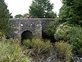 Bridge over River Hayle. - panoramio.jpg 4,000 × 3,000; 3.28 MB
-
 Building site on the edge of Hayle - geograph.org.uk - 5123642.jpg 640 × 426; 62 KB
-
 Building site on the edge of Hayle - geograph.org.uk - 5123644.jpg 640 × 426; 55 KB
-

-
 By the Cornish Main line - geograph.org.uk - 5117210.jpg 640 × 426; 42 KB
-
 C C C Lockgate. - panoramio.jpg 3,648 × 2,056; 5.01 MB
-
 Cabbage field - geograph.org.uk - 36079.jpg 640 × 480; 116 KB
-
 Car Park at Hayle Towans - geograph.org.uk - 2714699.jpg 2,816 × 2,112; 1.16 MB
-

-
 Carnsew Pool new lockgates just arrived. - panoramio.jpg 4,608 × 3,072; 4.81 MB
-
 Carwin Rise, Loggans Moor - geograph.org.uk - 1811722.jpg 640 × 480; 52 KB
-
 Chapel Terrace - geograph.org.uk - 5123667.jpg 640 × 426; 66 KB
-
 Chapel Terrace - geograph.org.uk - 6015923.jpg 1,024 × 681; 126 KB
-
 Chimney, North Quay, Hayle - geograph.org.uk - 5889150.jpg 640 × 480; 79 KB
-
 Cliffs at Hell's Mouth (5658851818).jpg 2,937 × 3,953; 8.43 MB
-
 Coast path in Phillack Towans - geograph.org.uk - 1856793.jpg 640 × 480; 84 KB
-
 Copperhouse Canal - geograph.org.uk - 577891.jpg 640 × 427; 108 KB
-
 Copperhouse Lockgate. - panoramio.jpg 3,648 × 2,056; 4.89 MB
-
 Copperhouse Pool (6575).jpg 4,288 × 2,848; 5.73 MB
-
 Copperhouse Pool (6576).jpg 4,288 × 2,848; 6.26 MB
-
 Copperhouse Pool - Old Sluice Gates.jpg 3,024 × 4,032; 5.42 MB
-
 Copperhouse Pool. - panoramio (1).jpg 4,000 × 2,248; 4.77 MB
-
 Copperhouse Pool. - panoramio.jpg 4,000 × 2,248; 4.58 MB
-
 Copperhouse, Hayle - geograph.org.uk - 6267518.jpg 640 × 480; 65 KB
-
 Cornwall Copper Company boundary stone by Lethlean Lane Bridge. - panoramio.jpg 4,608 × 3,072; 4.63 MB
-
 Cottage on Churchtown Road with Slag Block Quoins - geograph.org.uk - 6337175.jpg 4,000 × 3,000; 3.26 MB
-
 Crimean siege mortar - geograph.org.uk - 989441.jpg 640 × 427; 100 KB
-
 Crop field and woodland - geograph.org.uk - 6015909.jpg 1,024 × 681; 148 KB
-
 Crop field, Hayle - geograph.org.uk - 6015905.jpg 1,024 × 681; 142 KB
-
 Cycle Path - geograph.org.uk - 579528.jpg 640 × 427; 118 KB
-
 Daffodil field at Trethingey Farm - geograph.org.uk - 5191221.jpg 640 × 480; 58 KB
-
 Detail of the milestone in Steamers Hill - geograph.org.uk - 2577333.jpg 480 × 640; 138 KB
-
 Disused railway bridge. Built 1837. - panoramio.jpg 3,648 × 2,056; 5.44 MB
-
 Disused Railway Track. - panoramio.jpg 3,648 × 2,056; 5.14 MB
-
 Double Ford at Joppa - geograph.org.uk - 4682716.jpg 6,000 × 4,000; 6.31 MB
-

-
 Dracaena Avenue - geograph.org.uk - 5141589.jpg 640 × 426; 50 KB
-
 DSCN1082JennerPlaque.jpg 1,632 × 1,224; 978 KB
-
 East Quay - geograph.org.uk - 2505915.jpg 640 × 426; 196 KB
-
 East Quay, Hayle Harbour - geograph.org.uk - 5889159.jpg 640 × 480; 80 KB
-
 Edge of field off Drannack Mill Lane - geograph.org.uk - 5191203.jpg 640 × 480; 66 KB
-
 Entrance to Carnsew Pool, Hayle - geograph.org.uk - 5889538.jpg 640 × 480; 79 KB
-
 Entrance to Hayle RFC - geograph.org.uk - 3693877.jpg 640 × 427; 75 KB
-
 Environment Agency sign, Copperhouse Pool, Hayle, July 2022.jpg 4,032 × 3,024; 7.05 MB
-
 Estuary at Hayle - geograph.org.uk - 5841256.jpg 640 × 480; 61 KB
-
 Every day is different. - panoramio.jpg 4,000 × 2,248; 3.96 MB
-
 Factory entrance, Hayle - geograph.org.uk - 3825518.jpg 1,536 × 768; 592 KB
-
 Fallow field - geograph.org.uk - 5123705.jpg 640 × 426; 52 KB
-
 Farmland beside Wheal Alfred Road - geograph.org.uk - 3803714.jpg 1,024 × 680; 265 KB
-
 Farmland near Guildford - geograph.org.uk - 5123630.jpg 640 × 426; 37 KB
-
 Farmland, Trevassak - geograph.org.uk - 5123638.jpg 452 × 640; 34 KB
-

-
 Field headland and footpath - geograph.org.uk - 3803698.jpg 1,024 × 680; 270 KB
-
 Field of cabbages - geograph.org.uk - 3803711.jpg 1,024 × 680; 284 KB
-
 First Not Second Homes sticker, Hayle, August 2022.jpg 3,024 × 4,032; 2.92 MB
-
 Flood tide at Carnsew. - panoramio.jpg 3,648 × 2,056; 4.81 MB
-
 Flow diverter. - panoramio.jpg 4,000 × 3,000; 5.14 MB
-
 Flush Bracket OSBM S7036, Hayle, Church - geograph.org.uk - 5159950.jpg 960 × 1,280; 481 KB
-
 Footpath - panoramio (7).jpg 2,992 × 2,992; 3.77 MB
-
 Footpath - panoramio (8).jpg 2,248 × 4,000; 4.3 MB
-
 Young anglers at Hayle - Stanhope A Forbes - 1930.jpg 1,200 × 966; 362 KB
-
 Ford at Nineveh - geograph.org.uk - 36083.jpg 640 × 480; 147 KB
-
 Foundry Hill, (B3302), Hayle - geograph.org.uk - 5462584.jpg 640 × 480; 74 KB
-
 Glanmor House, Paradise Park, Hayle - geograph.org.uk - 6176381.jpg 640 × 480; 131 KB
-
 Graffiti on meter boxes, Hayle, Cornwall - May 2022.jpg 4,032 × 3,024; 3.38 MB
-
 Graffiti, Hayle Terrace, Hayle, Cornwall - May 2022.jpg 3,024 × 4,032; 3.65 MB
-
 H Boundary Stone. - panoramio.jpg 4,000 × 2,248; 4.06 MB
-
 Harveys Arch. - panoramio.jpg 4,000 × 2,248; 4.11 MB
-
 Hayle , A30 - geograph.org.uk - 6305235.jpg 6,000 × 4,000; 7.39 MB
-
 Hayle , A30 - geograph.org.uk - 6305236.jpg 6,000 × 4,000; 7.7 MB
-
 Hayle , Allotments - geograph.org.uk - 6337759.jpg 6,000 × 4,000; 7.63 MB
-
 Hayle , Beatrice Terrace B3301 - geograph.org.uk - 6337729.jpg 6,000 × 4,000; 7.23 MB
-
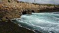
 Hayle , Black Cliff - geograph.org.uk - 6304053.jpg 6,000 × 4,000; 6.55 MB
-
 Hayle , Black Cliff - geograph.org.uk - 6304054.jpg 6,000 × 4,000; 6.91 MB
-
 Hayle , Black Cliff - geograph.org.uk - 6304055.jpg 6,000 × 4,000; 7.38 MB
-
 Hayle , Brookway - geograph.org.uk - 6337727.jpg 6,000 × 4,000; 6.09 MB
-
 Hayle , Caravans - geograph.org.uk - 6304075.jpg 6,000 × 4,000; 6.96 MB
-
 Hayle , Caravans - geograph.org.uk - 6304080.jpg 6,000 × 4,000; 5.74 MB
-
 Hayle , Copper Terrace B3301 - geograph.org.uk - 6337742.jpg 6,000 × 4,000; 6.4 MB
-
 Hayle , Footpath - geograph.org.uk - 6304077.jpg 6,000 × 4,000; 6.97 MB
-
 Hayle , Footpath - geograph.org.uk - 6304089.jpg 6,000 × 4,000; 6.6 MB
-
 Hayle , Godrevy Island - geograph.org.uk - 6304083.jpg 6,000 × 4,000; 4.85 MB
-
 Hayle , Gwithian Beach - geograph.org.uk - 6304043.jpg 6,000 × 4,000; 6.37 MB
-
 Hayle , Gwithian Beach - geograph.org.uk - 6304044.jpg 6,000 × 4,000; 5.29 MB
-
 Hayle , Gwithian Beach - geograph.org.uk - 6304045.jpg 6,000 × 4,000; 7.15 MB
-
 Hayle , Gwithian Beach - geograph.org.uk - 6304046.jpg 6,000 × 4,000; 6.95 MB
-
 Hayle , Gwithian Beach - geograph.org.uk - 6304047.jpg 6,000 × 4,000; 6.51 MB
-
 Hayle , Gwithian Beach - geograph.org.uk - 6304049.jpg 6,000 × 4,000; 6.74 MB
-
 Hayle , Gwithian Beach - geograph.org.uk - 6304051.jpg 6,000 × 4,000; 6.28 MB
-
 Hayle , Gwithian Beach - geograph.org.uk - 6304057.jpg 6,000 × 4,000; 6.66 MB
-
 Hayle , Gwithian Beach - geograph.org.uk - 6304071.jpg 6,000 × 4,000; 7.25 MB
-
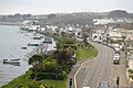
 Hayle , Hayle Sea Front - geograph.org.uk - 2501309.jpg 4,288 × 2,848; 4.92 MB
-
 Hayle , Hayle Towans - geograph.org.uk - 6304084.jpg 6,000 × 4,000; 5.96 MB
-
 Hayle , Home Bargains - geograph.org.uk - 6337740.jpg 6,000 × 4,000; 7.34 MB
-
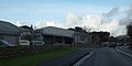
 Hayle , Lidl - geograph.org.uk - 6337722.jpg 6,000 × 4,000; 5.79 MB
-
 Hayle , Loggans Road B3301 - geograph.org.uk - 6337758.jpg 6,000 × 4,000; 6.79 MB
-
 Hayle , Loggans Road B3301 - geograph.org.uk - 6337760.jpg 6,000 × 4,000; 7.85 MB
-
 Hayle , Melyn Close - geograph.org.uk - 6337754.jpg 6,000 × 4,000; 6.61 MB
-
 Hayle , Mexico Towans Beach - geograph.org.uk - 6304009.jpg 6,000 × 4,000; 6.14 MB
-
 Hayle , Mexico Towans Beach - geograph.org.uk - 6304013.jpg 6,000 × 4,000; 7.09 MB
-
 Hayle , Mexico Towans Beach - geograph.org.uk - 6304015.jpg 6,000 × 4,000; 7.2 MB
-
 Hayle , Mexico Towans Beach - geograph.org.uk - 6304016.jpg 6,000 × 4,000; 6.38 MB
-
 Hayle , Mexico Towans Beach - geograph.org.uk - 6304020.jpg 6,000 × 4,000; 6.69 MB
-
 Hayle , Mexico Towans Beach - geograph.org.uk - 6304024.jpg 6,000 × 4,000; 5.75 MB
-
 Hayle , Mexico Towans Beach - geograph.org.uk - 6304029.jpg 6,000 × 4,000; 5.69 MB
-
 Hayle , Mexico Towans Beach - geograph.org.uk - 6304034.jpg 6,000 × 4,000; 6.27 MB
-
 Hayle , Mexico Towans Beach - geograph.org.uk - 6304040.jpg 6,000 × 4,000; 6.85 MB
-
 Hayle , Mexico Towans Beach - geograph.org.uk - 6304041.jpg 6,000 × 4,000; 7.91 MB
-
 Hayle , Penmare Terrace - geograph.org.uk - 6337752.jpg 6,000 × 4,000; 7.76 MB
-
 Hayle , Penmare Terrace B3301 - geograph.org.uk - 6337723.jpg 6,000 × 4,000; 5.66 MB
-
 Hayle , Penmare Terrace B3301 - geograph.org.uk - 6337726.jpg 6,000 × 4,000; 6.14 MB
-
 Hayle , Sand Dunes - geograph.org.uk - 6304058.jpg 6,000 × 4,000; 6.26 MB
-
 Hayle , Sand Dunes - geograph.org.uk - 6304069.jpg 6,000 × 4,000; 6.89 MB
-
 Hayle , Small Stream - geograph.org.uk - 6337731.jpg 6,000 × 4,000; 6.26 MB
-
 Hayle , Small Stream - geograph.org.uk - 6337736.jpg 6,000 × 4,000; 7.28 MB
-
 Hayle , St Ives Bay Holiday Park - geograph.org.uk - 6337762.jpg 6,000 × 4,000; 6.2 MB
-
 Hayle - Cornwall dot.png 417 × 599; 122 KB
-
 Hayle - geograph.org.uk - 3019760.jpg 640 × 480; 66 KB
-
 Hayle - geograph.org.uk - 6015914.jpg 1,024 × 681; 127 KB
-
 Hayle - geograph.org.uk - 6015921.jpg 1,024 × 681; 138 KB
-
 Hayle Bar - geograph.org.uk - 5912454.jpg 4,032 × 3,024; 993 KB
-
 Hayle Cornwall - geograph.org.uk - 5535617.jpg 640 × 480; 71 KB
-
 Hayle from near North Quay (6572).jpg 4,288 × 2,848; 6.22 MB
-
 Hayle pool.jpg 1,280 × 841; 404 KB
-
 Hayle Rly.png 1,006 × 657; 43 KB
-
 Hayle Station - geograph.org.uk - 6015927.jpg 1,024 × 681; 105 KB
-
 Hayle Station - geograph.org.uk - 6015929.jpg 1,024 × 559; 195 KB
-
 Hayle Terrace from St Elwyns Rise, Hayle, July 2022.jpg 4,032 × 3,024; 6.31 MB
-
 Hayle Tidal Barrier. - panoramio.jpg 4,000 × 2,672; 5.88 MB
-
 Hayle war memorial - geograph.org.uk - 3825525.jpg 1,536 × 1,151; 848 KB
-
 Hayle wharves swing bridge.jpg 800 × 600; 176 KB
-
 Holding back the tide. - panoramio.jpg 3,648 × 2,056; 5.34 MB
-
 Holiday chalets on Hayle Towans - geograph.org.uk - 35416.jpg 640 × 480; 91 KB
-
 Houses on Dracaena Avenue - geograph.org.uk - 5141590.jpg 640 × 426; 52 KB
-
 Houses, Meadowside Close - geograph.org.uk - 5123707.jpg 640 × 426; 26 KB
-
 Houses, Tremorva - geograph.org.uk - 5141588.jpg 640 × 426; 57 KB
-
 In the Plantation. - panoramio.jpg 4,000 × 3,000; 4.89 MB
-

-
 Lady of the Sea by Max Barratt, Penpol Terrace, Hayle, July 2022.jpg 3,024 × 4,032; 4.81 MB
-
 Lagoon at Ryan's Field. - panoramio.jpg 4,000 × 3,000; 5.63 MB
-
 Le Tour du monde-11-p398.jpg 1,893 × 1,407; 1.25 MB
-
 Lidl car park, Phillack - geograph.org.uk - 3824310.jpg 1,536 × 1,152; 955 KB
-
 Loggan's Moor Roundabout - geograph.org.uk - 6293072.jpg 1,024 × 768; 167 KB
-

-
-

-

-
 Lost line - geograph.org.uk - 988280.jpg 482 × 609; 128 KB
-
 March of the cones - geograph.org.uk - 4189063.jpg 4,000 × 2,664; 4.62 MB
-

-
 Memorial To Rick Rescorla - geograph.org.uk - 579417.jpg 640 × 427; 127 KB
-
 Merlin over Mexico Towans (6552).jpg 4,288 × 2,848; 3.86 MB
-
 Mexico Towans - geograph.org.uk - 6278426.jpg 1,024 × 768; 631 KB
-
 Milestone in Steamers Hill Angarrack - geograph.org.uk - 2577329.jpg 640 × 480; 99 KB
-
 Milestone, Commercial Road, Hayle - May 2022 (1).jpg 3,024 × 4,032; 5.63 MB
-
 Milestone, Commercial Road, Hayle - May 2022 (2).jpg 4,032 × 3,024; 6.33 MB
-
 Mill Pond, Hayle - geograph.org.uk - 5462580.jpg 640 × 480; 80 KB
-
 Mortar in Hayle (6580).jpg 4,288 × 2,848; 3.01 MB
-
 Mortar. - panoramio.jpg 2,992 × 2,992; 3.61 MB
-

-
 No Right Turn (3220323707).jpg 2,293 × 1,907; 4.17 MB
-
 No two days are the same. - panoramio.jpg 4,000 × 2,248; 4.13 MB
-
 North Quay - geograph.org.uk - 6294000.jpg 600 × 800; 106 KB
-
 North Quay. - panoramio.jpg 2,672 × 4,000; 6.14 MB
-
 Old Boundary Marker on Lethlean Lane, Hayle (geograph 6427110).jpg 660 × 882; 315 KB
-
 Old Boundary Marker on Penpol Terrace, Hayle (geograph 6426998).jpg 765 × 1,020; 328 KB
-

-

-

-

-

-

-
 Old Milestone in Penpol Road, Hayle - geograph.org.uk - 5623510.jpg 428 × 640; 77 KB
-
 Old Wayside Cross (geograph 6494872).jpg 960 × 720; 176 KB
-
 Old ^ new. - panoramio.jpg 3,648 × 2,432; 5.32 MB
-
 Ordnance Survey Flush Bracket S7036 - geograph.org.uk - 5432260.jpg 4,000 × 3,000; 4.88 MB
-
 Paradise Park - Jungle Express - geograph.org.uk - 6176412.jpg 640 × 480; 128 KB
-
 Part of the old lockgate washed up in Carnsew Pool. - panoramio.jpg 4,000 × 2,672; 3.81 MB
-
 Penpol Creek - geograph.org.uk - 579456.jpg 640 × 427; 79 KB
-
 Penwith , Hayle View - geograph.org.uk - 2501318.jpg 4,288 × 2,848; 6.15 MB
-
 Penwith hayle.png 217 × 208; 31 KB
-
 Phillack , Brookway - geograph.org.uk - 6337747.jpg 6,000 × 4,000; 7.29 MB
-
 Phillack , Churchtown Road - geograph.org.uk - 6305227.jpg 6,000 × 4,000; 7.57 MB
-
 Phillack , Clifton Terrace - geograph.org.uk - 6305206.jpg 6,000 × 4,000; 7.21 MB
-
 Phillack , Copperhouse Pool - geograph.org.uk - 6305204.jpg 6,000 × 4,000; 6.97 MB


.jpg)


.jpg)
.jpg)

.jpg)


.jpg)
.jpg)


,_Hayle_-_geograph.org.uk_-_5462584.jpg)


.jpg)


.jpg)


.jpg)
.jpg)

.jpg)


.jpg)


.jpg)
.jpg)


.jpg)


