Category:Hayfield, Derbyshire
Jump to navigation
Jump to search
village and civil parish in High Peak, Derbyshire, UK  | |||||
| Upload media | |||||
| Instance of | |||||
|---|---|---|---|---|---|
| Location | High Peak, Derbyshire, East Midlands, England | ||||
| Said to be the same as | Hayfield (Wikimedia duplicated page, civil parish) | ||||
 | |||||
Subcategories
This category has the following 20 subcategories, out of 20 total.
B
- Bowden Bridge (17 F)
E
- Edale Cross (34 F)
H
- Hayfield bus station (23 F)
- Hayfield railway station (5 F)
- Hayfield War Memorial (6 F)
- Hill Houses, Hayfield (12 F)
K
- Kinder Downfall (81 F)
- Kinder Low, Derbyshire (57 F)
- Kinder Reservoir (91 F)
L
- Lantern Pike (59 F)
- Little Hayfield (75 F)
M
- Matley Moor Farm (3 F)
- St Matthew's Church, Hayfield (19 F)
R
- Royal Hotel, Hayfield (8 F)
S
W
- William Clough (41 F)
Media in category "Hayfield, Derbyshire"
The following 200 files are in this category, out of 783 total.
(previous page) (next page)-
 "Captain Mainwaring" (Arthur Lowe) Born 1915 - geograph.org.uk - 4684418.jpg 1,728 × 2,304; 1.48 MB
-
 "The Cote" off Kinder Road - geograph.org.uk - 3118351.jpg 4,608 × 3,072; 3.49 MB
-
 "The Sportsman Inn", Hayfield - geograph.org.uk - 3118117.jpg 4,033 × 2,881; 2.44 MB
-
 13, Kinder Road, Hayfield.jpg 2,304 × 3,456; 4.45 MB
-
 17, 19 and 21, Kinder Road, Hayfield.jpg 2,304 × 3,456; 3.43 MB
-
 22 and 24, Church Street, Hayfield.jpg 3,456 × 2,304; 2.74 MB
-
 22, New Mills Road, Hayfield.jpg 3,456 × 2,304; 3.83 MB
-
 25, 27 And 29, Cote Lane, Hayfield.jpg 3,456 × 2,304; 3.35 MB
-
 4, 6, 8 and 10, Church Street, Hayfield.jpg 3,456 × 2,304; 3.17 MB
-
 4, New Mills Road. Hayfield.jpg 2,304 × 3,456; 3.74 MB
-
 41, New Mills Road, Hayfield.jpg 2,304 × 3,456; 2.95 MB
-
 49, New Mills Road, Hayfield.jpg 2,304 × 3,456; 2.47 MB
-
 51, New Mills Road, Hayfield.jpg 2,304 × 3,456; 2.26 MB
-
 A barn on the edge of Hayfield - geograph.org.uk - 2298550.jpg 3,872 × 2,592; 4.41 MB
-
 A Bus-Stop at the Gate - geograph.org.uk - 40274.jpg 640 × 480; 128 KB
-
 A grouse in the mist - geograph.org.uk - 1749951.jpg 2,272 × 1,712; 622 KB
-

-
 A view of Hayfield - geograph.org.uk - 2289178.jpg 3,648 × 2,736; 5.01 MB
-
 A view of Swine's Back, Kinder - geograph.org.uk - 3118579.jpg 3,072 × 4,608; 3.55 MB
-
 A wintry view of Hayfield - geograph.org.uk - 2178636.jpg 3,872 × 2,592; 3.3 MB
-
 A6015 - geograph.org.uk - 250214.jpg 640 × 432; 41 KB
-
 A624 at The Heys on Chinley Head - geograph.org.uk - 1479809.jpg 640 × 480; 43 KB
-
 A624 Chapel Road towards Hayfield - geograph.org.uk - 26854.jpg 640 × 480; 88 KB
-
 A624 Chapel Road, Hayfield - geograph.org.uk - 1479811.jpg 640 × 480; 50 KB
-
 A624 from Monk's Road - geograph.org.uk - 221622.jpg 480 × 640; 257 KB
-
 A624 Lay-by near Chinley Head - geograph.org.uk - 1504527.jpg 640 × 480; 69 KB
-
 A624 through Hayfield - geograph.org.uk - 3208201.jpg 1,024 × 769; 204 KB
-
 A624, Hayfield - geograph.org.uk - 5899777.jpg 640 × 480; 72 KB
-
 Above Ashop Head - geograph.org.uk - 5251147.jpg 640 × 453; 53 KB
-
 Above Farlands - geograph.org.uk - 3306484.jpg 3,456 × 2,304; 3.45 MB
-
 Above Kinder Downfall - geograph.org.uk - 4720894.jpg 4,608 × 3,456; 3.76 MB
-
 Above Tunstead Clough Farm - geograph.org.uk - 22687.jpg 640 × 480; 60 KB
-
 Access Land at Blackshaws - geograph.org.uk - 3121590.jpg 4,000 × 3,000; 3.12 MB
-
 Access road to Upper House - geograph.org.uk - 2063301.jpg 2,048 × 1,536; 1.19 MB
-
 Across Middle Moor from Snake Path - geograph.org.uk - 995194.jpg 640 × 480; 118 KB
-
 Across the Sett Valley to Tunstead Clough Farm - geograph.org.uk - 2815597.jpg 3,246 × 2,404; 1.12 MB
-
 Aircraft wreck on Mill Hill - geograph.org.uk - 2745260.jpg 852 × 480; 73 KB
-
 Alley from Kinder Road to Market St. - geograph.org.uk - 3428759.jpg 640 × 427; 65 KB
-
 Alley to Kinder Road - geograph.org.uk - 3428706.jpg 427 × 640; 65 KB
-
 Alley Way off Kinder Road - geograph.org.uk - 3152969.jpg 427 × 640; 224 KB
-
 An unfrozen pond on Mill Hill - geograph.org.uk - 2178051.jpg 3,872 × 2,592; 2.23 MB
-
 An upland valley - geograph.org.uk - 2491817.jpg 3,648 × 2,736; 5.78 MB
-
 Approach to Broad Clough - geograph.org.uk - 4971608.jpg 3,648 × 2,432; 7.82 MB
-
 Approaching Broad Clough - geograph.org.uk - 4976081.jpg 3,648 × 2,432; 5.28 MB
-
 Approaching The Heys on the A624 - geograph.org.uk - 2509612.jpg 4,000 × 2,048; 2.53 MB
-
 Arthur Lowe's Birth Place - geograph.org.uk - 3665356.jpg 3,014 × 4,386; 2.82 MB
-
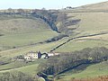
 Ashes and Tunstead Clough Farms - geograph.org.uk - 4331895.jpg 1,800 × 1,350; 502 KB
-
 Ashes Farm - geograph.org.uk - 4331956.jpg 1,800 × 1,350; 588 KB
-
 Ashes Farmhouse - geograph.org.uk - 4331890.jpg 1,800 × 1,350; 691 KB
-
 Ashes Farmhouse 01.jpg 4,000 × 3,000; 4.85 MB
-
 Ashes Farmhouse 02.jpg 4,000 × 3,000; 4.68 MB
-
 Ashes Farmhouse 03.jpg 4,000 × 3,000; 4.79 MB
-
 Ashop Head - geograph.org.uk - 4720920.jpg 4,608 × 3,456; 3.55 MB
-
 Backs of houses on Church Street - geograph.org.uk - 5556290.jpg 640 × 360; 100 KB
-
 Bank Cottages, Hayfield - geograph.org.uk - 1079514.jpg 640 × 480; 79 KB
-
 Bank Cottages, hayfield - geograph.org.uk - 1079591.jpg 640 × 480; 144 KB
-
 Bank Cottages, Hayfield. - geograph.org.uk - 1079602.jpg 480 × 640; 112 KB
-
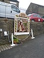
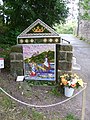
 Bank Street well dressing, Hayfield - geograph.org.uk - 1968882.jpg 640 × 480; 145 KB
-
 Bankend Farmhouse, Hayfield.jpg 4,000 × 3,000; 5.03 MB
-
 Bankvale Mill, Hayfield - geograph.org.uk - 157395.jpg 640 × 480; 140 KB
-
 Barely seen grouse - geograph.org.uk - 1441156.jpg 640 × 480; 29 KB
-
 Barn at Booth Farm.jpg 4,000 × 3,000; 7.34 MB
-
 Barn at Coldwell Clough - geograph.org.uk - 4331905.jpg 1,800 × 1,350; 520 KB
-
 Barn at Coldwell Clough 01.jpg 4,000 × 3,000; 5.04 MB
-
 Barn at Coldwell Clough 02.jpg 4,000 × 3,000; 4.66 MB
-
 Barn at Phoside Farm - geograph.org.uk - 3362452.jpg 4,320 × 3,240; 4.23 MB
-
 Barn opposite The Birches.jpg 3,456 × 2,304; 5.78 MB
-
 Beneath Kinder Downfall - geograph.org.uk - 5984284.jpg 515 × 768; 114 KB
-
 Big bales beside the River Sett - geograph.org.uk - 988238.jpg 640 × 427; 92 KB
-
 Big descent, big views - geograph.org.uk - 1194132.jpg 640 × 480; 112 KB
-
 Birthplace of Arthur Lowe - geograph.org.uk - 4667465.jpg 3,246 × 2,306; 2.49 MB
-
 Blackshaw Farm - geograph.org.uk - 2827652.jpg 3,872 × 2,592; 4.55 MB
-
 Blackshaw Farm - geograph.org.uk - 5641658.jpg 800 × 600; 147 KB
-
 Blackshaws - valley view - geograph.org.uk - 4971630.jpg 3,000 × 2,000; 6.83 MB
-
 Blanket Bog Restoration on Kinder Scout - geograph.org.uk - 3786076.jpg 2,486 × 1,544; 1,003 KB
-
 Blue plaque commemorating Arthur Lowe's Birthplace.jpg 2,048 × 1,536; 1.01 MB
-
 Bluebell Wood - geograph.org.uk - 1343055.jpg 640 × 480; 85 KB
-
 Boggy upland. - geograph.org.uk - 4819174.jpg 640 × 480; 47 KB
-
 Booth Farm.jpg 4,000 × 3,000; 4.81 MB
-
 Booth Farmhouse - geograph.org.uk - 4331884.jpg 1,800 × 1,350; 517 KB
-
 Booth Sheep Wash, River Kinder - geograph.org.uk - 2128413.jpg 1,024 × 768; 320 KB
-
 Booth sheep-dip on the River Kinder - geograph.org.uk - 711682.jpg 640 × 480; 119 KB
-
 Booth Sheepwash - geograph.org.uk - 5556256.jpg 640 × 427; 194 KB
-
 Bowden Bridge - geograph.org.uk - 4501413.jpg 5,054 × 3,188; 2.02 MB
-
 Bowden Bridge - geograph.org.uk - 5287522.jpg 1,280 × 851; 519 KB
-
 Brave cyclist - geograph.org.uk - 5556268.jpg 640 × 427; 109 KB
-
 Bridge at Coldwell Clough - geograph.org.uk - 3153507.jpg 640 × 427; 233 KB
-
 Bridge at Coldwell Clough - geograph.org.uk - 4331949.jpg 1,800 × 1,350; 549 KB
-
 Bridge over the River Kinder - geograph.org.uk - 2225436.jpg 2,592 × 1,944; 1.7 MB
-
 Bridleway at Knarrs Nook - geograph.org.uk - 3374745.jpg 640 × 386; 129 KB
-
 Bridleway below Kinder End - geograph.org.uk - 988277.jpg 640 × 426; 116 KB
-
 Bridleway beside the River Sett - geograph.org.uk - 1123305.jpg 640 × 480; 158 KB
-
 Bridleway crossing at Higher Heys Farm - geograph.org.uk - 5051311.jpg 1,024 × 768; 246 KB
-
 Bridleway Gate - geograph.org.uk - 6093102.jpg 5,152 × 3,864; 5.08 MB
-
 Bridleway to Coldwell Clough - geograph.org.uk - 3153907.jpg 640 × 427; 225 KB
-
 Bridleway to Coldwell Clough - geograph.org.uk - 3153910.jpg 640 × 427; 238 KB
-
 Bridleway to Farlands Booth - geograph.org.uk - 1194138.jpg 640 × 431; 69 KB
-
 Bridleway to Peep-o-Day - geograph.org.uk - 1066217.jpg 640 × 480; 107 KB
-
 Bridleway to Phoside - geograph.org.uk - 1066201.jpg 640 × 480; 90 KB
-
 Bridleway to White Brow, Kinder Reservoir - geograph.org.uk - 222394.jpg 480 × 640; 334 KB
-
 Bridleway towards Edale Cross - geograph.org.uk - 988262.jpg 640 × 426; 102 KB
-
 Bridleway towards Highgate Road - geograph.org.uk - 3979628.jpg 1,600 × 1,200; 640 KB
-
 Bridleway towards the main road at Peep-O-Day - geograph.org.uk - 3979623.jpg 1,600 × 1,200; 740 KB
-
 Broad Clough - geograph.org.uk - 1194149.jpg 481 × 640; 107 KB
-
 Broad Clough - geograph.org.uk - 2177895.jpg 3,872 × 2,592; 5.01 MB
-
 Broad Clough looking to Kinder Low - geograph.org.uk - 711603.jpg 640 × 480; 104 KB
-

-
 Broad-walk, Middle Moor - geograph.org.uk - 5556400.jpg 640 × 427; 116 KB
-
 BT Public Notice - Payphone Kiosk Removal - geograph.org.uk - 5287157.jpg 851 × 1,280; 256 KB
-
 Building on Kinder Road - geograph.org.uk - 3428720.jpg 640 × 427; 90 KB
-
 Bull's Head, Hayfield - geograph.org.uk - 981603.jpg 640 × 480; 65 KB
-
 Bullshaw Farm - geograph.org.uk - 2827696.jpg 3,872 × 2,592; 3.9 MB
-
 Bullshaw Farm entrance - geograph.org.uk - 2543062.jpg 640 × 480; 101 KB
-
 Burnt Hill - geograph.org.uk - 4109862.jpg 3,648 × 2,736; 4.95 MB
-

-
-
 Bus stop on New Mills Road - geograph.org.uk - 5899793.jpg 640 × 480; 70 KB
-

-
 By Red Brook - geograph.org.uk - 4720890.jpg 4,453 × 3,341; 1.46 MB
-
 By the northern end of Kinder Reservoir - geograph.org.uk - 6124286.jpg 1,600 × 1,200; 495 KB
-
 Cairn by path over Middle Moor - geograph.org.uk - 2769321.jpg 4,000 × 3,000; 2.42 MB
-
 Cairn by the Pennine Way - geograph.org.uk - 3786059.jpg 4,608 × 3,456; 3.21 MB
-
 Cairn, Middle Moor - geograph.org.uk - 222363.jpg 640 × 480; 255 KB
-
 Campsite, Hayfield - geograph.org.uk - 221625.jpg 640 × 480; 248 KB
-
 Checkpoint Charlie - Hayfield - geograph.org.uk - 433489.jpg 471 × 640; 118 KB
-
 Chinley Moor House - geograph.org.uk - 3703915.jpg 4,968 × 3,726; 3.75 MB
-

-
 Cobbled alley to Kinder Road - geograph.org.uk - 4150747.jpg 800 × 515; 99 KB
-
 Coldwell Clough (detail) - geograph.org.uk - 4331943.jpg 1,800 × 1,350; 592 KB
-
 Coldwell Clough - geograph.org.uk - 3153005.jpg 640 × 427; 266 KB
-
 Coldwell Clough - geograph.org.uk - 4500451.jpg 5,184 × 3,456; 1.98 MB
-
 Coldwell Clough Farm - geograph.org.uk - 2509748.jpg 4,000 × 3,000; 4.35 MB
-
 Coldwell Clough Farm 01.jpg 4,000 × 3,000; 4.78 MB
-
 Coldwell Clough Farm 02.jpg 4,000 × 3,000; 4.95 MB
-
 Coldwell Clough Farm 04.jpg 4,000 × 3,000; 4.84 MB
-
 Coming down off Middle Moor - geograph.org.uk - 2769326.jpg 4,000 × 3,000; 2.48 MB
-
 Comprehensive footpath directions - geograph.org.uk - 2491847.jpg 3,648 × 2,736; 4.51 MB
-
 Concession Footpath near Kinder Reservoir - geograph.org.uk - 3121561.jpg 4,000 × 3,000; 2.87 MB
-
 Cottage on Kinder Road, Hayfield - geograph.org.uk - 6292942.jpg 4,000 × 3,000; 2.9 MB
-
 Cottages on Kinder Road, Hayfield - geograph.org.uk - 2492154.jpg 3,648 × 2,736; 5.77 MB
-
 Cottages on Market Street - geograph.org.uk - 2983190.jpg 800 × 600; 155 KB
-
 Cottages, north of Hayfield - geograph.org.uk - 2769371.jpg 4,000 × 3,000; 2.59 MB
-
 Cotton grass on the High Peak - geograph.org.uk - 4061330.jpg 800 × 600; 135 KB
-
 Course of a small stream from Leygatehead Moor - geograph.org.uk - 3118767.jpg 4,608 × 3,072; 3.55 MB
-
 Crossroads signpost - geograph.org.uk - 2178020.jpg 3,872 × 2,592; 2.06 MB
-
 Crowden Head - geograph.org.uk - 80987.jpg 640 × 480; 165 KB
-
 Cut silage field north of Hayfield - geograph.org.uk - 5899770.jpg 640 × 480; 66 KB
-
 Cyclists please comply - geograph.org.uk - 1066243.jpg 640 × 480; 114 KB
-
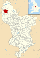 Derbyshire UK parish map highlighting Hayfield.svg 888 × 1,308; 2.34 MB
-
 Derelict building at Phoside Farm (geograph 2491893).jpg 3,648 × 2,736; 5.61 MB
-
 Descending towards Ridge Top - geograph.org.uk - 1877392.jpg 1,066 × 1,600; 167 KB
-
 Descent from Kinder Scout - geograph.org.uk - 4275413.jpg 640 × 480; 25 KB
-
 Dimpus Clough - geograph.org.uk - 3703902.jpg 5,002 × 3,752; 4.54 MB
-
 Dimpus Clough - geograph.org.uk - 4456169.jpg 5,032 × 3,355; 1.66 MB
-
 Disused Kinder Reservoir pumping house 2.jpg 4,624 × 3,472; 5.83 MB
-
 Disused Kinder Reservoir pumping house.jpg 3,472 × 4,624; 3.93 MB
-
 Dressed Well - Bank Street - Hayfield - geograph.org.uk - 2509578.jpg 3,000 × 4,000; 4.01 MB
-
 Dressed Well - Hayfield - geograph.org.uk - 2509583.jpg 3,000 × 4,000; 4.02 MB
-
 Edale this way - geograph.org.uk - 3306500.jpg 3,456 × 2,304; 1.6 MB
-
 Elizabeth II postbox on Hayfield Road, Birch Vale - geograph.org.uk - 5899809.jpg 2,848 × 2,136; 1.24 MB
-
 Elle Bank Viewed from Kinder Road - geograph.org.uk - 2815649.jpg 3,296 × 2,472; 951 KB
-
 Entering Hayfield - geograph.org.uk - 2298492.jpg 3,872 × 2,592; 3.6 MB
-
 Entering Hills farm. - geograph.org.uk - 4116969.jpg 640 × 480; 71 KB
-
 Entrance to Hayfield Campsite - geograph.org.uk - 2128424.jpg 1,024 × 768; 314 KB
-
 Entrance to Hayfield Campsite - geograph.org.uk - 988055.jpg 640 × 426; 102 KB
-
 Ewe and lambs below Mount Famine - geograph.org.uk - 4440295.jpg 3,772 × 4,952; 5.02 MB
-
 Exposed rock on the edge of Kinder Plateau - geograph.org.uk - 5062503.jpg 3,648 × 2,736; 2.69 MB
-
 Fairy Bank Crescent, Hayfield - geograph.org.uk - 5286041.jpg 1,280 × 851; 414 KB
-
 Fairy Bank Road, Hayfield - geograph.org.uk - 2492179.jpg 3,648 × 2,736; 5.56 MB
-
 Far Cown Edge Farm - geograph.org.uk - 5416697.jpg 4,204 × 2,245; 1.81 MB
-
 Far Phoside - geograph.org.uk - 3362460.jpg 4,320 × 3,240; 4.59 MB
-
 Farm and fields north of Hayfield - geograph.org.uk - 2769331.jpg 4,000 × 3,000; 2.46 MB
-
 Festive Tree on Kinder - geograph.org.uk - 4721261.jpg 3,200 × 1,800; 1.53 MB
-
 Field Patterns - geograph.org.uk - 4769074.jpg 1,600 × 900; 339 KB
-
 Fields on Matley Moor - geograph.org.uk - 2827678.jpg 3,872 × 2,592; 4.67 MB
-
 Five Bar Gate - geograph.org.uk - 4141436.jpg 3,648 × 2,736; 2.77 MB
-
 Footbridge at Hayfield - geograph.org.uk - 3407109.jpg 480 × 640; 130 KB
-
 Footbridge over the River Sett - geograph.org.uk - 3980825.jpg 1,600 × 1,200; 1.13 MB
-
 Footbridge over the River Sett - geograph.org.uk - 5285716.jpg 1,280 × 851; 607 KB
-
 Footbridge over the River Sett - geograph.org.uk - 5287897.jpg 1,280 × 851; 589 KB
-
 Footpath between Hill Houses and Tunstead Clough - geograph.org.uk - 4331889.jpg 1,800 × 1,350; 535 KB
-
 Footpath Crossroads on the Pennine Way - geograph.org.uk - 1898906.jpg 2,779 × 2,472; 902 KB
-
 Footpath junction Middle Moor - geograph.org.uk - 4685596.jpg 4,502 × 3,310; 4.88 MB
-
 Footpath junction, signpost - geograph.org.uk - 2769352.jpg 4,000 × 3,000; 2.48 MB
-
 Footpath off Kinder Road - geograph.org.uk - 2766462.jpg 4,000 × 3,000; 2.63 MB
-
 Footpath sign at Dimpus Clough - geograph.org.uk - 4061327.jpg 800 × 600; 83 KB
-
 Footpath to Brookhouses - geograph.org.uk - 4305407.jpg 1,800 × 1,350; 471 KB
-
 Footpath to the River Sett - geograph.org.uk - 5287096.jpg 851 × 1,280; 399 KB
-
 Footpath to the Snake Inn - geograph.org.uk - 6294332.jpg 4,000 × 3,000; 2.85 MB
-
 Former Bulls Head Inn, Hayfield.jpg 2,304 × 3,456; 2.95 MB
-
 Fox Hall Barn, Hayfield.jpg 3,456 × 2,304; 4.32 MB
-
 Fox Hall, Hayfield.jpg 3,456 × 2,304; 3.88 MB
-
 Foxholes Clough - geograph.org.uk - 1251791.jpg 640 × 480; 126 KB
-
 From the corner looking back - geograph.org.uk - 3306596.jpg 3,456 × 2,304; 2.4 MB
-
 Frosted star moss (Polytrichum commune) - geograph.org.uk - 4331797.jpg 1,800 × 1,350; 676 KB
-
 Frosty foxglove - geograph.org.uk - 4331962.jpg 1,800 × 1,350; 557 KB
-
 Frozen pond on Mill Hill - geograph.org.uk - 2178115.jpg 3,872 × 2,592; 5.03 MB
-
 Frozen puddle on path across Middle Moor - geograph.org.uk - 2769308.jpg 4,000 × 3,000; 2.55 MB
-
 Gate leading to access land - geograph.org.uk - 2178469.jpg 3,872 × 2,592; 2.36 MB
-
 Gate on Kinder Scout - geograph.org.uk - 5276473.jpg 3,648 × 2,736; 4.33 MB
_Born_1915_-_geograph.org.uk_-_4684418.jpg)


,_Little_Hayfield_-_geograph.org.uk_-_5899767.jpg)


_-_geograph.org.uk_-_4331943.jpg)


.jpg)


_-_geograph.org.uk_-_4331797.jpg)


