Category:Havermarkt 3, Breda
Jump to navigation
Jump to search
| Object location | | View all coordinates using: OpenStreetMap |
|---|
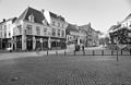
house in Breda, Netherlands  | |||||
| Upload media | |||||
| Instance of | |||||
|---|---|---|---|---|---|
| Location | Breda, North Brabant, Netherlands | ||||
| Street address |
| ||||
| Heritage designation |
| ||||
 | |||||
|
This is a category about rijksmonument number 10211
|
| Address |
|
Media in category "Havermarkt 3, Breda"
The following 8 files are in this category, out of 8 total.
-
 Aanzicht - Breda - 20041251 - RCE.jpg 1,200 × 961; 224 KB
-
 Aanzicht - Breda - 20041255 - RCE.jpg 963 × 1,200; 276 KB
-
 Aanzicht - Breda - 20041257 - RCE.jpg 973 × 1,200; 270 KB
-
 Breda Havermarkt3.jpg 2,736 × 3,648; 4.92 MB
-
 Overzicht - Breda - 20041266 - RCE.jpg 1,200 × 788; 219 KB
-
 Overzicht voorgevels en zicht op plein - Breda - 20332265 - RCE.jpg 1,200 × 783; 236 KB
-
 Pand Havermarkt Breda DSCF2002.JPG 2,112 × 2,816; 2.64 MB
-
 Voorgevels - Breda - 20041256 - RCE.jpg 806 × 1,200; 226 KB


