Category:Hato El Cedral
Jump to navigation
Jump to search
It is a livestock centre, historical tourist and animal observation area located in the Muñoz Municipality of Apure State, in the plains of Venezuela. .jpg) | |||||
| Upload media | |||||
| Location |
| ||||
|---|---|---|---|---|---|
 | |||||
Español: Hato El Cedral, espacio natural ubicado en la parroquia Mantecal, del Municipio Muñoz, Estado Apure, Venezuela, al norte de América del sur, cubre un área de 53.000 hectáreas
English: Hato El Cedral, a natural area located in the parish of Mantecal, Muñoz Municipality, Apure State, Venezuela, in northern South America, covers an area of 53,000 hectares.
Subcategories
This category has the following 2 subcategories, out of 2 total.
S
- Signs in Hato El Cedral (4 F)
- Sunsets of Hato El Cedral (4 F)
Media in category "Hato El Cedral"
The following 100 files are in this category, out of 100 total.
-
 A la caza.JPG 3,456 × 2,592; 2.64 MB
-
 Aguas de cazadores.jpg 3,872 × 2,592; 1.42 MB
-
 Alouatta arctoidea (Ursine howler monkey).jpg 992 × 661; 590 KB
-
 Amanecer en Apure.JPG 1,053 × 1,399; 662 KB
-
 Amanecer Hato El Cedral.JPG 3,264 × 2,448; 1.76 MB
-
 Anaconda (Eunectes akayima).jpg 4,578 × 3,052; 9.31 MB
-
 Anaconda (Eunectes murinus) (8990193853).jpg 1,600 × 1,067; 279 KB
-
 Anaconda en Apure.jpg 604 × 453; 70 KB
-
 Aves Del Hato El Cedral (28130397).jpeg 2,048 × 1,366; 1.22 MB
-
 Aves en el Hato El Cedral (8572787243).jpg 1,600 × 1,067; 385 KB
-
 Baba (Caiman crocodilus) (8570724338).jpg 1,600 × 1,067; 275 KB
-
 Baba (Caiman crocodilus) (8574077586).jpg 1,067 × 1,600; 227 KB
-
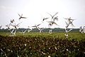
 Bandada vespertina.JPG 3,456 × 2,592; 2.79 MB
-
 Black-collared Hawk - Gavilán Colorado (Busarellus nigricollis) (9728972567).jpg 4,186 × 2,791; 4.24 MB
-
 Boat-billed Heron - Chicuaco Cajeto (Cochlearius cochlearius) juvenil (9722625740).jpg 4,365 × 2,910; 4.04 MB
-
 Buteogallus urubitinga -Apure State, Venezuela-8.jpg 2,048 × 1,366; 2.51 MB
-
 Caiman Hato Cedral.jpg 4,288 × 3,216; 3.55 MB
-
 Caimán Hato Cedral.jpg 3,127 × 2,346; 1.23 MB
-
 Capybara - Chigüire (Hydrochoerus hydrochaeris) (8564959837).jpg 2,048 × 1,366; 369 KB
-
 Capybara - Chigüire (Hydrochoerus hydrochaeris) (8578160737).jpg 1,600 × 1,067; 244 KB
-
 Capybara - Chigüire (Hydrochoerus hydrochaeris) (9722123353).jpg 5,184 × 3,456; 5.89 MB
-
 Caricare encrestado (Caracara cheriway) (8697085039).jpg 1,600 × 1,067; 489 KB
-
 Cascabel (Crotalus durissus cumanensis) (8586482853).jpg 1,600 × 1,067; 375 KB
-
 Cascabel Crotalus Durissus (27692823).jpeg 2,048 × 1,366; 1.54 MB
-
 Chavez y Bolivar Hato El Cedral Venezuela 2015-02-06 12.35.45.jpg 2,560 × 1,920; 1.22 MB
-
 Chenchena en Apure.jpg 604 × 453; 67 KB
-
 Chenchenas en Apure.jpg 604 × 453; 72 KB
-
 Chiguire Hato Cedral.jpg 2,815 × 2,112; 1.06 MB
-
 Chigüire (Hydrochoerus hydrochaeris) y Garcita Reznera (Bubulcus ibis) (8572904495).jpg 1,600 × 1,067; 275 KB
-
 Chigüires en el llano apureño.jpg 604 × 453; 46 KB
-
 Chigüires en la laguna.jpg 6,016 × 4,000; 1.14 MB
-
 Chigüirito decorado.JPG 3,456 × 2,592; 3.28 MB
-
 Cocoi Heron - Garza morena (Ardea cocoi) (9722302983).jpg 5,184 × 3,456; 7.58 MB
-
 Cotúa olivácea (Phalacrocorax brasilianus brasilianus) (8565529605).jpg 4,550 × 3,033; 6.51 MB
-

-
 El roedor mas grande.JPG 1,936 × 1,296; 811 KB
-
 El salto de la baba.JPG 1,936 × 1,296; 695 KB
-
 Familia de patos carreteros (Neochen jubata) (8572736913).jpg 1,600 × 1,067; 282 KB
-
 Flooded grassland La sabana inundada.jpg 5,184 × 3,456; 16.26 MB
-
 Ganado en Apure - Venezuela.jpg 604 × 404; 68 KB
-
 Ganado en Apure.jpg 604 × 404; 50 KB
-
 Garzas de los llanos.JPG 1,517 × 1,371; 375 KB
-
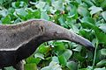
 Giant anteater - Oso hormiguero (Myrmecophaga tridactyla) (8697860914).jpg 5,184 × 3,456; 17.03 MB
-
 Giant anteater - Oso hormiguero (Myrmecophaga tridactyla) (8697863742).jpg 5,184 × 3,456; 17.63 MB
-
 Giant anteater - Oso hormiguero (Myrmecophaga tridactyla) (9864451663).jpg 3,954 × 2,636; 7.29 MB
-
 Gold tegu - Mato de agua (Tupinambis teguixin) (9740871937).jpg 3,941 × 2,627; 4.49 MB
-
 Great Black Hawk - Águila Negra (Buteogallus urubitinga) (10848288595).jpg 5,184 × 3,456; 11.09 MB
-
 Great Black Hawk - Águila Negra (Buteogallus urubitinga) (9735843020).jpg 5,184 × 3,456; 9.4 MB
-
 Great Egret - Garza real (Ardea alba) (9725858690).jpg 4,864 × 3,243; 4.91 MB
-
 Hato El Cedral Llanos de Venezuela 2015-02-05 11.33.14.jpg 2,560 × 1,920; 1.95 MB
-
 Hato El Cedral Llanos de Venezuela 2015-02-06 17.16.38.jpg 2,560 × 1,920; 2.29 MB
-
 Hato El Cedral Llanos de Venezuela 2015-02-06 17.16.46.jpg 2,560 × 1,920; 1.29 MB
-
 Hato El Cedral Llanos de Venezuela 2015-02-06 18.10.17.jpg 2,560 × 1,920; 1.31 MB
-
 Hato El Cedral Venezuela 2015-02-06 18.21.59.jpg 2,560 × 1,920; 1.12 MB
-
 Hato El Cedral.JPG 960 × 640; 296 KB
-
 Hembra Caiman Hato El Cedral.JPG 3,264 × 2,448; 1.66 MB
-
 Hembra Caimán Hato El Cedral.JPG 3,264 × 2,448; 1.51 MB
-
 Hongos en el llano venezolano.jpg 604 × 453; 53 KB
-
 Hongos llaneros.jpg 604 × 453; 56 KB
-
 Hongos sobre el cedral.jpg 604 × 453; 101 KB
-
 Horizonte llanero de Venezuela.jpg 604 × 453; 25 KB
-
 Iguana en Apure.jpg 604 × 453; 101 KB
-
 Jabiru - Garzón Soldado (Jabiru mycteria) (8576613973).jpg 4,804 × 3,202; 8.72 MB
-
 La sabana de Apure.jpg 604 × 453; 47 KB
-
 Los Llanos Venezolanos (8586243117).jpg 1,600 × 1,066; 199 KB
-
 Los llanos venezolanos.JPG 1,936 × 1,296; 920 KB
-
 Los Llanos Venezolanos.jpg 5,116 × 3,411; 7.7 MB
-
 Mirada fija.JPG 3,456 × 2,592; 2.89 MB
-
 Mirando el llano.JPG 3,456 × 2,592; 2.97 MB
-
 Mona Araguato Hato El Cedral.JPG 2,448 × 3,264; 1.24 MB
-
 Orinoco crocodile Cocodrilo del Orinoco (Crocodylus intermedius).jpg 5,184 × 3,456; 16.4 MB
-
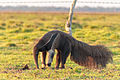 Oso hormiguero (Myrmecophaga tridactyla) (8567256236).jpg 5,184 × 3,456; 16.35 MB
-
 Oso hormiguero (Myrmecophaga tridactyla) (8696742551).jpg 5,184 × 3,456; 10.93 MB
-
 Oso hormiguero (Myrmecophaga tridactyla) (8697861712).jpg 5,184 × 3,456; 15.27 MB
-
 Oso hormiguero (Myrmecophaga tridactyla) (8697862490).jpg 5,184 × 3,456; 14.5 MB
-
 Oso hormiguero (Myrmecophaga tridactyla) (8697863110).jpg 5,184 × 3,456; 16.44 MB
-
 Oso hormiguero (Myrmecophaga tridactyla) (8697865538).jpg 5,184 × 3,456; 15.47 MB
-
 Oso hormiguero Venezuela.jpg 604 × 453; 48 KB
-
 Oso Hormiguero.JPG 1,936 × 1,296; 920 KB
-
 Picure descansando en Apure.jpg 604 × 453; 68 KB
-
 Picure llanero.jpg 604 × 453; 104 KB
-
 Recepción Hato El Cedra Venezuela 2015-02-07 11.19.29.jpg 2,560 × 1,920; 1.26 MB
-
 Riachuelo apureño.jpg 604 × 453; 33 KB
-
 Rojos llaneros.JPG 3,456 × 2,592; 2.79 MB
-
 Sabanas vestidas de Garzas Blancas.jpg 3,872 × 2,592; 763 KB
-
 Scarlet Ibis - Corocoras (Eudocimus ruber) (8564510499).jpg 2,048 × 1,366; 252 KB
-
 Scarlet Ibis - Corocoras (Eudocimus ruber) (8565370340).jpg 2,048 × 1,366; 397 KB
-
 Shakira posando.JPG 600 × 800; 125 KB
-
 Sol de verano apureño.jpg 4,000 × 6,016; 1.42 MB
-
 Southern Crested Caracara - Caricare Encrestado (Caracara plancus) (9741518519).jpg 3,833 × 2,555; 3.11 MB
-
 Southern tamandua - Oso melero (Tamandua tetradactyla nigra) (15228961344).jpg 5,184 × 3,456; 10.57 MB
-
 Spectacled Caiman - Baba (Caiman crocodilus) (8696830103).jpg 5,184 × 3,456; 12.62 MB
-
 Spectacled Caiman - Baba (Caiman crocodilus) (8698136554).jpg 5,184 × 3,456; 12.61 MB
-
 Ursine howler monkey (Alouatta seniculus arctoide) 2.jpg 2,662 × 2,157; 1.13 MB
-
 Ursine howler monkey (Alouatta seniculus arctoide) 3.jpg 2,398 × 1,943; 973 KB
-
 Ursine howler monkey (Alouatta seniculus arctoide).jpg 2,148 × 1,741; 674 KB
-
 Vista del hato el cedral.jpg 960 × 720; 165 KB
-
 Viuda Patilarga (Himantopus mexicanus mexicanus) (8573937200).jpg 1,600 × 1,067; 278 KB
-
 Wattled Jacana - Gallito de laguna (Jacana jacana) juvenil (9730031680).jpg 5,184 × 3,456; 5.52 MB
-


.jpg)


.jpg)
_(8990193853).jpg)

.jpeg)
.jpg)
_(8570724338).jpg)
_(8574077586).jpg)

_(9728972567).jpg)
_juvenil_(9722625740).jpg)


_(8564959837).jpg)
_(8578160737).jpg)
_(9722123353).jpg)
_(8697085039).jpg)
_(8586482853).jpg)
.jpeg)


_y_Garcita_Reznera_(Bubulcus_ibis)_(8572904495).jpg)


_(9722302983).jpg)
_(8565529605).jpg)
_(8573851428).jpg)


_(8572736913).jpg)


_(8697860914).jpg)
_(8697863742).jpg)
_(9864451663).jpg)
_(9740871937).jpg)
_(10848288595).jpg)
_(9735843020).jpg)
_(9725858690).jpg)


_(8576613973).jpg)


.jpg)
_(8567256236).jpg)
_(8696742551).jpg)
_(8697861712).jpg)
_(8697862490).jpg)
_(8697863110).jpg)
_(8697865538).jpg)


_(8564510499).jpg)
_(8565370340).jpg)


_(9741518519).jpg)
_(15228961344).jpg)
_(8696830103).jpg)
_(8698136554).jpg)
_2.jpg)
_3.jpg)
.jpg)

_(8573937200).jpg)
_juvenil_(9730031680).jpg)
_(9733116347).jpg)