Category:Hathersage
Jump to navigation
Jump to search

village and civil parish in Derbyshire, England  | |||||
| Upload media | |||||
| Instance of | |||||
|---|---|---|---|---|---|
| Located in protected area |
| ||||
| Location | Derbyshire Dales, Derbyshire, East Midlands, England | ||||
| Said to be the same as | Hathersage (Wikimedia duplicated page, civil parish) | ||||
 | |||||
Subcategories
This category has the following 10 subcategories, out of 10 total.
C
- Carl Wark (16 F)
H
- Hathersage railway station (13 F)
M
- Mother Cap (9 F)
N
- North Lees Hall (25 F)
O
- Outseats (9 F)
S
- Scraperlow House (6 F)
Media in category "Hathersage"
The following 200 files are in this category, out of 1,293 total.
(previous page) (next page)-
 "Riverside" Herb Centre off the A6187 Castleton Road - geograph.org.uk - 3095736.jpg 4,606 × 2,764; 3.08 MB
-
 "Scotsmans Pack", Hathersage - geograph.org.uk - 3176270.jpg 4,608 × 3,072; 3.04 MB
-
 "The Millstone Inn", Hathersage Booths - geograph.org.uk - 2218248.jpg 2,089 × 1,561; 903 KB
-
 "This is God's Acre..." - geograph.org.uk - 5870211.jpg 4,903 × 3,708; 4.97 MB
-
 04.06.12 Hathersage 185.130 (7156962473).jpg 4,000 × 3,000; 6.29 MB
-
 A bit of bad weather on the way - geograph.org.uk - 1421091.jpg 640 × 480; 66 KB
-
 A boggy bit below Stanage End - geograph.org.uk - 4761441.jpg 6,000 × 4,000; 4.01 MB
-
 A corner of Hathersage near the church - geograph.org.uk - 3134831.jpg 1,024 × 748; 251 KB
-
 A descent from Stanage Edge - geograph.org.uk - 6141559.jpg 640 × 640; 112 KB
-
 A farm access road at Cattis Side - geograph.org.uk - 3078786.jpg 800 × 600; 182 KB
-
 A footpath at the Warren - geograph.org.uk - 3078852.jpg 800 × 600; 144 KB
-
 A lonely tree - geograph.org.uk - 3333764.jpg 640 × 427; 105 KB
-
 A minor road leading to the A6013 - geograph.org.uk - 3079006.jpg 800 × 600; 128 KB
-
 A paraglider touches down near Overstones Farm - geograph.org.uk - 4256952.jpg 4,913 × 3,276; 3.98 MB
-
 A rock with a view - geograph.org.uk - 5865544.jpg 4,320 × 3,240; 4.59 MB
-
 A track towards Bole Hill - geograph.org.uk - 3078999.jpg 800 × 600; 73 KB
-
 A train approaching Hathersage - geograph.org.uk - 1729433.jpg 3,872 × 2,592; 2.8 MB
-

-
 A view of North Lees and Stanage Edge - geograph.org.uk - 4721881.jpg 3,888 × 5,184; 6.11 MB
-
 A view of North Lees Estate - geograph.org.uk - 5474981.jpg 5,184 × 3,888; 4.47 MB
-
 A view of the Hope Valley - geograph.org.uk - 3793831.jpg 5,182 × 3,702; 5.11 MB
-
 A view of the Hope Valley - geograph.org.uk - 4263328.jpg 4,912 × 2,760; 6.25 MB
-
 A wintry view of Burbage Moor - geograph.org.uk - 5656299.jpg 4,821 × 3,380; 4.18 MB
-
 A57 at Sheffield Boundary - geograph.org.uk - 6293534.jpg 5,456 × 3,632; 2.05 MB
-
 A57 at Sheffield Boundary - geograph.org.uk - 6293536.jpg 5,456 × 3,632; 1.37 MB
-

-
 A57 Moscar, near Strines turnoff - geograph.org.uk - 2103145.jpg 640 × 480; 42 KB
-
 A57 on the brow of the hill near Moscar Lodge - geograph.org.uk - 4760665.jpg 6,000 × 4,000; 4.45 MB
-
 A57 towards Glossop - geograph.org.uk - 5897440.jpg 640 × 487; 74 KB
-

-
 A6187 Approaching Hillfoot - geograph.org.uk - 3013011.jpg 640 × 427; 229 KB
-
 A6187 near Riverside garden centre - geograph.org.uk - 4179354.jpg 1,024 × 768; 195 KB
-
 A6187 near the Surprise View - geograph.org.uk - 3134604.jpg 1,024 × 768; 194 KB
-
 A6187 passes through Hathersage - geograph.org.uk - 3333834.jpg 640 × 411; 153 KB
-
 A6187 view from Hathersage Moor - geograph.org.uk - 751241.jpg 640 × 480; 89 KB
-
 Abandoned farm at Callow - geograph.org.uk - 4368266.jpg 3,888 × 4,964; 5.63 MB
-
 Abandoned House - geograph.org.uk - 3865140.jpg 1,024 × 768; 249 KB
-
 Abandoned mill pond in the Hood Brook valley - geograph.org.uk - 6008076.jpg 4,663 × 3,464; 7.15 MB
-
 Abandoned millstone at the south end of Stanage Edge - geograph.org.uk - 5665455.jpg 3,888 × 5,038; 5.85 MB
-
 Abandoned millstone below High Neb - geograph.org.uk - 4262879.jpg 5,001 × 3,866; 5.08 MB
-
 Abandoned millstone below Stanage Edge - geograph.org.uk - 5591015.jpg 3,723 × 5,048; 5.89 MB
-
 Abandoned millstone with a face - geograph.org.uk - 6252175.jpg 5,007 × 3,676; 6.3 MB
-
 Abandoned millstone with a view to Dennis Knoll - geograph.org.uk - 5591160.jpg 4,904 × 3,800; 5.46 MB
-
 Abandoned millstone with Stanage Edge beyond - geograph.org.uk - 6252208.jpg 4,971 × 3,870; 5.32 MB
-
 Abandoned millstones - geograph.org.uk - 5859273.jpg 4,917 × 3,644; 4.24 MB
-
 Abandoned millstones at the southern end of Stanage Edge - geograph.org.uk - 5665532.jpg 5,085 × 3,791; 6.16 MB
-
 Abandoned millstones below High Neb - geograph.org.uk - 5404868.jpg 5,073 × 3,711; 4.75 MB
-
 Abandoned millstones below High Neb - geograph.org.uk - 6252163.jpg 3,853 × 5,073; 6.29 MB
-
 Abandoned millstones below Stanage Edge - geograph.org.uk - 5404860.jpg 4,868 × 3,532; 4.07 MB
-
 Abandoned millstones below Stanage Edge - geograph.org.uk - 6373398.jpg 5,184 × 3,888; 4.79 MB
-
 Abandoned millstones by the track to Bole Hill Quarry - geograph.org.uk - 5461009.jpg 4,879 × 3,713; 6.61 MB
-
 Abandoned millstones in Bolehill Quarry - geograph.org.uk - 5197810.jpg 600 × 800; 209 KB
-
 Abandoned millstones in Bolehill Quarry - geograph.org.uk - 6015382.jpg 480 × 640; 151 KB
-
 Abandoned millstones in the snow - geograph.org.uk - 4330542.jpg 4,991 × 3,728; 4.81 MB
-
 Above Hathersage - geograph.org.uk - 3819680.jpg 5,065 × 3,618; 3.13 MB
-
 Above Hathersage Booths - geograph.org.uk - 3793753.jpg 4,900 × 3,267; 4.08 MB
-
 Above Overstones Farm - looking to The Hope Valley - geograph.org.uk - 5198449.jpg 3,878 × 4,878; 4.76 MB
-
 Across Hood Brook - geograph.org.uk - 3134855.jpg 1,024 × 768; 266 KB
-
 Across the field - geograph.org.uk - 5864110.jpg 4,320 × 3,240; 4.68 MB
-
 Across the Hope Valley - geograph.org.uk - 3819717.jpg 5,030 × 3,354; 2.84 MB
-
 Across the Hope Valley during a winter squall - geograph.org.uk - 3823384.jpg 5,182 × 3,702; 3.41 MB
-
 Ageing foxglove plant and old millstones - geograph.org.uk - 5464663.jpg 4,661 × 3,592; 3.01 MB
-
 Allotments, Hathersage - geograph.org.uk - 1166499.jpg 640 × 480; 116 KB
-
 Along the Edge (1) - geograph.org.uk - 5865075.jpg 4,320 × 3,240; 3.1 MB
-
 Along the Edge (2) - geograph.org.uk - 5865077.jpg 4,320 × 3,240; 3.59 MB
-
 Alpacas at the hall - geograph.org.uk - 5866011.jpg 3,575 × 2,681; 3.08 MB
-
 Anchor Man - geograph.org.uk - 6373374.jpg 5,011 × 3,597; 2.91 MB
-
 Ancient hollow way - geograph.org.uk - 3144834.jpg 1,600 × 1,200; 961 KB
-
 Ancient stone on Bamford Moor - geograph.org.uk - 2666011.jpg 1,952 × 2,608; 1.73 MB
-
 Angry Bird at Stanage - geograph.org.uk - 5317975.jpg 4,429 × 3,445; 3.18 MB
-
 Another View of North Lees Hall - geograph.org.uk - 6335610.jpg 4,867 × 3,591; 4.29 MB
-
 Another view of Offerton Hall - geograph.org.uk - 4179243.jpg 1,788 × 2,503; 1.25 MB
-
 Another view of Stanage Edge - geograph.org.uk - 6011131.jpg 5,183 × 3,769; 4.08 MB
-
 Approaching Netherhurst Farm - geograph.org.uk - 4912507.jpg 4,436 × 3,214; 4.57 MB
-
 Approaching the cricket ground - geograph.org.uk - 5863352.jpg 4,320 × 3,240; 3.86 MB
-
 As the sun sets over Derbyshire - geograph.org.uk - 4257095.jpg 5,184 × 3,888; 4.11 MB
-
 At Crow Chin, Stanage Edge - geograph.org.uk - 6252132.jpg 3,888 × 5,184; 5.37 MB
-
 At High Neb, Stanage Edge - geograph.org.uk - 5405079.jpg 3,888 × 5,077; 5.5 MB
-
 At Surprise View - geograph.org.uk - 4330411.jpg 3,739 × 5,087; 6.12 MB
-
 At The Border - geograph.org.uk - 4635286.jpg 5,035 × 3,757; 5.69 MB
-
 At The Going Down of the Sun - geograph.org.uk - 4635283.jpg 5,184 × 3,541; 3.54 MB
-
 At the southern end of Stanage Edge - geograph.org.uk - 5665550.jpg 4,996 × 3,737; 4.91 MB
-
 At Upper Burbage Bridge - geograph.org.uk - 3786943.jpg 4,994 × 3,330; 2.96 MB
-
-
 Awaiting a driver - geograph.org.uk - 5863359.jpg 4,320 × 3,240; 2.69 MB
-
 B6001 leaving Hathersage to the south - geograph.org.uk - 3133945.jpg 825 × 1,024; 228 KB
-
 Bank Cottages, Hathersage.jpg 4,168 × 3,127; 4.07 MB
-
 Bank House - geograph.org.uk - 5867662.jpg 3,711 × 2,782; 1.66 MB
-
 Bank Top from Coggers Lane - geograph.org.uk - 6135975.jpg 1,024 × 683; 204 KB
-
 Baulk Lane - geograph.org.uk - 5863357.jpg 4,320 × 3,240; 3.33 MB
-
 Baulk Lane cricket ground, Hathersage - geograph.org.uk - 5870204.jpg 4,962 × 3,326; 3.54 MB
-
 Behind the houses - geograph.org.uk - 5863351.jpg 4,320 × 3,240; 4.97 MB
-
 Below Bamford Moor - geograph.org.uk - 3668153.jpg 4,000 × 3,000; 2.21 MB
-
 Below Millstone Edge - geograph.org.uk - 592801.jpg 640 × 468; 159 KB
-
 Below Stanage Edge - geograph.org.uk - 5418332.jpg 1,024 × 768; 177 KB
-
 Belted Galloway cattle above Callow Bank - geograph.org.uk - 5665572.jpg 5,062 × 3,769; 4.69 MB
-
 Belted Galloway Cattle by The Dale - geograph.org.uk - 5656284.jpg 4,691 × 3,630; 4.04 MB
-
 Bench on Bole Hill - geograph.org.uk - 4762247.jpg 5,147 × 3,431; 6.63 MB
-

-
 Beside the Derwent - geograph.org.uk - 1730023.jpg 3,872 × 2,592; 5.71 MB
-
 Beware of Flying Motorcyclists - geograph.org.uk - 5198494.jpg 4,953 × 3,714; 3.91 MB
-
 Beware of sheep - geograph.org.uk - 4179798.jpg 1,024 × 768; 124 KB
-
 Birchin Wood - geograph.org.uk - 693857.jpg 640 × 427; 184 KB
-
 Birley Lane junction - geograph.org.uk - 262571.jpg 640 × 480; 136 KB
-
 Biscuit near Stanedge Pole - geograph.org.uk - 5051205.jpg 3,514 × 4,641; 3.71 MB
-
 Black faced sheep at High Neb - geograph.org.uk - 5405104.jpg 4,950 × 3,685; 4.22 MB
-
 Blooming Heather - geograph.org.uk - 4125862.jpg 2,551 × 1,822; 2.19 MB
-
 Blowin' in The Wind - geograph.org.uk - 6252291.jpg 5,164 × 3,637; 7.85 MB
-
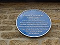 Blue plaque in Hathersage - geograph.org.uk - 4597921.jpg 640 × 480; 96 KB
-
 Bolehill Wood - geograph.org.uk - 4762334.jpg 6,000 × 4,000; 3.77 MB
-
 Booth's Farmhouse, Hathersage.jpg 4,000 × 3,000; 4.93 MB
-
 Bouldering in Stanage Edge - geograph.org.uk - 5419280.jpg 1,024 × 768; 172 KB
-
 Boulders below the byway - geograph.org.uk - 5865055.jpg 4,320 × 3,240; 4.65 MB
-
 Brackish pool north of Dennis Knoll - geograph.org.uk - 5404851.jpg 5,078 × 3,776; 5.26 MB
-
 Bridge under the railway - geograph.org.uk - 3134567.jpg 1,024 × 768; 336 KB
-
 Bridleway meets the road - geograph.org.uk - 5865907.jpg 4,320 × 3,240; 3.23 MB
-
 Broadhay Farm - geograph.org.uk - 3880335.jpg 4,607 × 2,683; 4 MB
-
 Broadhay Farm from the riverside footpath - geograph.org.uk - 3133979.jpg 1,024 × 457; 92 KB
-
 Broadhay Farm on a frosty November morning - geograph.org.uk - 5210619.jpg 4,895 × 3,637; 4.69 MB
-
 Bronte Cottage - geograph.org.uk - 5863371.jpg 4,320 × 3,240; 3.54 MB
-
 Bronte Cottage near North Lees Hall - geograph.org.uk - 6336741.jpg 4,949 × 3,698; 3.49 MB
-
 Bronte Cottage with North Lees above - geograph.org.uk - 4832290.jpg 640 × 427; 90 KB
-
 Brook above Upper Burbage Bridge - geograph.org.uk - 1720846.jpg 2,560 × 1,920; 788 KB
-
 Brook on Burbage Moor - geograph.org.uk - 2440185.jpg 683 × 1,024; 230 KB
-
 Brookfield Manor (1) - geograph.org.uk - 5863368.jpg 4,320 × 3,240; 3.53 MB
-
 Brookfield Manor (2) - geograph.org.uk - 5863369.jpg 4,320 × 3,240; 4.95 MB
-
 Brookfield Manor (3) - geograph.org.uk - 5866958.jpg 4,320 × 3,240; 4.59 MB
-
 Brookfield Manor - geograph.org.uk - 21656.jpg 640 × 480; 107 KB
-
 Brookfield Manor - geograph.org.uk - 5241827.jpg 4,758 × 3,172; 5.6 MB
-
 Building at Birley Farm - geograph.org.uk - 3078859.jpg 800 × 600; 118 KB
-
 Building at Out Lane Farm - geograph.org.uk - 3078876.jpg 800 × 600; 134 KB
-
 Bullock scratching itself - Hathersage Moor (geograph 5466353).jpg 4,662 × 3,458; 4.49 MB
-
 Burbage Bridge Car Park - geograph.org.uk - 5940716.jpg 4,000 × 3,000; 4.06 MB
-
 Burbage Brook View - geograph.org.uk - 750464.jpg 640 × 480; 107 KB
-

-
 Burbage Moor and a wing mirror - geograph.org.uk - 5300565.jpg 4,946 × 3,837; 2.42 MB
-
 Burbage Moor in wintertime - geograph.org.uk - 6031505.jpg 5,183 × 3,690; 5.28 MB
-
 Burbage Moor, Stanage and Clouds - geograph.org.uk - 3945520.jpg 2,588 × 1,726; 1.06 MB
-
 Burbage Valley - geograph.org.uk - 420005.jpg 640 × 480; 108 KB
-
 Bus stop on the Main Road - geograph.org.uk - 4597911.jpg 640 × 480; 69 KB
-
 By the River Derwent at Nether Hall - geograph.org.uk - 4179228.jpg 1,888 × 2,517; 2.01 MB
-
 Byway to the Edge (1) - geograph.org.uk - 5864136.jpg 4,320 × 3,240; 3.18 MB
-
 Byway to the Edge (2) - geograph.org.uk - 5864140.jpg 4,320 × 3,240; 3.19 MB
-
 Byway to the Edge (3) - geograph.org.uk - 5865048.jpg 4,320 × 3,240; 3.99 MB
-
 Byway to the Edge (4) - geograph.org.uk - 5865054.jpg 4,320 × 3,240; 4.89 MB
-
 Byway to the Edge (5) - geograph.org.uk - 5865058.jpg 2,881 × 2,881; 3.74 MB
-
 Callow - geograph.org.uk - 4038245.jpg 1,732 × 1,155; 275 KB
-
 Callow - geograph.org.uk - 4070329.jpg 1,024 × 768; 220 KB
-
 Callow Bank - Bridge over Brook - geograph.org.uk - 1610147.jpg 640 × 426; 181 KB
-
 Callow Bank - geograph.org.uk - 1420986.jpg 640 × 480; 81 KB
-
 Callow Bank - geograph.org.uk - 1989652.jpg 3,296 × 2,097; 824 KB
-
 Callow Bank - geograph.org.uk - 2253906.jpg 640 × 480; 72 KB
-
 Callow Bank and Higger Tor - geograph.org.uk - 1610144.jpg 640 × 427; 168 KB
-
 Callow Bank and Higger Tor seen from The Dale - geograph.org.uk - 4368255.jpg 3,682 × 4,979; 4.46 MB
-
 Callow Bank from Higger Tor - geograph.org.uk - 2520514.jpg 640 × 482; 80 KB
-
 Callow Bank from the Ringinglow road - geograph.org.uk - 2901571.jpg 4,608 × 3,072; 3.41 MB
-
 Callow Barn - geograph.org.uk - 3333792.jpg 640 × 427; 175 KB
-
 Callow Farm - geograph.org.uk - 1392417.jpg 640 × 480; 113 KB
-
 Callow Farm - geograph.org.uk - 1392424.jpg 480 × 640; 109 KB
-
 Camp Green ringwork, Hathersage.jpg 4,000 × 3,000; 4.94 MB
-
 Car parking at Hooks Car - geograph.org.uk - 3078718.jpg 800 × 600; 68 KB
-
 Carhead Rocks - geograph.org.uk - 1181812.jpg 640 × 480; 28 KB
-
 Carhead Rocks - geograph.org.uk - 3228403.jpg 1,600 × 1,200; 555 KB
-
 Carhead Rocks in late evening light - geograph.org.uk - 5815789.jpg 800 × 600; 106 KB
-
 Carhead Rocks on Cattis-side Moor - geograph.org.uk - 1840141.jpg 640 × 480; 131 KB
-
 Carr Head - geograph.org.uk - 2419062.jpg 1,024 × 768; 232 KB
-
 Carr Head - geograph.org.uk - 5410440.jpg 1,024 × 768; 195 KB
-
 Carr Head near Hathersage - geograph.org.uk - 2666020.jpg 2,418 × 1,814; 1.18 MB
-
 Carved chairs (2) - geograph.org.uk - 5866989.jpg 4,320 × 3,240; 2.23 MB
-
 Carved chairs - geograph.org.uk - 5866985.jpg 4,320 × 3,240; 2.41 MB
-
 Castleton Road railway bridge - geograph.org.uk - 4912611.jpg 4,432 × 3,208; 4.56 MB
-
 Cat in a car wreck - geograph.org.uk - 3633345.jpg 4,608 × 3,072; 5.88 MB
-
 Cattis Side - geograph.org.uk - 1715584.jpg 2,560 × 1,920; 1.65 MB
-
 Cattis- side Moor - geograph.org.uk - 1421081.jpg 640 × 480; 83 KB
-
 Cattle grid - geograph.org.uk - 5864125.jpg 4,320 × 3,240; 4.15 MB
-

-
 Cattle grid. - geograph.org.uk - 4438065.jpg 640 × 480; 45 KB
-
 Cattle in Hood Brook Valley - geograph.org.uk - 5186566.jpg 3,979 × 3,129; 3.84 MB
-
 Celestial panorama at Stanage - geograph.org.uk - 3959126.jpg 3,336 × 1,080; 521 KB
-
 Christmas Eve walkers on Birley Lane - geograph.org.uk - 6008582.jpg 5,115 × 3,696; 6.65 MB
-
 Church Bank Hathersage - geograph.org.uk - 5940738.jpg 4,000 × 3,000; 4.77 MB
-
 Church of St Michael ^ All Angels - geograph.org.uk - 6142304.jpg 480 × 640; 120 KB
-
 Cintra's Tea Rooms, Hathersage - geograph.org.uk - 1634827.jpg 482 × 640; 128 KB
-
 City centre car park? - geograph.org.uk - 695600.jpg 640 × 427; 213 KB
-
 Cleft in Stanage Edge - geograph.org.uk - 5398976.jpg 1,024 × 768; 187 KB
-
 Cliffs of Stanage Edge - geograph.org.uk - 6241309.jpg 3,648 × 2,432; 3.52 MB
-
 Climbers on the Edge - geograph.org.uk - 5865565.jpg 4,320 × 3,240; 3.3 MB
-
 Climbers resting at Stanage Edge - geograph.org.uk - 4230021.jpg 5,049 × 3,607; 3.8 MB
-
 Climbing activity at Hook's Car, Stanage Edge - geograph.org.uk - 5530924.jpg 5,010 × 3,808; 4.93 MB
-
 Climbing up to the heights - geograph.org.uk - 733551.jpg 640 × 480; 67 KB
-
 Cloud blanketing the Hope Valley - geograph.org.uk - 3819669.jpg 5,005 × 3,575; 3.04 MB
-
 Clouds over Sheepwash Bank and Stanage - geograph.org.uk - 3861560.jpg 5,182 × 3,702; 3.34 MB
-
 Clouds over Stanage - geograph.org.uk - 3945515.jpg 1,854 × 2,472; 1.11 MB
-
 Cobbled path leading up to Hathersage Church - geograph.org.uk - 2153894.jpg 768 × 1,024; 250 KB
-

-
 Coggers Lane, Hathersage - geograph.org.uk - 3590146.jpg 750 × 563; 131 KB
-
 Contrails at Sunset - geograph.org.uk - 4646478.jpg 5,184 × 3,701; 3.43 MB
-
 Contrails over the Derbyshire hills - geograph.org.uk - 4646477.jpg 3,667 × 4,995; 3.83 MB
-
 Controlled heather burning above the Hope Valley - geograph.org.uk - 3861540.jpg 5,068 × 3,379; 2.75 MB
-
 Controlled moorland burning above The Hope Valley - geograph.org.uk - 6373161.jpg 4,990 × 3,410; 2.43 MB


.jpg)


,_towards_Hathersage_-_geograph.org.uk_-_1166409.jpg)


_-_geograph.org.uk_-_5865075.jpg)
_-_geograph.org.uk_-_5865077.jpg)


_-_geograph.org.uk_-_5863368.jpg)
_-_geograph.org.uk_-_5863369.jpg)
_-_geograph.org.uk_-_5866958.jpg)


.jpg)


_-_geograph.org.uk_-_5864136.jpg)
_-_geograph.org.uk_-_5864140.jpg)
_-_geograph.org.uk_-_5865048.jpg)
_-_geograph.org.uk_-_5865054.jpg)
_-_geograph.org.uk_-_5865058.jpg)


_-_geograph.org.uk_-_5866989.jpg)


