Category:Hasholme
Jump to navigation
Jump to search
English: Hasholme is a hamlet in the East Riding of Yorkshire, England. It is situated approximately 3.5 miles (5.6 km) south of the village of Holme-on-Spalding-Moor and 5.5 miles (8.9 km) north east of the market town of Howden. It lies to the north of the River Foulness.
village in United Kingdom  | |||||
| Upload media | |||||
| Instance of | |||||
|---|---|---|---|---|---|
| Location | Holme-on-Spalding-Moor, East Riding of Yorkshire, Yorkshire and the Humber, England | ||||
 | |||||
Media in category "Hasholme"
The following 35 files are in this category, out of 35 total.
-
 Bridge over River Foulness - geograph.org.uk - 1222712.jpg 640 × 480; 83 KB
-

-
 Drain Lane towards Tollingham - geograph.org.uk - 184772.jpg 640 × 480; 133 KB
-
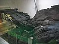
 Hasholme boat 6 July 2018 1.jpg 3,264 × 1,840; 1.87 MB
-
 Hasholme boat 6 July 2018 2.jpg 3,072 × 2,304; 1.78 MB
-
 Hasholme Carr - geograph.org.uk - 717870.jpg 640 × 442; 63 KB
-
 Hasholme Garth Farm.jpg 640 × 480; 81 KB
-
 Hasholme Grange Farm.jpg 640 × 480; 59 KB
-
 Hasholme Hall - geograph.org.uk - 1222908.jpg 640 × 480; 118 KB
-
 Hasholme Hall - geograph.org.uk - 234372.jpg 640 × 426; 146 KB
-
 Hasholme Hall.jpg 640 × 426; 129 KB
-
 Lagoon and Pump - geograph.org.uk - 234550.jpg 640 × 426; 145 KB
-
 Lane toward Bursea and the A614 - geograph.org.uk - 1222952.jpg 640 × 480; 91 KB
-
 Lane toward Grange Farm - geograph.org.uk - 1222929.jpg 640 × 480; 103 KB
-
 Main Drain - geograph.org.uk - 1222957.jpg 640 × 480; 107 KB
-
 New Lane Hasholme.jpg 640 × 422; 69 KB
-
 Pumphouse - geograph.org.uk - 234363.jpg 640 × 426; 129 KB
-
 Reedbed Near Hasholme Grange.jpg 640 × 426; 152 KB
-
 River Foulness - geograph.org.uk - 234359.jpg 640 × 426; 128 KB
-
 River Foulness 1.jpg 640 × 426; 132 KB
-
 River Foulness 2.jpg 640 × 480; 65 KB
-
 Sign Made From a Millstone.jpg 640 × 426; 155 KB
-
 The Market Weighton Canal - geograph.org.uk - 365402.jpg 640 × 480; 122 KB
-
 The Market Weighton Canal - geograph.org.uk - 365584.jpg 640 × 480; 119 KB
-
 The River Foulness - geograph.org.uk - 689774.jpg 640 × 480; 73 KB
-
 The River Foulness - geograph.org.uk - 689777.jpg 640 × 480; 61 KB
-
 The Track to Hasholme - geograph.org.uk - 689763.jpg 640 × 480; 89 KB
-
 The Turf Crop - geograph.org.uk - 689767.jpg 640 × 480; 89 KB
-
 Towpath Obstruction - geograph.org.uk - 365599.jpg 640 × 480; 133 KB
-
 Track and Fields - geograph.org.uk - 1222897.jpg 640 × 480; 81 KB
-
 Track at Hasholme Grange - geograph.org.uk - 234353.jpg 640 × 426; 129 KB
-
 Track to Hasholme Hall - geograph.org.uk - 1222919.jpg 640 × 480; 117 KB
-
 Two lanes to Wholsea Grange - geograph.org.uk - 1222966.jpg 640 × 480; 68 KB
-
 Wholsea Grange - geograph.org.uk - 1154112.jpg 640 × 480; 69 KB
-
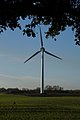 Wind turbine near Hasholme Hall (geograph 3734840).jpg 681 × 1,024; 190 KB


.jpg)