Category:Harwell, Oxfordshire
Jump to navigation
Jump to search
village and civil parish in Vale of White Horse district, Oxfordshire, England  | |||||
| Upload media | |||||
| Instance of | |||||
|---|---|---|---|---|---|
| Location | Vale of White Horse, Oxfordshire, South East England, England | ||||
| Different from | |||||
| Said to be the same as | Harwell (Wikimedia duplicated page, civil parish) | ||||
| official website | |||||
 | |||||
English: Harwell is a village and civil parish in Oxfordshire, England, about 2 miles (3 Km) west of Didcot. Until 1974 it was in Berkshire.
Nederlands: Harwell is een groot dorp en civil parish in het Engelse graafschap Oxfordshire (voorheen in Berkshire). Het ligt nabij het wandelpad de "Ridgeway", halfweg tussen Abingdon en Newbury en op 3,5 km van Didcot. Harwell telt ongeveer 2.400 inwoners.
Polski: Harwell to miasto w Wielkiej Brytanii.
Subcategories
This category has the following 9 subcategories, out of 9 total.
Media in category "Harwell, Oxfordshire"
The following 200 files are in this category, out of 409 total.
(previous page) (next page)-
 1969-1973 Harwell Apprentices.jpg 2,410 × 1,389; 1.01 MB
-
 A few of the headstones - geograph.org.uk - 2589378.jpg 1,024 × 683; 219 KB
-
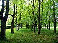
 A line of trees - geograph.org.uk - 2726746.jpg 640 × 427; 92 KB
-
 A return visit - geograph.org.uk - 2293891.jpg 1,024 × 683; 236 KB
-
 A second path - geograph.org.uk - 2589360.jpg 533 × 800; 126 KB
-
 A second plaque - geograph.org.uk - 2605171.jpg 533 × 800; 86 KB
-

-
 A34 at Hagbourne Hill - geograph.org.uk - 3103598.jpg 640 × 480; 45 KB
-
 A34 crossed by Didcot Road A4493 - geograph.org.uk - 2533782.jpg 3,648 × 2,736; 1.78 MB
-
 A34 footbridge carrying path from Hagbourne Hill - geograph.org.uk - 2533769.jpg 3,648 × 2,736; 1.55 MB
-
 A34 Near Harwell - geograph.org.uk - 3294745.jpg 640 × 480; 376 KB
-
 A34 northbound - geograph.org.uk - 3341351.jpg 640 × 480; 36 KB
-
 A34 northbound - geograph.org.uk - 3341353.jpg 640 × 480; 45 KB
-
 A34 northbound - geograph.org.uk - 3341357.jpg 640 × 480; 54 KB
-
 A34 northbound - geograph.org.uk - 3341362.jpg 640 × 480; 64 KB
-
 A34 northbound - geograph.org.uk - 3341371.jpg 640 × 480; 52 KB
-
 A34 northbound - geograph.org.uk - 3341379.jpg 640 × 480; 40 KB
-
 A34 northbound - geograph.org.uk - 5637525.jpg 640 × 428; 67 KB
-
 A34 northbound - geograph.org.uk - 5637527.jpg 640 × 428; 83 KB
-
 A34 northbound - geograph.org.uk - 5637531.jpg 640 × 428; 79 KB
-
 A34 northbound - geograph.org.uk - 5637536.jpg 640 × 428; 81 KB
-
 A34 northbound - geograph.org.uk - 5637541.jpg 640 × 428; 90 KB
-
 A34 northbound - geograph.org.uk - 5637544.jpg 640 × 428; 104 KB
-
 A34 northbound - geograph.org.uk - 5637547.jpg 640 × 428; 81 KB
-
 A34 northbound towards Milton Interchange - geograph.org.uk - 4688876.jpg 1,600 × 1,200; 591 KB
-
 A34 passes under Cow Lane - geograph.org.uk - 3103586.jpg 640 × 481; 58 KB
-
 A34 Southbound - geograph.org.uk - 2623611.jpg 1,024 × 683; 137 KB
-
 A34 southbound at Chilton - geograph.org.uk - 6263385.jpg 640 × 481; 44 KB
-
 A34 southeast of Harwell - geograph.org.uk - 2310535.jpg 640 × 480; 78 KB
-
 A34, Milton Hill - geograph.org.uk - 3294962.jpg 640 × 480; 429 KB
-
 A34, North of Chilton - geograph.org.uk - 3292094.jpg 640 × 480; 377 KB
-
 A4130 passing Mill Farm - geograph.org.uk - 3671404.jpg 640 × 448; 70 KB
-
 A417 approaches Harwell Village - geograph.org.uk - 3284160.jpg 3,648 × 2,432; 1.22 MB
-
 A417 at Harwell village boundary - geograph.org.uk - 3129963.jpg 640 × 480; 55 KB
-
 A417 at Rowstock village boundary - geograph.org.uk - 3129972.jpg 640 × 480; 86 KB
-
 A417 east of Rowstock - geograph.org.uk - 3284250.jpg 3,648 × 2,432; 1.96 MB
-
 A417 junction with A4185 - geograph.org.uk - 3284200.jpg 3,394 × 2,311; 1.16 MB
-
 A417 junction with B4493 - geograph.org.uk - 3284230.jpg 3,648 × 2,432; 1.84 MB
-
 A417 to Rowstock at Harwell - geograph.org.uk - 1315598.jpg 640 × 427; 81 KB
-
 A4185 approaching pumping station - geograph.org.uk - 3923695.jpg 640 × 470; 35 KB
-
 Abingdon 7 miles - geograph.org.uk - 2298356.jpg 533 × 800; 151 KB
-
 Abingdon Road, Rowstock - geograph.org.uk - 6311287.jpg 1,848 × 1,164; 1.65 MB
-
 Admin block North side - geograph.org.uk - 2485652.jpg 480 × 640; 88 KB
-
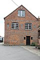
 Admin south side - geograph.org.uk - 2485648.jpg 1,024 × 768; 189 KB
-
 Agricultural building near Cow Lane - geograph.org.uk - 1292101.jpg 640 × 427; 73 KB
-

-
 An odd encounter - geograph.org.uk - 2602376.jpg 986 × 1,600; 270 KB
-
 Another old Pub - geograph.org.uk - 2600089.jpg 1,024 × 683; 119 KB
-
 Another path - geograph.org.uk - 2292785.jpg 1,024 × 683; 282 KB
-
 Another view of the surgery - geograph.org.uk - 2484644.jpg 1,024 × 768; 199 KB
-

-
 Around Harwell Village, Harwell Village - panoramio.jpg 2,605 × 3,980; 2.54 MB
-
 Atomic Energy Commission Property - geograph.org.uk - 10277.jpg 640 × 480; 393 KB
-
 B4493 Didcot Road goes over the A34 - geograph.org.uk - 4688890.jpg 1,600 × 1,200; 728 KB
-
 Back of the Admin block - geograph.org.uk - 2485597.jpg 1,024 × 768; 274 KB
-
 Barn off the lane - geograph.org.uk - 2603920.jpg 1,024 × 683; 160 KB
-
 Benchmark on 'The Bungalow' - geograph.org.uk - 2317073.jpg 600 × 800; 179 KB
-
 Benchmark on building at Zulu Farm - geograph.org.uk - 2798934.jpg 1,024 × 683; 252 KB
-
 Benchmark on buttress of St Matthew's Church - geograph.org.uk - 2799001.jpg 683 × 1,024; 254 KB
-
 Benchmark on chimney breast of Zulu Farmhouse - geograph.org.uk - 2798970.jpg 683 × 1,024; 202 KB
-
 Benchmark on the step - geograph.org.uk - 2598892.jpg 426 × 640; 108 KB
-

-
 Benchmark on Townsend Cottage, Townsend - geograph.org.uk - 2799357.jpg 683 × 1,024; 292 KB
-
 Benchmark on west end of St Matthew's Church - geograph.org.uk - 2799236.jpg 683 × 1,024; 324 KB
-
 Berkshire Vale Transport - geograph.org.uk - 377116.jpg 581 × 566; 158 KB
-
 Blue plaque on the Thomson Avenue Gate - geograph.org.uk - 3703925.jpg 1,500 × 999; 214 KB
-
 Blue tarp marks the place - geograph.org.uk - 2623058.jpg 1,024 × 683; 209 KB
-
 Boundary marker by the road - geograph.org.uk - 2360315.jpg 1,024 × 768; 370 KB
-
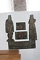 Brasses on the wall - geograph.org.uk - 2605573.jpg 533 × 800; 75 KB
-
 Bricked up entrances - geograph.org.uk - 2589414.jpg 533 × 800; 106 KB
-
 Bridleway by Harwell - geograph.org.uk - 1315534.jpg 640 × 427; 79 KB
-
 Bridleway into Harwell - geograph.org.uk - 2623065.jpg 533 × 800; 185 KB
-
 Broadway in Harwell - geograph.org.uk - 2586164.jpg 533 × 800; 134 KB
-
 Broadway, Harwell - geograph.org.uk - 4526526.jpg 640 × 408; 122 KB
-
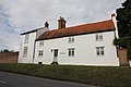
 Broadway, Harwell, Oxfordshire.jpg 1,200 × 800; 426 KB
-
 Brook near the church - geograph.org.uk - 2594950.jpg 533 × 800; 181 KB
-
 Building in the wood - geograph.org.uk - 2298336.jpg 1,024 × 683; 309 KB
-
 Building on the doors - geograph.org.uk - 2360272.jpg 1,024 × 768; 200 KB
-
 Burr Street - geograph.org.uk - 2598617.jpg 1,024 × 683; 205 KB
-
 Bus shelter by the drive - geograph.org.uk - 1348467.jpg 640 × 480; 79 KB
-
 Bus shelter, Abingdon Road, Rowstock - geograph.org.uk - 5873840.jpg 1,600 × 1,283; 770 KB
-
 Bus stop on Newbury Road - geograph.org.uk - 3703979.jpg 1,500 × 975; 257 KB
-
 Bus stops at the Harwell Campus - geograph.org.uk - 3338858.jpg 1,500 × 968; 142 KB
-
 Butcher and Newsagent shops, Harwell.jpg 1,200 × 800; 426 KB
-
 Byway from Chilton to Harwell - geograph.org.uk - 1481428.jpg 640 × 480; 68 KB
-
 Byway, Chilton - geograph.org.uk - 2232370.jpg 640 × 480; 137 KB
-
 Byway, Harwell - geograph.org.uk - 2232374.jpg 640 × 480; 94 KB
-
 Car in the drive - geograph.org.uk - 1348457.jpg 640 × 480; 125 KB
-
 Cars going Past - geograph.org.uk - 5150393.jpg 1,024 × 768; 203 KB
-
 Chapel over the road - geograph.org.uk - 2596783.jpg 1,024 × 683; 159 KB
-
 Cherry Barns, Harwell.jpg 1,200 × 900; 553 KB
-
 Cherry Orchard, Harwell - geograph.org.uk - 2344607.jpg 3,604 × 2,232; 2 MB
-
 Chillbrook - geograph.org.uk - 2586168.jpg 1,024 × 683; 252 KB
-
 Chillbrook to the right - geograph.org.uk - 2589205.jpg 1,024 × 683; 193 KB
-
 Cob wall in Harwell - geograph.org.uk - 1483279.jpg 640 × 480; 138 KB
-
 Church Lane - geograph.org.uk - 2589239.jpg 1,024 × 683; 197 KB
-
 Church Lane - geograph.org.uk - 2589252.jpg 533 × 800; 87 KB
-
 Church Lane by the church - geograph.org.uk - 2594955.jpg 533 × 800; 121 KB
-
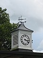 Clock and weather vane - geograph.org.uk - 2484624.jpg 600 × 800; 72 KB
-
 Close by the cemetery - geograph.org.uk - 2624523.jpg 1,024 × 683; 161 KB
-
 Coins not accepted here - geograph.org.uk - 2081998.jpg 1,024 × 683; 254 KB
-
 Commonwealth War Graves - geograph.org.uk - 2603787.jpg 1,024 × 683; 151 KB
-
 Cookery Centre and Hall at Harwell by Arthur Jessop Hardwick.jpg 1,109 × 662; 180 KB
-
 Cottage behind the hedge - geograph.org.uk - 2623057.jpg 1,024 × 683; 157 KB
-
 Cottage on School lane - geograph.org.uk - 2600137.jpg 1,024 × 683; 146 KB
-
 Cow Lane - geograph.org.uk - 1292086.jpg 640 × 427; 104 KB
-
 Cow Lane - geograph.org.uk - 1292110.jpg 640 × 427; 92 KB
-
 Cow Lane at junction into field - geograph.org.uk - 2798760.jpg 1,024 × 683; 246 KB
-
 Cow Lane footpath - geograph.org.uk - 1292079.jpg 640 × 427; 127 KB
-
 Cow Lane goes over the A34 - geograph.org.uk - 4688894.jpg 1,600 × 1,175; 574 KB
-
 Cow Lane to Harwell - geograph.org.uk - 1292135.jpg 640 × 427; 117 KB
-

-
 Cow Lane, Harwell - geograph.org.uk - 82278.jpg 640 × 480; 161 KB
-
 Crane at the dish - geograph.org.uk - 4002248.jpg 1,024 × 768; 134 KB
-
 Creeper on the farmhouse - geograph.org.uk - 2596302.jpg 1,024 × 683; 199 KB
-
 Crossing near the track - geograph.org.uk - 1347319.jpg 640 × 480; 94 KB
-
 Curie Avenue - geograph.org.uk - 2292758.jpg 1,024 × 683; 363 KB
-
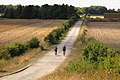 Cyclists on the Icknield Way - geograph.org.uk - 3703973.jpg 1,500 × 999; 256 KB
-
 Didcot , Didcot Print Works - geograph.org.uk - 2580995.jpg 2,048 × 1,536; 448 KB
-
 Didcot , The A4130 - geograph.org.uk - 4050874.jpg 4,288 × 2,848; 4.64 MB
-
 Didcot Power Station - geograph.org.uk - 3294769.jpg 640 × 480; 456 KB
-
 Didcot Power Station from the Icknield Way - geograph.org.uk - 3703972.jpg 1,500 × 976; 190 KB
-
 Didcot Power Station.jpg 2,337 × 1,174; 938 KB
-
 Door and loophole - geograph.org.uk - 1347366.jpg 640 × 480; 99 KB
-
 Door to Admin - geograph.org.uk - 2485619.jpg 600 × 800; 139 KB
-
 Down the drive - geograph.org.uk - 2291483.jpg 1,024 × 683; 354 KB
-
 Entrance to the Kingswell - geograph.org.uk - 2623072.jpg 1,024 × 683; 217 KB
-
 Farmland and barn, Harwell - geograph.org.uk - 2232419.jpg 640 × 480; 140 KB
-
 Farmland by the Kingswell - geograph.org.uk - 2624491.jpg 1,024 × 683; 105 KB
-
 Farmland, Harwell - geograph.org.uk - 1576780.jpg 640 × 480; 150 KB
-
 Farmland, Harwell - geograph.org.uk - 2232381.jpg 640 × 427; 102 KB
-
 Farmland, Harwell - geograph.org.uk - 2232396.jpg 640 × 480; 179 KB
-
 Fence by the Dish - geograph.org.uk - 4002192.jpg 1,024 × 768; 137 KB
-
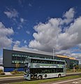
 AlexanderDennis Enviro200 MMC YX69 NVE Harwell.jpg 1,310 × 736; 580 KB
-
 AlexanderDennis Enviro200 MMC YX69 NVH Harwell.jpg 1,268 × 634; 516 KB
-
 Volvo Wright Gemini3 BN68 XSO Harwell right.jpg 1,280 × 513; 322 KB
-
 Volvo Wright Gemini3 BN68 XSO Harwell left.jpg 1,280 × 720; 424 KB
-
 Volvo Wright Gemini3 BN68 XTO Harwell FermiAve.jpg 1,234 × 1,280; 598 KB
-
 Field by Reading Road, Rowstock - geograph.org.uk - 5974122.jpg 1,920 × 1,280; 1.29 MB
-
 Fields by Zulu Farm - geograph.org.uk - 2809947.jpg 800 × 593; 133 KB
-
 Fields in Harwell - geograph.org.uk - 1481403.jpg 640 × 480; 54 KB
-
 Flagpole over the doorway - geograph.org.uk - 2485630.jpg 1,024 × 768; 189 KB
-
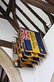 Flags in the roof - geograph.org.uk - 2605581.jpg 533 × 800; 92 KB
-
 Flowering at the front - geograph.org.uk - 2360185.jpg 1,024 × 768; 222 KB
-
 Footbridge over the A34, Hagbourne Hill - geograph.org.uk - 3292099.jpg 640 × 480; 392 KB
-
 Footpath across the farmland - geograph.org.uk - 2634932.jpg 1,024 × 683; 240 KB
-
 Footpath off Burr Street - geograph.org.uk - 2598878.jpg 533 × 800; 149 KB
-
 Footpath to Harwell - geograph.org.uk - 2634930.jpg 1,024 × 683; 306 KB
-
 Footpath to St Matthew's Church - geograph.org.uk - 2799023.jpg 683 × 1,024; 199 KB
-
 Footpath to the road - geograph.org.uk - 2603868.jpg 533 × 800; 165 KB
-
 Front of a Type 26 - geograph.org.uk - 2293898.jpg 1,024 × 683; 350 KB
-
 Front of the chapel - geograph.org.uk - 2596984.jpg 1,024 × 683; 179 KB
-
 Gap in the hedge - geograph.org.uk - 2622691.jpg 1,024 × 683; 237 KB
-
 Gate by the bridge - geograph.org.uk - 2596263.jpg 533 × 800; 170 KB
-
 Gate to Cow Lane footpath - geograph.org.uk - 1292058.jpg 640 × 427; 135 KB
-
 Gatepost at the entrance - geograph.org.uk - 2291505.jpg 533 × 800; 98 KB
-
 Getting ready for outer space (19881084392).jpg 640 × 960; 82 KB
-
 Gory memorial - geograph.org.uk - 2604101.jpg 533 × 800; 91 KB
-
 Grove Road - geograph.org.uk - 2596995.jpg 533 × 800; 88 KB
-
 Hangar in the distance - geograph.org.uk - 2499989.jpg 1,024 × 768; 176 KB
-
 Harvesting by the A34 - geograph.org.uk - 3703962.jpg 1,500 × 999; 195 KB
-

-
 Local shops in Harwell - geograph.org.uk - 1315552.jpg 640 × 427; 68 KB
-
 Poppies in a field of rape at Rowstock - geograph.org.uk - 1371165.jpg 640 × 427; 105 KB
-
 Post box in the hedge - geograph.org.uk - 1348471.jpg 450 × 600; 92 KB
-
 Road to Rowstock - geograph.org.uk - 1347481.jpg 640 × 480; 73 KB
-
 Route 44 through the field - geograph.org.uk - 1347305.jpg 640 × 480; 58 KB
-
 Signs on Icknield Way - geograph.org.uk - 1348389.jpg 640 × 480; 110 KB
-
 What I came to see - geograph.org.uk - 1347330.jpg 640 × 480; 117 KB
-
 Harwell Bowls club - geograph.org.uk - 2586020.jpg 1,024 × 683; 156 KB
-
 Harwell Cemetery - geograph.org.uk - 2603856.jpg 1,024 × 683; 161 KB
-
 Harwell Field from The Winaway - geograph.org.uk - 3495806.jpg 2,560 × 1,920; 1.04 MB
-
 Harwell Horse - geograph.org.uk - 2344631.jpg 3,288 × 2,232; 1.32 MB
-
 Harwell HQ - geograph.org.uk - 5727625.jpg 1,024 × 771; 151 KB
-
 Harwell Tree Line - geograph.org.uk - 1734846.jpg 1,600 × 1,204; 447 KB
-
 Harwell Village Hall - geograph.org.uk - 2600143.jpg 1,024 × 683; 103 KB
-
 Holly bank benchmark - geograph.org.uk - 2622703.jpg 533 × 800; 135 KB
-
 Houses on North Drive - geograph.org.uk - 2825105.jpg 1,024 × 768; 217 KB
-
 Icknield Way goes over the A34 - geograph.org.uk - 4688902.jpg 1,600 × 1,174; 663 KB
-
 Impressive cob wall - geograph.org.uk - 2589200.jpg 1,024 × 683; 267 KB
-
 In Memory of Valentine Baker - geograph.org.uk - 2605148.jpg 1,024 × 683; 181 KB
-
 Information panel on the Icknield Way - geograph.org.uk - 3703932.jpg 1,500 × 999; 316 KB
-
 Into Harwell - geograph.org.uk - 2586145.jpg 1,024 × 683; 133 KB
-
 Jennings Lane - geograph.org.uk - 2600094.jpg 1,024 × 683; 142 KB
-
 Junction of bridleway and The Driftway - geograph.org.uk - 2799327.jpg 1,024 × 683; 131 KB
-

-
 Junction on Wantage Road - geograph.org.uk - 2586117.jpg 1,024 × 683; 163 KB
-
 Junction with the A417 at Harwell - geograph.org.uk - 1315597.jpg 640 × 427; 65 KB
-
 Junction with the link road. - geograph.org.uk - 2635117.jpg 1,024 × 683; 168 KB
-
 Kathleen Florence Seacole - geograph.org.uk - 2603840.jpg 800 × 1,271; 161 KB
-
-
 Kings Lane - geograph.org.uk - 2600101.jpg 1,024 × 683; 164 KB
-
 Lane past the gate - geograph.org.uk - 2624721.jpg 1,024 × 683; 240 KB
-
 Lane to Princes Manor Farm from A417 - geograph.org.uk - 3923700.jpg 640 × 427; 88 KB
-
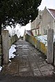
 Lane to the cemetery - geograph.org.uk - 2589400.jpg 1,024 × 683; 219 KB
-
 Lane to the cemetery - geograph.org.uk - 2604071.jpg 533 × 800; 161 KB
-
 Lay-by with telephone box - geograph.org.uk - 2082006.jpg 1,024 × 683; 237 KB
-
 Layby on the A34 - geograph.org.uk - 3294759.jpg 640 × 480; 460 KB
-
 Leaves in the entrance - geograph.org.uk - 2293968.jpg 533 × 800; 180 KB
-
 Lines of poplars near Harwell - geograph.org.uk - 6153348.jpg 1,024 × 768; 184 KB


.jpg)


