Category:Hartshorne, Derbyshire
Jump to navigation
Jump to search
English: Hartshorne is a village in the English county of Derbyshire. It is north of the town of Swadlincote.
village and civil parish in South Derbyshire, Derbyshire, England  | |||||
| Upload media | |||||
| Instance of | |||||
|---|---|---|---|---|---|
| Location | South Derbyshire, Derbyshire, East Midlands, England | ||||
 | |||||
Subcategories
This category has the following 2 subcategories, out of 2 total.
I
P
Media in category "Hartshorne, Derbyshire"
The following 101 files are in this category, out of 101 total.
-
 A line of hedges along a field - geograph.org.uk - 5989262.jpg 2,000 × 1,333; 2.48 MB
-
 A minor country road - geograph.org.uk - 5989263.jpg 2,000 × 1,333; 2.36 MB
-
 Admiral Rodney Hartshorne.JPG 3,652 × 2,244; 1.9 MB
-
 Along the footpath past Hartshorn Bog - geograph.org.uk - 3396351.jpg 1,306 × 979; 317 KB
-
 An unnamed church in Hartshorne - geograph.org.uk - 2770728.jpg 800 × 600; 95 KB
-
 Approaching Broomy Furlong - geograph.org.uk - 377293.jpg 640 × 480; 60 KB
-
 Ashby Road - geograph.org.uk - 2086876.jpg 640 × 480; 63 KB
-
 Bend ahead on Coal Lane - geograph.org.uk - 2967590.jpg 1,024 × 768; 142 KB
-
 Boundary Water Tower - geograph.org.uk - 3944840.jpg 2,087 × 2,498; 2.17 MB
-
 Bridleway past Buildings Farm - geograph.org.uk - 4657570.jpg 1,066 × 1,600; 484 KB
-
 Brookdale Road - geograph.org.uk - 5566000.jpg 2,000 × 1,333; 1.72 MB
-
 Bull's Head, Hartshorne.jpg 2,596 × 2,804; 3.34 MB
-
 Bus stop and junction ahead with Ticknall Road - geograph.org.uk - 2967604.jpg 1,024 × 768; 114 KB
-
 Chesterfield Hartshone.JPG 3,496 × 2,244; 1.87 MB
-
 Collarbone Canon - geograph.org.uk - 2075100.jpg 1,536 × 2,048; 833 KB
-
 Coppice Farm from above - geograph.org.uk - 3768804.jpg 1,142 × 857; 388 KB
-
 Cottages in Hartshorne - geograph.org.uk - 5565976.jpg 2,000 × 1,333; 1.74 MB
-
 Countryside north of Hartshorne - geograph.org.uk - 615603.jpg 640 × 429; 136 KB
-
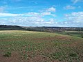 Crop Field Overlooking Hartshorne - geograph.org.uk - 4405104.jpg 4,000 × 3,000; 3.43 MB
-
 Derbyshire UK parish map highlighting Hartshorn.svg 888 × 1,308; 2.35 MB
-
 Dinmore Grange - geograph.org.uk - 5565992.jpg 2,000 × 1,333; 1.94 MB
-
 Disused barn seen from Mereoak Lane - geograph.org.uk - 4658510.jpg 1,600 × 1,066; 391 KB
-
 Down the avenue to Nether Hall - geograph.org.uk - 3165920.jpg 1,200 × 900; 114 KB
-
 Electricity wires by the Forest Way - geograph.org.uk - 4657551.jpg 1,600 × 1,066; 377 KB
-
 Entering Boundary on Manchester Lane - geograph.org.uk - 2770762.jpg 800 × 600; 65 KB
-
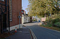
 Entering Hartshorne on Repton Road - geograph.org.uk - 2770731.jpg 800 × 600; 132 KB
-
 Farm drive - geograph.org.uk - 387462.jpg 640 × 480; 114 KB
-
 Fields at the end of Tower Road - geograph.org.uk - 3822609.jpg 640 × 480; 54 KB
-
 Fields at the end of Tower Road - geograph.org.uk - 3822615.jpg 640 × 480; 65 KB
-
 Fields near Broomy Furlong - geograph.org.uk - 4373169.jpg 4,000 × 3,000; 2.49 MB
-
 Footpath along the edge of the wood - geograph.org.uk - 4658215.jpg 1,066 × 1,600; 547 KB
-
 Footpath Approaching Coppice Farm - geograph.org.uk - 4373347.jpg 4,000 × 3,000; 2.86 MB
-
 Footpath near Hedgefield Farm - geograph.org.uk - 4376234.jpg 4,000 × 3,000; 2.76 MB
-
 Footpath to Boundary - geograph.org.uk - 377259.jpg 640 × 480; 79 KB
-
 Footpath to Several Woods Farm - geograph.org.uk - 386692.jpg 640 × 480; 76 KB
-
 Footpath to Several Woods Farm - geograph.org.uk - 4657651.jpg 1,600 × 1,066; 637 KB
-
 Footpath to The Scaddows - geograph.org.uk - 4657654.jpg 1,066 × 1,600; 547 KB
-
 Footpath towards Several Woods Farm - geograph.org.uk - 4657643.jpg 1,600 × 1,066; 461 KB
-
 Footpath towards The Scaddows - geograph.org.uk - 4658207.jpg 1,600 × 1,067; 762 KB
-
 Goseley Avenue in Woodville - geograph.org.uk - 4373157.jpg 3,784 × 2,702; 1.69 MB
-
 Grand - geograph.org.uk - 312655.jpg 640 × 480; 108 KB
-
 Grassy Avenue in Nether Hall Wood - geograph.org.uk - 4405096.jpg 4,000 × 3,000; 2.78 MB
-
 Grazing near Manor Farm in Hartshorne - geograph.org.uk - 4373342.jpg 4,000 × 3,000; 2.77 MB
-
 Hartshorne Cricket Club Pavilion - geograph.org.uk - 5133985.jpg 640 × 427; 380 KB
-
 Hartshorne Dams - geograph.org.uk - 1743524.jpg 2,272 × 1,704; 2.29 MB
-
 Hartshorne Village - geograph.org.uk - 5483935.jpg 2,000 × 1,333; 1.42 MB
-
 Hartshorne village - geograph.org.uk - 615584.jpg 640 × 421; 103 KB
-
 Harvested fields by Pistern Hill - geograph.org.uk - 4657444.jpg 1,600 × 1,067; 665 KB
-
 Heading for Hartshorne - geograph.org.uk - 616292.jpg 640 × 429; 106 KB
-
 Heath Lane - geograph.org.uk - 5989360.jpg 2,000 × 1,333; 2.01 MB
-
 Horn Hill - geograph.org.uk - 386696.jpg 640 × 480; 68 KB
-
 Horn Hill - geograph.org.uk - 616302.jpg 640 × 429; 123 KB
-
 Junction of lanes at the top of Gravelpit Hill - geograph.org.uk - 3396358.jpg 1,142 × 857; 319 KB
-
 Leaving Broomy Furlong - geograph.org.uk - 377361.jpg 640 × 437; 105 KB
-
 Lower Midway - geograph.org.uk - 377377.jpg 640 × 480; 91 KB
-
 Lower Midway - geograph.org.uk - 5483955.jpg 2,000 × 1,333; 1.76 MB
-
 Lower Midway - geograph.org.uk - 5680416.jpg 2,000 × 1,333; 2.03 MB
-
 Methodist Hartshorne.JPG 3,288 × 2,316; 1.52 MB
-
 Moxon's Hill - geograph.org.uk - 312746.jpg 640 × 480; 117 KB
-
 My Little Pony - geograph.org.uk - 312718.jpg 640 × 480; 93 KB
-
 National Forest Way towards Foremark reservoir - geograph.org.uk - 4657557.jpg 1,600 × 1,066; 514 KB
-
 National Forest Way with Harsthorne in the distance - geograph.org.uk - 4657564.jpg 1,600 × 1,066; 456 KB
-
 Nether Hall - geograph.org.uk - 312753.jpg 640 × 480; 95 KB
-
 New planting for the National Forest - geograph.org.uk - 615732.jpg 640 × 429; 106 KB
-
 Old Toll House (geograph 6114486).jpg 640 × 478; 113 KB
-
 On the National Forest Way heading towards Hartshorne - geograph.org.uk - 5617248.jpg 5,184 × 2,920; 1.92 MB
-

-
 Opposite Coal Lane - geograph.org.uk - 5680411.jpg 2,000 × 1,333; 2.63 MB
-
 Ordnance Survey Drawings - Hartshorn (OSD 295).jpg 4,198 × 4,576; 2.99 MB
-
 Pistern Hill trig - detail - geograph.org.uk - 3768823.jpg 857 × 1,142; 530 KB
-
 Pistern Hill trigpoint - geograph.org.uk - 3768821.jpg 1,142 × 857; 535 KB
-
 Pond in The Oaklands - geograph.org.uk - 4658210.jpg 1,600 × 1,066; 555 KB
-
 Radleigh Grange - geograph.org.uk - 2930413.jpg 1,600 × 1,200; 205 KB
-
 Recent planting for the National Forest - geograph.org.uk - 4657538.jpg 1,600 × 1,066; 614 KB
-
 Recently-created pool - geograph.org.uk - 616286.jpg 640 × 429; 121 KB
-
 Rough land - geograph.org.uk - 5989258.jpg 2,000 × 1,333; 2.85 MB
-
 Saplings and hedge - geograph.org.uk - 387460.jpg 640 × 480; 104 KB
-
 Stand of trees above Coppice Farm - geograph.org.uk - 615744.jpg 640 × 447; 100 KB
-
 Storage field - geograph.org.uk - 377386.jpg 640 × 480; 72 KB
-
 Telephone Box - Hartshorne - geograph.org.uk - 3944813.jpg 2,492 × 2,544; 2.69 MB
-
 The A514 - geograph.org.uk - 5565968.jpg 2,000 × 1,333; 2.05 MB
-
 The A514 by the Goseley Estate - geograph.org.uk - 3944818.jpg 3,710 × 1,742; 2.17 MB
-
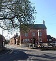
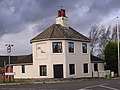
 The Admiral Rodney Inn - geograph.org.uk - 5565982.jpg 2,000 × 1,333; 1.63 MB
-
 The Admiral Rodney Inn, Hartshorne - geograph.org.uk - 2770744.jpg 800 × 600; 86 KB
-
 The Admiral Rodney Inn, Hartshorne - geograph.org.uk - 5133982.jpg 640 × 427; 390 KB
-
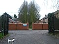
 The entrance to Short Hazel Farm - geograph.org.uk - 2770750.jpg 800 × 600; 96 KB
-
 The entrance to Short Hazel Farm - geograph.org.uk - 5989352.jpg 2,000 × 1,333; 1.55 MB
-
 The Manor House in Hartshorne (geograph 4373333).jpg 3,891 × 2,838; 2.19 MB
-
 The road to Hartshorn - geograph.org.uk - 5989344.jpg 2,000 × 1,333; 2.56 MB
-
 Ticknall Road - geograph.org.uk - 3944807.jpg 2,839 × 1,879; 2.87 MB
-
 Tower Road - geograph.org.uk - 3822606.jpg 640 × 480; 67 KB
-
 Track Below Daniel Hayes - geograph.org.uk - 4373440.jpg 4,000 × 3,000; 2.76 MB
-
 Track towards Daniel Hayes - geograph.org.uk - 615623.jpg 640 × 429; 119 KB
-
 Tree lined pool west of Hartshorne - geograph.org.uk - 615617.jpg 640 × 429; 115 KB
-
 Undulating - geograph.org.uk - 312739.jpg 640 × 480; 59 KB
-
 View down driveway to carpark - geograph.org.uk - 1743470.jpg 3,072 × 2,304; 2.97 MB
-
 View of Hartshorne from top of Brook street - geograph.org.uk - 1745374.jpg 2,048 × 1,536; 878 KB
-
 Water tower at Boundary over the fields - geograph.org.uk - 4657649.jpg 1,600 × 1,066; 450 KB
-
 Broomy Furlong - geograph.org.uk - 377302.jpg 640 × 480; 76 KB
-
 Footpath to Goseley Dale - geograph.org.uk - 377272.jpg 640 × 480; 127 KB
-
 Hill Top Farm - geograph.org.uk - 377239.jpg 640 × 473; 105 KB


.jpg)


.jpg)


.jpg)


