Category:Harter Fell, Mardale
Jump to navigation
Jump to search
English: Harter Fell is a hill in the civil parishes of Shap Rural and Kentmere, in the Westmorland and Furness district, in the ceremonial county of Cumbria, England.
mountain in Kentmere, Westmorland and Furness, Cumbria, England  | |||||
| Upload media | |||||
| Instance of | |||||
|---|---|---|---|---|---|
| Location |
| ||||
| Mountain range | |||||
| Topographic prominence |
| ||||
| Elevation above sea level |
| ||||
| Parent peak | |||||
 | |||||
Media in category "Harter Fell, Mardale"
The following 56 files are in this category, out of 56 total.
-

-
 Abandoned Fence Post, Harter Fell - geograph.org.uk - 1201595.jpg 427 × 640; 277 KB
-
 Above the north east face, Harter Fell - geograph.org.uk - 4272441.jpg 800 × 600; 171 KB
-
 Ascending Branstree - geograph.org.uk - 677409.jpg 640 × 480; 106 KB
-
 Ascending Harter Fell - geograph.org.uk - 4373640.jpg 4,608 × 3,456; 3.58 MB
-
 Ascending Harter Fell above Mardale - geograph.org.uk - 4154661.jpg 4,608 × 3,456; 4.12 MB
-
 Benchmarked Boulder - geograph.org.uk - 1202097.jpg 640 × 427; 287 KB
-
 Cairn on Harter Fell - geograph.org.uk - 4296085.jpg 4,608 × 2,398; 4.71 MB
-
 Fence on Harter Fell - geograph.org.uk - 1201579.jpg 427 × 640; 298 KB
-
 Fence, Harter Fell - geograph.org.uk - 1204347.jpg 640 × 427; 261 KB
-
 Fence-line on top of Harter Fell - geograph.org.uk - 4296088.jpg 3,526 × 3,122; 4.3 MB
-
 Fenceline Harter Fell - geograph.org.uk - 2217526.jpg 640 × 480; 90 KB
-
 Footpath on Harter Fell - geograph.org.uk - 2020718.jpg 640 × 426; 409 KB
-
 From Harter Fell - geograph.org.uk - 669722.jpg 640 × 480; 62 KB
-
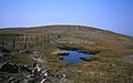
 Frozen Tarn, Kentmere Pike - geograph.org.uk - 680301.jpg 640 × 480; 93 KB
-
 Harter Fell - geograph.org.uk - 3344093.jpg 4,608 × 3,456; 3.54 MB
-
 Harter Fell - geograph.org.uk - 4296083.jpg 4,608 × 3,456; 6.28 MB
-
 Harter Fell across the top of the Nan Bield Pass - geograph.org.uk - 4154603.jpg 4,608 × 3,456; 4.23 MB
-
 Harter Fell from Little Harter Fell - geograph.org.uk - 1082569.jpg 640 × 480; 79 KB
-
 Harter Fell from Little Harter Fell - geograph.org.uk - 1106189.jpg 640 × 419; 88 KB
-
 Harter Fell on a frosty morning. - geograph.org.uk - 114601.jpg 640 × 480; 84 KB
-
 Harter Fell Summit - geograph.org.uk - 2217519.jpg 640 × 480; 113 KB
-
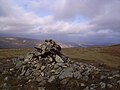
 Harter Fell Summit Cairn - geograph.org.uk - 35508.jpg 640 × 480; 91 KB
-
 Harter Fell summit. - geograph.org.uk - 1747370.jpg 640 × 480; 57 KB
-
 Haweswater from Harter Fell - geograph.org.uk - 1201635.jpg 427 × 640; 288 KB
-
 Haweswater from Harter Fell. - geograph.org.uk - 279183.jpg 640 × 480; 91 KB
-
 Haweswater from Little Harter Fell - geograph.org.uk - 1202091.jpg 640 × 427; 282 KB
-
 High Street and Blea Water from Harter Fell - geograph.org.uk - 2829009.jpg 3,072 × 2,304; 2.29 MB
-
 High Street from Harter Fell - geograph.org.uk - 701071.jpg 640 × 430; 65 KB
-
 High Street from Harter Fell Summit - geograph.org.uk - 1201588.jpg 640 × 427; 278 KB
-
 Ill Bell from Harter Fell - geograph.org.uk - 1201627.jpg 640 × 427; 288 KB
-
 New snow, Harter Fell - geograph.org.uk - 4272429.jpg 800 × 600; 126 KB
-
 North-east ridge of Harter Fell - geograph.org.uk - 2791754.jpg 1,500 × 1,125; 1.01 MB
-
 On Harter Fell - geograph.org.uk - 1369572.jpg 640 × 480; 65 KB
-
 On Harter Fell - geograph.org.uk - 1369575.jpg 640 × 480; 48 KB
-
 On Harter Fell - geograph.org.uk - 1526992.jpg 640 × 480; 74 KB
-
 On Harter Fell - geograph.org.uk - 1981813.jpg 640 × 427; 234 KB
-
 On Harter Fell - geograph.org.uk - 28410.jpg 640 × 401; 63 KB
-
 Path leading up Harter Fell above Mardale - geograph.org.uk - 4154646.jpg 4,608 × 3,456; 5.48 MB
-
 Sheep, Harter Fell - geograph.org.uk - 1367997.jpg 640 × 480; 74 KB
-
 Sheepfold, Thornthwaite Crag - geograph.org.uk - 110417.jpg 640 × 480; 80 KB
-
 Sheepfolds Below Harter Fell Gully - geograph.org.uk - 1201662.jpg 427 × 640; 359 KB
-
 Snow and mist, Harter Fell - geograph.org.uk - 4273941.jpg 800 × 600; 120 KB
-
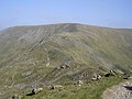
 Summit area of Harter Fell - geograph.org.uk - 2792823.jpg 1,500 × 843; 750 KB
-
 Summit Cairn, Harter Fell - geograph.org.uk - 1039181.jpg 640 × 426; 91 KB
-
 Summit cairn, Harter Fell - geograph.org.uk - 2874313.jpg 640 × 414; 117 KB
-
 Summit Cairn, Harter Fell - geograph.org.uk - 669717.jpg 640 × 480; 61 KB
-
 Summit of Harter Fell - geograph.org.uk - 3452992.jpg 1,600 × 1,040; 305 KB
-
 The north east face of Harter Fell - geograph.org.uk - 4273079.jpg 800 × 600; 142 KB
-
 The path to Harter Fell - geograph.org.uk - 1526989.jpg 640 × 480; 84 KB
-
-
 The summit ridge of Harter Fell - geograph.org.uk - 3527848.jpg 3,872 × 2,592; 3.3 MB
-
 The top of Harter Fell - geograph.org.uk - 423728.jpg 640 × 480; 77 KB
-
 The upper slopes of Harter Fell - geograph.org.uk - 1619093.jpg 640 × 480; 83 KB
-
 Towards Harter Fell - geograph.org.uk - 1107520.jpg 640 × 342; 79 KB
-
 View along Little Harter Fell. - geograph.org.uk - 1747367.jpg 640 × 480; 55 KB


