Category:Harrisend Fell
Jump to navigation
Jump to search
English: Harrisend Fell is a Fell on the western side of the Forest of Bowland. It has a highest point 280 metres above sea level.
| Upload media | |||||
| Instance of | |||||
|---|---|---|---|---|---|
| Location |
| ||||
 | |||||
Media in category "Harrisend Fell"
The following 24 files are in this category, out of 24 total.
-
 Burnt Fence - geograph.org.uk - 1032264.jpg 640 × 480; 78 KB
-
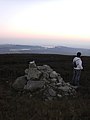 Cairn Harrisend Fell - geograph.org.uk - 698977.jpg 480 × 640; 40 KB
-
 Cairn, Harrisend Fell - geograph.org.uk - 1032293.jpg 640 × 480; 70 KB
-
 Cairn, Harrisend Fell - geograph.org.uk - 1032309.jpg 640 × 480; 93 KB
-
 Fell End farm and Harrisend Fell - geograph.org.uk - 1144756.jpg 504 × 335; 177 KB
-
 Fell End Planting - geograph.org.uk - 1412101.jpg 640 × 480; 70 KB
-
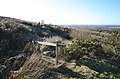 Footbridge and Stile on Harrisend Fell - geograph.org.uk - 1150565.jpg 640 × 420; 121 KB
-
 Footpath on Harrisend Fell - geograph.org.uk - 1150547.jpg 640 × 441; 135 KB
-
 Footpath on Harrisend Fell - geograph.org.uk - 1773214.jpg 640 × 480; 114 KB
-
 Harrisend Fell - geograph.org.uk - 1032094.jpg 640 × 480; 68 KB
-
 Harrisend Fell - geograph.org.uk - 1150723.jpg 640 × 426; 99 KB
-

-

-
 Looking Down to Lane Head Farm - geograph.org.uk - 1150554.jpg 640 × 426; 96 KB
-
 On Harrisend Fell - geograph.org.uk - 1032276.jpg 640 × 480; 73 KB
-
 Path on Harrisend Fell - geograph.org.uk - 739142.jpg 640 × 427; 71 KB
-
 Road under Harrisend Fell - geograph.org.uk - 1463865.jpg 640 × 480; 54 KB
-
 Road under Harrisend Fell - geograph.org.uk - 1773208.jpg 800 × 600; 77 KB
-
 Rough Grazing, Harrisend Fell - geograph.org.uk - 1150718.jpg 640 × 426; 111 KB
-
 Scorched Earth - geograph.org.uk - 1032270.jpg 640 × 480; 96 KB
-

-
 The Cairn on Harrisend Fell - geograph.org.uk - 15994.jpg 640 × 480; 73 KB
-
 Water Channel on Harrisend Fell - geograph.org.uk - 1150534.jpg 640 × 426; 135 KB
-
 Water Monitoring Well - geograph.org.uk - 1150540.jpg 400 × 600; 143 KB


