Category:Harpsden
Jump to navigation
Jump to search
village and civil parish in South Oxfordshire district, Oxfordshire, England  | |||||
| Upload media | |||||
| Instance of | |||||
|---|---|---|---|---|---|
| Location | South Oxfordshire, Oxfordshire, South East England, England | ||||
| Area |
| ||||
 | |||||
English: Harpsden is a village and civil parish just south of Henley-on-Thames in South Oxfordshire.
Subcategories
This category has the following 4 subcategories, out of 4 total.
Media in category "Harpsden"
The following 161 files are in this category, out of 161 total.
-

-
 'Three Men in a Boat' - geograph.org.uk - 2514005.jpg 1,024 × 680; 264 KB
-
 A Thames Scene - geograph.org.uk - 2510132.jpg 1,024 × 768; 342 KB
-
 A Tiny Chapel at Harpsden Church - geograph.org.uk - 3370455.jpg 1,638 × 1,845; 1.39 MB
-
 A4155 northwest of Lower Shiplake - geograph.org.uk - 2819271.jpg 3,648 × 2,631; 1.74 MB
-
 A4155 west of Lower Bolney Farm - geograph.org.uk - 2819275.jpg 3,648 × 2,502; 1.14 MB
-
 A4155 west of Sheephouse Farm - geograph.org.uk - 2819481.jpg 3,382 × 2,574; 1.59 MB
-
 Across the River Thames to Happy Valley - geograph.org.uk - 4439172.jpg 2,592 × 1,944; 1.87 MB
-
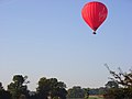 Balloon over Harpsden - geograph.org.uk - 559042.jpg 640 × 480; 73 KB
-
 Berkshire , Reading Scenery - geograph.org.uk - 5442103.jpg 6,000 × 4,000; 6.04 MB
-
 Beware flying balls - geograph.org.uk - 2169714.jpg 640 × 426; 219 KB
-
 Blossom in the wood - geograph.org.uk - 722235.jpg 479 × 639; 230 KB
-
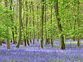
 Bluebells in High Wood - geograph.org.uk - 3511089.jpg 3,968 × 2,232; 2.86 MB
-
 Boathouse, Park Place - geograph.org.uk - 2349823.jpg 640 × 444; 95 KB
-
 Bolney Lane, Shiplake - geograph.org.uk - 3970860.jpg 1,024 × 768; 309 KB
-
 Bolney Road, Lower Shiplake - geograph.org.uk - 2349288.jpg 495 × 640; 142 KB
-
 Bridleway between Northfield Avenue and A4155 - geograph.org.uk - 5201311.jpg 5,184 × 3,456; 5.15 MB
-
 Bridleway near Lower Shiplake - geograph.org.uk - 2169759.jpg 640 × 426; 265 KB
-
 Bridleway through Gillsmithers Wood - geograph.org.uk - 3523109.jpg 640 × 427; 273 KB
-
 Bridleway to Lower Shiplake - geograph.org.uk - 1713423.jpg 2,592 × 1,944; 2.41 MB
-
 Bridleway to Lower Shiplake - geograph.org.uk - 2169769.jpg 640 × 427; 219 KB
-
 Bus stop on Henley Road. - geograph.org.uk - 5201364.jpg 4,737 × 3,465; 3.75 MB
-
 By the Thames Path - geograph.org.uk - 2349360.jpg 640 × 422; 92 KB
-
 Chalk Hill lane meets Perseverance Hill - geograph.org.uk - 2918906.jpg 3,648 × 2,736; 2.43 MB
-
 Corner of the Golf Course - geograph.org.uk - 3980422.jpg 1,600 × 1,148; 604 KB
-
 Cray House gate - geograph.org.uk - 5201372.jpg 4,932 × 3,049; 4.2 MB
-
 Crossing Harpsden golf course - geograph.org.uk - 3521446.jpg 640 × 427; 202 KB
-
 Crowsley Park - geograph.org.uk - 1059520.jpg 640 × 480; 156 KB
-
 Crowsley Park - geograph.org.uk - 1059535.jpg 640 × 480; 161 KB
-
 Dead Wood in the River - geograph.org.uk - 5329719.jpg 3,888 × 2,592; 3.93 MB
-
 Devil's Hill^ Really^ - geograph.org.uk - 3511226.jpg 1,600 × 950; 638 KB
-
 Down to Harpsden - geograph.org.uk - 2169674.jpg 640 × 427; 222 KB
-
 Entrance at Round Wood - geograph.org.uk - 3523013.jpg 640 × 428; 206 KB
-
 Entrance to Old Place - geograph.org.uk - 3523101.jpg 640 × 427; 235 KB
-
 Fairytale Oratory.jpg 2,448 × 2,448; 2.8 MB
-
 Farmland, Harpsden - geograph.org.uk - 6081516.jpg 1,024 × 768; 247 KB
-
 Farmland, Shiplake - geograph.org.uk - 2333208.jpg 640 × 480; 126 KB
-
 Field boundary at Bolney - geograph.org.uk - 2169739.jpg 640 × 427; 242 KB
-
 Field Boundary, Harpsden Bottom - geograph.org.uk - 3511160.jpg 3,968 × 2,232; 2.42 MB
-
 Flowercroft Wood - geograph.org.uk - 2495039.jpg 3,968 × 2,232; 2.13 MB
-
 Flowercroft Wood 2 - geograph.org.uk - 2510591.jpg 3,968 × 2,232; 2 MB
-
 Footpath to Harpsden - geograph.org.uk - 3521436.jpg 640 × 427; 221 KB
-
 Footpath towards Upper Hailey Wood - geograph.org.uk - 5201393.jpg 5,202 × 3,465; 4.12 MB
-
 Fritillary Butterfly, Flowercroft Wood - geograph.org.uk - 2510602.jpg 3,888 × 2,592; 1.14 MB
-
 Gates on the edge of Gillsmithers Wood - geograph.org.uk - 5203206.jpg 4,495 × 3,016; 4.3 MB
-
 Gillott's Hill, Harpsden - geograph.org.uk - 4932092.jpg 2,304 × 1,728; 845 KB
-
 Gable end - geograph.org.uk - 722222.jpg 635 × 471; 202 KB
-
 Green and Blue Landscape, Henley-on-Thames (2).jpg 4,137 × 2,763; 2.86 MB
-
 Green and Blue Landscape, Henley-on-Thames (3).jpg 4,240 × 2,832; 3.5 MB
-
 Green and Blue Landscape, Henley-on-Thames (4).jpg 4,240 × 2,832; 4.71 MB
-
 Green and Blue Landscape, Henley-on-Thames.jpg 4,240 × 2,832; 3.46 MB
-
 High Wood, Harpsden - geograph.org.uk - 794956.jpg 640 × 480; 207 KB
-
 High Wood, Harpsden - geograph.org.uk - 797780.jpg 640 × 480; 210 KB
-
 High Wood, Harpsden - geograph.org.uk - 797784.jpg 640 × 480; 202 KB
-
 High Wood, Harpsden - geograph.org.uk - 797792.jpg 640 × 480; 208 KB
-
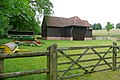
 Ornate barn - geograph.org.uk - 722225.jpg 639 × 479; 214 KB
-
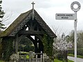 Woodlands Road lych gate - geograph.org.uk - 722230.jpg 639 × 479; 213 KB
-
 Harpsden Bottom - geograph.org.uk - 614730.jpg 640 × 480; 172 KB
-
 Harpsden Court-geograph-3370472.jpg 1,306 × 987; 583 KB
-
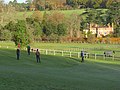
 Harpsden Cricket Club pavilion - geograph.org.uk - 2918513.jpg 3,244 × 2,460; 1.82 MB
-
 Harpsden cricket ground - geograph.org.uk - 2918698.jpg 3,648 × 2,736; 1.8 MB
-
 Harpsden golf club - geograph.org.uk - 2169548.jpg 640 × 428; 194 KB
-
 Harpsden Road passes through High Wood - geograph.org.uk - 2918911.jpg 3,587 × 2,549; 2.04 MB
-
 Harpsden Village - geograph.org.uk - 1713177.jpg 2,592 × 1,944; 2.07 MB
-
 Harpsden Village Hall - geograph.org.uk - 2169696.jpg 640 × 426; 191 KB
-
 Harpsden Village Hall - geograph.org.uk - 4932069.jpg 2,304 × 1,728; 846 KB
-
 Harpsden Way approaches Harpsden - geograph.org.uk - 2918879.jpg 3,648 × 2,736; 2.15 MB
-
 Harpsden Wood - geograph.org.uk - 722231 cropped.jpg 479 × 355; 109 KB
-
 Hedge at Harpsden - geograph.org.uk - 2169723.jpg 640 × 427; 231 KB
-
 Henley Golf Club part of the 9th fairway - geograph.org.uk - 2918890.jpg 3,648 × 2,736; 2.5 MB
-
 Henley Rd, A4155 - geograph.org.uk - 3684729.jpg 640 × 430; 85 KB
-
 Hunts Green - geograph.org.uk - 1713193.jpg 2,592 × 1,944; 2.38 MB
-
 Into Redhill Wood - geograph.org.uk - 3523114.jpg 640 × 427; 230 KB
-
 King's Farm Lane - geograph.org.uk - 5203687.jpg 4,813 × 3,151; 4.11 MB
-
 Kings Farm Lane - geograph.org.uk - 1713201.jpg 2,592 × 1,944; 2.61 MB
-
 Lake, Bolney Court - geograph.org.uk - 3564929.jpg 3,572 × 2,136; 1.48 MB
-
 Leaving Lucy's Copse - geograph.org.uk - 3521441.jpg 640 × 427; 251 KB
-
 Leisurely Cruise - geograph.org.uk - 3438432.jpg 640 × 480; 97 KB
-
 Lighting the entrance - geograph.org.uk - 2169730.jpg 426 × 640; 207 KB
-
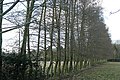
 Line of trees - geograph.org.uk - 3980383.jpg 1,600 × 1,007; 500 KB
-
 Lodge and boathouse, Park Place - geograph.org.uk - 3263530.jpg 2,560 × 1,920; 2.84 MB
-
 Lodge and boathouse, Park Place estate - geograph.org.uk - 2349699.jpg 640 × 480; 110 KB
-
 Looking across Harpsden towards the golf course - geograph.org.uk - 4856906.jpg 6,000 × 2,514; 4.51 MB
-
 Mag's Wood with Dandelions - geograph.org.uk - 3511166.jpg 1,600 × 900; 577 KB
-
 Manor Wood Gate - geograph.org.uk - 2169775.jpg 640 × 427; 220 KB
-
 Mary Stuart on the Thames near Shiplake - geograph.org.uk - 5268006.jpg 800 × 531; 138 KB
-
 Meadowsweet in the Marsh - geograph.org.uk - 3564480.jpg 3,565 × 2,232; 1.93 MB
-
 Miniature railway at Bolney Court - geograph.org.uk - 5267998.jpg 1,024 × 680; 346 KB
-

-
 Model of St Moritz railway station - geograph.org.uk - 2513979.jpg 1,024 × 680; 259 KB
-
 More Bluebells.... - geograph.org.uk - 3969677.jpg 640 × 452; 150 KB
-
 Northfield Avenue, Shiplake - geograph.org.uk - 5201302.jpg 4,948 × 3,135; 4.03 MB
-
 Old barn at Harpsden - geograph.org.uk - 2169709.jpg 640 × 427; 170 KB
-
 Old Phone Box, Mays Green - geograph.org.uk - 3511085.jpg 3,668 × 2,232; 2.59 MB
-
 On the Golf Course - geograph.org.uk - 3980408.jpg 1,600 × 1,125; 846 KB
-
 Opposite Old Place - geograph.org.uk - 3523107.jpg 640 × 427; 184 KB
-
 Orange Way after Wiltshire (361) - geograph.org.uk - 3609751.jpg 800 × 600; 147 KB
-
 Orange Way after Wiltshire (362) - geograph.org.uk - 3609761.jpg 800 × 600; 168 KB
-
 Orange Way after Wiltshire (363) - geograph.org.uk - 3609777.jpg 800 × 600; 134 KB
-
 Paddocks near Lower Shiplake - geograph.org.uk - 2169772.jpg 640 × 426; 205 KB
-
 Part of Old Place - geograph.org.uk - 3523105.jpg 640 × 427; 197 KB
-
 Path from Harpsden Bottom - geograph.org.uk - 3521451.jpg 427 × 640; 214 KB
-
 Path into Gilsmithers Wood - geograph.org.uk - 5203682.jpg 640 × 463; 134 KB
-
 Path into High Wood - geograph.org.uk - 3969665.jpg 640 × 586; 148 KB
-

-
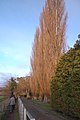 Poplars by the Thames Path - geograph.org.uk - 2184249.jpg 426 × 640; 69 KB
-
 Postie on King's Farm Lane - geograph.org.uk - 3523032.jpg 640 × 427; 234 KB
-
 Private Road - geograph.org.uk - 1713431.jpg 2,592 × 1,944; 2.39 MB
-
 Quaint Little Bridge - geograph.org.uk - 5383797.jpg 3,609 × 2,592; 2.19 MB
-
 Reading Road coming into Shiplake - geograph.org.uk - 5649085.jpg 2,304 × 1,728; 1.18 MB
-
 Reading Road coming into Shiplake - geograph.org.uk - 5649090.jpg 2,304 × 1,728; 871 KB
-
 Red Leaves in Woodlands Road - geograph.org.uk - 3969409.jpg 800 × 754; 295 KB
-
 River Thames north of Shiplake - geograph.org.uk - 4440763.jpg 2,592 × 1,944; 2 MB
-
 River Thames, upstream of Marsh Lock - geograph.org.uk - 4439164.jpg 2,592 × 1,944; 1.48 MB
-
 Road from Woodlands Road to Upper Bolney House - geograph.org.uk - 5201386.jpg 5,056 × 3,000; 3.35 MB
-
 Roses at King's Farm - geograph.org.uk - 3523022.jpg 640 × 427; 226 KB
-
 Saint Berinus Chapel, Harpsden - geograph.org.uk - 3370463.jpg 1,920 × 2,560; 1.25 MB
-
 Satellite dishes from King's Farm Lane - geograph.org.uk - 5203691.jpg 5,184 × 3,456; 6.87 MB
-
 Shiplake Garden Centre - geograph.org.uk - 3375824.jpg 1,600 × 1,200; 539 KB
-
 Shiplake Garden Centre - geograph.org.uk - 3375826.jpg 1,600 × 1,200; 602 KB
-
 South of Henley-on-Thames, aerial - geograph.org.uk - 3514540.jpg 640 × 427; 70 KB
-
 St Margaret of Antioch Church - geograph.org.uk - 2918510.jpg 3,648 × 2,736; 1.57 MB
-
 Tennis court at Cray House - geograph.org.uk - 2169751.jpg 640 × 427; 200 KB
-
 Thames above Marsh Lock - geograph.org.uk - 2349678.jpg 640 × 480; 99 KB
-
 Thames below Bolney Court - geograph.org.uk - 2349347.jpg 640 × 480; 100 KB
-
 Thames near Marsh Lock - geograph.org.uk - 2350573.jpg 640 × 480; 96 KB
-
 Thames Path - geograph.org.uk - 2202672.jpg 640 × 480; 111 KB
-
 Thames Path - geograph.org.uk - 3263528.jpg 2,560 × 1,920; 2.84 MB
-
 Thames Path near Bolney Court - geograph.org.uk - 2513985.jpg 680 × 1,024; 242 KB
-
 Thames Path north of Shiplake - geograph.org.uk - 2264307.jpg 480 × 640; 75 KB
-
 The boathouse of Park Place - geograph.org.uk - 5695742.jpg 4,592 × 3,056; 4.96 MB
-
 The centre of Harpsden - geograph.org.uk - 4932068.jpg 2,304 × 1,728; 850 KB
-
 The daffs are out - geograph.org.uk - 722213.jpg 479 × 639; 258 KB
-
 The Garden House, Lower Shiplake - geograph.org.uk - 2349318.jpg 640 × 480; 82 KB
-
 The Henley Branch Line near Shiplake - geograph.org.uk - 3564958.jpg 1,024 × 576; 157 KB
-
 The Old Laundry - geograph.org.uk - 2169704.jpg 640 × 427; 189 KB
-
 The Old School - geograph.org.uk - 2169701.jpg 640 × 427; 243 KB
-
 The Postman's Here - geograph.org.uk - 3511120.jpg 1,024 × 613; 188 KB
-
 The Rev. Frederic Bagot - geograph.org.uk - 3376536.jpg 1,600 × 880; 461 KB
-
 The River Thames, Wargrave - geograph.org.uk - 2819660.jpg 640 × 480; 169 KB
-
 The Thames near Marsh Lock - geograph.org.uk - 2513998.jpg 1,024 × 680; 213 KB
-
 The village of Harpsden - geograph.org.uk - 4856655.jpg 5,292 × 3,780; 4.77 MB
-
 The village of Harpsden coated with snow - geograph.org.uk - 5276464.jpg 4,616 × 3,096; 2.52 MB
-
 Transport area at Gillott's School - geograph.org.uk - 3521462.jpg 640 × 435; 189 KB
-
 Up From Harpsden Bottom - geograph.org.uk - 3511135.jpg 1,024 × 702; 306 KB
-
 Upper Bolney Lodge - geograph.org.uk - 66291.jpg 640 × 481; 60 KB
-
 Whiteness in Harpsden Wood - geograph.org.uk - 722231.jpg 479 × 639; 198 KB
-
 Woods and farmland, Harpsden - geograph.org.uk - 616911.jpg 640 × 480; 176 KB
-
 Wyevale Garden Centre in Shiplake - geograph.org.uk - 1466137.jpg 640 × 427; 87 KB
-
 Wyevale Garden Centre in Shiplake - geograph.org.uk - 1466140.jpg 640 × 427; 63 KB
-
 Drawback Hill - geograph.org.uk - 97323.jpg 640 × 480; 82 KB
-
 Fir Trees and Pasture - geograph.org.uk - 66294.jpg 640 × 481; 87 KB
-

-
 Frosty dawn, Hennerton Golf Club - geograph.org.uk - 82508.jpg 597 × 400; 85 KB
-
 Frosty hillside, near Wargrave - geograph.org.uk - 82572.jpg 597 × 400; 83 KB
-
 Frosty meadows near Wargrave - geograph.org.uk - 82566.jpg 597 × 400; 77 KB
-
 Harpsden Way - geograph.org.uk - 87580.jpg 640 × 481; 77 KB
-
 Hunt's Green - geograph.org.uk - 86947.jpg 597 × 400; 67 KB
-
 Marsh being replenished - geograph.org.uk - 665217.jpg 640 × 480; 114 KB
-
 Pasture - geograph.org.uk - 66295.jpg 640 × 481; 69 KB
-


.jpg)
.jpg)
.jpg)


_-_geograph.org.uk_-_3609751.jpg)
_-_geograph.org.uk_-_3609761.jpg)
_-_geograph.org.uk_-_3609777.jpg)


