Category:Harlaston
Jump to navigation
Jump to search
village and civil parish in Staffordshire, UK  | |||||
| Upload media | |||||
| Instance of | |||||
|---|---|---|---|---|---|
| Location | Lichfield, Staffordshire, West Midlands, England | ||||
| official website | |||||
 | |||||
Subcategories
This category has the following 3 subcategories, out of 3 total.
Media in category "Harlaston"
The following 119 files are in this category, out of 119 total.
-
 A513 Near Elford (1) - geograph.org.uk - 1882420.jpg 3,072 × 2,048; 3.84 MB
-
 A513 Near Elford (2) - geograph.org.uk - 1882450.jpg 2,048 × 3,072; 3.15 MB
-
 A513 Near Elford (3) - geograph.org.uk - 1882476.jpg 3,072 × 2,048; 2.88 MB
-
 A513 Near Elford (4) - geograph.org.uk - 1882527.jpg 2,048 × 3,072; 3.17 MB
-
 A513 Near Elford (5) - geograph.org.uk - 1882634.jpg 3,072 × 2,048; 3.89 MB
-
 A513 Near Elford (6) - geograph.org.uk - 1882663.jpg 3,072 × 2,048; 4.11 MB
-
 A513 Near Elford (7) - geograph.org.uk - 1884082.jpg 3,072 × 2,048; 3.76 MB
-
 A513 Near Elford (8) - geograph.org.uk - 1884096.jpg 3,072 × 2,048; 3.18 MB
-
 A513 towards Tamworth - geograph.org.uk - 5335523.jpg 640 × 480; 112 KB
-
 A513 towards Tamworth - geograph.org.uk - 5335542.jpg 640 × 480; 49 KB
-

-
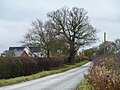
 Approaching Harlaston from the east - geograph.org.uk - 4760325.jpg 1,024 × 768; 119 KB
-
 Approaching Harlaston from the south - geograph.org.uk - 5839100.jpg 1,469 × 1,102; 618 KB
-

-
 Approaching the bends in Little Harlaston - geograph.org.uk - 5839101.jpg 1,469 × 1,102; 637 KB
-
 Arable field crossed by power lines - geograph.org.uk - 4760273.jpg 1,024 × 768; 165 KB
-
 Arable field, east of Birdsley Farm - geograph.org.uk - 4759484.jpg 1,024 × 768; 151 KB
-
 Ash Villa near Harlaston - geograph.org.uk - 3198013.jpg 640 × 413; 74 KB
-
 Cabbage crop, Portway - geograph.org.uk - 3197996.jpg 640 × 480; 128 KB
-
 Churchside, Harlaston - geograph.org.uk - 2507804.jpg 640 × 428; 78 KB
-
 Cottage near Haunton - geograph.org.uk - 3198016.jpg 640 × 480; 50 KB
-
 Country track - geograph.org.uk - 1304258.jpg 640 × 427; 106 KB
-
 Crop field east of the A513 - geograph.org.uk - 5335518.jpg 640 × 444; 47 KB
-
 Crop field towards Grange Farm - geograph.org.uk - 5335520.jpg 640 × 480; 62 KB
-

-
 Discoloured crop at a field entrance, Portway - geograph.org.uk - 4760017.jpg 1,024 × 768; 158 KB
-
 Driveway to Haselour House, Harlaston - geograph.org.uk - 2507801.jpg 640 × 428; 101 KB
-
 Farmland alongside the River Mease - geograph.org.uk - 4760334.jpg 1,024 × 768; 154 KB
-
 Farmland at Portway - geograph.org.uk - 4760015.jpg 1,024 × 615; 154 KB
-
 Farmland near Harlaston - geograph.org.uk - 3197998.jpg 640 × 480; 103 KB
-
 Farmland near Portway - geograph.org.uk - 3197989.jpg 640 × 480; 92 KB
-
 Farmland near Portway - geograph.org.uk - 3200884.jpg 640 × 500; 53 KB
-
 Farmland south of Little Harlaston - geograph.org.uk - 4760290.jpg 1,024 × 614; 127 KB
-
 Farmland west of Winterdyne Farm - geograph.org.uk - 4760005.jpg 1,024 × 768; 168 KB
-

-
 Farmland, Birdsley Farm - geograph.org.uk - 3197983.jpg 640 × 480; 64 KB
-
 Farmland, Haselour - geograph.org.uk - 3200879.jpg 800 × 534; 77 KB
-
 Field entrance off Main Road - geograph.org.uk - 3198011.jpg 640 × 480; 95 KB
-
 Field with Water Trough for Cattle - geograph.org.uk - 2507881.jpg 640 × 428; 69 KB
-
 Fields by the line - geograph.org.uk - 6206045.jpg 1,869 × 1,013; 151 KB
-

-
 Flying the Flag in Portway Lane - geograph.org.uk - 2841405.jpg 640 × 425; 50 KB
-

-

-
 Grange Farm triangulation pillar - geograph.org.uk - 295067.jpg 551 × 640; 101 KB
-
 Grazing near the River Mease - geograph.org.uk - 3198015.jpg 640 × 476; 105 KB
-
 Harlaston milestone, from the south-east - geograph.org.uk - 4760311.jpg 1,024 × 768; 328 KB
-
 Harlaston milestone, from the south-west - geograph.org.uk - 4760308.jpg 1,024 × 768; 337 KB
-
 Harlaston Road railway bridge - geograph.org.uk - 4759997.jpg 1,024 × 768; 250 KB
-
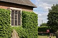
 Harlaston, Staffordshire, St Matthew - geograph.org.uk - 5916235.jpg 4,608 × 3,456; 3.95 MB
-
 Hull Saltend to Baglan Bay tanks - geograph.org.uk - 2152406.jpg 640 × 425; 88 KB
-
 Is it the peloton^ - geograph.org.uk - 5838082.jpg 1,469 × 1,102; 601 KB
-

-
 Main Road - geograph.org.uk - 2423583.jpg 3,072 × 2,048; 3.47 MB
-
 Main Road heading east - geograph.org.uk - 3198008.jpg 640 × 480; 94 KB
-
 Main Road heading east - geograph.org.uk - 3198014.jpg 640 × 480; 140 KB
-
 Main Road heading north - geograph.org.uk - 3198002.jpg 640 × 480; 81 KB
-

-
 Main Road, heading east to Haunton - geograph.org.uk - 4760374.jpg 1,024 × 768; 238 KB
-
 Main Road, heading west to Harlaston - geograph.org.uk - 4760377.jpg 1,024 × 768; 143 KB
-
 Milepost at SK 21741110.jpg 492 × 701; 55 KB
-
 Minor road heading east - geograph.org.uk - 3198017.jpg 640 × 480; 134 KB
-

-
 Minor road towards Harlaston - geograph.org.uk - 5335524.jpg 640 × 480; 57 KB
-
 Muddy entrance to an arable field, Portway - geograph.org.uk - 4760019.jpg 1,024 × 768; 228 KB
-

-
 Portway Farm - geograph.org.uk - 3197995.jpg 640 × 387; 45 KB
-
 Portway Lane heading north - geograph.org.uk - 3197993.jpg 640 × 480; 60 KB
-
 Portway Lane heading north - geograph.org.uk - 3197997.jpg 640 × 480; 76 KB
-
 Portway Lane, heading northwards to Portway - geograph.org.uk - 4759473.jpg 1,024 × 768; 113 KB
-
 Post Office and Village Store in Harlaston - geograph.org.uk - 2665998.jpg 3,296 × 2,472; 972 KB
-
 Postbox on Portway Lane - geograph.org.uk - 4760009.jpg 1,024 × 768; 144 KB
-
 Power lines changing direction near Portway Farm - geograph.org.uk - 4760021.jpg 1,024 × 768; 136 KB
-
 Railway towards Tamworth - geograph.org.uk - 3197986.jpg 640 × 407; 52 KB
-
 Road Bridge near Harlaston - geograph.org.uk - 2665977.jpg 3,296 × 2,472; 1.1 MB
-
 Road Junction and Bridge, Harlaston - geograph.org.uk - 2507812.jpg 640 × 428; 128 KB
-
 Road leaving Harlaston to the north-east - geograph.org.uk - 4760302.jpg 1,024 × 768; 185 KB
-

-
 Roadside tree near Portway Farm - geograph.org.uk - 4760024.jpg 1,024 × 768; 138 KB
-
 Roadside tree, east of Harlaston - geograph.org.uk - 4760317.jpg 1,024 × 768; 159 KB
-
 Roadside tree, Main Road, Harlaston - geograph.org.uk - 4760265.jpg 1,024 × 768; 184 KB
-
 Rusting steel by the line - geograph.org.uk - 6206042.jpg 2,000 × 1,330; 1.22 MB
-
 Smoke at Coppinshill Barn - geograph.org.uk - 4760253.jpg 1,024 × 614; 135 KB
-
 St Matthew Church (5) - geograph.org.uk - 2423192.jpg 3,072 × 2,048; 3.69 MB
-
 St Matthews Church (1) - geograph.org.uk - 2423117.jpg 3,072 × 2,048; 2.98 MB
-
 St Matthews Church (10) - geograph.org.uk - 2423367.jpg 3,072 × 2,048; 1.85 MB
-
 St Matthews Church (11) - geograph.org.uk - 2423403.jpg 2,048 × 3,072; 2.65 MB
-
 St Matthews Church (12) - geograph.org.uk - 2423451.jpg 3,072 × 2,048; 2.34 MB
-
 St Matthews Church (13) - geograph.org.uk - 2423484.jpg 3,072 × 2,048; 3.11 MB
-
 St Matthews Church (14) - geograph.org.uk - 2423519.jpg 3,072 × 2,048; 3.86 MB
-
 St Matthews Church (15) - geograph.org.uk - 2423539.jpg 3,072 × 2,048; 3.14 MB
-
 St Matthews Church (2) - geograph.org.uk - 2423141.jpg 2,048 × 3,072; 2.17 MB
-
 St Matthews Church (3) - geograph.org.uk - 2423152.jpg 3,072 × 2,048; 1.91 MB
-
 St Matthews Church (4) - geograph.org.uk - 2423167.jpg 3,072 × 2,048; 2.16 MB
-
 St Matthews Church (6) - geograph.org.uk - 2423206.jpg 3,072 × 2,048; 2 MB
-
 St Matthews Church (7) - geograph.org.uk - 2423322.jpg 640 × 427; 99 KB
-
 St Matthews Church (8) - geograph.org.uk - 2423341.jpg 3,072 × 2,048; 3.91 MB
-
 St Matthews Church (9) - geograph.org.uk - 2423352.jpg 3,072 × 2,048; 3.04 MB
-

-
 Storm-damaged tree, east of Birdsley Farm - geograph.org.uk - 4759490.jpg 1,024 × 768; 160 KB
-
 The road from Harlaston to Haunton, heading east - geograph.org.uk - 4760349.jpg 1,024 × 768; 172 KB
-
 The road from Haunton to Harlaston, heading west - geograph.org.uk - 4760352.jpg 1,024 × 768; 177 KB
-
 The Tamworth - Burton upon Trent railway line - geograph.org.uk - 4760000.jpg 1,024 × 768; 204 KB
-
 The White Lion at Harlaston - geograph.org.uk - 2841896.jpg 640 × 425; 87 KB
-
 The White Lion in Harlaston - geograph.org.uk - 2666076.jpg 3,296 × 2,472; 1,003 KB
-
 The White Lion, Harlaston - geograph.org.uk - 3198007.jpg 640 × 480; 62 KB
-
 They'll take some catching - geograph.org.uk - 5838083.jpg 1,469 × 1,102; 628 KB
-
 Track off Main Road - geograph.org.uk - 3198000.jpg 640 × 480; 61 KB
-

-
 Trees along a tributary of the River Mease - geograph.org.uk - 4760344.jpg 1,024 × 768; 178 KB
-
 Two pairs of semis on Winterdyne Lane - geograph.org.uk - 4760008.jpg 1,024 × 614; 111 KB
-
 Typical View for This Area - geograph.org.uk - 2632783.jpg 640 × 428; 43 KB
-
 View north under the power lines on Portway Lane - geograph.org.uk - 5839096.jpg 1,469 × 1,102; 648 KB
-

-
 Willow Bottom Lane - geograph.org.uk - 4760012.jpg 1,024 × 768; 160 KB
-

-

-
 Winterdyne Lane - geograph.org.uk - 4760013.jpg 1,024 × 614; 120 KB
-
 Wooden pylon on arable field, off Main Road - geograph.org.uk - 4760287.jpg 1,024 × 768; 145 KB
_-_geograph.org.uk_-_1882420.jpg)
_-_geograph.org.uk_-_1882450.jpg)
_-_geograph.org.uk_-_1882476.jpg)
_-_geograph.org.uk_-_1882527.jpg)
_-_geograph.org.uk_-_1882634.jpg)
_-_geograph.org.uk_-_1882663.jpg)
_-_geograph.org.uk_-_1884082.jpg)
_-_geograph.org.uk_-_1884096.jpg)


.jpg)


_-_geograph.org.uk_-_2423192.jpg)
_-_geograph.org.uk_-_2423117.jpg)
_-_geograph.org.uk_-_2423367.jpg)
_-_geograph.org.uk_-_2423403.jpg)
_-_geograph.org.uk_-_2423451.jpg)
_-_geograph.org.uk_-_2423484.jpg)
_-_geograph.org.uk_-_2423519.jpg)
_-_geograph.org.uk_-_2423539.jpg)
_-_geograph.org.uk_-_2423141.jpg)
_-_geograph.org.uk_-_2423152.jpg)
_-_geograph.org.uk_-_2423167.jpg)
_-_geograph.org.uk_-_2423206.jpg)
_-_geograph.org.uk_-_2423322.jpg)
_-_geograph.org.uk_-_2423341.jpg)
_-_geograph.org.uk_-_2423352.jpg)


