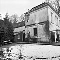
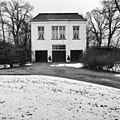
Category:Harinxmastate
Jump to navigation
Jump to search
| Object location | | View all coordinates using: OpenStreetMap |
|---|
complex of multiple built objects | |||||
| Upload media | |||||
| Instance of | |||||
|---|---|---|---|---|---|
| Part of | |||||
| Location | Beetsterzwaag, Friesland, Netherlands | ||||
| Located on street | |||||
| Heritage designation |
| ||||
 | |||||
|
This is a category about rijksmonumentcomplex number 414319
|
Landhuis
|
This is a category about rijksmonument number 414346
|
Historische aanleg
|
This is a category about rijksmonument number 414349
|
Koetshuis annex koetsierswoning
|
This is a category about rijksmonument number 414350
|
Tuinmanswoning
|
This is a category about rijksmonument number 414351
|
Oostelijk toegangshek
|
This is a category about rijksmonument number 414352
|
Westelijktoegangshek
|
This is a category about rijksmonument number 414353
|
Bakstenen muur
|
This is a category about rijksmonument number 414354
|
Gebouwtje in gele baksteen
|
This is a category about rijksmonument number 414355
|
Hondehok
|
This is a category about rijksmonument number 414356
|
Lodewijk XV sokkel
|
This is a category about rijksmonument number 414357
|
Houten hek in "Overpark"
|
This is a category about rijksmonument number 414358
|
| Address |
|
Media in category "Harinxmastate"
The following 53 files are in this category, out of 53 total.
-
Aanzicht - Beetsterzwaag - 20030012 - RCE.jpg 1,200 × 810; 278 KB
-
Achtergevel - Beetsterzwaag - 20030022 - RCE.jpg 1,183 × 1,200; 331 KB
-
Achtergevel - Beetsterzwaag - 20030023 - RCE.jpg 1,190 × 1,200; 449 KB
-
Achtergevel, vanuit park - Beetsterzwaag - 20030020 - RCE.jpg 1,200 × 1,200; 424 KB
-
Achtergevel, vanuit park - Beetsterzwaag - 20030021 - RCE.jpg 1,192 × 1,200; 440 KB
-
Beetstersweach, Harinxmastate.jpg 2,795 × 1,858; 2.27 MB
-
Bijgebouw, achtergevel - Beetsterzwaag - 20030027 - RCE.jpg 1,188 × 1,200; 452 KB
-
Bijgebouw, linkerzijgevel - Beetsterzwaag - 20030025 - RCE.jpg 1,188 × 1,200; 510 KB
-
Bijgebouw, rechterzijgevel - Beetsterzwaag - 20030026 - RCE.jpg 1,178 × 1,200; 459 KB
-
Bijgebouw, voorgevel - Beetsterzwaag - 20030024 - RCE.jpg 1,183 × 1,200; 486 KB
-
Exterieur ACHTERGEVEL - Beetsterzwaag - 20296572 - RCE.jpg 1,197 × 1,200; 404 KB
-
Exterieur GEDEELTE LINKER ZIJGEVEL - Beetsterzwaag - 20296571 - RCE.jpg 1,195 × 1,200; 499 KB
-
Exterieur KOETSHUIS, LINKER ZIJGEVEL - Beetsterzwaag - 20296576 - RCE.jpg 1,197 × 1,200; 524 KB
-
Exterieur KOETSHUIS, LINKER ZIJGEVEL - Beetsterzwaag - 20296577 - RCE.jpg 1,195 × 1,200; 339 KB
-
Exterieur KOETSHUIS, OVERZICHT ACHTERGEVEL - Beetsterzwaag - 20296578 - RCE.jpg 1,192 × 1,200; 380 KB
-
Exterieur KOETSHUIS, OVERZICHT RECHTER ZIJGEVEL - Beetsterzwaag - 20296575 - RCE.jpg 1,200 × 1,195; 480 KB
-
Exterieur KOETSHUIS, VOORGEVEL - Beetsterzwaag - 20296574 - RCE.jpg 1,200 × 1,200; 377 KB
-
Exterieur LINKER ZIJGEVEL - Beetsterzwaag - 20296570 - RCE.jpg 1,200 × 1,197; 425 KB
-
Exterieur OVERZICHT - Beetsterzwaag - 20296569 - RCE.jpg 1,195 × 1,200; 453 KB
-
Exterieur OVERZICHT KOETSHUIS - Beetsterzwaag - 20296573 - RCE.jpg 1,193 × 1,200; 448 KB
-
Exterieur OVERZICHT TUIN - Beetsterzwaag - 20296567 - RCE.jpg 1,188 × 1,200; 448 KB
-
Exterieur OVERZICHT TUIN - Beetsterzwaag - 20296568 - RCE.jpg 1,200 × 1,200; 441 KB
-
Exterieur VOORGEVEL - Beetsterzwaag - 20296579 - RCE.jpg 1,200 × 1,195; 408 KB
-
Harinxmastate Beetsterzwaag kaartje.jpg 581 × 301; 47 KB
-
Harinxmastate Beetsterzwaag.jpg 1,296 × 972; 544 KB
-
Harinxmastate linker deel westelijk toegangshek.jpg 1,824 × 1,368; 903 KB
-
Harinxmastate rechter deel oostelijk toeganshek.jpg 1,614 × 1,254; 836 KB
-
Harinxmastate, hondenhok, Beetsterzwaag.JPG 4,608 × 3,456; 3.31 MB
-
Harinxmastate, hoofdgebouw, Beetsterzwaag.JPG 4,608 × 3,456; 3.36 MB
-
Harinxmastate, oostelijk toegangshek, Beetsterzwaag.JPG 4,608 × 3,456; 3.16 MB
-
Harinxmastate, tuin- en park, Beetsterzwaag.JPG 4,608 × 3,456; 3.13 MB
-
Harinxmastate, tuinmanswoning..JPG 4,608 × 3,456; 3.57 MB
-
Harinxmastate, westelijk toegangshek, beetsterzwaag.JPG 4,608 × 3,456; 3.26 MB
-
Harinxmastate..JPG 4,608 × 3,456; 1.83 MB
-
Harinxmastate.jpg 588 × 447; 288 KB
-
Harinxmastate2 Beetsterzwaag.jpg 2,592 × 1,944; 786 KB
-
Hoofdgebouw Harinxmastate Beetsterzwaag.jpg 1,728 × 1,296; 588 KB
-
INTERIEUR, DETAIL SCHOT MET PAARDENHOOFD - Beetsterzwaag - 20296583 - RCE.jpg 1,200 × 1,200; 213 KB
-
INTERIEUR, OVERZICHT PAARDENSTAL - Beetsterzwaag - 20296580 - RCE.jpg 1,200 × 1,192; 354 KB
-
INTERIEUR, PAARDENSTAL - Beetsterzwaag - 20296581 - RCE.jpg 1,200 × 1,200; 320 KB
-
INTERIEUR, PAARDENSTAL - Beetsterzwaag - 20296582 - RCE.jpg 1,200 × 1,200; 320 KB
-
INTERIEUR, PAARDENSTAL, DETAIL RUIF - Beetsterzwaag - 20296584 - RCE.jpg 1,190 × 1,200; 311 KB
-
Linkerzijgevel - Beetsterzwaag - 20030019 - RCE.jpg 1,195 × 1,200; 503 KB
-
Lyndenstein, hoofdgebouw, Beetsterzwaag.JPG 4,608 × 3,456; 3.48 MB
-
Overzicht + linkerzijgevel - Beetsterzwaag - 20030015 - RCE.jpg 1,190 × 1,200; 409 KB
-
Overzicht - Beetsterzwaag - 20030014 - RCE.jpg 1,192 × 1,200; 435 KB
-
R.zijde - Beetsterzwaag - 20030011 - RCE.jpg 1,200 × 1,197; 410 KB
-
Rechterzijgevel - Beetsterzwaag - 20030018 - RCE.jpg 1,190 × 1,200; 440 KB
-
Toeganshek-State..JPG 4,608 × 3,456; 3 MB
-
Voor- en zijgevel - Beetsterzwaag - 20030017 - RCE.jpg 1,188 × 1,200; 433 KB
-
Voorgevel - Beetsterzwaag - 20030016 - RCE.jpg 1,200 × 1,197; 415 KB
-
Voorzijde - Beetsterzwaag - 20030013 - RCE.jpg 1,193 × 1,200; 359 KB


