Category:Harberton
Jump to navigation
Jump to search
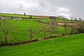
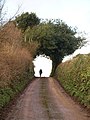
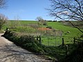
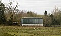
English: Harberton is a village and civil parish 3 miles south west of Totnes, Devon, England, in South Hams District. The parish also includes the village of Harbertonford. In the 2001 census the parish had a population of 1,285.
a village located in South Hams, United Kingdom  | |||||
| Upload media | |||||
| Instance of | |||||
|---|---|---|---|---|---|
| Location | South Hams, Devon, South West England, England | ||||
 | |||||
Subcategories
This category has the following 5 subcategories, out of 5 total.
Media in category "Harberton"
The following 200 files are in this category, out of 708 total.
(previous page) (next page)-
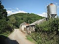
 A newly built barn - geograph.org.uk - 5801756.jpg 640 × 370; 31 KB
-
 A private view of the Harbourne River - geograph.org.uk - 2001801.jpg 640 × 480; 504 KB
-
 A small south Devon stream valley - geograph.org.uk - 4953802.jpg 640 × 426; 53 KB
-
 A381 and Brockhills - geograph.org.uk - 2269515.jpg 800 × 600; 315 KB
-
 A381 at Harbertonford - geograph.org.uk - 3148852.jpg 524 × 640; 94 KB
-
 A381 below Brockhills - geograph.org.uk - 2004322.jpg 640 × 480; 339 KB
-

-
 A381 north of Brockhills - geograph.org.uk - 2004327.jpg 640 × 480; 358 KB
-
 A381 passing Brockhills - geograph.org.uk - 2147908.jpg 640 × 480; 86 KB
-
 A381 to Harbertonford - geograph.org.uk - 3034091.jpg 640 × 390; 26 KB
-
 Alpacas at West Leigh - geograph.org.uk - 1159342.jpg 640 × 480; 90 KB
-
 An Alpaca - geograph.org.uk - 5403794.jpg 640 × 426; 66 KB
-
 Approaching East Leigh Cross - geograph.org.uk - 3867559.jpg 1,920 × 2,402; 1.21 MB
-
 Approaching Key's Englebourne - geograph.org.uk - 5577228.jpg 1,488 × 1,927; 486 KB
-
 Approaching Luscombe Cross - geograph.org.uk - 1134958.jpg 480 × 640; 100 KB
-
 Approaching Luscombe Cross - geograph.org.uk - 6165336.jpg 2,848 × 4,288; 1.99 MB
-
 Approaching Mill Cross - geograph.org.uk - 3940503.jpg 1,920 × 2,465; 910 KB
-
 Arable field near Belsford - geograph.org.uk - 4101502.jpg 1,920 × 2,474; 1.37 MB
-
 Ash tree near Luscombe Cross - geograph.org.uk - 6160219.jpg 3,992 × 2,848; 1.87 MB
-
 Ashridge Fork - geograph.org.uk - 3782298.jpg 2,028 × 1,325; 578 KB
-
 Ashwell Brook - geograph.org.uk - 5577595.jpg 2,048 × 1,536; 588 KB
-
 At Foales Leigh - geograph.org.uk - 2987476.jpg 511 × 640; 62 KB
-
 B road to Avonwick - geograph.org.uk - 3915485.jpg 640 × 425; 87 KB
-
 B road to Totnes - geograph.org.uk - 3915479.jpg 640 × 425; 77 KB
-
 Back end of two lambs, Tristford House - geograph.org.uk - 4101614.jpg 1,246 × 805; 262 KB
-
 Back gate to Great Englebourne - geograph.org.uk - 2002548.jpg 640 × 480; 503 KB
-
 Bales, Lower Ashridge - geograph.org.uk - 5460871.jpg 640 × 361; 48 KB
-
 Barley south of Key's Englebourne - geograph.org.uk - 2002551.jpg 640 × 480; 382 KB
-
 Barley, Luscombe Cross - geograph.org.uk - 6165727.jpg 4,070 × 2,663; 1.8 MB
-
 Barley, Luscombe Cross - geograph.org.uk - 6165738.jpg 2,868 × 1,958; 605 KB
-
 Barley, Luscombe Cross - geograph.org.uk - 6166173.jpg 3,587 × 2,318; 1.43 MB
-
 Barn and bales at Lower Ashridge Farm - geograph.org.uk - 3599161.jpg 1,024 × 513; 81 KB
-
 Barn and bales at New Barn - geograph.org.uk - 2001080.jpg 640 × 480; 372 KB
-
 Barn and meadows near Belsford - geograph.org.uk - 4100899.jpg 1,920 × 1,440; 798 KB
-
 Barn in corner of field - geograph.org.uk - 5749657.jpg 640 × 426; 56 KB
-
 Barn in corner of field - geograph.org.uk - 5801752.jpg 640 × 426; 43 KB
-
 Barn near Hazard - geograph.org.uk - 1165031.jpg 640 × 480; 109 KB
-
 Barn near Hazard - geograph.org.uk - 3864300.jpg 1,920 × 1,440; 539 KB
-
 Barn, Dundridge Gardens - geograph.org.uk - 4638453.jpg 1,920 × 1,275; 1.03 MB
-
 Barn, Key's Englebourne - geograph.org.uk - 5577112.jpg 2,048 × 1,536; 447 KB
-
 Barn, Lower Ashridge - geograph.org.uk - 5275416.jpg 640 × 426; 47 KB
-
 Barn, Lower Ashridge - geograph.org.uk - 5683053.jpg 640 × 426; 56 KB
-
 Barn, Lower Ashridge - geograph.org.uk - 5709121.jpg 640 × 426; 48 KB
-
 Barn, Luscombe (geograph 6161007).jpg 4,177 × 2,502; 1.29 MB
-
 Barn, Rolster Bridge Farm - geograph.org.uk - 2987470.jpg 640 × 480; 90 KB
-
 Barns, Lower Ashridge - geograph.org.uk - 5763865.jpg 640 × 426; 53 KB
-
 Beenleigh Brook in summer - geograph.org.uk - 2000167.jpg 640 × 480; 563 KB
-
 Beenleigh Brook valley - geograph.org.uk - 5760988.jpg 3,114 × 2,333; 968 KB
-
 Bennett's Cross - geograph.org.uk - 5574567.jpg 1,536 × 2,048; 578 KB
-
 Bennett's Cross - geograph.org.uk - 5574577.jpg 2,048 × 1,536; 482 KB
-
 Bennetts Cross - geograph.org.uk - 5327325.jpg 640 × 426; 122 KB
-
 Berrystone Rock - geograph.org.uk - 3867511.jpg 2,250 × 1,207; 705 KB
-
 Big boat, small pond - geograph.org.uk - 5763871.jpg 600 × 640; 81 KB
-
 Blakemore Cross - geograph.org.uk - 1265144.jpg 640 × 427; 87 KB
-
 Blakemore from near Whispering Firs - geograph.org.uk - 3781976.jpg 1,857 × 1,189; 398 KB
-
 Boggy ground near Beenleigh Brook - geograph.org.uk - 2000148.jpg 640 × 480; 487 KB
-
 Bow Road - geograph.org.uk - 3152176.jpg 640 × 469; 91 KB
-
 Bow Road - geograph.org.uk - 6255048.jpg 2,848 × 4,288; 2.56 MB
-
 Bow Road, Harbertonford - geograph.org.uk - 3311329.jpg 1,600 × 1,200; 576 KB
-
 Bridge near Harberton - South Hams - geograph.org.uk - 42186.jpg 640 × 425; 161 KB
-
 Bridge near Hazard Quarry - geograph.org.uk - 3864375.jpg 1,920 × 1,440; 757 KB
-
 Bridge west of Monkey Oak Farm - geograph.org.uk - 2001786.jpg 640 × 480; 537 KB
-
 Bridges over Beenleigh Brook - geograph.org.uk - 2000155.jpg 640 × 480; 563 KB
-
 Brockhills - geograph.org.uk - 150293.jpg 640 × 480; 124 KB
-
 Buildings at Luscombe - geograph.org.uk - 6161161.jpg 4,109 × 2,783; 1.09 MB
-
 Catkins south of Larcombe Quarry - geograph.org.uk - 3866811.jpg 1,920 × 1,440; 1.04 MB
-
 Cattle above Woodcourt - geograph.org.uk - 3042768.jpg 640 × 421; 54 KB
-
 Cattle grazing - geograph.org.uk - 5327374.jpg 640 × 426; 66 KB
-
 Cattle grazing - geograph.org.uk - 5403799.jpg 640 × 426; 71 KB
-
 Cattle grazing - geograph.org.uk - 5425091.jpg 640 × 426; 34 KB
-
 Cattle grazing - geograph.org.uk - 5763878.jpg 640 × 342; 54 KB
-
 Cattle in mud, Cholwell - geograph.org.uk - 3869971.jpg 1,920 × 1,408; 509 KB
-
 Cattle near Key's Engelbourne - geograph.org.uk - 4638395.jpg 1,719 × 1,098; 527 KB
-
 Cattle near Luscombe Cross - geograph.org.uk - 4131458.jpg 1,920 × 1,140; 568 KB
-
 Cattle pasture, Tristford House - geograph.org.uk - 3869501.jpg 1,920 × 1,233; 571 KB
-
 Cholwell Cross - geograph.org.uk - 3870042.jpg 1,920 × 1,440; 533 KB
-
 Church Green at the centre of Harbertonford - geograph.org.uk - 3346723.jpg 1,024 × 768; 107 KB
-
 Collapsing shed, Leigh Bridge - geograph.org.uk - 3868223.jpg 1,920 × 2,552; 1.43 MB
-
 Colourful cottages - geograph.org.uk - 5327399.jpg 640 × 426; 67 KB
-

-

-
 Corrugated barn - geograph.org.uk - 5888818.jpg 1,024 × 603; 136 KB
-
 Corrugated barn - geograph.org.uk - 6036693.jpg 1,024 × 681; 224 KB
-
 Corrugated iron shed - geograph.org.uk - 5275409.jpg 640 × 426; 64 KB
-
 Cottages near Leigh Bridge - geograph.org.uk - 6187588.jpg 2,584 × 3,921; 1.71 MB
-
 Countryside near North Park Corner - geograph.org.uk - 3148870.jpg 640 × 532; 75 KB
-
 Countryside near Tigley - geograph.org.uk - 3782137.jpg 2,048 × 1,536; 474 KB
-
 Countryside south of Harberton - geograph.org.uk - 4638330.jpg 1,920 × 1,024; 532 KB
-
 Covered reservoir, Copperthorn Cross - geograph.org.uk - 6299028.jpg 4,288 × 2,848; 1.8 MB
-
 Crowdy Mill (geograph 6250888).jpg 3,332 × 2,224; 1.44 MB
-
 Crowdy Mill - geograph.org.uk - 161426.jpg 640 × 480; 101 KB
-
 Crowdy Mill, Harbertonford - geograph.org.uk - 4083455.jpg 640 × 480; 123 KB
-
 Dattins - geograph.org.uk - 150511.jpg 640 × 480; 113 KB
-
 Descending to Belsford - geograph.org.uk - 4098263.jpg 2,892 × 3,854; 2.52 MB
-
 Devon bank, West Leigh Cross - geograph.org.uk - 6079909.jpg 3,070 × 1,743; 1.05 MB
-
 Devon countryside - geograph.org.uk - 5601198.jpg 640 × 426; 45 KB
-
 Devon countryside - geograph.org.uk - 5601202.jpg 640 × 364; 41 KB
-
 Devon Farmland - geograph.org.uk - 4953800.jpg 640 × 426; 40 KB
-
 Devon hillside - geograph.org.uk - 5601211.jpg 640 × 344; 24 KB
-
 Devon scenery - geograph.org.uk - 5601221.jpg 640 × 426; 61 KB
-
 Devon scenery - geograph.org.uk - 5709116.jpg 640 × 426; 70 KB
-
 Disused farm trailer - geograph.org.uk - 42174.jpg 640 × 425; 159 KB
-
 Dorseley Park Cottage - geograph.org.uk - 5425094.jpg 640 × 426; 54 KB
-
 Dorseley Park Cottages - geograph.org.uk - 5437329.jpg 640 × 426; 58 KB
-
 Dorsley Barton (geograph 5574231).jpg 1,982 × 1,249; 175 KB
-
 Dorsley Barton and Whiteley Farm - geograph.org.uk - 150275.jpg 640 × 480; 92 KB
-
 Dorsley Park Farm - geograph.org.uk - 5574200.jpg 1,940 × 1,218; 171 KB
-
 Dottin's quarry - geograph.org.uk - 5577600.jpg 2,048 × 1,536; 586 KB
-
 Drive entrance, Leigh Hill - geograph.org.uk - 3867664.jpg 1,920 × 1,195; 706 KB
-
 Drive to Great Englebourne - geograph.org.uk - 2004331.jpg 640 × 480; 386 KB
-
 Dundridge - geograph.org.uk - 4638472.jpg 2,449 × 3,360; 2.27 MB
-
 Dundridge House - geograph.org.uk - 150289.jpg 640 × 480; 81 KB
-
 Dundridge House - geograph.org.uk - 5574554.jpg 2,048 × 1,536; 396 KB
-
 East Devon , A381 Road Junction - geograph.org.uk - 1217634.jpg 640 × 480; 131 KB
-
 East Leigh Cross - geograph.org.uk - 1160695.jpg 480 × 640; 108 KB
-
 East Leigh Cross - geograph.org.uk - 3867564.jpg 1,920 × 1,440; 639 KB
-
 East Leigh Farm - geograph.org.uk - 2001053.jpg 640 × 480; 397 KB
-
 Eastern Lodge - geograph.org.uk - 3869489.jpg 1,920 × 2,318; 782 KB
-
 Entering Harbertonford, A381 - geograph.org.uk - 5350609.jpg 640 × 374; 91 KB
-
 Entrance to Dundridge House - geograph.org.uk - 5574445.jpg 2,048 × 1,536; 453 KB
-
 Entrance to Great Englebourne Farm - geograph.org.uk - 5327382.jpg 640 × 424; 65 KB
-
 Entrance to Hill Mill Nursery - geograph.org.uk - 2002568.jpg 640 × 480; 474 KB
-
 Entrance to Westleigh Barton - geograph.org.uk - 3867408.jpg 2,503 × 1,378; 789 KB
-
 Farm at Brockhills - geograph.org.uk - 4487774.jpg 1,200 × 802; 936 KB
-
 Farm buildings at Hazard - geograph.org.uk - 6331738.jpg 4,282 × 2,423; 2.11 MB
-
 Farm lane to Little Cholwell - geograph.org.uk - 3870001.jpg 1,920 × 1,346; 421 KB
-
 Farm west of Rolster Bridge - geograph.org.uk - 2000187.jpg 640 × 480; 430 KB
-
 Farm, Brockhills - geograph.org.uk - 5577003.jpg 2,048 × 1,536; 426 KB
-
 Farmland - geograph.org.uk - 4821823.jpg 640 × 426; 52 KB
-
 Farmland near Great Engelbourne - geograph.org.uk - 4638317.jpg 1,920 × 1,280; 758 KB
-
 Farmland near Great Engelbourne - geograph.org.uk - 4638413.jpg 1,274 × 603; 231 KB
-
 Farmland near the Allertons - geograph.org.uk - 2518448.jpg 640 × 471; 143 KB
-
 Farmland near Tigley - geograph.org.uk - 5437325.jpg 640 × 426; 55 KB
-
 Farmland, Cholwell - geograph.org.uk - 3870032.jpg 1,920 × 1,190; 439 KB
-
 Farmland, Dorsley Barton - geograph.org.uk - 4813837.jpg 640 × 313; 22 KB
-
 Field above Belsford - geograph.org.uk - 4097659.jpg 1,920 × 1,358; 817 KB
-
 Field above Luscombe - geograph.org.uk - 6160998.jpg 4,282 × 2,400; 1.95 MB
-
 Field above the Harbourne valley - geograph.org.uk - 6160846.jpg 3,431 × 2,452; 1.24 MB
-
 Field access track above Luscombe - geograph.org.uk - 6160976.jpg 2,848 × 4,288; 2.06 MB
-
 Field at Harberton - geograph.org.uk - 4097459.jpg 1,920 × 1,369; 684 KB
-
 Field barn - geograph.org.uk - 5927656.jpg 1,024 × 681; 91 KB
-
 Field boundary near Berrystone Rock - geograph.org.uk - 3867500.jpg 1,920 × 2,610; 1.15 MB
-
 Field boundary near Berrystone Rock - geograph.org.uk - 6079883.jpg 2,944 × 1,673; 1.24 MB
-
 Field boundary south of Luscombe Cross - geograph.org.uk - 6160306.jpg 4,288 × 2,848; 2.82 MB
-
 Field boundary, Hazard Hill - geograph.org.uk - 6331805.jpg 4,141 × 2,587; 1.53 MB
-
 Field by A381 - geograph.org.uk - 5327365.jpg 640 × 425; 51 KB
-
 Field by A381 - geograph.org.uk - 5350613.jpg 498 × 640; 63 KB
-
 Field by Copperthorn Cross - geograph.org.uk - 6299007.jpg 4,266 × 2,529; 2.76 MB
-
 Field by Copperthorn Cross - geograph.org.uk - 6299014.jpg 3,941 × 2,177; 1.24 MB
-
 Field by Copperthorn Cross - geograph.org.uk - 6299018.jpg 4,288 × 2,848; 2.37 MB
-
 Field by Luscombe Cross - geograph.org.uk - 6165667.jpg 2,780 × 3,825; 1.5 MB
-
 Field by Luscombe Cross - geograph.org.uk - 6166182.jpg 4,260 × 2,378; 1.28 MB
-
 Field by Mill Cross - geograph.org.uk - 6299208.jpg 4,288 × 2,848; 2.47 MB
-
 Field by Sandwell Cross - geograph.org.uk - 3863808.jpg 1,920 × 1,440; 569 KB
-
 Field entrance near Beenleigh - geograph.org.uk - 6199898.jpg 2,848 × 4,288; 2.51 MB
-
 Field near Gill's Cross - geograph.org.uk - 6299190.jpg 3,262 × 1,678; 869 KB
-
 Field near Hazard Quarry - geograph.org.uk - 6331830.jpg 4,221 × 2,711; 1.76 MB
-
 Field near Hernaford - geograph.org.uk - 3152197.jpg 640 × 480; 93 KB
-
 Field near Hernaford - geograph.org.uk - 3152228.jpg 640 × 450; 85 KB
-
 Field near Luscombe - geograph.org.uk - 6161170.jpg 4,288 × 2,848; 2.9 MB
-
 Field near Tristford House - geograph.org.uk - 3869452.jpg 1,920 × 1,440; 696 KB
-
 Field near Tristford House - geograph.org.uk - 3869653.jpg 1,920 × 1,440; 442 KB
-
 Field near West Leigh Cross - geograph.org.uk - 1160687.jpg 640 × 480; 99 KB
-
-
 Field south of Luscombe Cross - geograph.org.uk - 6160251.jpg 4,288 × 2,585; 1.47 MB
-
 Field south of Luscombe Cross - geograph.org.uk - 6160300.jpg 4,288 × 2,848; 1.96 MB
-
 Field south of Luscombe Cross - geograph.org.uk - 6162043.jpg 4,288 × 2,848; 1.68 MB
-
 Field south of Luscombe Cross - geograph.org.uk - 6163800.jpg 4,288 × 2,848; 1.63 MB
-
 Field south-west of Luscombe Cross - geograph.org.uk - 6162518.jpg 4,288 × 2,848; 2.07 MB
-
 Field south-west of Luscombe Cross - geograph.org.uk - 6162853.jpg 2,848 × 4,288; 1.23 MB
-
 Field west of Luscombe - geograph.org.uk - 6161873.jpg 4,208 × 2,122; 1.08 MB
-
 Field, Hazard - geograph.org.uk - 6331733.jpg 4,223 × 2,756; 1.99 MB
-
 Field, Hazard - geograph.org.uk - 6331822.jpg 4,288 × 2,848; 1.26 MB
-
 Fields above Harbourne River - geograph.org.uk - 2001023.jpg 640 × 480; 459 KB
-
 Fields at New Barn - geograph.org.uk - 2001096.jpg 640 × 480; 351 KB
-
 Fields from Mill Cross - geograph.org.uk - 1160734.jpg 640 × 480; 97 KB
-
 Fields near Dundridge House - geograph.org.uk - 5574437.jpg 2,048 × 1,536; 450 KB
-
 Fields near Langford Barn - geograph.org.uk - 1160493.jpg 640 × 370; 57 KB
-
 Fields west of Key's Englebourne - geograph.org.uk - 2002557.jpg 640 × 480; 340 KB
-
 Filling Station, Harbertonford - geograph.org.uk - 5350612.jpg 640 × 426; 65 KB
-
 Fletcher's Combe - geograph.org.uk - 150544.jpg 640 × 480; 134 KB
-
 Fletcher's Combe - geograph.org.uk - 5577939.jpg 2,048 × 1,536; 413 KB
-
 Fletcher's Combe - geograph.org.uk - 5578069.jpg 2,048 × 1,536; 489 KB
-
 Flooded quarry - geograph.org.uk - 1999426.jpg 480 × 640; 550 KB
-
 Flooded track, Peak Cross - geograph.org.uk - 4635238.jpg 1,830 × 1,290; 854 KB
-
 Floor of the Harbourne Brook valley, 1 - geograph.org.uk - 2001765.jpg 640 × 475; 410 KB
-
 Floor of the Harbourne Brook valley, 2 - geograph.org.uk - 2001797.jpg 640 × 480; 392 KB
-
 Foales Leigh - geograph.org.uk - 2001008.jpg 640 × 475; 355 KB
-
 Foales Leigh, East Leigh - geograph.org.uk - 3867495.jpg 1,920 × 1,312; 504 KB
-
 Footbridge over Beenleigh Brook - geograph.org.uk - 5578551.jpg 1,536 × 2,048; 460 KB
-
 Footbridge over Beenleigh Brook - geograph.org.uk - 5578553.jpg 2,048 × 1,536; 507 KB
-
 Footbridge over Harbourne River - geograph.org.uk - 3869259.jpg 1,920 × 2,560; 1.46 MB
-
 Footpath and lane, Higher Beenleigh - geograph.org.uk - 6071589.jpg 4,284 × 2,699; 2.61 MB
-
 Footpath at East Leigh - geograph.org.uk - 2987724.jpg 640 × 480; 114 KB
-
 Footpath to East Leigh - geograph.org.uk - 2987468.jpg 480 × 640; 119 KB
-
 Footpath, Larcombe - geograph.org.uk - 3866494.jpg 1,920 × 2,416; 1.19 MB
-
 Footpath, Vicarage Ball - geograph.org.uk - 3868883.jpg 1,920 × 2,560; 1.26 MB
-
 Ford House, Harbertonford - geograph.org.uk - 3152172.jpg 492 × 640; 64 KB
-
 Fork in the tracks, Jackman's Lane - geograph.org.uk - 6186474.jpg 1,200 × 1,600; 1.03 MB
-
 Frosty meadow, Leigh Bridge - geograph.org.uk - 6187662.jpg 4,261 × 2,704; 2.14 MB


.jpg)


.jpg)


.jpg)


