Category:Hanging valleys of England
Jump to navigation
Jump to search
Media in category "Hanging valleys of England"
The following 25 files are in this category, out of 25 total.
-
 Clavell's Hard - geograph.org.uk - 769110.jpg 640 × 480; 95 KB
-
 Cliffs east of Cuddle - geograph.org.uk - 768923.jpg 640 × 480; 99 KB
-
 Coast path to the south of Encombe - geograph.org.uk - 909865.jpg 640 × 480; 97 KB
-
 Cotterdale village - geograph.org.uk - 441668.jpg 640 × 427; 150 KB
-
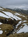
 Grisedale Hause - geograph.org.uk - 858867.jpg 640 × 480; 121 KB
-
 Infant Trout Beck - geograph.org.uk - 1751960.jpg 480 × 640; 73 KB
-
 Kimmeridge ledges and coastal path - geograph.org.uk - 432362.jpg 640 × 480; 86 KB
-
 Marshy ground above Eskdale - geograph.org.uk - 126336.jpg 640 × 480; 110 KB
-
 River Esk - geograph.org.uk - 62203.jpg 640 × 409; 77 KB
-
 River Esk. - geograph.org.uk - 64206.jpg 640 × 414; 82 KB
-
 Speke's Mill Beach - geograph.org.uk - 506886.jpg 640 × 471; 106 KB
-
 Spoil heaps, Force Crag mine - geograph.org.uk - 1750725.jpg 800 × 530; 209 KB
-
-
 The Scar Gill - geograph.org.uk - 199132.jpg 640 × 428; 53 KB
-
 Under Crag Hill - geograph.org.uk - 935708.jpg 640 × 480; 90 KB
-
 Under Long Crag - geograph.org.uk - 1057348.jpg 640 × 480; 87 KB
-
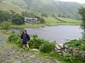 Watendlath - geograph.org.uk - 288592.jpg 640 × 480; 101 KB
-
 Bleaberry Tarn - geograph.org.uk - 782497.jpg 640 × 480; 147 KB
-
 Caw Fell from Bleaberry Gill - geograph.org.uk - 293235.jpg 640 × 480; 109 KB
-
 Clough Gill - Westerdale Moor - geograph.org.uk - 145078.jpg 640 × 415; 95 KB
-
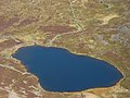
 Codale Tarn - geograph.org.uk - 5889.jpg 640 × 480; 49 KB
-
 Grey Friar and Calf Cove - geograph.org.uk - 394293.jpg 640 × 480; 76 KB
-
 Little Dale - geograph.org.uk - 283909.jpg 640 × 480; 80 KB
-
 Tent Link Cove - geograph.org.uk - 206586.jpg 640 × 480; 100 KB
-
 Waterfall, Threapland Gill - geograph.org.uk - 89749.jpg 640 × 427; 151 KB


