Category:Hambleton Hills
Jump to navigation
Jump to search
hills in North Yorkshire, England, UK | |||||
| Upload media | |||||
| Instance of |
| ||||
|---|---|---|---|---|---|
| Location | North Yorkshire, Yorkshire and the Humber, England | ||||
 | |||||
Subcategories
This category has the following 3 subcategories, out of 3 total.
Media in category "Hambleton Hills"
The following 50 files are in this category, out of 50 total.
-
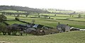
 Abandoned sheds near Hambleton Hill - geograph.org.uk - 1269223.jpg 640 × 480; 206 KB
-
 Across Cod Beck - geograph.org.uk - 1636351.jpg 478 × 640; 60 KB
-
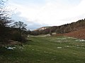
 Bridleway to Cold Kirby - geograph.org.uk - 1636166.jpg 480 × 640; 66 KB
-
 Cam Farm - geograph.org.uk - 735067.jpg 640 × 339; 29 KB
-
 Chestnut Bank, Borrowby - geograph.org.uk - 198860.jpg 480 × 640; 120 KB
-
 Cleveland Way - geograph.org.uk - 33592.jpg 640 × 480; 64 KB
-
 Cleveland Way above South Woods - geograph.org.uk - 1628371.jpg 640 × 480; 65 KB
-
 Cleveland Way on Little Moor - geograph.org.uk - 582723.jpg 640 × 430; 78 KB
-
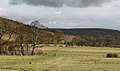
 Cowesby from the south - geograph.org.uk - 878709.jpg 640 × 480; 70 KB
-
 Dry valley, Kirby Knowle - geograph.org.uk - 733687.jpg 640 × 480; 63 KB
-
 Field and Moor - geograph.org.uk - 717250.jpg 640 × 378; 56 KB
-
 Footbridge over Burtis Beck. - geograph.org.uk - 552437.jpg 480 × 640; 144 KB
-
 Gallops at Hambleton House - geograph.org.uk - 1628328.jpg 640 × 382; 30 KB
-
 Glacial meltwater channel. - geograph.org.uk - 403281.jpg 640 × 480; 83 KB
-
 Glacial overflow channel near Kilburn - geograph.org.uk - 683045.jpg 640 × 480; 74 KB
-
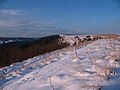
 Hambleton Hills - geograph.org.uk - 1636246.jpg 640 × 480; 86 KB
-
 Hambleton Hills - geograph.org.uk - 165475.jpg 640 × 438; 149 KB
-
 Hambleton Hills Views - geograph.org.uk - 165481.jpg 640 × 462; 146 KB
-
 Horizontal and vertical - geograph.org.uk - 1065585.jpg 480 × 640; 41 KB
-
 Ivy Scar - geograph.org.uk - 1024997.jpg 480 × 640; 97 KB
-
 Ivy Scar - geograph.org.uk - 1065549.jpg 551 × 640; 85 KB
-
 Middle Gill Slack - geograph.org.uk - 696333.jpg 640 × 327; 48 KB
-
 Military road on Waitwith Moor - geograph.org.uk - 171878.jpg 640 × 480; 65 KB
-
 Newburgh Lake - geograph.org.uk - 1630747.jpg 640 × 342; 40 KB
-
 On the slopes of Hood Hill - geograph.org.uk - 1095277.jpg 640 × 480; 81 KB
-
 Road junction at Dialstone - geograph.org.uk - 1628345.jpg 640 × 480; 71 KB
-
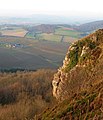
 Roulston Scar - geograph.org.uk - 1065554.jpg 602 × 640; 100 KB
-
 Royston Scar Yorkshire.jpg 3,648 × 2,736; 2.91 MB
-
 Scawton Lane, Hambleton Hills - geograph.org.uk - 297967.jpg 452 × 640; 60 KB
-
 South Woods - geograph.org.uk - 1628378.jpg 640 × 480; 68 KB
-
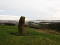 Standing stone, Nether Silton - geograph.org.uk - 678243.jpg 640 × 480; 55 KB
-
 Stockhill Farm - geograph.org.uk - 683123.jpg 640 × 324; 51 KB
-
 The edge of the hills - geograph.org.uk - 878696.jpg 480 × 640; 73 KB
-
 The eye of the horse - geograph.org.uk - 1065543.jpg 640 × 480; 84 KB
-
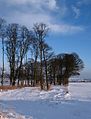 Winter trees - geograph.org.uk - 1628355.jpg 488 × 640; 81 KB
-
 Bluebell wood near Brickyard Cottage - geograph.org.uk - 122017.jpg 467 × 318; 55 KB
-
 Boltby Scar Views - geograph.org.uk - 165533.jpg 640 × 480; 113 KB
-
 Hambleton Hills, North Yorkshire - geograph.org.uk - 33601.jpg 640 × 480; 118 KB
-
 Marrs Beck near Hovingham. - geograph.org.uk - 348757.jpg 480 × 640; 126 KB
-
 Road to Over Silton. - geograph.org.uk - 403302.jpg 640 × 480; 59 KB
-
 Roulston Scar - geograph.org.uk - 165018.jpg 640 × 438; 113 KB
-
 Ryedale and Hawnby - geograph.org.uk - 128260.jpg 640 × 308; 44 KB
-
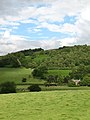
 South Woods - geograph.org.uk - 165476.jpg 640 × 392; 128 KB
-

-
 Stormy skies over Yorkshire - geograph.org.uk - 165484.jpg 531 × 640; 209 KB
-
 Thorodale Lake Hambleton Hills - geograph.org.uk - 324175.jpg 421 × 640; 68 KB
-
 View over South Woods - geograph.org.uk - 144097.jpg 640 × 348; 62 KB
-
 Views from Roulston Scar - geograph.org.uk - 159492.jpg 640 × 480; 153 KB
-
 Views from Roulston Scar - geograph.org.uk - 165049.jpg 480 × 640; 176 KB
-
 Whitestonecliffe - geograph.org.uk - 121532.jpg 560 × 321; 43 KB


