Category:Halton West
Jump to navigation
Jump to search
village in United Kingdom  | |||||
| Upload media | |||||
| Instance of | |||||
|---|---|---|---|---|---|
| Location | Craven, North Yorkshire, Yorkshire and the Humber, England | ||||
 | |||||
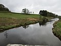
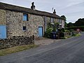
English: Halton West is a village and civil parish in the Craven district of North Yorkshire, England. it is situated on the River Ribble and about 7 miles north of Barnoldswick.
Media in category "Halton West"
The following 90 files are in this category, out of 90 total.
-

-
 Access Lane from Lower Thornber Farm - geograph.org.uk - 3054623.jpg 4,320 × 3,240; 4.71 MB
-

-
 Auld Hall Farm - geograph.org.uk - 3003293.jpg 4,000 × 3,000; 6.92 MB
-
 Barn at Halton West - geograph.org.uk - 3003519.jpg 4,000 × 2,507; 4.75 MB
-
 Benchmark on a gatepost southeast of High Scale - geograph.org.uk - 3140415.jpg 2,048 × 1,536; 608 KB
-
 Boundary stone, Halton West side - geograph.org.uk - 6240462.jpg 1,500 × 2,000; 881 KB
-
 Boundary stone, Wigglesworth side - geograph.org.uk - 6240467.jpg 1,500 × 2,000; 1.02 MB
-
 Bridleway ofn driveway to Lowerhornber - geograph.org.uk - 6240441.jpg 2,000 × 1,500; 1.27 MB
-
 Bridleway towards Pie Cross - geograph.org.uk - 5871355.jpg 640 × 480; 100 KB
-
 Brook Lane at Beggars Hill Plantation - geograph.org.uk - 3140552.jpg 2,048 × 1,536; 550 KB
-
 Brook Lane towards Beggars Hill Plantation - geograph.org.uk - 3140549.jpg 2,048 × 1,536; 655 KB
-
 Brook Lane, Halton West - geograph.org.uk - 3003524.jpg 4,000 × 3,000; 5.4 MB
-
 Carholme Moor - geograph.org.uk - 5092062.jpg 4,617 × 2,637; 1.7 MB
-
 Cottages, Halton West - geograph.org.uk - 5872583.jpg 3,648 × 2,736; 1.99 MB
-
 Cow Hill - geograph.org.uk - 5092061.jpg 4,973 × 2,488; 1.91 MB
-
 Dairy Operations at West Thornber Farm - geograph.org.uk - 3054635.jpg 4,320 × 3,240; 2.51 MB
-
 Dunhazles - geograph.org.uk - 5092050.jpg 3,909 × 3,057; 1.86 MB
-
 Edge of Old Close Plantation - geograph.org.uk - 5872070.jpg 640 × 449; 49 KB
-
 Farm building near Lower Thornber - geograph.org.uk - 5871358.jpg 640 × 480; 97 KB
-
 Farm building, Halton West - geograph.org.uk - 5871395.jpg 640 × 480; 70 KB
-
 Field at Halton West - geograph.org.uk - 3003513.jpg 3,988 × 2,482; 4.26 MB
-
 Field by Long Bank Farm - geograph.org.uk - 3054590.jpg 4,320 × 3,240; 4.21 MB
-
 Footpath between West Thornber and Higher Agden - geograph.org.uk - 3054648.jpg 4,320 × 3,240; 3.9 MB
-
 Gate which doesn't open fully - geograph.org.uk - 3709602.jpg 480 × 640; 121 KB
-
 Ged Beck looking Downstream - geograph.org.uk - 2660060.jpg 4,320 × 3,240; 5.24 MB
-

-
 Grassland towards Worthy Hill - geograph.org.uk - 5871372.jpg 640 × 480; 67 KB
-
 Grassland, Halton West - geograph.org.uk - 5871389.jpg 640 × 480; 54 KB
-
 Halton Bridge - geograph.org.uk - 3057584.jpg 3,264 × 2,448; 2.22 MB
-
 Halton Bridge - geograph.org.uk - 5092047.jpg 5,184 × 3,456; 1.86 MB
-
 Halton West - geograph.org.uk - 143924.jpg 640 × 480; 85 KB
-
 Halton West - geograph.org.uk - 696229.jpg 640 × 427; 38 KB
-
 High Laithe - geograph.org.uk - 3054642.jpg 4,320 × 3,240; 3.12 MB
-
 Lane opposite the boundary stone - geograph.org.uk - 6240472.jpg 2,000 × 1,500; 1.28 MB
-
 Lane to Halton West village - geograph.org.uk - 6240447.jpg 2,000 × 1,500; 1.21 MB
-
 Long Bank Lane - geograph.org.uk - 3054606.jpg 4,320 × 3,240; 3.81 MB
-
 Long Bank Lane - geograph.org.uk - 5871374.jpg 640 × 480; 137 KB
-
 Long Nursery - geograph.org.uk - 5130621.jpg 5,183 × 2,637; 1.97 MB
-
 Low Scale - geograph.org.uk - 3060216.jpg 4,320 × 3,240; 2.7 MB
-
 Low Scale Farm - geograph.org.uk - 3140441.jpg 2,048 × 1,536; 655 KB
-
 Lower Thornber - geograph.org.uk - 5092065.jpg 5,184 × 2,365; 1.88 MB
-
 Lower Thornbur - geograph.org.uk - 5092054.jpg 5,184 × 3,456; 1.84 MB
-
 Masons' marks on Halton Bridge - geograph.org.uk - 2891376.jpg 640 × 480; 193 KB
-
 Minor road towards Bolton-by-Bowland - geograph.org.uk - 5871383.jpg 640 × 480; 101 KB
-
 Minor road towards Halton West - geograph.org.uk - 5871390.jpg 640 × 480; 65 KB
-
 Minor road towards Paythorne Moor - geograph.org.uk - 5871333.jpg 640 × 480; 135 KB
-
 Minor road towards Wigglesworth - geograph.org.uk - 5871364.jpg 640 × 445; 77 KB
-
 Minor road, Halton West - geograph.org.uk - 5872068.jpg 640 × 480; 64 KB
-
 Old Close Plantation - geograph.org.uk - 2660045.jpg 4,320 × 3,240; 4.21 MB
-
 Old Close Plantation - geograph.org.uk - 5091455.jpg 4,527 × 1,718; 1.8 MB
-
 Old Close Plantation - geograph.org.uk - 5091457.jpg 4,266 × 2,120; 1.67 MB
-
 Ordnance Survey Cut Mark - geograph.org.uk - 3057546.jpg 3,264 × 2,448; 2.12 MB
-
 Ordnance Survey Cut Mark - geograph.org.uk - 3057562.jpg 3,264 × 2,448; 2.01 MB
-
 Ordnance Survey Cut Mark - geograph.org.uk - 3057580.jpg 3,264 × 2,448; 2.32 MB
-
 Pennine Bridleway access to Paythorne Moor - geograph.org.uk - 3141742.jpg 2,048 × 1,536; 807 KB
-
 Pennine Bridleway approaching High Scale - geograph.org.uk - 3060205.jpg 4,320 × 3,240; 2.89 MB
-
 Pennine Bridleway east of New House - geograph.org.uk - 3141737.jpg 2,048 × 1,536; 600 KB
-
 River Ribble below Halton Bridge - geograph.org.uk - 2891359.jpg 640 × 480; 125 KB
-
-
 Road signs at the crossroads - geograph.org.uk - 5966220.jpg 1,600 × 900; 627 KB
-
 Rose Cottage and barn - geograph.org.uk - 3003290.jpg 4,000 × 3,000; 6.71 MB
-

-
 Sheep grazing near Pie Cross - geograph.org.uk - 5871329.jpg 640 × 480; 67 KB
-
 Start of footpath north of lane, Halton West - geograph.org.uk - 6240435.jpg 2,000 × 1,500; 1.09 MB
-
 Start of footpath south of lane, Halton West - geograph.org.uk - 6240426.jpg 2,000 × 1,500; 974 KB
-
 Stubble field near Ged Beck Bridge - geograph.org.uk - 5871380.jpg 640 × 480; 86 KB
-
 Telephone box, Halton West - geograph.org.uk - 5872065.jpg 640 × 480; 90 KB
-
 The village of Halton West - geograph.org.uk - 3140560.jpg 2,048 × 1,536; 603 KB
-
 Town End - geograph.org.uk - 5092060.jpg 5,184 × 3,456; 1.77 MB
-
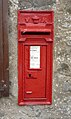 Victorian postbox, Halton West - geograph.org.uk - 5872580.jpg 1,589 × 2,665; 962 KB
-
 Wet field outside Paythorne - geograph.org.uk - 5106441.jpg 1,280 × 960; 1.06 MB
-

-
 Carr Moor Plantation - geograph.org.uk - 143944.jpg 640 × 480; 178 KB
-
 Castle Hill - geograph.org.uk - 357438.jpg 640 × 426; 93 KB
-
 Deep Dale - geograph.org.uk - 357447.jpg 640 × 426; 193 KB
-
 Deep Dale Syke meets the River Ribble - geograph.org.uk - 357429.jpg 640 × 426; 178 KB
-
 Fingerpost for New House - geograph.org.uk - 143932.jpg 640 × 480; 141 KB
-
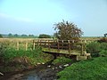 Foot bridge - geograph.org.uk - 261658.jpg 640 × 480; 207 KB
-
 Gate onto Hyles Moor - geograph.org.uk - 143949.jpg 640 × 480; 136 KB
-
 Ged Beck - geograph.org.uk - 261655.jpg 640 × 480; 201 KB
-
 Halton Bridge - geograph.org.uk - 696277.jpg 640 × 427; 46 KB
-
 Halton Bridge and The River Ribble - geograph.org.uk - 631109.jpg 640 × 480; 98 KB
-
 Halton West - geograph.org.uk - 696216.jpg 640 × 427; 52 KB
-
 Halton West - geograph.org.uk - 696331.jpg 640 × 427; 104 KB
-
 Halton West - geograph.org.uk - 706165.jpg 640 × 420; 141 KB
-
 High Scale Farm - geograph.org.uk - 357472.jpg 640 × 426; 139 KB
-
 Long Bank Farm - geograph.org.uk - 164810.jpg 630 × 469; 134 KB
-
 River Ribble - geograph.org.uk - 696247.jpg 640 × 427; 44 KB
-
 River Ribble - geograph.org.uk - 696288.jpg 640 × 427; 57 KB


