Category:Halde Rungenberg
Jump to navigation
Jump to search
| Object location | | View all coordinates using: OpenStreetMap |
|---|
 | |||||
| Upload media | |||||
| Instance of | |||||
|---|---|---|---|---|---|
| Location | Gelsenkirchen, Münster Government Region, North Rhine-Westphalia, Germany | ||||
 | |||||
Subcategories
This category has the following 7 subcategories, out of 7 total.
- Flora of Halde Rungenberg (17 F)
- Fungi of Halde Rungenberg (36 F)
D
N
S
- Schienenplateau (12 F)
V
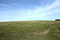
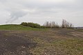
- Views from Halde Rungenberg (47 F)
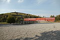
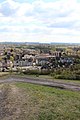
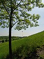
Media in category "Halde Rungenberg"
The following 119 files are in this category, out of 119 total.
-
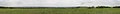
 360° panorama at the Rungenberg-Halde - panoramio (1).jpg 18,603 × 2,212; 22.74 MB
-
 360° panorama at the Rungenberg-Halde - panoramio (2).jpg 18,718 × 2,158; 23.05 MB
-
 360° panorama at the Rungenberg-Halde - panoramio (3).jpg 18,594 × 2,110; 23.91 MB
-
 360° panorama at the Rungenberg-Halde - panoramio.jpg 19,362 × 2,187; 24.38 MB
-
 Bw Hugo2.jpg 2,872 × 2,064; 436 KB
-
 Dream (95730487).jpeg 2,048 × 1,365; 687 KB
-
 Gelsenkirchen - Halde Rungenberg 01 ies.jpg 5,616 × 3,744; 6.6 MB
-
 Gelsenkirchen - Halde Rungenberg 02 ies.jpg 5,616 × 3,744; 11.8 MB
-
 Gelsenkirchen - Halde Rungenberg 03 ies.jpg 5,616 × 3,744; 12.25 MB
-
 Gelsenkirchen - Halde Rungenberg 04 ies.jpg 5,616 × 3,744; 14.86 MB
-
 Gelsenkirchen - Halde Rungenberg 05 ies.jpg 5,616 × 3,744; 13.4 MB
-
 Gelsenkirchen - Halde Rungenberg 06 ies.jpg 5,616 × 3,744; 15.76 MB
-
 Gelsenkirchen - Halde Rungenberg 07 ies.jpg 5,616 × 3,744; 13.42 MB
-
 Gelsenkirchen - Halde Rungenberg 08 ies.jpg 5,616 × 3,744; 12.05 MB
-
 Gelsenkirchen - Halde Rungenberg 09 ies.jpg 5,616 × 3,744; 9.21 MB
-
 Gelsenkirchen - Halde Rungenberg 10 ies.jpg 5,616 × 3,744; 12.32 MB
-
 Gelsenkirchen - Halde Rungenberg 11 ies.jpg 5,616 × 3,744; 11.52 MB
-
 Gelsenkirchen - Halde Rungenberg 13 ies.jpg 5,616 × 3,744; 12.08 MB
-
 Gelsenkirchen - Halde Rungenberg 14 ies.jpg 5,616 × 3,744; 9.43 MB
-
 Gelsenkirchen - Halde Rungenberg 15 ies.jpg 5,616 × 3,744; 11.2 MB
-
 Gelsenkirchen - Halde Rungenberg 17 ies.jpg 5,616 × 3,744; 10.98 MB
-
 Gelsenkirchen - Halde Rungenberg 18 ies.jpg 5,616 × 3,744; 11.59 MB
-
 Gelsenkirchen - Halde Rungenberg 22 ies.jpg 5,616 × 3,744; 9.47 MB
-
 Gelsenkirchen - Halde Rungenberg 32 ies.jpg 5,616 × 3,744; 9.97 MB
-
 Gelsenkirchen - Halde Rungenberg 33 ies.jpg 5,616 × 3,744; 9.91 MB
-
 Gelsenkirchen - Halde Rungenberg 34 ies.jpg 5,616 × 3,744; 13.6 MB
-
 Gelsenkirchen - Heinz-Günter-Breucker-Weg+Halde Rungenberg 01 ies.jpg 5,616 × 3,744; 9.62 MB
-
 Gelsenkirchen - Holthauser Straße - Brücke+Halde Rungenberg 01 ies.jpg 3,744 × 5,616; 7.46 MB
-
 Gelsenkirchen - Holthauser Straße - Brücke+Halde Rungenberg 02 ies.jpg 3,744 × 5,616; 9.5 MB
-
 Gelsenkirchen - Horster Straße + Halde Rungenberg 01 ies.jpg 5,616 × 3,744; 9.4 MB
-
 Gelsenkirchen - Horster Straße - Zeche Hugo 1-4 + Halde Rungenberg 01 ies.jpg 5,616 × 3,744; 9.56 MB
-

-

-
-
 Gelsenkirchen - Horster Straße - Zeche Hugo 1-4-Halde Rungenberg - Lanferbach 01 ies.jpg 3,744 × 5,616; 10.85 MB
-
 Gelsenkirchen - Horster Straße - Zeche Hugo 1-4-Halde Rungenberg - Lanferbach 02 ies.jpg 5,616 × 3,744; 14.74 MB
-
 Gelsenkirchen - Horster Straße - Zeche Hugo 1-4-Halde Rungenberg - Lanferbach 03 ies.jpg 5,616 × 3,744; 14.51 MB
-
 Gelsenkirchen - Kraftwerk Scholven+HaldeOberscholven+Zeche Hugo (Halde Rungenberg) 03 ies.jpg 3,744 × 5,616; 10.57 MB
-
 Gelsenkirchen - Zeche Hugo 2-5-8+Halde Oberscholven (Halde Rungenberg) 01 ies.jpg 5,616 × 3,744; 7.61 MB
-
 Gladbeck (Halde Im Brauck) 03 ies.jpg 18,000 × 3,500; 30.69 MB
-
 Halde rungenberg 1.jpg 1,600 × 1,200; 418 KB
-
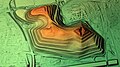 Halde Rungenberg Geländemodell.jpg 1,920 × 1,080; 1.44 MB
-
 Lanferbach Ursprung.jpg 1,944 × 2,896; 3.2 MB
-
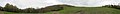
 Scenic view at the Rungenberg-Halde - panoramio (1).jpg 5,184 × 3,456; 8.02 MB
-
 Scenic view at the Rungenberg-Halde - panoramio (10).jpg 5,184 × 3,456; 6.52 MB
-
 Scenic view at the Rungenberg-Halde - panoramio (11).jpg 5,184 × 3,456; 5.78 MB
-
 Scenic view at the Rungenberg-Halde - panoramio (12).jpg 5,184 × 3,456; 5.24 MB
-
 Scenic view at the Rungenberg-Halde - panoramio (13).jpg 5,184 × 3,456; 5.39 MB
-
 Scenic view at the Rungenberg-Halde - panoramio (14).jpg 5,184 × 3,456; 6.06 MB
-
 Scenic view at the Rungenberg-Halde - panoramio (15).jpg 5,184 × 3,456; 6.13 MB
-
 Scenic view at the Rungenberg-Halde - panoramio (16).jpg 5,184 × 3,456; 5.46 MB
-
 Scenic view at the Rungenberg-Halde - panoramio (17).jpg 5,184 × 3,456; 5.39 MB
-
 Scenic view at the Rungenberg-Halde - panoramio (18).jpg 5,184 × 3,456; 6.69 MB
-
 Scenic view at the Rungenberg-Halde - panoramio (19).jpg 5,184 × 3,456; 6 MB
-
 Scenic view at the Rungenberg-Halde - panoramio (2).jpg 5,184 × 3,456; 5.12 MB
-
 Scenic view at the Rungenberg-Halde - panoramio (20).jpg 3,456 × 5,184; 6.99 MB
-
 Scenic view at the Rungenberg-Halde - panoramio (21).jpg 3,456 × 5,184; 6.56 MB
-
 Scenic view at the Rungenberg-Halde - panoramio (22).jpg 3,456 × 5,184; 7.09 MB
-
 Scenic view at the Rungenberg-Halde - panoramio (23).jpg 3,456 × 5,184; 6.63 MB
-
 Scenic view at the Rungenberg-Halde - panoramio (24).jpg 3,456 × 5,184; 6.87 MB
-
 Scenic view at the Rungenberg-Halde - panoramio (25).jpg 3,456 × 5,184; 6.04 MB
-
 Scenic view at the Rungenberg-Halde - panoramio (26).jpg 3,456 × 5,184; 6.18 MB
-
 Scenic view at the Rungenberg-Halde - panoramio (27).jpg 3,456 × 5,184; 6.03 MB
-
 Scenic view at the Rungenberg-Halde - panoramio (28).jpg 3,456 × 5,184; 6.35 MB
-
 Scenic view at the Rungenberg-Halde - panoramio (29).jpg 3,456 × 5,184; 6.14 MB
-
 Scenic view at the Rungenberg-Halde - panoramio (3).jpg 5,184 × 3,456; 5.35 MB
-
 Scenic view at the Rungenberg-Halde - panoramio (30).jpg 3,456 × 5,184; 6.08 MB
-
 Scenic view at the Rungenberg-Halde - panoramio (31).jpg 3,456 × 5,184; 6.25 MB
-
 Scenic view at the Rungenberg-Halde - panoramio (32).jpg 3,456 × 5,184; 5.39 MB
-
 Scenic view at the Rungenberg-Halde - panoramio (34).jpg 5,184 × 3,456; 5.7 MB
-
 Scenic view at the Rungenberg-Halde - panoramio (35).jpg 5,184 × 3,456; 6.17 MB
-
 Scenic view at the Rungenberg-Halde - panoramio (36).jpg 5,184 × 3,456; 5.84 MB
-
 Scenic view at the Rungenberg-Halde - panoramio (37).jpg 5,184 × 3,456; 5.76 MB
-
 Scenic view at the Rungenberg-Halde - panoramio (38).jpg 5,184 × 3,456; 5.94 MB
-
 Scenic view at the Rungenberg-Halde - panoramio (39).jpg 5,184 × 3,456; 6.07 MB
-
 Scenic view at the Rungenberg-Halde - panoramio (4).jpg 5,184 × 3,456; 6.89 MB
-
 Scenic view at the Rungenberg-Halde - panoramio (40).jpg 5,184 × 3,456; 5.74 MB
-
 Scenic view at the Rungenberg-Halde - panoramio (41).jpg 5,184 × 3,456; 6.46 MB
-
 Scenic view at the Rungenberg-Halde - panoramio (42).jpg 5,184 × 3,456; 6.36 MB
-
 Scenic view at the Rungenberg-Halde - panoramio (43).jpg 5,184 × 3,456; 6.82 MB
-
 Scenic view at the Rungenberg-Halde - panoramio (44).jpg 5,184 × 3,456; 6.26 MB
-
 Scenic view at the Rungenberg-Halde - panoramio (45).jpg 5,184 × 3,456; 7.12 MB
-
 Scenic view at the Rungenberg-Halde - panoramio (46).jpg 5,184 × 3,456; 6.25 MB
-
 Scenic view at the Rungenberg-Halde - panoramio (47).jpg 5,184 × 3,456; 6.53 MB
-
 Scenic view at the Rungenberg-Halde - panoramio (48).jpg 5,184 × 3,456; 6.31 MB
-
 Scenic view at the Rungenberg-Halde - panoramio (49).jpg 5,184 × 3,456; 6.73 MB
-
 Scenic view at the Rungenberg-Halde - panoramio (5).jpg 5,184 × 3,456; 7.02 MB
-
 Scenic view at the Rungenberg-Halde - panoramio (50).jpg 5,184 × 3,456; 6.61 MB
-
 Scenic view at the Rungenberg-Halde - panoramio (51).jpg 3,456 × 5,184; 7.01 MB
-
 Scenic view at the Rungenberg-Halde - panoramio (52).jpg 3,456 × 5,184; 6.82 MB
-
 Scenic view at the Rungenberg-Halde - panoramio (53).jpg 3,456 × 5,184; 6.75 MB
-
 Scenic view at the Rungenberg-Halde - panoramio (54).jpg 3,456 × 5,184; 6.83 MB
-
 Scenic view at the Rungenberg-Halde - panoramio (55).jpg 3,456 × 5,184; 7.37 MB
-
 Scenic view at the Rungenberg-Halde - panoramio (6).jpg 5,184 × 3,456; 6.38 MB
-
 Scenic view at the Rungenberg-Halde - panoramio (7).jpg 5,184 × 3,456; 5.85 MB
-
 Scenic view at the Rungenberg-Halde - panoramio (8).jpg 5,184 × 3,456; 7.61 MB
-
 Scenic view at the Rungenberg-Halde - panoramio (9).jpg 5,184 × 3,456; 6.88 MB
-
 Scenic view at the Rungenberg-Halde - panoramio.jpg 5,184 × 3,456; 8.67 MB
-
 Scenic view from the Rungenberg-Halde - panoramio (84).jpg 3,456 × 5,184; 7.84 MB
-
 Scenic view from the Rungenberg-Halde - panoramio (85).jpg 3,456 × 5,184; 7.66 MB
-
 Scenic view from the Rungenberg-Halde - panoramio (86).jpg 3,456 × 5,184; 7.72 MB
-
 Scenic view from the Rungenberg-Halde - panoramio (87).jpg 3,456 × 5,184; 7.74 MB
-
 Scenic view from the Rungenberg-Halde - panoramio (88).jpg 3,456 × 5,184; 6.62 MB
-
 Scenic view from the Rungenberg-Halde - panoramio (89).jpg 3,456 × 5,184; 7.34 MB
-
 Scenic view from the Rungenberg-Halde - panoramio (90).jpg 3,456 × 5,184; 7.28 MB
-
 Scenic view from the Rungenberg-Halde - panoramio (91).jpg 3,456 × 5,184; 8.12 MB
-
 Scenic view from the Rungenberg-Halde - panoramio (92).jpg 3,456 × 5,184; 8.76 MB
-
 Scenic view from the Rungenberg-Halde - panoramio (93).jpg 3,456 × 5,184; 6.28 MB
-
 Scenic view from the Rungenberg-Halde - panoramio (94).jpg 3,456 × 5,184; 8.97 MB
-
 Scenic view from the Rungenberg-Halde - panoramio.jpg 9,469 × 3,556; 22.02 MB
-
 Schachtzeichen29931.jpg 2,592 × 3,456; 3.03 MB
-
 Schachtzeichen29940.jpg 3,456 × 2,592; 1.81 MB
-
 Schachtzeichen29960.jpg 3,456 × 2,592; 1.25 MB
-
 Schachtzeichen29970.jpg 3,456 × 2,592; 1.87 MB
-
 Schachtzeichen30019.jpg 2,592 × 3,456; 1.75 MB
-
 Top of the Rungenberg-Halde - panoramio (1).jpg 5,184 × 3,456; 10.58 MB
-
 Top of the Rungenberg-Halde - panoramio.jpg 5,184 × 3,456; 10.81 MB
-
 View of Buer from the Rungenberg-Halde - panoramio.jpg 10,883 × 4,536; 20.96 MB
-
 View South from the Rungenberg-Halde - panoramio.jpg 14,645 × 2,770; 24.58 MB

.jpeg)


_03_ies.jpg)
_01_ies.jpg)


.jpg)
.jpg)
.jpg)
.jpg)
.jpg)
.jpg)
.jpg)
.jpg)
.jpg)
.jpg)
.jpg)
.jpg)
.jpg)
.jpg)
.jpg)
.jpg)
.jpg)
.jpg)
.jpg)
.jpg)
.jpg)
.jpg)
.jpg)
.jpg)
.jpg)
.jpg)
.jpg)
.jpg)
.jpg)
.jpg)
.jpg)
.jpg)
.jpg)
.jpg)
.jpg)
.jpg)
.jpg)
.jpg)
.jpg)
.jpg)
.jpg)
.jpg)
.jpg)
.jpg)
.jpg)
.jpg)
.jpg)
.jpg)
.jpg)
.jpg)
.jpg)
.jpg)
.jpg)
.jpg)

.jpg)
.jpg)
.jpg)
.jpg)
.jpg)
.jpg)
.jpg)
.jpg)
.jpg)
.jpg)
.jpg)


.jpg)


.jpg)
.jpg)
.jpg)
_03_ies.jpg)