Category:Halde Prosperstraße
Jump to navigation
Jump to search
| Object location | | View all coordinates using: OpenStreetMap |
|---|
_02_ies.jpg) | |||||
| Upload media | |||||
| Instance of | |||||
|---|---|---|---|---|---|
| Location | Bottrop, Münster Government Region, North Rhine-Westphalia, Germany | ||||
 | |||||
Subcategories
This category has the following 2 subcategories, out of 2 total.
A
V
- Views from Halde Prosperstraße (40 F)
Media in category "Halde Prosperstraße"
The following 15 files are in this category, out of 15 total.
-
 Ausblick vom Gasometer Oberhausen am 23 08 2012 mit Sicht zum Tetraeder Bottrop.JPG 4,288 × 3,216; 3.07 MB
-
 Bottrop - Halde Prosperstraße 01 ies.jpg 5,616 × 3,744; 6.95 MB
-
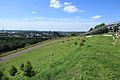 Bottrop - Halde Prosperstraße 02 ies.jpg 5,616 × 3,744; 7.6 MB
-

-
 Bottrop - Halde Prosperstraße+Kokerei Prosper (Tetraeder) 01 ies.jpg 5,616 × 3,744; 6.68 MB
-
 Bottrop - Halde Prosperstraße+Kokerei Prosper (Tetraeder) 02 ies.jpg 5,616 × 3,744; 8.13 MB
-
 Bottrop - Prosperstraße (Halde Prosperstraße ) 01 ies.jpg 5,616 × 3,744; 7.86 MB
-
 Bottrop - Prosperstraße+Halde Prosperstraße 01 ies.jpg 5,616 × 3,744; 7.73 MB
-

-
 Gladbeck-Bottrop - Halde Prosperstraße+Knappenhalde+Halde Beckstraße (Halde 22) 01 ies.jpg 5,616 × 3,744; 8.36 MB
-

-
 Halde Prosperstraße Geländemodell.jpg 1,920 × 1,080; 1.36 MB
-
 TetraederAliens 09.jpg 3,264 × 2,448; 2.17 MB
-
 TetraederAliens 21.jpg 3,264 × 2,448; 2.19 MB
-
 Travelshirt Tetraeder4645.jpg 3,456 × 2,592; 4.26 MB


_01.jpg)
_01_ies.jpg)
_01_ies.jpg)

_01_ies.jpg)
_01_ies.jpg)
_01_ies.jpg)


