Category:Hármashatárhegy Airfield
Jump to navigation
Jump to search
Magyar: Hármas-Határ Hegyi Repülőtér. - Budapest, II. kerület, Kővár (városrész), Arad utca 9.
 | |||||
| Upload media | |||||
| Instance of | |||||
|---|---|---|---|---|---|
| Location |
| ||||
 | |||||
Subcategories
This category has the following 9 subcategories, out of 9 total.
1
- 1957 at Hármashatárhegy Airfield (14 F)
- 1964 at Hármashatárhegy Airfield (36 F)
- 1966 at Hármashatárhegy Airfield (17 F)
- 1967 at Hármashatárhegy Airfield (14 F)
H
Media in category "Hármashatárhegy Airfield"
The following 49 files are in this category, out of 49 total.
-

-
 Déli fedett lépcső, vitorlázó repülőtér, 2017 Hűvösvölgy.jpg 2,272 × 1,704; 982 KB
-

-
 Motoros akrobaták. Fortepan 10680.jpg 4,002 × 3,613; 8.92 MB
-
-
 Rubik R-22 Június 18 típusú vitorlázó repülőgép. Fortepan 29789.jpg 4,554 × 2,896; 9.62 MB
-
 Csörlő. Fortepan 29795.jpg 4,434 × 2,806; 9.73 MB
-
 Rubik R-15 Koma vitorlázó repülőgép. Fortepan 29806.jpg 4,869 × 2,942; 9.41 MB
-
 Rubik R-22 Laminár 18 vitorlázó repülőgép. Fortepan 29808.jpg 4,483 × 2,828; 9.1 MB
-

-

-
 Jancsó-Szokolay M-22 - Fortepan 31172.jpg 4,993 × 3,737; 9.01 MB
-
 Jancsó-Szokolay M-22 - Fortepan 31173.jpg 3,660 × 4,619; 6.98 MB
-
 Jancsó-Szokolay M-22 vitorlázó repülőgép. Fortepan 31174.jpg 3,756 × 3,085; 6.1 MB
-
 Rubik R-08c Pilis típusú vitorlázó repülőgép a felső hangár előtt. Fortepan 31176.jpg 5,010 × 3,724; 8.24 MB
-
 Rubik R-08c Pilis típusú vitorlázó repülőgép a felső hangár előtt. Fortepan 31177.jpg 5,040 × 3,730; 7.33 MB
-
 Jancsó-Szokolay M-22 típusú vitorlázó repülőgépek. Fortepan 31180.jpg 5,098 × 3,650; 7.84 MB
-
 Jancsó-Szokolay M-22 típusú vitorlázó repülőgép. Fortepan 31181.jpg 4,834 × 3,482; 9.4 MB
-
 Jancsó-Szokolay M-22 - Fortepan 31182.jpg 5,151 × 3,696; 8.49 MB
-

-

-
-
 Durucz Jenő (MALÉV-kapitány) oktató eligazítást tart. Fortepan 31262.jpg 4,803 × 3,226; 9.6 MB
-
 Durucz Jenő (MALÉV-kapitány) oktató eligazítást tart. Fortepan 31263.jpg 4,735 × 2,949; 9.5 MB
-
 Hungary, Budapest II., Hármashatárhegy Airport Fortepan 31264.jpg 5,172 × 3,203; 9.71 MB
-
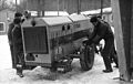 Toldi csörlőaggregátor. Fortepan 31265.jpg 4,672 × 2,956; 9.17 MB
-
 Hóeltakarítás a hangár előtt. Fortepan 31266.jpg 5,129 × 3,250; 9.18 MB
-
 Vitorlázó repülőgép szállítókocsi és a Toldi csörlőaggregátor. Fortepan 31288.jpg 4,875 × 3,073; 9.38 MB
-
 Toldi csörlőaggregátor. Fortepan 31289.jpg 5,172 × 3,300; 9.21 MB
-
 Polikarpov Po-2 típusú repülőgép. Fortepan 31291.jpg 5,576 × 3,661; 8.75 MB
-
 Polikarpov Po-2 típusú repülőgép. Fortepan 31292.jpg 4,710 × 2,972; 8.98 MB
-
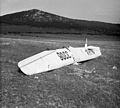
 SZD-22C Mucha vitorlázó repülőgép. Fortepan 31293.jpg 4,695 × 2,926; 9.14 MB
-
 SZD-22C Mucha vitorlázó repülőgép. Fortepan 31294.jpg 4,879 × 3,108; 9.25 MB
-
 Aggregátor szerelés a hangár előtt. Fortepan 31372.jpg 4,864 × 3,063; 9.45 MB
-
 Aggregátor szerelés a hangár előtt. Fortepan 31373.jpg 4,519 × 3,160; 9.35 MB
-
-

-
 Hatarhegyreptercivertanlegi1.jpg 363 × 450; 66 KB
-
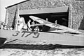
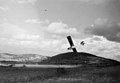
 Hármashatárhegy Airfield 01.JPG 1,024 × 680; 577 KB
-
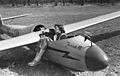
 Hármashatárhegy Airfield 02.JPG 1,024 × 681; 494 KB
-
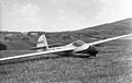
 Hármashatárhegy Airfield 03.JPG 1,024 × 680; 478 KB
-
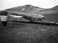
 Hármashatárhegy Airfield 04.JPG 1,024 × 680; 473 KB
-
 Hármashatárhegy Airfield 05.JPG 1,024 × 680; 527 KB
-
 Hármashatárhegy Airfield 06.JPG 1,024 × 679; 468 KB
-
 Hármashatárhegyi reptér látképe - panoramio.jpg 3,122 × 1,080; 1.09 MB
-
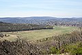
 Hármashatárhegyi repülőtér a Homok-hegyről.jpg 4,160 × 3,120; 4.66 MB
-

-
 Repülő.JPG 2,048 × 1,536; 697 KB
-
 Újlaki-hegy kilátás.jpg 4,608 × 2,592; 5.46 MB


._Rubik_R-08c_Pilis_vitorl%C3%A1z%C3%B3_rep%C3%BCl%C5%91g%C3%A9p._Fortepan_31171.jpg)


_oktat%C3%B3_eligaz%C3%ADt%C3%A1st_tart._Fortepan_31262.jpg)
_oktat%C3%B3_eligaz%C3%ADt%C3%A1st_tart._Fortepan_31263.jpg)


