Category:Gunthorpe, Nottinghamshire
Jump to navigation
Jump to search
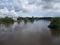
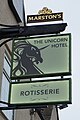
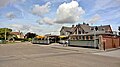
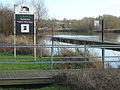
English: Gunthorpe is a small village outside of Nottingham, England. Gunthorpe Bridge is the only bridge over the River Trent between Newark and Nottingham. Gunthorpe is in the Newark and Sherwood district. Gunthorpe also has 4 pubs/restaurants. The Anchor, Tom Browns, The Unicorn and The Toll House. There is a caravan centre called Lowdham Leisureworld, a car sales garage called David Fuller Cars, and a van rental garage called AVR.
village and civil parish outside of Nottingham, England  | |||||
| Upload media | |||||
| Instance of | |||||
|---|---|---|---|---|---|
| Location | Newark and Sherwood, Nottinghamshire, East Midlands, England | ||||
 | |||||
Subcategories
This category has the following 6 subcategories, out of 6 total.
Media in category "Gunthorpe, Nottinghamshire"
The following 147 files are in this category, out of 147 total.
-
 A6097 with premature sign, Lowdham - geograph.org.uk - 3713818.jpg 1,024 × 768; 129 KB
-
 A612, Nottingham Road at Bulcote - geograph.org.uk - 5054927.jpg 3,072 × 1,728; 3.4 MB
-
 Alchemy at Gunthorpe - copper transmuting to gold - geograph.org.uk - 6320984.jpg 1,280 × 1,280; 725 KB
-
 Approaching Gunthorpe Lock and Weir - geograph.org.uk - 5056126.jpg 800 × 600; 128 KB
-
 Bilingual sign, Gunthorpe Lock - geograph.org.uk - 6320980.jpg 967 × 1,289; 411 KB
-

-
 Boats moored next to Gunthorpe Lock - geograph.org.uk - 4887476.jpg 800 × 524; 141 KB
-
 Boom at Gunthorpe Lock - geograph.org.uk - 5102869.jpg 1,600 × 1,064; 543 KB
-
 Breaking the soil - geograph.org.uk - 1551520.jpg 640 × 479; 162 KB
-
 Breaking the soil - geograph.org.uk - 1551523.jpg 640 × 426; 167 KB
-
 Bridge and Bayleaf, Gunthorpe - geograph.org.uk - 6320978.jpg 1,280 × 960; 253 KB
-
 Bridge and Pipe - geograph.org.uk - 1026103.jpg 640 × 480; 93 KB
-
 Bridleway alongside the Trent east of Gunthorpe - geograph.org.uk - 5214199.jpg 1,024 × 768; 135 KB
-
 Bridleway by the Trent - geograph.org.uk - 6330707.jpg 1,024 × 768; 221 KB
-

-
 Bus turning circle, Gunthorpe - geograph.org.uk - 3713762.jpg 1,024 × 768; 182 KB
-
 Bypass and old road, Lowdham - geograph.org.uk - 3713824.jpg 1,024 × 768; 122 KB
-
 Church of St John the Baptist, Gunthorpe - geograph.org.uk - 3713781.jpg 1,024 × 768; 143 KB
-
 Cocker Beck outlet - geograph.org.uk - 1551549.jpg 640 × 479; 184 KB
-
 Cows may safely graze - geograph.org.uk - 5056815.jpg 2,841 × 1,109; 2.16 MB
-
 Cruising with Dignity - geograph.org.uk - 5056834.jpg 3,038 × 1,664; 3.61 MB
-
 Davids Lane, Gunthorpe - geograph.org.uk - 3713770.jpg 1,024 × 768; 100 KB
-
 Dover Beck east of Caythorpe - geograph.org.uk - 5214212.jpg 1,024 × 768; 334 KB
-
 Entering Gunthorpe Lock on the River Trent - geograph.org.uk - 5104548.jpg 1,600 × 1,064; 459 KB
-
 Evening at Gunthorpe - geograph.org.uk - 1613683.jpg 640 × 410; 86 KB
-
 Evening at Gunthorpe - geograph.org.uk - 1613689.jpg 640 × 479; 135 KB
-
 Evening at Gunthorpe Marina - geograph.org.uk - 1613678.jpg 640 × 424; 67 KB
-
 Farmland and pylons near Lowdham (1) - geograph.org.uk - 3713805.jpg 1,024 × 768; 114 KB
-
 Farmland and pylons near Lowdham (2) - geograph.org.uk - 3713811.jpg 1,024 × 768; 141 KB
-
 Farmland, Gunthorpe - geograph.org.uk - 1758339.jpg 640 × 480; 88 KB
-
 Fishing Pond - geograph.org.uk - 2012128.jpg 640 × 480; 177 KB
-
 Footbridge just on the edge of Caythorpe - geograph.org.uk - 1046289.jpg 640 × 480; 131 KB
-
 Footpath north to Caythorpe - geograph.org.uk - 956115.jpg 640 × 480; 121 KB
-
 Former chapel, Gunthorpe - geograph.org.uk - 6330693.jpg 1,024 × 768; 208 KB
-
 Gate along the Trent Valley Way - geograph.org.uk - 4887460.jpg 800 × 573; 103 KB
-
 Gate next to the Trent east of Gunthorpe - geograph.org.uk - 5214197.jpg 1,024 × 768; 184 KB
-
 Grange Farm, near Gunthorpe - geograph.org.uk - 3713799.jpg 1,024 × 768; 197 KB
-

-
-

-
 Gunthorpe Hall - geograph.org.uk - 1551543.jpg 479 × 640; 240 KB
-
 Gunthorpe Hall - geograph.org.uk - 1551555.jpg 640 × 479; 147 KB
-
 Gunthorpe lock and weir - geograph.org.uk - 5055653.jpg 3,046 × 1,682; 3.7 MB
-
 Gunthorpe Lock on the R Trent at Gunthorpe - geograph.org.uk - 6006871.jpg 5,184 × 2,920; 4.41 MB
-
 Gunthorpe mooring - geograph.org.uk - 2140148.jpg 640 × 480; 96 KB
-
 Gunthorpe next to the River Trent - geograph.org.uk - 4869034.jpg 800 × 555; 95 KB
-
 Gunthorpe Primary School - geograph.org.uk - 5102839.jpg 1,600 × 1,064; 324 KB
-
 Gunthorpe toll house - geograph.org.uk - 2140144.jpg 640 × 480; 92 KB
-
 Gunthorpe village sign - geograph.org.uk - 3933033.jpg 1,280 × 960; 363 KB
-
 Gunthorpe Weir - geograph.org.uk - 5104563.jpg 1,600 × 1,064; 473 KB
-
 Gunthorpe Weir - geograph.org.uk - 6320982.jpg 1,280 × 919; 433 KB
-
 Hazelas Drive - geograph.org.uk - 1551535.jpg 640 × 479; 97 KB
-

-
 Hedgerow near Gunthorpe - geograph.org.uk - 1551526.jpg 640 × 479; 162 KB
-
 High water at Gunthorpe - geograph.org.uk - 1613669.jpg 640 × 479; 76 KB
-
 High water at Gunthorpe - geograph.org.uk - 1613673.jpg 640 × 479; 77 KB
-
 Houses on Trentside in Gunthorpe - geograph.org.uk - 4887489.jpg 800 × 547; 111 KB
-
 Humbrian Sea at Gunthorpe Lock - geograph.org.uk - 5054917.jpg 3,038 × 1,664; 3.47 MB
-
 Italian restaurant, Main Street, Gunthorpe - geograph.org.uk - 2647120.jpg 3,648 × 2,736; 4.69 MB
-
 Lads' day out - geograph.org.uk - 1395553.jpg 640 × 480; 95 KB
-
 Lane near Gunthorpe - geograph.org.uk - 3713802.jpg 1,024 × 768; 286 KB
-
 Lane to Glebe Farm - geograph.org.uk - 1551528.jpg 640 × 479; 114 KB
-
 Lowdhams Leisureworld - geograph.org.uk - 5056109.jpg 800 × 599; 87 KB
-
 Main Street, Gunthorpe - geograph.org.uk - 1551541.jpg 640 × 479; 163 KB
-
 Main Street, Gunthorpe - geograph.org.uk - 1551545.jpg 640 × 479; 146 KB
-
 Main Street, Gunthorpe - geograph.org.uk - 1758325.jpg 640 × 480; 84 KB
-
 Main Street, Gunthorpe - geograph.org.uk - 1758335.jpg 640 × 480; 92 KB
-
 Main Street, Gunthorpe - geograph.org.uk - 2647123.jpg 3,648 × 2,736; 4.5 MB
-
 Main Street, Gunthorpe - geograph.org.uk - 5055644.jpg 3,068 × 1,720; 2.93 MB
-

-
 Marlock House Farm - geograph.org.uk - 1758345.jpg 640 × 480; 80 KB
-
 Migrating picnic tables, Gunthorpe - geograph.org.uk - 6320976.jpg 1,280 × 960; 556 KB
-
 Mock Tudor semi at corner of fields - geograph.org.uk - 2647146.jpg 3,648 × 2,736; 5.48 MB
-
 Moorings near Gunthorpe Bridge - geograph.org.uk - 1567961.jpg 640 × 427; 60 KB
-
 Moorings on the River Trent above Gunthorpe Lock - geograph.org.uk - 5104539.jpg 1,600 × 1,064; 380 KB
-
 Moorings on the River Trent at Gunthorpe - geograph.org.uk - 5056122.jpg 800 × 600; 103 KB
-
 Narrowboat on the River Trent - geograph.org.uk - 5056144.jpg 800 × 600; 125 KB
-

-
 New notice at Gunthorpe Lock - geograph.org.uk - 6320983.jpg 1,280 × 960; 332 KB
-
 Nice gate - geograph.org.uk - 5055642.jpg 3,072 × 1,728; 4.66 MB
-
 North end of Main Street, Gunthorpe - geograph.org.uk - 3713791.jpg 1,024 × 768; 144 KB
-
 Not a place to nod off^ - geograph.org.uk - 1074214.jpg 640 × 480; 66 KB
-
 Old brick barn with corrugated iron roof addition - geograph.org.uk - 2647128.jpg 3,648 × 2,736; 4.89 MB
-
 Old gravel workings near Gunthorpe - geograph.org.uk - 652884.jpg 640 × 480; 104 KB
-
 Old Hill next to the River Trent - geograph.org.uk - 4887322.jpg 800 × 552; 135 KB
-
 On Peck Lane - geograph.org.uk - 1551534.jpg 640 × 479; 116 KB
-
 Paddle gear on Gunthorpe lock - geograph.org.uk - 652504.jpg 433 × 640; 101 KB
-
 Peacock Close, Gunthorpe - geograph.org.uk - 3713765.jpg 1,024 × 768; 122 KB
-
 Peck Lane - geograph.org.uk - 1551538.jpg 640 × 479; 170 KB
-
 Peck Lane leading out of Gunthorpe - geograph.org.uk - 956130.jpg 640 × 480; 68 KB
-
 Peck Lane, Gunthorpe - geograph.org.uk - 3713774.jpg 1,024 × 768; 162 KB
-
 Power lines across the Trent south of Caythorpe - geograph.org.uk - 5214202.jpg 1,024 × 768; 105 KB
-

-
 Ragwort by the River Trent - geograph.org.uk - 5055654.jpg 3,072 × 1,728; 5.26 MB
-
 Remains of former Gunthorpe Toll Bridge - geograph.org.uk - 955984.jpg 640 × 480; 124 KB
-
 Remains of former Gunthorpe Toll Bridge - geograph.org.uk - 956029.jpg 640 × 480; 121 KB
-
 River scene at Gunthorpe - geograph.org.uk - 6320977.jpg 1,280 × 899; 537 KB
-
 River Trent from Gunthorpe Bridge - geograph.org.uk - 1758314.jpg 640 × 480; 71 KB
-

-
 River Trent near Gunthorpe Bridge - geograph.org.uk - 4869015.jpg 800 × 560; 134 KB
-
 River Trent south of Caythorpe - geograph.org.uk - 5214207.jpg 1,024 × 768; 110 KB
-
 Riverside bridleway, Gunthorpe - geograph.org.uk - 6320989.jpg 1,280 × 960; 519 KB
-
 Riverside bridleway, Gunthorpe - geograph.org.uk - 6320991.jpg 1,280 × 960; 644 KB
-
 Riverside car park at Gunthorpe - geograph.org.uk - 6320987.jpg 1,280 × 957; 275 KB
-
 Riverside car park at Gunthorpe - geograph.org.uk - 6320988.jpg 1,280 × 960; 437 KB
-
 Riverside car park at Gunthorpe - geograph.org.uk - 6320990.jpg 1,280 × 960; 415 KB
-
 Scrubland near Gunthorpe - geograph.org.uk - 1551578.jpg 640 × 479; 143 KB
-
 Stream Crossed by Two Pipes - geograph.org.uk - 1026107.jpg 480 × 640; 140 KB
-
 Sunlight under the larches - geograph.org.uk - 6320981.jpg 1,280 × 960; 555 KB
-
 The boom at Gunthorpe weir - geograph.org.uk - 653289.jpg 460 × 626; 121 KB
-
 The green at Gunthorpe - geograph.org.uk - 6320975.jpg 1,280 × 960; 331 KB
-
 The green at Gunthorpe - geograph.org.uk - 6320985.jpg 1,280 × 960; 614 KB
-
 The River Trent - geograph.org.uk - 1395637.jpg 640 × 427; 96 KB
-
 The River Trent - geograph.org.uk - 5056134.jpg 800 × 600; 107 KB
-
 The River Trent north of Gunthorpe Lock - geograph.org.uk - 5056130.jpg 800 × 600; 193 KB
-
 The tail of Gunthorpe Weir - geograph.org.uk - 6320979.jpg 1,280 × 960; 399 KB
-
 The Trent below Gunthorpe Bridge - geograph.org.uk - 956020.jpg 640 × 480; 46 KB
-
 The Trent below Gunthorpe Lock - geograph.org.uk - 1398798.jpg 640 × 427; 127 KB
-
 The Unicorn at Gunthorpe (geograph 6320994).jpg 1,280 × 960; 285 KB
-
 The Unicorn Hotel - geograph.org.uk - 3789308.jpg 640 × 480; 30 KB
-
 The Unicorn Hotel - geograph.org.uk - 5056116.jpg 800 × 600; 122 KB
-
 The Unicorn Hotel, Gunthorpe - geograph.org.uk - 4966660.jpg 1,600 × 1,065; 516 KB
-
 The Unicorn Hotel, Gunthorpe - geograph.org.uk - 4966665.jpg 1,600 × 1,065; 426 KB
-
 The Unicorn Hotel, Gunthorpe - geograph.org.uk - 4966667.jpg 1,065 × 1,600; 389 KB
-
 The Unicorn Hotel, Gunthorpe - geograph.org.uk - 5055648.jpg 3,072 × 1,728; 3.54 MB
-
 Tom Brown's Brasserie, Gunthorpe - geograph.org.uk - 5055652.jpg 3,072 × 1,728; 2.9 MB
-
 Tom Browns Brasserie, Gunthorpe - geograph.org.uk - 4966680.jpg 1,600 × 1,018; 611 KB
-
 Tom Browns Brasserie, Gunthorpe - geograph.org.uk - 652814.jpg 640 × 480; 77 KB
-
 Track to Marlock House Farm - geograph.org.uk - 4879490.jpg 800 × 541; 156 KB
-
 Trent Valley Way - geograph.org.uk - 956046.jpg 640 × 480; 127 KB
-
 Trent Valley Way along the River Trent - geograph.org.uk - 4887310.jpg 800 × 464; 100 KB
-
 Trent Valley Way east of Caythorpe - geograph.org.uk - 5214216.jpg 1,024 × 768; 139 KB
-
 Welcome to Gunthorpe Visitor Moorings - geograph.org.uk - 6320974.jpg 1,280 × 922; 474 KB
-
 Wild flower set-aside in fields near Gunthorpe - geograph.org.uk - 2647141.jpg 3,648 × 2,736; 6.41 MB
-
 Willow by the Trent - geograph.org.uk - 653283.jpg 630 × 460; 101 KB
-
 Winter cereal - geograph.org.uk - 1551525.jpg 640 × 479; 145 KB
-
 Gate but no fence - geograph.org.uk - 711557.jpg 640 × 480; 66 KB
-
 Gunthorpe Marina - geograph.org.uk - 652832.jpg 640 × 480; 91 KB
-
 Gunthorpe Marina - geograph.org.uk - 652833.jpg 640 × 480; 96 KB
-
 Gunthorpe Marina - geograph.org.uk - 652948.jpg 640 × 480; 73 KB
-
 Gunthorpe riverside - geograph.org.uk - 652821.jpg 640 × 480; 117 KB
-
 Gunthorpe Visitor moorings - geograph.org.uk - 652817.jpg 640 × 480; 110 KB
-
 Main Street, Gunthorpe - geograph.org.uk - 652805.jpg 631 × 446; 66 KB
-
 Riverside path at Gunthorpe. - geograph.org.uk - 652829.jpg 640 × 480; 121 KB
-
 Rough grazing in the Trent Valley - geograph.org.uk - 652888.jpg 640 × 480; 89 KB
-
 The old Gunthorpe Toll bridge - geograph.org.uk - 652938.jpg 640 × 480; 152 KB
-


_-_geograph.org.uk_-_3713805.jpg)
_-_geograph.org.uk_-_3713811.jpg)


.jpg)


