Category:Grimethorpe
Jump to navigation
Jump to search
English: Grimethorpe is a large village which is part of the metropolitan borough of Barnsley in South Yorkshire, England. It has a population of 1,873.
Italiano: Grimethorpe è un paese di 1.900 abitanti della contea del South Yorkshire, in Inghilterra.
village in South Yorkshire, UK  | |||||
| Upload media | |||||
| Instance of | |||||
|---|---|---|---|---|---|
| Location | Barnsley, South Yorkshire, Yorkshire and the Humber, England | ||||
 | |||||
Subcategories
This category has the following 4 subcategories, out of 4 total.
Media in category "Grimethorpe"
The following 51 files are in this category, out of 51 total.
-
-
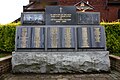 CollieryMemorial.jpg 4,272 × 2,848; 2.96 MB
-
 DellPools.jpg 2,816 × 2,112; 2.94 MB
-
 FerrymoorPool.png 2,809 × 2,107; 9.26 MB
-

-
 FromPark-NE.jpg 2,816 × 2,112; 2.76 MB
-

-
 Ginny-1.jpg 2,816 × 2,112; 2.7 MB
-
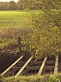
 Graffiti on a former rail bridge - geograph.org.uk - 1135876.jpg 640 × 480; 103 KB
-

-
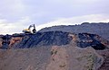
 Grimethorpe 'muck' stack remediation - geograph.org.uk - 481951.jpg 640 × 193; 61 KB
-
 Grimethorpe bypass. - geograph.org.uk - 493068.jpg 640 × 453; 106 KB
-
 Grimethorpe Cemetery - geograph.org.uk - 117729.jpg 640 × 480; 98 KB
-

-
 Grimethorpe Sewerage Works - geograph.org.uk - 117731.jpg 640 × 480; 91 KB
-

-

-
 New factory for Symphony kitchens. - geograph.org.uk - 522824.jpg 640 × 480; 82 KB
-

-

-
 NUM R.I.P. - geograph.org.uk - 1490742.jpg 640 × 480; 88 KB
-
 ParkPooltowardsStLukes.jpg 2,809 × 2,107; 1.85 MB
-
 Poppies at twilight - geograph.org.uk - 842239.jpg 640 × 480; 77 KB
-

-
 Roadside flora at Sunset - geograph.org.uk - 837996.jpg 640 × 537; 73 KB
-
 Sunrise at Grimethorpe.JPG 6,000 × 4,000; 14.51 MB
-
 The face - geograph.org.uk - 1490735.jpg 640 × 436; 80 KB
-
 The Green Sash - geograph.org.uk - 584047.jpg 640 × 318; 69 KB
-
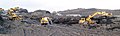
 The remediation goes on. - geograph.org.uk - 522823.jpg 640 × 414; 76 KB
-

-
 Who combed that field - geograph.org.uk - 597413.jpg 640 × 312; 143 KB
-
 Willowgarth High School - geograph.org.uk - 117726.jpg 625 × 459; 61 KB
-
 WoodAcrossGrimethorpe.png 2,816 × 2,112; 11.45 MB
-
 Autumn in Howell Wood - geograph.org.uk - 597422.jpg 640 × 553; 131 KB
-

-
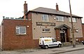 Bullet sports and social club - geograph.org.uk - 584068.jpg 640 × 413; 99 KB
-
 Burntwood Court signage. - geograph.org.uk - 555951.jpg 605 × 640; 147 KB
-
 Caution Archery Area^ - geograph.org.uk - 597417.jpg 640 × 480; 140 KB
-
 Close up of coal mining shaft wheel - geograph.org.uk - 601940.jpg 640 × 506; 165 KB
-
 Common Road, Brierley - geograph.org.uk - 438343.jpg 640 × 480; 88 KB
-
 Cordeux Corner - geograph.org.uk - 438324.jpg 640 × 480; 109 KB
-
 Elm Farm House - geograph.org.uk - 438307.jpg 640 × 480; 129 KB
-
 Engine Lane - geograph.org.uk - 584044.jpg 640 × 480; 81 KB
-
 Entrance to Burntwood Court - geograph.org.uk - 601935.jpg 640 × 381; 51 KB
-

-
 Private road to West Haigh farm. - geograph.org.uk - 555944.jpg 640 × 301; 71 KB
-
 Rebuilding the 'Seaside' estate - geograph.org.uk - 584057.jpg 640 × 480; 116 KB
-
 Regeneration. - geograph.org.uk - 506332.jpg 640 × 396; 87 KB
-
 The edge of Houghton Common. - geograph.org.uk - 561620.jpg 640 × 480; 174 KB
-
 The lake in Howell Wood - geograph.org.uk - 597437.jpg 640 × 435; 117 KB
-
 Violet Farm House - geograph.org.uk - 438332.jpg 640 × 480; 90 KB


