Category:Grieshorn
Jump to navigation
Jump to search
|
Grieshorn has an entry on OpenStreetMap (show). |
mountain shared by Switzerland and Italy  | |||||
| Upload media | |||||
| Instance of | |||||
|---|---|---|---|---|---|
| Location | Bedretto, Airolo Subdistrict, Leventina District, Ticino, Switzerland | ||||
| Mountain range | |||||
| Topographic prominence |
| ||||
| Elevation above sea level |
| ||||
| Parent peak | |||||
 | |||||
Media in category "Grieshorn"
The following 4 files are in this category, out of 4 total.
-
 Corno Gries.JPG 2,048 × 1,536; 1.42 MB
-

-
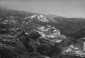 ETH-BIB-Ägenetal, Blick Südosten Basòdino-LBS H1-018952.tif 6,723 × 4,692; 90.37 MB
-
 Up, skiing to the summit! (33993397211).jpg 5,488 × 3,664; 1.25 MB
.jpg)