Category:Great Waldingfield
Jump to navigation
Jump to search
English: Great Waldingfield is a village and civil parish in the Babergh district of Suffolk, England about two miles (3 km) north-east of Sudbury and two miles (3 km) south-west of its sister village, Little Waldingfield. The village is split into two separate parts; the older and smaller part around the St. Lawrence Church, and the newer and larger section along the B1115 road between Sudbury and Hadleigh. Most of the houses in the newer section were built after World War II, including much council housing. The population is estimated to be 1,460.[1]
village and civil parish in Suffolk, UK  | |||||
| Upload media | |||||
| Instance of | |||||
|---|---|---|---|---|---|
| Location | Babergh, Suffolk, East of England, England | ||||
 | |||||
- ↑ Cite error: Invalid
<ref>tag; no text was provided for refs namedpopulation
Subcategories
This category has the following 6 subcategories, out of 6 total.
Media in category "Great Waldingfield"
The following 89 files are in this category, out of 89 total.
-
 B1071 near Upsher Green - geograph.org.uk - 3856247.jpg 640 × 480; 289 KB
-
 B1071 south of Red House Farm - geograph.org.uk - 3583279.jpg 3,648 × 2,736; 1.28 MB
-
 B1071 southwest of Brandeston Hall - geograph.org.uk - 3583272.jpg 3,648 × 2,736; 1.37 MB
-
 B1071 southwest of Elm Tree Farm - geograph.org.uk - 3584278.jpg 3,648 × 2,736; 1.41 MB
-
 B1071-B1115 Junction - geograph.org.uk - 3856259.jpg 640 × 480; 262 KB
-
 B1115 junction with B1071 - geograph.org.uk - 3583252.jpg 3,648 × 2,736; 1.44 MB
-
 B1115 north of Northfields Farm - geograph.org.uk - 3583244.jpg 3,648 × 2,736; 2.32 MB
-
 Badley Road - geograph.org.uk - 2735496.jpg 1,024 × 768; 356 KB
-
 Badleys - geograph.org.uk - 2735478.jpg 1,024 × 768; 202 KB
-
 Church Gate, Great Waldingfield (geograph 7539420).jpg 1,600 × 900; 561 KB
-
 Cornfield near Great Waldingfield - geograph.org.uk - 185465.jpg 640 × 480; 87 KB
-
 Country Lane - geograph.org.uk - 3269054.jpg 768 × 1,024; 263 KB
-
 Country Lane - geograph.org.uk - 3269056.jpg 1,024 × 768; 321 KB
-
 Country Road - geograph.org.uk - 2735563.jpg 1,024 × 768; 195 KB
-
 Cycling Prohibited - geograph.org.uk - 2622168.jpg 1,024 × 768; 270 KB
-
 Dyer's Green Farm, Lavenham Road - geograph.org.uk - 3856264.jpg 640 × 480; 265 KB
-
 Elephant Hawk Moth - geograph.org.uk - 5431698.jpg 640 × 640; 150 KB
-
 Elm Tree Farm, Washmere Green - geograph.org.uk - 5354672.jpg 640 × 480; 107 KB
-
 Farm buildings near Washmere Green - geograph.org.uk - 2110405.jpg 3,648 × 2,736; 1.35 MB
-
 Farmland just east of Washmere Green - geograph.org.uk - 3024444.jpg 3,648 × 2,736; 2.69 MB
-
 Field Edge And Hedge - geograph.org.uk - 5192319.jpg 768 × 1,024; 298 KB
-
 Field House - geograph.org.uk - 2735469.jpg 1,024 × 768; 343 KB
-
 Footpath - geograph.org.uk - 2736421.jpg 1,024 × 768; 358 KB
-
 Footpath to Church Road - geograph.org.uk - 3055675.jpg 1,623 × 2,441; 1.44 MB
-
 Great Waldingfield village centre - geograph.org.uk - 2015320.jpg 3,648 × 2,736; 1.19 MB
-
 Great Waldingfield World War One War Memorial - geograph.org.uk - 4773451.jpg 1,410 × 1,246; 484 KB
-
 High Thatch, Great Waldingfield (geograph 7539366).jpg 1,600 × 900; 645 KB
-
 Highwood Lane - geograph.org.uk - 2041815.jpg 3,648 × 2,736; 1.35 MB
-
 Highwood Lane - geograph.org.uk - 2735483.jpg 1,024 × 768; 230 KB
-

-

-

-
 Jasmine Cottage, Great Waldingfield (geograph 7539367).jpg 1,600 × 900; 515 KB
-
 Lane near Powers Farm - geograph.org.uk - 5431883.jpg 640 × 480; 208 KB
-
-
 Minor Road Junction, Acton - geograph.org.uk - 3856243.jpg 640 × 480; 310 KB
-
 Oaktree Farm - geograph.org.uk - 2736481.jpg 1,024 × 768; 249 KB
-
 Old Access Valve Marker - geograph.org.uk - 2736460.jpg 768 × 1,024; 350 KB
-
 Old School Wood - geograph.org.uk - 2736427.jpg 1,024 × 768; 227 KB
-
 Ordnance Survey Flush Bracket S8109 - geograph.org.uk - 4451069.jpg 4,000 × 3,000; 3.77 MB
-
 Part of the B1071 - geograph.org.uk - 2015342.jpg 3,648 × 2,736; 1.01 MB
-
 Penalty £5 - geograph.org.uk - 2622175.jpg 1,024 × 768; 252 KB
-
 Public footpath to Little Waldingfield from the B1071 - geograph.org.uk - 3024427.jpg 3,648 × 2,736; 3.2 MB
-
 Restricted byway to Abbot's Hall - geograph.org.uk - 3024456.jpg 3,648 × 2,736; 3.5 MB
-
 Road Sign - geograph.org.uk - 2735493.jpg 1,024 × 768; 304 KB
-
 Road to Acton - geograph.org.uk - 3792543.jpg 640 × 480; 158 KB
-
 Rush hour in Great Waldingfield - geograph.org.uk - 6281752.jpg 640 × 480; 91 KB
-
 School Farm Lane - geograph.org.uk - 2311439.jpg 3,648 × 2,736; 1.46 MB
-
 School Farm on School Farm Lane - geograph.org.uk - 2080731.jpg 640 × 480; 77 KB
-
 School Farmhouse - geograph.org.uk - 4010579.jpg 2,486 × 1,818; 1.68 MB
-
 School safety zone ends - geograph.org.uk - 5431674.jpg 640 × 480; 190 KB
-
 Speed derestriction sign north-east of Great Waldingfield - geograph.org.uk - 4076788.jpg 1,600 × 1,200; 1.33 MB
-

-

-

-

-

-

-

-

-

-

-
 Sugar Beet - geograph.org.uk - 2735464.jpg 1,024 × 768; 191 KB
-
 The B1071, heading for Lavenham - geograph.org.uk - 2015350.jpg 3,648 × 2,736; 1.37 MB
-
 The Heath, Great Waldingfield - geograph.org.uk - 4076778.jpg 1,600 × 1,201; 1.03 MB
-
 The road to Great Waldingfield church from the B1115 - geograph.org.uk - 2272386.jpg 3,648 × 2,736; 1.19 MB
-
 Track through woodland - geograph.org.uk - 5431886.jpg 640 × 480; 213 KB
-
 Unmetalled Road close to New Barn - geograph.org.uk - 560189.jpg 640 × 480; 110 KB
-

-
 Usher Green near Power's Farm - geograph.org.uk - 4508959.jpg 1,024 × 768; 437 KB
-
 Valley Road, Great Waldingfield - geograph.org.uk - 5431661.jpg 640 × 480; 126 KB
-
 Walking on School Farm Lane - geograph.org.uk - 2080985.jpg 640 × 480; 89 KB
-
 Washmere Green, Lavenham - geograph.org.uk - 4508939.jpg 1,024 × 768; 441 KB
-
 Wheat field at Usher Green - geograph.org.uk - 4508966.jpg 1,024 × 768; 373 KB
-

-
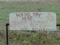 Woring Day here on Sunday, whatever that is^ - geograph.org.uk - 4631354.jpg 1,240 × 930; 580 KB
-

-
 Farm machinery at Brandeston Hall - geograph.org.uk - 185428.jpg 640 × 480; 87 KB
-
 Farmhouse at White Hall Farm - geograph.org.uk - 277782.jpg 640 × 418; 68 KB
-
 Hardstanding surrounded by hay stacks - geograph.org.uk - 561198.jpg 640 × 480; 74 KB
-
 Meadow View, Great Waldingfield - geograph.org.uk - 185423.jpg 640 × 480; 104 KB
-
 New housing at Great Waldingfield - geograph.org.uk - 185415.jpg 640 × 480; 88 KB
-
 Peakhall Lane - geograph.org.uk - 561202.jpg 640 × 480; 117 KB
-
 Pond in New Barn - geograph.org.uk - 560183.jpg 640 × 480; 121 KB
-
 Redhouse Farm - geograph.org.uk - 185426.jpg 640 × 480; 75 KB
-

-
 The only barn in New Barn - geograph.org.uk - 558030.jpg 640 × 480; 77 KB
-
 The only House in New Barn - geograph.org.uk - 560179.jpg 640 × 480; 103 KB
-
 Waldingfield Airfield - geograph.org.uk - 296266.jpg 640 × 480; 70 KB


.jpg)


.jpg)


_-_geograph.org.uk_-_6281758.jpg)
_-_geograph.org.uk_-_6281760.jpg)
_-_geograph.org.uk_-_6281767.jpg)
.jpg)


_-_geograph.org.uk_-_6281771.jpg)
_-_geograph.org.uk_-_6281772.jpg)
_-_geograph.org.uk_-_6281774.jpg)
_-_geograph.org.uk_-_6281753.jpg)
_-_geograph.org.uk_-_6281755.jpg)
_-_geograph.org.uk_-_6281757.jpg)


