Category:Great Trigonometrical Survey (Old Map)
Jump to navigation
Jump to search
Media in category "Great Trigonometrical Survey (Old Map)"
The following 6 files are in this category, out of 6 total.
-
 1801 - 20 - 52 Operations of Trigonometrical Survey by Lambton 1800 to 1818.jpg 9,268 × 11,373; 4.76 MB
-
 1847 Plan of Great Arc between Seronj and Dehra Dun by Everest.jpg 3,422 × 19,346; 2.81 MB
-
 1870 Index Chart to GTS India-1.jpg 7,308 × 7,006; 25.55 MB
-
 1922 Index of Great Trigonometrical Survey of India.jpg 5,560 × 4,448; 16.54 MB
-
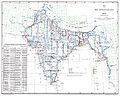
 GTS 1892.jpg 1,269 × 1,146; 329 KB
-
 GTS Peninsula Asiatic Researches.jpg 3,701 × 1,563; 1.46 MB


