Category:Great Shelford
Jump to navigation
Jump to search
English: Great Shelford is a village located approximately four miles (6 km) to the south of Cambridge, in the county of Cambridgeshire, in eastern England. In 1850 Great Shelford parish contained By 2001, this had grown to 3,949.
Nederlands: Great Shelford is een dorp (village en civil parish) in het Engelse graafschap Cambridgeshire. Het dorp ligt in het district South Cambridgeshire en telt 3949 inwoners.
village in the United Kingdom  | |||||
| Upload media | |||||
| Instance of | |||||
|---|---|---|---|---|---|
| Location | South Cambridgeshire, Cambridgeshire, East of England, England | ||||
 | |||||
Subcategories
This category has the following 8 subcategories, out of 8 total.
G
- Great Shelford Memorial Hall (6 F)
N
P
- Pubs in Great Shelford (5 F)
S
- Shelford railway station (10 F)
T
- Transport in Great Shelford (7 F)
Media in category "Great Shelford"
The following 200 files are in this category, out of 1,088 total.
(previous page) (next page)-
 'Semis' in Granhams Close - geograph.org.uk - 755383.jpg 640 × 473; 74 KB
-

-
 170111 near Great Shelford.jpg 800 × 532; 262 KB
-
 365539 near Great Shelford.jpg 800 × 532; 244 KB
-
 A 'mammoth' water feature - geograph.org.uk - 973779.jpg 471 × 640; 117 KB
-
 A 'mammoth' water feature 2 - geograph.org.uk - 973781.jpg 480 × 640; 139 KB
-
 A barley field and a Cambridge train - geograph.org.uk - 5412116.jpg 1,024 × 768; 972 KB
-
 A barley field by The Genome Path - geograph.org.uk - 5412460.jpg 1,024 × 768; 961 KB
-
 A bend in Granham's Road - geograph.org.uk - 4918996.jpg 1,024 × 731; 1.18 MB
-
 A Cambridge train and The Genome Path - geograph.org.uk - 5064805.jpg 1,024 × 732; 1.16 MB
-
 A changed view - geograph.org.uk - 4598070.jpg 1,024 × 732; 1.01 MB
-
 A collision on the A1307 - geograph.org.uk - 6005883.jpg 1,024 × 682; 682 KB
-
 A frosty morning on The Genome Path - geograph.org.uk - 4257724.jpg 1,024 × 768; 1.06 MB
-
 A gap in the hedge and the new southern edge of Cambridge - geograph.org.uk - 4357419.jpg 1,024 × 1,024; 1.46 MB
-
 A house in the country - geograph.org.uk - 765870.jpg 640 × 461; 110 KB
-
 A house on White Hill - geograph.org.uk - 4962901.jpg 1,024 × 1,024; 1.58 MB
-
 A hump in the DNA - geograph.org.uk - 755104.jpg 640 × 478; 59 KB
-
 A July evening in The Beechwoods - geograph.org.uk - 3561442.jpg 828 × 1,024; 1.08 MB
-
 A July evening on the western slopes of The Gogs - geograph.org.uk - 3052361.jpg 1,024 × 768; 1.06 MB
-
 A King's Cross stopper - geograph.org.uk - 4859106.jpg 819 × 1,024; 1.14 MB
-
 A King's Cross train and the Genome Path - geograph.org.uk - 5465487.jpg 1,024 × 768; 975 KB
-
 A King's Cross train at Shepreth Branch Junction - geograph.org.uk - 6249465.jpg 1,024 × 768; 1.05 MB
-
 A King's Cross train near the Shelfords - geograph.org.uk - 4262789.jpg 1,024 × 808; 1.32 MB
-
 A much-changed view - geograph.org.uk - 5348385.jpg 1,024 × 768; 835 KB
-
 A new edge of Cambridge - geograph.org.uk - 5065039.jpg 1,024 × 731; 1.01 MB
-
 A pair of shops - geograph.org.uk - 976964.jpg 480 × 640; 89 KB
-
 A pink village post office - geograph.org.uk - 1070262.jpg 640 × 474; 59 KB
-
 A quiet car park - Scotsdales - geograph.org.uk - 973791.jpg 640 × 474; 77 KB
-
 A snowy morning in The Beechwoods - geograph.org.uk - 3295795.jpg 1,024 × 768; 431 KB
-
 A spring morning on Worts Causeway - geograph.org.uk - 5331862.jpg 1,024 × 768; 1.03 MB
-
 A summer evening at the crossroads - geograph.org.uk - 4024406.jpg 1,024 × 734; 1 MB
-
 A Sunday walk in The Beechwoods Nature Reserve - geograph.org.uk - 6028842.jpg 819 × 1,024; 1.39 MB
-
 A Sunday-morning walk - geograph.org.uk - 4357460.jpg 1,024 × 768; 1.08 MB
-
 A view across Limekiln Hill - geograph.org.uk - 4295818.jpg 1,024 × 732; 980 KB
-
 A view from The Beechwoods - geograph.org.uk - 6028831.jpg 1,024 × 768; 946 KB
-
 A1307 to Cambridge - geograph.org.uk - 4870004.jpg 1,600 × 1,200; 652 KB
-
 Above The Beechwoods - geograph.org.uk - 4708772.jpg 1,024 × 732; 991 KB
-
 Access road for Shelford Rugby Club - geograph.org.uk - 795204.jpg 640 × 470; 63 KB
-

-
 Across the fields towards Addenbrooke's - geograph.org.uk - 5208377.jpg 1,024 × 732; 1,006 KB
-
 Addenbrooke's Biomedical Campus - geograph.org.uk - 3231162.jpg 1,024 × 706; 156 KB
-
 Addenbrooke's Hospital from Nine Wells - geograph.org.uk - 3113337.jpg 1,024 × 744; 1.04 MB
-
 Addenbrooke's Hospital, aerial 2017 - geograph.org.uk - 5468044.jpg 640 × 427; 75 KB
-
 Addenbrooke's Road Bridge - geograph.org.uk - 3113329.jpg 1,024 × 735; 870 KB
-
 Addenbrooke's Road Bridge - geograph.org.uk - 4962769.jpg 1,024 × 732; 886 KB
-
 Addenbrooke's Road Bridge and The Genome Path - geograph.org.uk - 4750351.jpg 1,024 × 732; 1,010 KB
-
 Addenbrooke's Road to White Hill - geograph.org.uk - 4227815.jpg 1,024 × 683; 920 KB
-
 Air ambulance and Addenbrooke's Hospital - geograph.org.uk - 6378501.jpg 1,024 × 768; 908 KB
-
 All shapes, colours and sizes - geograph.org.uk - 1134357.jpg 640 × 480; 74 KB
-
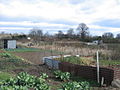
 Allotment Garden - Shelford - geograph.org.uk - 992122.jpg 640 × 476; 93 KB
-
 Allotment Shed - geograph.org.uk - 992126.jpg 640 × 476; 75 KB
-
 Allotments - More's Meadow - geograph.org.uk - 767335.jpg 640 × 453; 98 KB
-
-
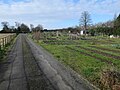
 Allotments by Great Shelford cemetery - geograph.org.uk - 766790.jpg 640 × 455; 88 KB
-
-
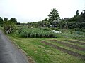
 Allotments, Great Shelford - geograph.org.uk - 4868624.jpg 1,600 × 1,200; 850 KB
-
 An ever-changing view - geograph.org.uk - 5284460.jpg 1,024 × 768; 1,020 KB
-
 An Unusual Sight - geograph.org.uk - 795236.jpg 640 × 460; 48 KB
-
 Approaching Shepreth Branch Junction - geograph.org.uk - 3834461.jpg 837 × 1,024; 1.18 MB
-
 Approaching The Beechwoods on a July evening - geograph.org.uk - 3052375.jpg 1,024 × 768; 1.08 MB
-
 At Granham's Road Level Crossing - geograph.org.uk - 3770853.jpg 836 × 1,024; 1.1 MB
-
 At Shepreth Branch Junction - geograph.org.uk - 3323866.jpg 1,200 × 888; 1.13 MB
-
 At Shepreth Branch Junction - geograph.org.uk - 5855572.jpg 1,024 × 1,024; 1.33 MB
-
 Auditions for the Italian Job - geograph.org.uk - 795246.jpg 640 × 470; 66 KB
-
 Autumn cultivation at White Hill Farm - geograph.org.uk - 5558095.jpg 1,024 × 768; 1.04 MB
-

-
 Babraham Road, The Hill Trees - geograph.org.uk - 5666388.jpg 1,024 × 682; 861 KB
-
 Bales and barns near Hauxton Mill - geograph.org.uk - 6315948.jpg 1,024 × 732; 873 KB
-
 Barley by Hinton Way - geograph.org.uk - 5030302.jpg 1,600 × 1,212; 468 KB
-
 Barley by the railway - geograph.org.uk - 5855657.jpg 1,024 × 768; 989 KB
-
 Barley fields beside the railway - geograph.org.uk - 5412126.jpg 1,024 × 732; 868 KB
-
 Barley on Limekiln Hill - geograph.org.uk - 6193856.jpg 1,024 × 768; 838 KB
-
 Barley on the slopes of Limekiln Hill - geograph.org.uk - 5472798.jpg 1,024 × 768; 891 KB
-
 Barley on White Hill - geograph.org.uk - 4962954.jpg 1,024 × 768; 930 KB
-
 Barley, wheat and White Hill - geograph.org.uk - 4598031.jpg 1,024 × 732; 1.08 MB
-
 Barley, wheat and White Hill - geograph.org.uk - 5464322.jpg 1,024 × 768; 904 KB
-
 Beech boles - geograph.org.uk - 2480520.jpg 1,024 × 768; 1.15 MB
-
 Beechwood - geograph.org.uk - 5312829.jpg 640 × 426; 67 KB
-
 Beechwood - geograph.org.uk - 5697886.jpg 640 × 426; 48 KB
-
 Beechwood - geograph.org.uk - 5697887.jpg 640 × 426; 54 KB
-
 Beechwood - geograph.org.uk - 5697889.jpg 640 × 426; 59 KB
-
 Beechwood Nature Reserve - geograph.org.uk - 5312852.jpg 640 × 426; 112 KB
-
 Beechwoods - geograph.org.uk - 3466701.jpg 1,600 × 1,000; 871 KB
-
 Beechwoods - geograph.org.uk - 3466708.jpg 1,200 × 1,600; 1.04 MB
-
 Beechwoods - geograph.org.uk - 3984248.jpg 1,600 × 1,200; 825 KB
-
 Beechwoods Local Nature Reserve - geograph.org.uk - 3444198.jpg 4,000 × 3,000; 4.27 MB
-
 Beechwoods Local Nature Reserve - geograph.org.uk - 3444201.jpg 3,000 × 4,000; 4.37 MB
-
 Beechwoods Local Nature Reserve - geograph.org.uk - 3444204.jpg 3,000 × 4,000; 4.24 MB
-
 Beechwoods Nature Reserve - geograph.org.uk - 4295290.jpg 1,280 × 872; 486 KB
-
 Beechwoods Nature Reserve in October - geograph.org.uk - 5954015.jpg 731 × 1,024; 1.27 MB
-
 Beechwoods to Limekiln Hill in May - geograph.org.uk - 3457392.jpg 1,200 × 901; 1.36 MB
-
 Bench and Palms - Scotsdales - geograph.org.uk - 973796.jpg 640 × 474; 94 KB
-
 Between Great Shelford and Hauxton Mill - geograph.org.uk - 4262771.jpg 1,024 × 1,024; 1.37 MB
-
 Between Great Shelford and Trumpington - geograph.org.uk - 3834448.jpg 1,200 × 869; 1.24 MB
-
 Birmingham train at Shepreth Branch Junction - geograph.org.uk - 4202121.jpg 812 × 1,024; 1.02 MB
-
 Birmingham-bound at Shelford - geograph.org.uk - 6380870.jpg 1,024 × 1,024; 1.02 MB
-
 Black and White House - geograph.org.uk - 795182.jpg 640 × 451; 62 KB
-
 Blue and Green - geograph.org.uk - 973786.jpg 640 × 459; 48 KB
-
 Bound for Birmingham - geograph.org.uk - 5558166.jpg 1,024 × 819; 1.03 MB
-

-
 Brick yard - Scotsdales - geograph.org.uk - 973093.jpg 640 × 473; 86 KB
-
 Bridge Close - geograph.org.uk - 784073.jpg 640 × 453; 75 KB
-
 Bridge Close bungalow - geograph.org.uk - 784076.jpg 640 × 455; 97 KB
-
 Bridle path and bales - geograph.org.uk - 6315963.jpg 1,024 × 768; 872 KB
-
 Bridle track and water meadows - geograph.org.uk - 6315870.jpg 1,024 × 768; 863 KB
-
 Building at White Hill Farm - geograph.org.uk - 6052940.jpg 1,024 × 768; 886 KB
-
 Building continuing - geograph.org.uk - 4868636.jpg 1,600 × 1,200; 586 KB
-
 Building work at White Hill Farm - geograph.org.uk - 5855506.jpg 1,024 × 768; 913 KB
-
 Bungalow in Bridge Close - geograph.org.uk - 784069.jpg 640 × 456; 75 KB
-
 Bungalow on the Cambridge Road - geograph.org.uk - 784142.jpg 640 × 480; 87 KB
-
 Bungalows - Chaston Road - geograph.org.uk - 1067385.jpg 640 × 460; 75 KB
-
 Busy at the weekend - geograph.org.uk - 976464.jpg 640 × 480; 86 KB
-
 Cabbage Moor - geograph.org.uk - 771224.jpg 640 × 474; 106 KB
-
 Cable tensioning system - geograph.org.uk - 740490.jpg 480 × 640; 64 KB
-
 Cam water meadows near Hauxton - geograph.org.uk - 4193088.jpg 1,024 × 768; 1.18 MB
-
 Cambridge Biomedical Campus - geograph.org.uk - 4321307.jpg 1,024 × 576; 87 KB
-
 Cambridge Biomedical Campus, Abcam - geograph.org.uk - 6053403.jpg 1,024 × 768; 1.02 MB
-
 Cambridge bound at Bridge 33 - geograph.org.uk - 5127990.jpg 819 × 1,024; 1.15 MB
-
 Cambridge bound at Shepreth Branch Junction - geograph.org.uk - 4918991.jpg 1,024 × 732; 1,007 KB
-
 Cambridge Building Society - geograph.org.uk - 976954.jpg 640 × 485; 75 KB
-
 Cambridge City Boundary - geograph.org.uk - 795313.jpg 640 × 468; 72 KB
-
 Cambridge getting closer - geograph.org.uk - 4193026.jpg 1,024 × 768; 1.12 MB
-
 Cambridge Rd - geograph.org.uk - 5293994.jpg 640 × 426; 68 KB
-
 Cambridge Rd - geograph.org.uk - 5293997.jpg 640 × 426; 67 KB
-
 Cambridge Rd - geograph.org.uk - 5293999.jpg 524 × 640; 71 KB
-
 Cambridge Rd - geograph.org.uk - 5294004.jpg 640 × 426; 59 KB
-
 Cambridge Road (A1301) - geograph.org.uk - 5214714.jpg 640 × 480; 58 KB
-
 Cambridge Road (A1301) - geograph.org.uk - 5214734.jpg 640 × 480; 57 KB
-
 Cambridge Road (A1301) - geograph.org.uk - 5216211.jpg 3,648 × 2,736; 2.08 MB
-
 Cambridge Road - close to The Hectare - geograph.org.uk - 992135.jpg 640 × 475; 69 KB
-
 Cambridge Road - geograph.org.uk - 2016108.jpg 1,152 × 864; 431 KB
-
 Cambridge Road - geograph.org.uk - 4868618.jpg 1,600 × 1,200; 691 KB
-
 Cambridge Road - geograph.org.uk - 784275.jpg 640 × 463; 66 KB
-
 Cambridge Road - geograph.org.uk - 795186.jpg 640 × 472; 86 KB
-
 Cambridge Road - geograph.org.uk - 795226.jpg 640 × 471; 78 KB
-
 Cambridge Road - geograph.org.uk - 795262.jpg 640 × 476; 71 KB
-

-

-
 Cambridge Road - Stonehill Road - geograph.org.uk - 795167.jpg 640 × 472; 81 KB
-
 Cambridge Road housing - geograph.org.uk - 795216.jpg 640 × 477; 94 KB
-
 Cambridge skyline from The Beechwoods - geograph.org.uk - 4241230.jpg 1,024 × 768; 985 KB
-
 Cambridge Tracks Divide - geograph.org.uk - 744259.jpg 640 × 426; 190 KB
-
 Cambridge-bound at Shepreth Branch Junction - geograph.org.uk - 5412306.jpg 1,024 × 768; 1.03 MB
-
 Camping ^ Caravan Club Campsite - Cambridge - geograph.org.uk - 2015471.jpg 4,224 × 3,168; 6.25 MB
-
 Care home under construction - geograph.org.uk - 4868620.jpg 1,600 × 1,200; 744 KB
-
 Cattle in the shade - geograph.org.uk - 4676470.jpg 819 × 1,024; 1.19 MB
-
 Cereal crop in a field - geograph.org.uk - 5592915.jpg 640 × 426; 63 KB
-
 Cereals and suburbs - geograph.org.uk - 5592920.jpg 640 × 426; 59 KB
-
 Cereals near the garden centre - geograph.org.uk - 5592918.jpg 640 × 426; 51 KB
-
 Chalk hills on the edge of Cambridge - geograph.org.uk - 6393136.jpg 1,024 × 768; 1,002 KB
-
 Chalky fields in March - geograph.org.uk - 2866979.jpg 1,024 × 768; 939 KB
-
 Chalky fields on a July evening - geograph.org.uk - 3052373.jpg 800 × 593; 662 KB
-

-
 Changing view from The Genome Path - geograph.org.uk - 4793110.jpg 1,024 × 731; 937 KB
-
 Chaston Road - blocks of flats - geograph.org.uk - 1067409.jpg 640 × 461; 74 KB
-
 Chaston Road - geograph.org.uk - 1067388.jpg 640 × 465; 67 KB
-
 Chaston Road - geograph.org.uk - 1067422.jpg 640 × 459; 62 KB
-
 Chaston Road Great Shelford - geograph.org.uk - 3718194.jpg 640 × 480; 86 KB
-
 Cherry Hinton Road - geograph.org.uk - 3064621.jpg 640 × 450; 47 KB
-
 Cherry Hinton Road roundabout - geograph.org.uk - 4295297.jpg 1,280 × 960; 429 KB
-
 Christmas decorations by the Genome Path - geograph.org.uk - 3781441.jpg 800 × 800; 877 KB
-
 Church Street then the High Street - geograph.org.uk - 1064334.jpg 640 × 472; 64 KB
-
 Church Street, Great Shelford - geograph.org.uk - 3584381.jpg 640 × 360; 53 KB
-
 Church Street, Great Shelford - geograph.org.uk - 5388711.jpg 2,304 × 1,728; 861 KB
-
 Citi Bus on Cambridge Road (A1301) - geograph.org.uk - 5214719.jpg 640 × 480; 75 KB
-

-
 Close up, Elizabeth II postbox on Cambridge Road (A1301) - geograph.org.uk - 5216207.jpg 1,373 × 2,828; 857 KB
-
 Close up, Elizabeth II postbox, Shelford Bottom Cottages - geograph.org.uk - 5216173.jpg 1,897 × 3,648; 1.15 MB
-

-
 Colourful Terrace - Woollards Lane - geograph.org.uk - 976334.jpg 479 × 640; 77 KB
-
 Communications Shelford Rugby Club - geograph.org.uk - 1090565.jpg 480 × 640; 70 KB
-
 Conifer Section - geograph.org.uk - 1134344.jpg 640 × 480; 79 KB
-
 Conservatory selection - Scotsdales - geograph.org.uk - 973065.jpg 640 × 471; 67 KB
-
 Continuation of the DNA path - geograph.org.uk - 755118.jpg 640 × 474; 63 KB
-
 Contrasting Styles - geograph.org.uk - 795165.jpg 640 × 474; 71 KB
-
 Coppice Avenue Great Shelford - geograph.org.uk - 3718190.jpg 480 × 640; 115 KB
-
 Corner of a field close to Nine Wells - geograph.org.uk - 782535.jpg 640 × 474; 77 KB
-
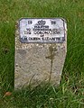 Coronation Stone - geograph.org.uk - 751480.jpg 495 × 640; 142 KB
-

-
 Cottages near Hauxton Mill - geograph.org.uk - 4262738.jpg 1,024 × 731; 790 KB
-
 Cottages on Hinton Way - geograph.org.uk - 1067433.jpg 640 × 459; 78 KB
-
 Cottages, Granham's Rd - geograph.org.uk - 5570687.jpg 640 × 352; 59 KB
-
 Countryside view - geograph.org.uk - 782538.jpg 640 × 467; 73 KB
-
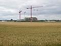 Cranes and a wheatfield - geograph.org.uk - 5464292.jpg 1,024 × 768; 899 KB
-
 Cricket field at Great Shelford - geograph.org.uk - 5164328.jpg 640 × 480; 54 KB
-
 Crop field and hedgerow - geograph.org.uk - 5214802.jpg 640 × 480; 66 KB
-
 Crop field beside woodland - geograph.org.uk - 5214739.jpg 640 × 480; 71 KB
-
 Crop field off Granham's Road - geograph.org.uk - 5214805.jpg 640 × 480; 68 KB
-
 Crop field off Hinton Way - geograph.org.uk - 5214824.jpg 640 × 480; 79 KB
-
 Crop field, Great Shelford - geograph.org.uk - 5214786.jpg 640 × 480; 60 KB
-
 Cropland - geograph.org.uk - 4789662.jpg 640 × 426; 49 KB
-

-
 Crossing a farm crossing near Great Shelford - geograph.org.uk - 6315698.jpg 1,024 × 768; 925 KB
-
 Crossroads, Great Shelford - geograph.org.uk - 5294017.jpg 640 × 426; 81 KB
-
 Curve in the track - White Hill - geograph.org.uk - 782677.jpg 640 × 467; 78 KB
-
 Cycle path meets the road - geograph.org.uk - 755115.jpg 640 × 473; 58 KB
-
 Cycle path to Shelford - geograph.org.uk - 3231147.jpg 1,024 × 757; 279 KB
-
 Cycle path to Shelford - geograph.org.uk - 751712.jpg 640 × 472; 62 KB
-
 Cycle path to the hospital - geograph.org.uk - 3606603.jpg 640 × 425; 108 KB
-
 Cycleway 11 - leaving Addenbrooke's - geograph.org.uk - 3610605.jpg 640 × 425; 92 KB


_-_geograph.org.uk_-_5214727.jpg)


_towards_Haverhill_-_geograph.org.uk_-_5214842.jpg)


_-_geograph.org.uk_-_5214714.jpg)
_-_geograph.org.uk_-_5214734.jpg)
_-_geograph.org.uk_-_5216211.jpg)


_-_geograph.org.uk_-_5214719.jpg)

_-_geograph.org.uk_-_5216207.jpg)


