Category:Great Maplestead
Jump to navigation
Jump to search
village and civil parish in Essex, UK | |||||
| Upload media | |||||
| Instance of | |||||
|---|---|---|---|---|---|
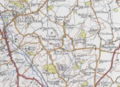
| Location | Braintree, Essex, East of England, England | ||||
| Said to be the same as | Great Maplestead (Wikimedia duplicated page, civil parish) | ||||
 | |||||
Subcategories
This category has the following 2 subcategories, out of 2 total.
D
G
Media in category "Great Maplestead"
The following 41 files are in this category, out of 41 total.
-
 30 limit for Great Maplestead - geograph.org.uk - 4368190.jpg 640 × 480; 137 KB
-
 Bennett's Park - geograph.org.uk - 4368247.jpg 640 × 428; 79 KB
-
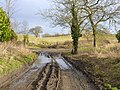
 Burrowing activity on Mill Lane - geograph.org.uk - 4368217.jpg 640 × 480; 123 KB
-
 Church Street - geograph.org.uk - 4660392.jpg 768 × 1,024; 332 KB
-
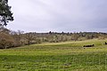
 Cows near the Colne, Great Maplestead - geograph.org.uk - 3482384.jpg 3,648 × 2,736; 3.27 MB
-
 Entrance into fields - geograph.org.uk - 3040310.jpg 640 × 480; 212 KB
-
 Field Boundary - geograph.org.uk - 4660317.jpg 1,024 × 768; 174 KB
-
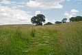
 Footpath - geograph.org.uk - 4660437.jpg 1,024 × 768; 245 KB
-
 Footpath And Sign - geograph.org.uk - 4660421.jpg 768 × 1,024; 405 KB
-
 Footpath near Mill Farm, Great Maplestead - geograph.org.uk - 5021374.jpg 3,648 × 2,432; 3.14 MB
-

-
 Footpath through oilseed rape field, Great Maplestead - geograph.org.uk - 4982629.jpg 3,648 × 2,736; 4.72 MB
-

-
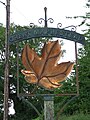 Great Maplestead Village Sign - geograph.org.uk - 4660370.jpg 768 × 1,024; 232 KB
-
 Great Maplestead.PNG 606 × 440; 620 KB
-
 Great Yeldham and area, aerial 2017 - geograph.org.uk - 5536272.jpg 800 × 533; 97 KB
-
 If You Are A Bus It's O.K. - geograph.org.uk - 4660456.jpg 1,024 × 768; 333 KB
-
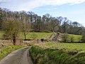
 Lane towards Great Maplestead - geograph.org.uk - 5447077.jpg 640 × 428; 128 KB
-
 Lane towards Sible Hedingham - geograph.org.uk - 5447086.jpg 640 × 480; 200 KB
-

-
 Mill Farm - geograph.org.uk - 4660309.jpg 1,024 × 768; 237 KB
-
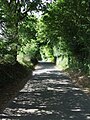
 Mill Lane - geograph.org.uk - 4372074.jpg 640 × 480; 155 KB
-
 Mill Lane - geograph.org.uk - 4372080.jpg 640 × 480; 116 KB
-
 Mill Lane - geograph.org.uk - 4372087.jpg 640 × 480; 187 KB
-
 Mill Lane - geograph.org.uk - 4660299.jpg 1,024 × 768; 191 KB
-
 Monks Lodge Rd Maplestead (51684449823).jpg 2,236 × 2,616; 1.78 MB
-
 Oak trees on Oak Road Halstead, Essex, UK (51683390742).jpg 5,326 × 3,246; 3.23 MB
-
 Old Barn - geograph.org.uk - 4660493.jpg 1,024 × 768; 276 KB
-

-
 Park land and Dynes Hall - geograph.org.uk - 5890357.jpg 4,320 × 3,240; 5.46 MB
-
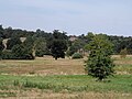
 Pasture near Barretts Hall, Great Maplestead - geograph.org.uk - 5021338.jpg 3,648 × 2,432; 3.04 MB
-

-
 Road Signs At Junction - geograph.org.uk - 4660407.jpg 1,024 × 768; 294 KB
-
 Road to Little Maplestead near Doe's Corner - geograph.org.uk - 4986890.jpg 3,648 × 2,736; 3.01 MB
-
 Rural junction - geograph.org.uk - 4368180.jpg 640 × 480; 147 KB
-

-
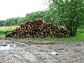 Stacked logs by Rookery Wood - geograph.org.uk - 3040314.jpg 640 × 480; 219 KB
-
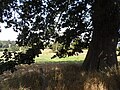 The shade of an oak tree - geograph.org.uk - 5890368.jpg 4,320 × 3,240; 2.91 MB
-
 Tree by the road - geograph.org.uk - 4368205.jpg 640 × 480; 94 KB
-
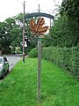 Village Sign - geograph.org.uk - 4660360.jpg 768 × 1,024; 304 KB
-
 Wallace's Farm - geograph.org.uk - 4660484.jpg 1,024 × 768; 274 KB


.jpg)
.jpg)

_-_geograph.org.uk_-_5021355.jpg)


