Category:Great Chart
Jump to navigation
Jump to search
English: Great Chart is a village in civil parish of Great Chart with Singleton in the Ashford District of Kent, England. The parish is split between the ancient village of Great Chart and the modern Singleton housing development, which is part of the western outskirts of Ashford. The village centre of Great Chart lies about two miles (3.2km) from the town centre.
village in Kent, United Kingdom   | |||||
| Upload media | |||||
| Instance of |
| ||||
|---|---|---|---|---|---|
| Location | Great Chart with Singleton, Ashford, Kent, South East England, England | ||||
| Area |
| ||||
 | |||||
Subcategories
This category has the following 10 subcategories, out of 10 total.
A
- The Almshouses, Great Chart (3 F)
B
- Bucksford Manor, Great Chart (8 F)
G
- Great Chart war memorial (3 F)
H
M
N
O
P
- The Pest House, Great Chart (5 F)
S
- The Swan, Great Chart (5 F)
V
- Great Chart Village Sign (4 F)
Media in category "Great Chart"
The following 81 files are in this category, out of 81 total.
-

-

-

-

-
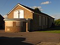 Abandoned Methodist Church - geograph.org.uk - 1279195.jpg 640 × 480; 57 KB
-

-
 Bridge over the A28 Ashford Road - geograph.org.uk - 1602308.jpg 640 × 427; 92 KB
-
 Children's play area, Great Chart - geograph.org.uk - 1271894.jpg 640 × 480; 121 KB
-

-
 Construction work at Friars School - geograph.org.uk - 1604352.jpg 640 × 427; 92 KB
-
 Court Lodge Farm Barn - geograph.org.uk - 1602285.jpg 640 × 427; 57 KB
-
 Cricket pitch, Great Chart - geograph.org.uk - 2479477.jpg 640 × 430; 41 KB
-
 Derelict shop on The Street - geograph.org.uk - 1272548.jpg 640 × 480; 146 KB
-

-

-

-

-
 Forge Stores, Great Chart - geograph.org.uk - 2489385.jpg 640 × 430; 60 KB
-
 Great Chart Cricket Pavilion - geograph.org.uk - 567921.jpg 640 × 480; 72 KB
-
 Great Stour River, Worten - geograph.org.uk - 403370.jpg 640 × 475; 176 KB
-

-

-
 HoodenersHorse.jpg 2,304 × 3,072; 3.01 MB
-
 Horses in a paddock at Great Chart, Kent, England.jpg 640 × 480; 149 KB
-
 House on Chart Road - geograph.org.uk - 1602255.jpg 640 × 427; 70 KB
-
 Housing on Hillcrest, Great Chart - geograph.org.uk - 1272494.jpg 640 × 480; 121 KB
-

-
 Looking N along Bucksford Lane - geograph.org.uk - 1270535.jpg 480 × 640; 171 KB
-
 Looking N along footpath - geograph.org.uk - 1272614.jpg 640 × 480; 125 KB
-
 Looking NE along The Street, Great Chart - geograph.org.uk - 1272546.jpg 640 × 480; 118 KB
-

-
 Ninn Lane, Great Chart - geograph.org.uk - 2489383.jpg 640 × 430; 58 KB
-

-
 Pavilion on playing fields, Great Chart - geograph.org.uk - 1272553.jpg 640 × 480; 114 KB
-
 Pavilion, Great Chart - geograph.org.uk - 2479472.jpg 640 × 430; 60 KB
-
 Pavilion, Great Chart - geograph.org.uk - 2491380.jpg 640 × 430; 57 KB
-
 Playing fields, Great Chart - geograph.org.uk - 2491383.jpg 640 × 430; 38 KB
-
 Railway to Pluckley - geograph.org.uk - 1602207.jpg 640 × 427; 99 KB
-
 Rose Cottage, Great Chart - geograph.org.uk - 1602242.jpg 640 × 427; 78 KB
-
 Singleton Rd, Great Chart - geograph.org.uk - 2489382.jpg 640 × 430; 97 KB
-

-
 South Lodge, Great Chart - geograph.org.uk - 2479480.jpg 640 × 406; 66 KB
-
 Stour Valley Walk crosses Bucksford Lane - geograph.org.uk - 1279193.jpg 640 × 480; 122 KB
-
 Subway under the A28, Great Chart - geograph.org.uk - 130718.jpg 640 × 480; 132 KB
-
 The Black Barn - geograph.org.uk - 1604349.jpg 640 × 427; 43 KB
-
 The Cottage, The Street, Great Chart - geograph.org.uk - 2489403.jpg 640 × 430; 84 KB
-
 The Granary, Great Chart - geograph.org.uk - 229896.jpg 640 × 487; 130 KB
-

-
 The Hoodener's Horse, Great Chart - geograph.org.uk - 2489410.jpg 640 × 551; 82 KB
-

-
 The Moat - geograph.org.uk - 1604339.jpg 640 × 427; 80 KB
-
 The Old Bakehouse - geograph.org.uk - 1602225.jpg 640 × 427; 82 KB
-
 The Old School, Great Chart - geograph.org.uk - 1271994.jpg 640 × 480; 135 KB
-
 The Old School, Great Chart - geograph.org.uk - 222081.jpg 640 × 480; 83 KB
-

-
 The River Stour near Godinton Park - geograph.org.uk - 1273888.jpg 640 × 480; 148 KB
-
 The Street, Great Chart - geograph.org.uk - 1271931.jpg 640 × 480; 129 KB
-
 The Street, Great Chart - geograph.org.uk - 1705384.jpg 640 × 480; 77 KB
-
 The Street, Great Chart - geograph.org.uk - 222079.jpg 640 × 480; 92 KB
-
 The Street, Great Chart - geograph.org.uk - 2489388.jpg 640 × 430; 79 KB
-

-

-
 View along The Street, Great Chart - geograph.org.uk - 1271923.jpg 640 × 480; 182 KB
-

-

-
 Village hall, Great Chart - geograph.org.uk - 1272504.jpg 640 × 480; 133 KB
-
 Warehouse on Leacon Road - geograph.org.uk - 1764396.jpg 640 × 427; 73 KB
-

-
 Woodgate house - geograph.org.uk - 396858.jpg 640 × 480; 371 KB
-
 Worten Mill, probably Kent's oldest mill - geograph.org.uk - 1275592.jpg 640 × 480; 360 KB
-
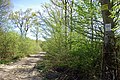 Byway through the woods - geograph.org.uk - 408817.jpg 640 × 428; 475 KB
-
 Dovecote - geograph.org.uk - 418217.jpg 640 × 468; 144 KB
-
 Empty farmland near Kingsnorth - geograph.org.uk - 198407.jpg 640 × 424; 53 KB
-
 Flowering tree in Louden Court - geograph.org.uk - 407035.jpg 480 × 640; 286 KB
-
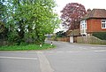
 Great Chart Crossroads - geograph.org.uk - 567947.jpg 640 × 480; 121 KB
-
 Nichols House - geograph.org.uk - 396841.jpg 640 × 480; 260 KB
-
 Old roadsign, Great Chart Crossroads - geograph.org.uk - 75463.jpg 640 × 271; 41 KB
-
 Spring in Louden Court - geograph.org.uk - 407015.jpg 640 × 480; 246 KB
-
 Track to Goldwell - geograph.org.uk - 403347.jpg 640 × 463; 184 KB
-
 Trees in Louden Way Godington Park - geograph.org.uk - 407047.jpg 640 × 480; 265 KB
-
 Unnamed Road - geograph.org.uk - 403330.jpg 640 × 455; 170 KB


