Category:Grand Union Canal in Warwickshire
Jump to navigation
Jump to search
Subcategories
This category has the following 4 subcategories, out of 4 total.
G
S
- Saltisford Canal Arm (8 F)
- Grand Union Canal (Solihull) (13 F)
Media in category "Grand Union Canal in Warwickshire"
The following 80 files are in this category, out of 80 total.
-

-

-
 Across the canal at Shuckburgh - geograph.org.uk - 1259147.jpg 640 × 465; 114 KB
-
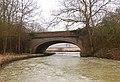
 Birdingbury Wharf bridge, Warwickshire - geograph.org.uk - 1086276.jpg 640 × 549; 104 KB
-
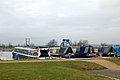
 Boat at bridge 32, Grand Union Canal - geograph.org.uk - 1556225.jpg 640 × 408; 98 KB
-
 Boating at Shuckburgh - geograph.org.uk - 1259151.jpg 640 × 445; 113 KB
-
-

-

-

-
-

-

-

-

-

-

-

-

-

-

-
 Brook by Grand Union Canal - geograph.org.uk - 1655431.jpg 640 × 480; 124 KB
-
 Canal and railway near Hatton - geograph.org.uk - 1099526.jpg 640 × 490; 117 KB
-
 Canal footbridge near Hatton - geograph.org.uk - 1099504.jpg 640 × 502; 106 KB
-
 Canalside decay - geograph.org.uk - 1228918.jpg 640 × 428; 58 KB
-

-

-

-
 Falcondale.JPG 2,816 × 2,112; 1.48 MB
-
 Floating Restaurant, Radford Semele - geograph.org.uk - 1216723.jpg 640 × 480; 108 KB
-

-

-
 Grand Union Canal diversion - geograph.org.uk - 126774.jpg 640 × 480; 89 KB
-
 Grand Union Canal near Bascote - geograph.org.uk - 155267.jpg 640 × 480; 300 KB
-
 Grand Union Canal, Royal Leamington Spa - geograph.org.uk - 35963.jpg 640 × 480; 114 KB
-
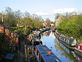
 Lapworth canal basin (30946720300).jpg 3,913 × 1,951; 1.25 MB
-
 Long Itchington-Grand Union Canal - geograph.org.uk - 2114885.jpg 640 × 480; 70 KB
-
 Looking south from Bridge No 67 - geograph.org.uk - 1346709.jpg 640 × 425; 122 KB
-
 Marina entrance, Birdingbury Wharf - geograph.org.uk - 1259685.jpg 640 × 500; 93 KB
-

-
 Nelson arm, Grand Union Canal - geograph.org.uk - 1086285.jpg 640 × 556; 179 KB
-
 Nimrod Bridge in winter - geograph.org.uk - 1114205.jpg 640 × 436; 125 KB
-
 Old canal bridge - geograph.org.uk - 1228906.jpg 640 × 428; 79 KB
-
 Ordnance Survey Sheet SP 46 Southam, Published 1951.jpg 7,588 × 8,827; 19.16 MB
-

-
 Paddle gear, Stockton locks - geograph.org.uk - 1277035.jpg 485 × 640; 109 KB
-

-

-
 Radford Bottom Lock - geograph.org.uk - 1213210.jpg 640 × 480; 78 KB
-
 Radford Semele-Grand Union Canal - geograph.org.uk - 765469.jpg 640 × 480; 95 KB
-

-

-

-
 Rowington, UK - panoramio (12).jpg 5,472 × 3,648; 6.03 MB
-
 Rowington, UK - panoramio (7).jpg 5,472 × 3,648; 5.62 MB
-
 Rowington, UK - panoramio (9).jpg 5,472 × 3,648; 4.42 MB
-
 Saltisford Arm, Warwick - geograph.org.uk - 4651.jpg 640 × 480; 83 KB
-

-

-

-

-
 St. Nicholas Church, Radford Semele - geograph.org.uk - 1658760.jpg 640 × 552; 92 KB
-

-

-

-
 Stockton Bridge, Grand Union Canal - geograph.org.uk - 4654324.jpg 640 × 480; 119 KB
-

-
 The Blue Lias and the Grand Union Canal - geograph.org.uk - 4628275.jpg 1,280 × 851; 323 KB
-
 The Grand Union Canal at Stockton - geograph.org.uk - 735356.jpg 640 × 428; 161 KB
-

-
 Tomlow Bridge in winter - geograph.org.uk - 1107505.jpg 640 × 490; 97 KB
-

-
-

-

-
 Welsh Road bridge, Grand Union Canal - geograph.org.uk - 1403463.jpg 640 × 445; 114 KB
-
 Welsh Road canal bridge - geograph.org.uk - 1403451.jpg 640 × 403; 115 KB
-

-
 Welsh Road lock, Grand Union Canal - geograph.org.uk - 1403458.jpg 640 × 426; 137 KB
-
 Wolfhampcote - Grand Union canal - geograph.org.uk - 52772.jpg 640 × 480; 158 KB


_-_geograph.org.uk_-_1680030.jpg)
_-_geograph.org.uk_-_1680032.jpg)
_-_geograph.org.uk_-_1580448.jpg)
_-_geograph.org.uk_-_1580476.jpg)
_-_geograph.org.uk_-_1580483.jpg)
_-_geograph.org.uk_-_1580488.jpg)
_-_geograph.org.uk_-_1580491.jpg)
_-_geograph.org.uk_-_1580451.jpg)
_-_geograph.org.uk_-_1580456.jpg)
_-_geograph.org.uk_-_1580459.jpg)
_-_geograph.org.uk_-_1580463.jpg)
_-_geograph.org.uk_-_1580468.jpg)
_-_geograph.org.uk_-_1580470.jpg)
_-_geograph.org.uk_-_1580474.jpg)


.jpg)


_-_geograph.org.uk_-_1432445.jpg)


.jpg)
.jpg)
.jpg)


_and_footpath_to_Grand_Union_Canal_(right)_-_geograph.org.uk_-_1404521.jpg)


