Category:Grafton Regis
Jump to navigation
Jump to search
village and civil parish in Northamptonshire, UK  | |||||
| Upload media | |||||
| Instance of | |||||
|---|---|---|---|---|---|
| Location | West Northamptonshire, Northamptonshire, East Midlands, England | ||||
| Population |
| ||||
| Area |
| ||||
 | |||||
Subcategories
This category has the following 2 subcategories, out of 2 total.
M
- St Mary's Church, Grafton Regis (10 F)
T
Media in category "Grafton Regis"
The following 94 files are in this category, out of 94 total.
-
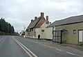 A508 passes The White Hart Public House (geograph 3345421).jpg 3,526 × 2,449; 1.02 MB
-
 A508 southeast of Brick Kiln Farm - geograph.org.uk - 3345435.jpg 3,594 × 2,677; 1.15 MB
-
 Bozenham Bridge No 56 - geograph.org.uk - 4745332.jpg 800 × 620; 153 KB
-
 Bozenham Mill Lane - geograph.org.uk - 1988364.jpg 640 × 480; 76 KB
-
 Bozenham Mill Lane - geograph.org.uk - 3346148.jpg 3,452 × 2,606; 1.47 MB
-
 Bozenham Mill Lane - geograph.org.uk - 5070308.jpg 5,184 × 3,456; 7.47 MB
-
 Bozenham Mill Lane - geograph.org.uk - 5070331.jpg 5,100 × 3,400; 4.35 MB
-
 Bozenham Mill Lane canal bridge - geograph.org.uk - 5070325.jpg 3,468 × 3,456; 3.49 MB
-
 Bridge 55, Grand Junction Canal - geograph.org.uk - 2950849.jpg 4,000 × 3,000; 4.55 MB
-
 Bridge 56, Grand Junction Canal - geograph.org.uk - 2950851.jpg 4,000 × 3,000; 4.86 MB
-
 Bridge 56, Grand Union Canal - geograph.org.uk - 6323609.jpg 1,280 × 851; 298 KB
-
 Bridge 57 on the Grand Union Canal - geograph.org.uk - 32040.jpg 640 × 480; 149 KB
-
 Bridge 57 over the Grand Union Canal - geograph.org.uk - 3253450.jpg 1,600 × 1,069; 561 KB
-
 Bridge 57, Grand Junction Canal - geograph.org.uk - 2950863.jpg 4,000 × 3,000; 5.11 MB
-
 Bridge 58, Grand Junction Canal - geograph.org.uk - 2738817.jpg 4,000 × 3,000; 4.82 MB
-
 Bridleway to Queens Oak - geograph.org.uk - 3420292.jpg 1,200 × 1,600; 923 KB
-
 Church Lane - geograph.org.uk - 5070305.jpg 5,100 × 3,400; 4.69 MB
-
 Church Road - geograph.org.uk - 6233094.jpg 640 × 480; 74 KB
-
 Entering Grafton Regis - geograph.org.uk - 2680955.jpg 640 × 480; 104 KB
-
 Farm bridge over Grand Union Canal - geograph.org.uk - 5070330.jpg 5,184 × 3,456; 7.21 MB
-

-
 Farmland next to the Grand Union Canal - geograph.org.uk - 4745316.jpg 800 × 600; 116 KB
-
 Fessey Bridge No 58 - geograph.org.uk - 4745398.jpg 800 × 676; 204 KB
-
 Field by Bozenham Mill Lane - geograph.org.uk - 5070318.jpg 5,184 × 3,456; 6.98 MB
-
 Footpath to Alderton - geograph.org.uk - 3253547.jpg 1,200 × 1,600; 522 KB
-
 Geese by Grand Union Canal - geograph.org.uk - 5070321.jpg 3,456 × 3,468; 2.91 MB
-
 Geese by Grand Union Canal - geograph.org.uk - 5070322.jpg 5,184 × 3,456; 6.46 MB
-
 Grafton Overflow Weir - geograph.org.uk - 4562326.jpg 2,000 × 1,500; 480 KB
-

-

-

-
 Grafton Regis Bridge No 57 - geograph.org.uk - 4745362.jpg 800 × 607; 173 KB
-

-
 Grafton Regis Village Hall - geograph.org.uk - 3253541.jpg 1,600 × 1,068; 428 KB
-
 Grafton Regis, Bozenham Mill Lane - geograph.org.uk - 3728200.jpg 640 × 480; 89 KB
-
 Grafton Regis-Church Lane - geograph.org.uk - 6336016.jpg 1,600 × 940; 461 KB
-
 Grafton Regis-Grand Union Canal - geograph.org.uk - 6336008.jpg 1,600 × 1,067; 601 KB
-
 Grand Union Canal - geograph.org.uk - 2680950.jpg 640 × 480; 83 KB
-
 Grand Union Canal - geograph.org.uk - 5070350.jpg 8,552 × 3,428; 5.81 MB
-
 Grand Union Canal - geograph.org.uk - 5070351.jpg 5,100 × 3,400; 4.53 MB
-
 Grand Union Canal at Bozenham Mill Lane - geograph.org.uk - 5070310.jpg 5,184 × 3,456; 6.97 MB
-
 Grand Union Canal from Bridge 57 - geograph.org.uk - 3345324.jpg 3,648 × 2,736; 1.87 MB
-
 Grand Union Canal near Grafton Regis - geograph.org.uk - 4745364.jpg 800 × 620; 145 KB
-
 Grand Union Canal towpath - geograph.org.uk - 535424.jpg 640 × 427; 97 KB
-
 Grand Union Canal Walk - geograph.org.uk - 5627927.jpg 640 × 480; 71 KB
-
 Grand Union Canal, Bridge Number 57 - geograph.org.uk - 3661656.jpg 640 × 480; 85 KB
-
 Grand Union Canal, Bridge Number 58 - geograph.org.uk - 3661713.jpg 640 × 480; 63 KB
-

-

-

-

-

-
 Grand Union Canal, River Tove pump - geograph.org.uk - 3103442.jpg 640 × 480; 97 KB
-

-
 Grove Cottage - geograph.org.uk - 3345412.jpg 3,648 × 2,736; 1.53 MB
-
 Hungry sheep in a field by the canal - geograph.org.uk - 3253460.jpg 1,600 × 1,068; 562 KB
-
 Looking across to The Lane - geograph.org.uk - 2680964.jpg 640 × 480; 80 KB
-
 Milestone 22 - geograph.org.uk - 4796767.jpg 640 × 480; 198 KB
-
 Narrow Boats and Grand Union Canal near Lower Lock Farm - geograph.org.uk - 5722551.jpg 5,184 × 3,888; 905 KB
-
 Narrow Boats at Low Farm, Grand Union Canal - geograph.org.uk - 3622668.jpg 1,066 × 800; 209 KB
-
 Narrowboat by Grand Union Canal - geograph.org.uk - 5070329.jpg 4,000 × 3,000; 4.48 MB
-

-
 Narrowboat on the Grand Union Canal - geograph.org.uk - 4745344.jpg 800 × 686; 133 KB
-
 Narrowboat, Grand Union Canal - geograph.org.uk - 5070316.jpg 5,184 × 3,456; 7.19 MB
-
 North Eastern entrance to Grafton Regis - geograph.org.uk - 3253520.jpg 1,600 × 1,068; 548 KB
-
 Northampton Road - geograph.org.uk - 5070301.jpg 5,184 × 3,456; 7.45 MB
-
 OS Flush Bracket - geograph.org.uk - 5480315.jpg 640 × 480; 124 KB
-
 OS Flush Bracket - geograph.org.uk - 5480316.jpg 640 × 480; 95 KB
-

-
 Path towards Queens Oak - geograph.org.uk - 2965135.jpg 480 × 640; 151 KB
-
 Ploughing field by Northampton Road - geograph.org.uk - 5070297.jpg 8,021 × 3,216; 7.2 MB
-
 Rectory and meadow by the canal - geograph.org.uk - 3253473.jpg 1,600 × 1,069; 428 KB
-
 River Tove by Mill Farm - geograph.org.uk - 3253499.jpg 1,600 × 1,068; 471 KB
-

-

-
 Sheep near Grand Union Canal - geograph.org.uk - 5070324.jpg 3,456 × 5,184; 3.51 MB
-
 Small quarry in a field by Queens Oak - geograph.org.uk - 2965132.jpg 640 × 426; 108 KB
-
 Sunken narrowboat below Stoke Bruerne Locks - geograph.org.uk - 6325267.jpg 1,280 × 851; 398 KB
-
 Thatched Cottage, Grafton Regis - geograph.org.uk - 1593844.jpg 640 × 480; 65 KB
-
 Thatched Cottages - geograph.org.uk - 324285.jpg 640 × 453; 114 KB
-
 The outfall of the River Tove - geograph.org.uk - 4745289.jpg 600 × 800; 164 KB
-
 The River Tove enters the Grand Union Canal - geograph.org.uk - 4520470.jpg 2,000 × 1,500; 413 KB
-
 The White Hart - geograph.org.uk - 6233084.jpg 640 × 480; 46 KB
-

-
 Tow-path by the Grand Union - geograph.org.uk - 3253455.jpg 1,600 × 1,067; 470 KB
-
 Towpath along the Grand Union Canal - geograph.org.uk - 4744552.jpg 800 × 548; 153 KB
-
 Towpath along the Grand Union Canal - geograph.org.uk - 4745377.jpg 800 × 600; 146 KB
-
 Watercourse from the canal overflow - geograph.org.uk - 3253465.jpg 1,600 × 1,067; 382 KB
-
 Weir, Grand Union Canal - geograph.org.uk - 4520497.jpg 2,000 × 1,500; 832 KB
-
 Alderton - geograph.org.uk - 437071.jpg 640 × 480; 115 KB
-
 Bozenham Mill Lane Bridge - geograph.org.uk - 535407.jpg 640 × 427; 94 KB
-
 Grand Union Canal - geograph.org.uk - 535415.jpg 640 × 427; 69 KB
-
 Grand Union Canal - geograph.org.uk - 535426.jpg 640 × 427; 72 KB
-
 Stoke Bruerne - geograph.org.uk - 453159.jpg 640 × 480; 157 KB
.jpg)


